
Portions of Jasper National Park remain closed or affected due to impacts from the Jasper Wildfire. Please check for up to date information.
Trail conditions at Jasper National Park
Jasper National Park
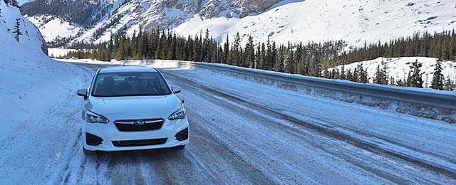
Check the latest road conditions before you go!
Whether you're out for a leisurely hike or a longer adventure, make your trip a safe one by checking the latest conditions.
You are responsible for your own safety.
If you are planning to hike or back pack in Jasper National Park, be prepared for:
- Rapid changes in weather, trail and road access.
- Travelling on ice covered water is unsafe. The Red Cross recommends an ice thickness of at least 15 centimetres. This does not apply to moving waters.
- Travelling in avalanche terrain. Whenever there is snow on a slope, there is potential for an avalanche.
- Snow and/or conditions that may require skills in route finding and navigation at higher elevation.
- Wildlife encounters and warnings.
- Variable water levels. Challenging or unsafe water crossings for hikers.
Stay informed. Always be ready to change your plans when you visit the Canadian Rocky Mountains.

CAUTION! Avalanche danger
You are responsible for your own safety. Check the Avalanche Bulletin for the latest conditions.
Dogs are prohibited from trails and areas in sensitive habitats to reduce the stress that dogs have on grizzly bears, caribou, ground-nesting birds, and/or other sensitive species. Notice of prohibition: Dogs in sensitive habitat
For the 2025 season, the Friends of Jasper National Park will continue their successful volunteer flat-packing program on the trails surrounding the Town of Jasper.
On this page
Around Town
Keep pets on a leash at all times. Report unsafe or aggressive human-wildlife interactions to Jasper Dispatch (780) 852-6155. Trails shared with commercial horse riding groups: 2, 2b, 2c, 2e, 2f, 4, 4b, 4e, 4f, 6, 6a, 6c, 7, 7e, 13.
| Jasper Discovery Trail: North (11) | Poor. | 28-03-2025: Icy sections; Muddy sections; | Trail details | |
| Jasper Discovery Trail: South (11) | Poor. | 28-03-2025: Icy sections; Muddy sections; | Trail details | |
| Lakes Loop Trail (13) | Poor. | 28-03-2025: Icy sections; Muddy sections; | Trail details | |
| Lakes Loop Trail (14) | Partially Closed | 28-03-2025: Icy sections; Muddy sections; | Trail details | |
| Lakes Loop Trail (18) | Poor. | 28-03-2025: Icy sections; Muddy sections; | Trail details | |
| Lac Beauvert Loop (4a) | Partially Closed | 28-03-2025: See trail details; Icy sections; Muddy sections; | Trail details | |
| Lake Annette Loop (4d) | Fair. | 28-03-2025: Icy sections; | Trail details | |
| Old Fort Point Loop (1) | Poor. | 28-03-2025: Flood ice; Icy sections; Muddy sections; | Trail details | |
| Campgrounds Trail (12) | Partially Closed | 28-03-2025: See trail details; Icy sections; Muddy sections; | Trail details | |
| Cottonwood Creek Loop (2, 2a, 11) | Poor. | 28-03-2025: Icy sections; Muddy sections; | Trail details | |
| Overlook Loop (2, 2b, 2f, 2g) | Poor. | 28-03-2025: Icy sections; Muddy sections; | Trail details | |
| Pyramid Trail (15) | Poor. | 28-03-2025: Icy sections; Muddy sections; | Trail details | |
| Valley of the Five Lakes : Short Loop (9a, 9b, 9) | Closed. | 28-03-2025: Superintendent closure, no public access; | Trail details | |
| Valley of the Five Lakes : Long Loop (9a, 9) | Closed. | 28-03-2025: Superintendent closure, no public access; | Trail details | |
| Dorothy and Christine Lakes (60, 60a) | Poor. | 28-03-2025: Snow patches; Icy sections; Muddy sections; | Trail details |
Maligne Valley
Check 511.alberta.ca for road updates.
| Maligne Canyon (7, 7f) | Closed. | 28-03-2025: Superintendent closure, no public access; | Trail details | |
| Overlander (10) | Poor. | 28-03-2025: Sixth Bridge Road and Trail 10A closed for wildfire debris removal. Detour in place.; Muddy sections; Icy sections; | Trail details | |
| Mary Schäffer Loop: From Trailhead (South) to Viewpoint (21) | Poor. | 28-03-2025: Snow covered; Icy sections; | Trail details | |
| Mary Schäffer Loop: From Trailhead (North) to Viewpoint (21) | Poor. | 28-03-2025: Snow covered; Icy sections; | Trail details | |
| Moose Lake Loop (20) | Poor. | 28-03-2025: Snow covered; Icy sections; | Trail details | |
| Lorraine and Mona Lakes (100) | Poor. | 28-03-2025: Snow covered; Icy sections; No dogs allowed |
Trail details | |
| Bald Hills (23) | Poor. | 28-03-2025: Avalanche danger at high altitude; Snow covered; Skier tracked. Do not walk on ski tracks; No dogs allowed |
Trail details | |
| Jacques Lake: Trailhead to Beaver Lake (139) | Poor. | 28-03-2025: Snow covered; Icy sections; Muddy sections; | Trail details | |
| Jacques Lake: Beaver Lake to Summit Lakes (139) | Poor. | 28-03-2025: Avalanche danger; Snow covered; Icy sections; Muddy sections; | Trail details | |
| Jacques Lake: Summit Lakes to Jacques Lake (139) | Poor. | 28-03-2025: Avalanche danger; Snow covered; Icy sections; | Trail details |
Icefields Parkway (93N)
Check 511.alberta.ca for road updates.
| Athabasca Falls | Poor. | 28-03-2025: Snow patches; Icy sections; Muddy sections; | Trail details | |
| Wabasso Lake (9) | Closed. | 28-03-2025: Superintendent closure, no public access; | Trail details | |
| Lower Sunwapta Falls (125) | Poor. | 28-03-2025: Snow covered sections; Icy sections; Muddy sections; | Trail details | |
| Sunwapta Falls | Poor. | 28-03-2025: Snow covered sections; Icy sections; Muddy sections; | Trail details | |
| Forefield Trail (53) | Poor. | 28-03-2025: Snow covered; Icy sections; | Trail details | |
| Toe of the Athabasca Glacier (52) | Poor. | 28-03-2025: Snow covered; Icy sections; | Trail details | |
| Wilcox Pass: Wilcox Viewpoint - Red Chairs (50) | Poor. | 28-03-2025: Snow covered; Icy sections; | Trail details | |
| Wilcox Pass: Upper Wilcox Pass (50) | Poor. | 28-03-2025: Avalanche danger beyond the Red Chairs; Snow covered; | Trail details |
Jasper Backcountry
Check 511.alberta.ca for road updates.
| Chaba trail: Trailhead to Athabasca Crossing Campground (126) | Spring conditions | 28-03-2025: Variable conditions; | Trail details | |
| Saturday Night Lake Loop: South (3, 3d) | Spring conditions | 28-03-2025: Variable conditions; | Trail details | |
| Saturday Night Lake Loop: North (3, 3c) | Spring conditions | 28-03-2025: Variable conditions; | Trail details | |
| Fryatt trail (122) - winter access | See comment section | 28-03-2025: Variable conditions; See trail details; | Trail details |
Cross-country ski trails
Winter grooming services in Jasper National Park have been suspended for the season. The trails remain accessible for your enjoyment while snow permits. If you are heading out on the trails, beware of variable conditions and possible icy sections in the morning.
| Cross-country ski trails | 20-03-2025: Maintenance has been suspended for the season; | Trail details |
- Date modified :