
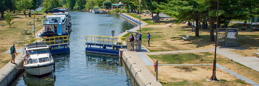
Lock 31 - Buckhorn
Trent-Severn Waterway National Historic Site
Lock 31 is a short walk to the hamlet of Buckhorn where boaters can find various facilities. Good lake cruising can be found above and below the lock. Please note there is a maximum of 1 night mooring period available at this lock station because of its very busy use.
Getting here
- Address: 1961 Lakehurst Road, Buckhorn, Ontario
- Nautical chart: #2024 (more on Nautical charts)
- Kilometer marker: 194.2 km (mile 120.7)
- GPS: 44°33'20.0"N 78°20'46.2"W
Hours of Operation
Contact:
- Phone number: (705) 657 - 8725
- Email address: trentsevern@pc.gc.ca
Navigational data
- Lock length: 37.8 m (124 ft)
- Lock width: 9.7 m (32 ft)
- Average lift: 3.5 m (11.5 ft))
- Max. mooring period: 1 night
Facilities and services
- Overnight mooring
- Shore power
- Camping (not recommended)
- Paddle dock
- Washrooms
- Potable water
- Picnic area
- Firewood ($)
- Ice ($)
- Visitor information
History
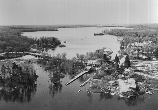
Constructed: 1882-1884
Originally known as Halls Bridge, the town was later known as Buckhorn due to the collection of deer antlers that decorated the local grist mill. This site boasted a bustling hamlet with a dam, timber slide and mills. The community expanded with temporary workers when construction began on the lock and refurbishment of the dam. Today Buckhorn boasts a thriving cottage and tourism industry.
Tourism information
- Trent-Severn Trail Towns (Buckhorn)
- Peterborough and the Kawarthas Tourism
Phone number: (705) 742-2201 or 1-800-461-6424
- Kawarthas Northumberland
Google Street View
Related links
- Lock 1 - Trenton
- Lock 2 - Sydney
- Lock 3 - Glen Miller
- Lock 4 - Batawa
- Lock 5 - Trent
- Lock 6 - Frankford
- Lock 7 - Glen Ross
- Lock 8 - Percy Reach
- Lock 9 - Meyers
- Lock 10 - Hagues Reach
- Lock 11-12 - Ranney Falls
- Lock 13 - Campbellford
- Lock 14 - Crowe Bay
- Lock 15 - Healey Falls
- Lock 16 / 17 - Healey Falls Flight Lock
- Lock 18 - Hastings
- Lock 19 - Scotts Mills
- Lock 20 - Ashburnham
- Lock 21 - Peterborough Lift Lock
- Lock 22 - Nassau Mills
- Lock 23 - Otonabee
- Lock 24 - Douro
- Lock 25 - Sawer Creek
- Lock 26 - Lakefield
- Lock 27 - Young's Point
- Lock 28 - Burleigh Falls
- Lock 30 - Lovesick
- Lock 32 - Bobcaygeon
- Lock 33 - Lindsay
- Lock 34 - Fenelon Falls
- Lock 35 - Rosedale
- Lock 36 - Kirkfield
- Lock 37 - Bolsover
- Lock 38 - Talbot
- Lock 39 - Portage
- Lock 40 - Thorah
- Lock 41 - Gamebridge
- Lock 42 - Couchiching
- Lock 43 - Swift Rapids
- Lock 44 - Big Chute Marine Railway
- Lock 45 - Port Severn
- Date modified :