
Lock 18 - Hastings
Trent-Severn Waterway National Historic Site
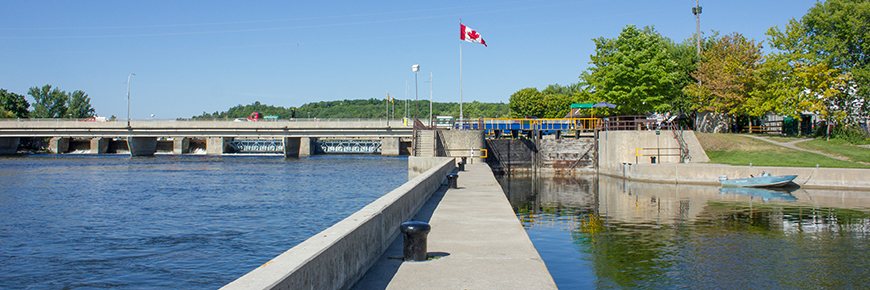
Located in the Town of Hastings, this is the last lock before entering Rice Lake. The lock itself has a nice park area with tables providing a great spot for lunch or an afternoon break. There are 60 kilometres of open channel upstream to the next station at Scotts Mills.
Getting here
- Address: 4 Bridge St. N, Hastings, Ontario
- Nautical chart: #2021 (more on Nautical charts)
- Kilometer marker: 82.3 km (mile 51.1)
- GPS: 44°18'32.0"N 77°57'21.1"W
Hours of Operation
Contact:
- Phone number: 705) 696 - 2864
- Email address: trentsevern@pc.gc.ca
Navigational data
- Lock length: 46.9 m (154 ft)
- Lock width: 9.7 m (32 ft)
- Average lift: 2.7 m (9 ft)
- Max. mooring period: 5 nights
Facilities and services
- Overnight mooring
- Camping (not recommended)
- Washrooms
- Potable water
- Picnic area
- Visitor information
History

Constructed: 1908-1912
The site of an early milling complex, a masonry lock was built at Crooks Rapids in 1838 for $25K. Renamed Hastings, the town had numerous industries powered by a timber dam and slide, till fires destroyed the complex. Randolph MacDonald & Company won the contract for a new concrete lock, dam and railway piers. Today, Hasting is a friendly town that is a favourite for those that like to fish.
Local tourism
- Trent-Severn Trail Towns (Hastings)
- Trent Hills & District Chamber of Commerce
Phone number: (705) 653-1551 or 1-888-653-1556
- Northumberland Tourism
Phone number: (905) 372-3329 ext 2257 or 2237 or 1-866-401-3278
- Municipality of Trent Hills
Phone number: 1-888-653-1556
- Kawarthas Northumberland
Google Street View
Related links
- Lock 1 - Trenton
- Lock 2 - Sydney
- Lock 3 - Glen Miller
- Lock 4 - Batawa
- Lock 5 - Trent
- Lock 6 - Frankford
- Lock 7 - Glen Ross
- Lock 8 - Percy Reach
- Lock 9 - Meyers
- Lock 10 - Hagues Reach
- Lock 11-12 - Ranney Falls
- Lock 13 - Campbellford
- Lock 14 - Crowe Bay
- Lock 15 - Healey Falls
- Lock 16 / 17 - Healey Falls Flight Lock
- Lock 19 - Scotts Mills
- Lock 20 - Ashburnham
- Lock 21 - Peterborough Lift Lock
- Lock 22 - Nassau Mills
- Lock 23 - Otonabee
- Lock 24 - Douro
- Lock 25 - Sawer Creek
- Lock 26 - Lakefield
- Lock 27 - Young's Point
- Lock 28 - Burleigh Falls
- Lock 30 - Lovesick
- Lock 31 - Buckhorn
- Lock 32 - Bobcaygeon
- Lock 33 - Lindsay
- Lock 34 - Fenelon Falls
- Lock 35 - Rosedale
- Lock 36 - Kirkfield
- Lock 37 - Bolsover
- Lock 38 - Talbot
- Lock 39 - Portage
- Lock 40 - Thorah
- Lock 41 - Gamebridge
- Lock 42 - Couchiching
- Lock 43 - Swift Rapids
- Lock 44 - Big Chute Marine Railway
- Lock 45 - Port Severn
- Date modified :