
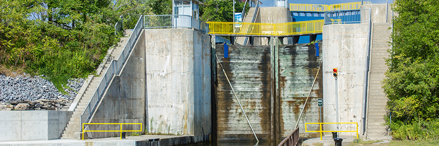
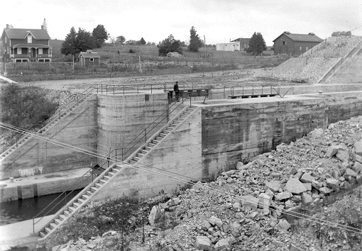
Lock 16 / 17 - Healey Falls Flight Lock
Trent-Severn Waterway National Historic Site
Healey Falls Locks are the second flight locks on the Waterway. Located approximately 11 kilometres (7 miles) upstream from the Town of Campbellford, they are tucked in a nice corner of Northumberland County amidst the Trent Hills. There is almost always a cooling breeze at the upper level. The picturesque falls are especially spectacular in the spring or whenever there are high river flows.
Getting here
- Address: 222 Canal Rd, Seymour Twp., Ontario
- Nautical chart: #2021 (more on Nautical charts)
- Kilometer marker: 58.5 km (mile 36.5)
- GPS: 44°22'22.9"N 77°46'49.0" W
Date Hours of Operation
Contact:
- Phone number: (705) 653 - 2380
- Email address: trentsevern@pc.gc.ca
Navigational data
- Lock length: 46.9 m (154 ft)
- Lock width: 9.7 m (32 ft)
- Average lift: 8.2 m (54 ft)
- Max. mooring period: 5 nights
- Overnight mooring
- Camping
- Washrooms
- Potable water
- Picnic area
- Visitor information
Related links
- Lock 1 - Trenton
- Lock 2 - Sydney
- Lock 3 - Glen Miller
- Lock 4 - Batawa
- Lock 5 - Trent
- Lock 6 - Frankford
- Lock 7 - Glen Ross
- Lock 8 - Percy Reach
- Lock 9 - Meyers
- Lock 10 - Hagues Reach
- Lock 11-12 - Ranney Falls
- Lock 13 - Campbellford
- Lock 14 - Crowe Bay
- Lock 15 - Healey Falls
- Lock 18 - Hastings
- Lock 19 - Scotts Mills
- Lock 20 - Ashburnham
- Lock 21 - Peterborough Lift Lock
- Lock 22 - Nassau Mills
- Lock 23 - Otonabee
- Lock 24 - Douro
- Lock 25 - Sawer Creek
- Lock 26 - Lakefield
- Lock 27 - Young's Point
- Lock 28 - Burleigh Falls
- Lock 30 - Lovesick
- Lock 31 - Buckhorn
- Lock 32 - Bobcaygeon
- Lock 33 - Lindsay
- Lock 34 - Fenelon Falls
- Lock 35 - Rosedale
- Lock 36 - Kirkfield
- Lock 37 - Bolsover
- Lock 38 - Talbot
- Lock 39 - Portage
- Lock 40 - Thorah
- Lock 41 - Gamebridge
- Lock 42 - Couchiching
- Lock 43 - Swift Rapids
- Lock 44 - Big Chute Marine Railway
- Lock 45 - Port Severn
- Date modified :