
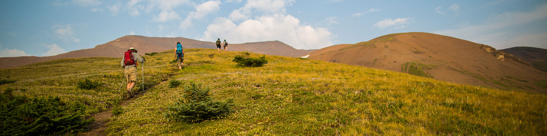
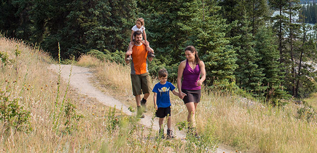
Day hiking in Jasper National Park
Jasper National Park
An area closure is in effect for Miette Hot Springs area and Fiddle River Valley to ensure public safety and facilitate Parks Canada operations to respond to a wildfire.Utopia Wildfire
Jasper National Park is closed
An Evacuation Order has been issued for Jasper
Everyone in Jasper must evacuate now. Wildfire status.
Reservations from July 23 to August 6 in Jasper National Park will automatically be cancelled and fully refunded
Reservations from July 23 to August 6 in Jasper National Park will automatically be cancelled and fully refunded. There is no need for further action on the part of visitors for these cancellations and refunds.
Reopening dates will be confirmed when available and any further cancelations communicated as required. If you wish to cancel reservations beyond August 6, regular cancellation charges may apply.
We are sorry for the inconvenience and disappointment this news brings to your travel plans. We appreciate your patience as we take necessary action to keep our visitors safe.
Since Jasper National Park was established in 1907, its historical trail networks have been expanded and maintained for everyone wanting to experience Jasper’s wilderness. Whether you are strolling along the shores of Maligne Lake or hiking all day in the alpine, the following information will help you plan a trip that is right for you.
Explore the trails
Jasper Connector Trails
Across the river
Across the river
| Trail | Distance (round trip) | Time | Elevation | Trail # | Level of difficulty | Biking | Dogs | Horses |
| Old Fort Point Loop | 3.8 km | 1-2 hours | 130 m | 1, 1a | Moderate | No | Yes | No |
| Overlander Trail | 31 km | 10-12 hours | 65 m | 10 | Moderate | Yes | Yes | Yes |
| Maligne Canyon | 4.4 km | 2-4 hours | 100 m | 7g 7 |
Moderate |
Yes No |
Yes Yes |
No No |
| Lake Annette Loop | 2.4 km | 1-1.5 hours | 0 m | 4d | Easy | No | Yes | No |
West and Southwest of Jasper
West and Southwest of Jasper
| Trail | Distance (round trip) | Time | Elevation | Trail # | Level of difficulty | Biking | Dogs | Horses |
| Caledonia Lake | 8 km | 4-6 hours | 97 m | 3 | Moderate | Yes | Yes | Yes |
| Virl, Dorothy and Christine Lakes | 8.6 km | 4-6 hours | 250 m | 60, 60a | Moderate | Yes | Yes | Yes |
| The Whistlers Summit Trail | 2.2 km | 1-2 hours | 150 m | 5a | Moderate | No | Yes | No |
| The Whistlers Trail | 13.6 km | 5-8 hours | 1200 m | 5 | Difficult | No | Yes | No |
Maligne Lake
Maligne Lake
| Trail | Distance (round trip) | Time | Elevation | Trail # | Level of difficulty | Biking | Dogs | Horses |
|
Opal Hills Loop |
8.2 km |
4-6 hours | 460 m | 22 | Difficult | No | No | No |
| Bald Hills | 10.4 km | 4-6 hours | 500 m | 23 | Difficult | No |
No |
No |
| Moose Lake Loop | 2.7 km | 1-2 hours | 59 m | 20 | Easy | No | Yes | No |
| Mary Schäffer Loop | 3.2 km | 1-2 hours | 0 m | 21 | Easy | No | Yes | No |
| Lorraine Lake and Mona Lake | 5.2 km | 2-3 hours | 80 m | 100 | Easy | No | No | No |
Pyramid Bench
Pyramid Bench
| Trail | Distance (round trip) | Time | Elevation | Trail # | Level of difficulty | Biking | Dogs | Horses |
| Pyramid Trail | 10.4 km | 2-4 hours | 118 m | 15 | Moderate | Yes | Yes | Yes |
| Cottonwood Creek Loop | 5.1 km | 1-2 hours | 60 m | 2, 2a, 11 | Moderate | Yes | Yes | Yes |
| Patricia Lake Loop | 4.8 km | 2-3 hours | 60 m | 6 | Moderate | Yes | Yes | Yes |
| Mina-Riley Lakes Loop | 9 km | 3-4 hours | 172 m | 8 | Moderate | Yes | Yes | Yes |
South of town
South of town
| Trail | Distance (round trip) | Time | Elevation | Trail # | Level of difficulty | Biking | Dogs | Horses |
| Valley of the Five Lakes | 4.6 km | 2 hours | 66 m | 9a, 9b, 9 | Moderate | Yes | Yes | Yes |
| Wabasso Lake | 6.4 km | 2-3 hours | 38 m | 9 | Moderate | Yes | Yes | Yes |
Mount Edith Cavell
| Trail | Distance (round trip) | Time | Elevation | Trail # | Level of difficulty | Biking | Dogs | Horses |
| Path of the Glacier Trail | 1.4 km | 1 hour | 70 m | 41 | Moderate | No | Yes | No |
| Cavell Meadows Trail | 7 km | 3-5 hours | 500 m | 42 | Moderate | No | No | No |
Icefield Parkway
Icefield Parkway
| Trail | Distance (round trip) | Time | Elevation | Trail # | Level of difficulty | Biking | Dogs | Horses |
| Athabasca Falls | 200 m | 0.5 hour | Minimal | Moderate | No | Yes | No | |
| Lower Sunwapta Falls | 2.6 km | 1 hour | 87 m | 125 | Moderate | No | Yes | No |
| Forefield Trail | 3.6 km | 1-2 hours | Minimal | 53 | Moderate | No | Yes | No |
| Toe of the Athabasca Glacier | 1.8 km | 1 hour | 60 m | 52 | Moderate | No | Yes | No |
| Nigel Pass | 14.4 km | 5 hours | 365 m | 130 | Moderate | No | Yes | Yes |
| Wilcox Pass | 2.4 km return to first viewpoint; 8 km return to pass | 1 hour return to first viewpoint, 2-3 hours return to Pass | 390 m | 50 | Moderate | No | Yes | No |
| Parker Ridge | 5.4 km | 3 hours | 250 m | 51 | Moderate | No | Yes | No |
Miette Hotsprings
Miette Hotsprings
| Trail | Distance (round trip) | Time | Elevation | Trail # | Level of difficulty | Biking | Dogs | Horses |
| Sulphur Skyline | 8 km | 4-6 hours | 700 m | 30 | Difficult | No | Yes | No |
| Miette Mine Trail | 800 m lower loop, 1.7 km upper loop |
20 min for lower loop, 45 min for upper loop |
0 m | 31/32 | Easy | No | Yes | No |
| Jasper House Viewpoint | 0.7 km | 20 min | 0 m | 33 | Easy | No | Yes | No |
Day Hiking Guide
While we aim to achieve high standards, inclement mountain weather and events can considerably change trail conditions instantly.
How was your trip? Please submit a trail condition report.
- Date modified :