
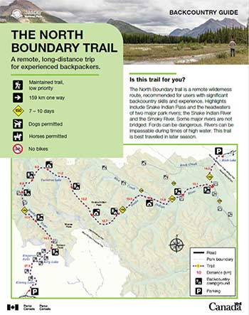
A remote, long-distance trip for experienced backpackers.
The North Boundary Trail
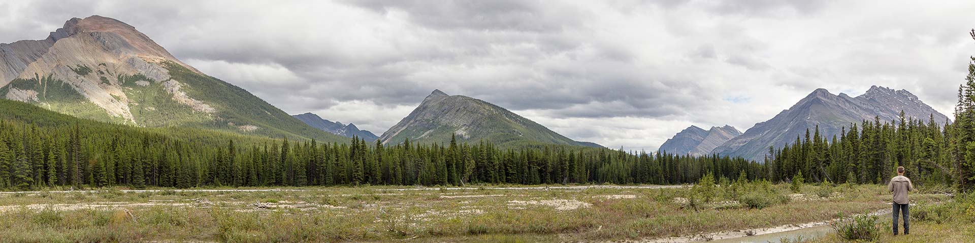
Jasper National Park
 North Boundary Trail Backcountry Guide (PDF, 705 KB)
The North Boundary trail is a remote wilderness route, recommended for users with significant backcountry skills and experience. Highlights include Snake Indian Pass and the headwaters of two major park rivers; the Snake Indian River and the Smoky River. Some major rivers are not bridged. Fords can be dangerous. Rivers can be impassable during times of high water. This trail is best travelled in later season.
Planning considerations
- Maintained trail: low priority
- 159 km one way
- Trail #150: 7 - 10 days
- Dogs permitted
- Horses permitted
- No bikes
The details
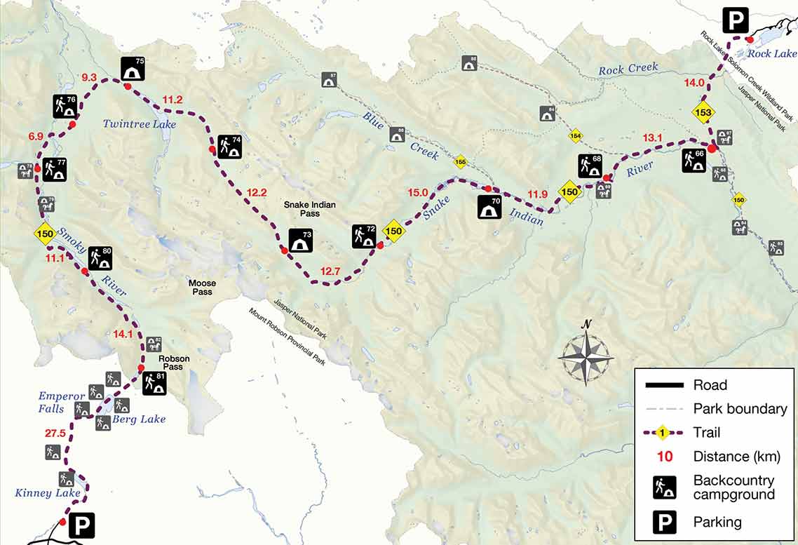
The trail begins at Rock Lake, in the Province of Alberta. The first 1.5 km of trail is on an old road. At the first junction, follow the trail to Willow Creek and cross into Jasper National Park at km 5. The first campsite at Willow Creek (#66) is in the Snake Indian River Valley. Between the Little Heaven Junction and the Blue Creek junction, take a short 400 m side trip off the trail to see Welbourne Falls. The trail gradually ascends with occasional views of the Snake Indian River to its headwaters in Snake Indian Pass. From the alpine meadows of the pass, the trail descends to Twintree Lake and then joins the Smoky River further down. The trail climbs along the Smoky River to Adolphus Lake and then to Robson Pass. This pass marks the boundary between Jasper National Park and Mt. Robson Provincial Park in British Columbia. From here, the final 23 km along the Berg Lake trail is popular and often busy. This trail can be hiked late into the season (early October).
There is an alternative starting point at Celestine Lake. See Celestine to Rock Lake guide.
There is an alternative route. See Little Heaven – Upper Blue Creek Trail Guide (PDF, 862 KB).
- Many creeks and rivers are not bridged. Fords can be dangerous or impassable. Travel is not recommended during times of high water.
- The trail may be overgrown and difficult to find in places; expect route finding.
- Campground locations are signed but not the facilities within them. Some can be challenging to locate; coordinates are available. Camping areas are basic. Bear proof containers are recommended.
- Fires are permitted only in approved fire pits. Check for fire bans.
- The Rock Creek trail and the North Boundary trail are seasonally closed for caribou conservation from November 1 to May 15.
- Camping in Mount Robson Provincial Park requires a reservation with BC Parks.
- Dogs are not permitted overnight.
Campground information
| Campground | Elevation (m) | Description | # of sites | Toilet type | Food storage | UTM |
|---|---|---|---|---|---|---|
| Willow Creek – Hiker #66 |
1360 m | A simple camping area near Willow Creek, across the creek from Willow Creek Horse Camp. | 4 | Throne | Cable | 11U 410612 5914645 |
| Welbourne – Hiker #68 |
1440 m | A beautiful camping area along the shore of the Snake Indian River. | 4 | Bar | Pole | 11U 400416 5911090 |
| Blue Creek #70 |
1520 m | A simple camping area, that is shared with horse groups, in the forest near Blue Creek. | 4 | Throne | Pole | 11U 391067 5910390 |
| Three Slides #72 |
1600 m | A simple camping area with stunning views of the upper valley near the Snake Indian River. | 4 | Bar | None | 11U 380383 5905210 |
| Oatmeal #73 |
1768 m | A simple camping area in an open forest with some mountain views. | 4 | Throne | Cable | 11U 371608 5905189 |
| Byng #74 |
1803 m | A simple camping area in an open forest along the Snake Indian River with mountain views. | 4 | Bar | Cable | 11U 365296 5914411 |
| Twintree #75 |
1563 m | A pretty camping area in the forest on the shore of Twintree Lake and Twintree Creek with great views over the lake. | 4 | Throne | Pole | 11U 357430 5919640 |
| Donaldson Creek #76 |
1400 m | A simple camping area in the forest. | 4 | Bar | Cable | 11U 352417 5916365 |
| Chown Creek – Hiker #77 |
1441 m | A beautiful camping area on the shore of Chown Creek with great views. | 4 | Bar | Cable | 11U 349209 5912358 |
| Wolverine North #80 |
1525 m | A simple camping area in open forest along the trail. | 4 | Bar | Pole | 11U 353440 5903140 |
| Aldolphus – Hiker #81 |
1681 m | A simple camping are in an open forest with some mountain views. | 4 | Bar | Pole | 11U 358730 5894746 |
How to get there

Rock Lake trailhead
This trailhead is located in the Willmore Wilderness outside of the park.
- Travel Highway 16 east, about 70 km, toward Hinton
- Turn north on Hwy 40 and travel about 40 km
- Turn west at the Rock Lake turnoff and travel 32 km on a gravel road to Rock Lake
- Look for the signs directing you to Willmore Wilderness Park and the trailhead parking lot. You do not want to park at the Rock Lake Campground.
Mount Robson Provincial Park/Berg Lake trailhead
This trailhead is located in Mount Robson Provincial Park west of Jasper.
- Drive 80 km west on Highway 16 to the Mount Robson Provincial Park Visitor Centre
- The access road to the trailhead is at this turnoff
Are you prepared?

Safety is your responsibility
Refer to the Jasper National Park Backcountry Planning Guide:
- descriptions of trail types and campground facilities;
- equipment checklists;
- responsible camping practices;
- safety information.
Before heading out, check trail, weather and road conditions at: parks.canada.ca/jaspertrails.
Maps
| NTS |
|---|
| Rock Lake 83E/8 Blue Creek 83E/7 Twintree Lake 83E/6 Mount Robson 83E/3 |
Permits
A backcountry camping permit is mandatory for all overnight trips and can be obtained online at reservation.pc.gc.ca or by calling 1-877-737-3783.
Related links
- Athabasca Island
- Athabasca Pass
- The Brazeau Loop
- Celestine Lake to Rock Lake Trail
- Fiddle River Trail
- Fryatt Trail
- Saturday Night Lake Loop
- Jacques Lake
- Maligne Lake
- Skyline
- Tonquin Valley Trail
- Random camping
- Little Heaven – Upper Blue Creek
- Maligne Pass
- Jonas Pass-Poboktan Creek
- South Boundary trail
- Bivouacking guidelines
- Horse use in Jasper National Park
- Date modified :