

Height-of-Land Lookout Tower
Prince Albert National Park
A Bird’s-eye View
At the Height-of-Land tower you are standing on the divide where waters to the north flow into the Churchill River and waters to the south flow into the Saskatchewan River.
At the top of the 15 metre tower you are 100 metres higher than Waskesiu; you can see King Island, Shady Lake and Beartrap Creek. Golden aspen, icy-blue waters, fresh green foliage and sparkling snow greet you in different seasons. Come at night for a breath-taking view of twinkling stars.
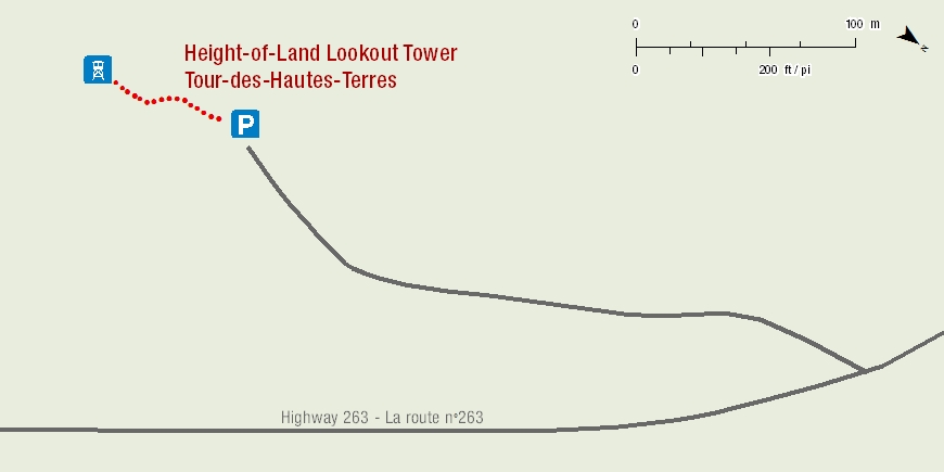
Length: 60m, one way
Time: 15 minutes
Level of Difficulty: Easy, 15m tall tower with stairs.
Significant Features: 15m tower overlooks the mixed wood forest surrounding Shady Lake and Bear Trap Creek.
Trailhead: 8.5 km from the visitor centre on highway #263.
GPS Co-ordinates for Trailhead (in decimal degrees):
Lat.: 53.86676150 Long.: -106.0969391
Related links
- Trail conditions
- Amyot Lake Trail
- Treebeard Trail
- Routes to Grey Owl's Cabin
- Fisher Trail
- Grey Owl Trail
- Hunters Lake Trail
- Kingsmere River Trail
- Boundary Bog Trail
- Narrows Peninsula Trail
- Red Deer Trail
- Spruce River Highlands Trail
- Waskesiu River Trail
- Mud Creek Trail
- Shady Lake Trail
- Freight Tait Springs Trail
- Valleyview Trail Network
- Elk Trail
- Date modified :