
Hiking
Prince Albert National Park
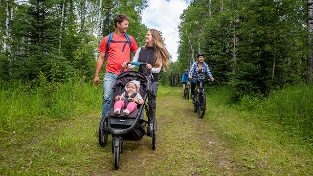
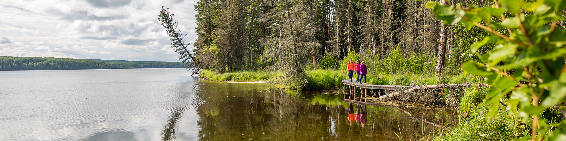
Experience firsthand the amazing variety of natural wonders that are waiting for you in Prince Albert National Park. Over 150km of hiking trails within the park provide you access to the incredible diversity of life found in this transition zone between fescue grasslands, aspen parkland and northern boreal forest.
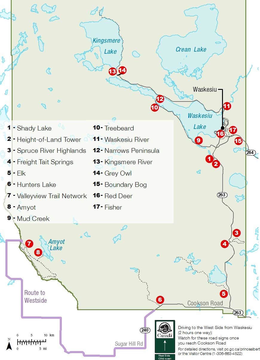
The park features 17 trails varying in length and level of difficulty. While hiking in the park you can enjoy short walks, day hikes and overnight backcountry excursions. Although you will encounter steep hills on some trails there is little overall change in elevation throughout the park.
Dogs are welcome! Please keep them on a leash and pick up after them.
Before venturing out,
- Review bear safety information before departure.
- Be prepared to explore safely
- Cellphone coverage is limited.
- Review the weather, trail conditions, and important bulletins before your trip and enjoy!
- Contact the Visitor Centre staff for up-to-date reports or to learn more about visitor safety
List of trails
| # | Trail | Distance | Time | Difficulty |
|---|---|---|---|---|
| 1 |
Shady Lake trail A 45m staircase leads down into the aspen forest surrounding Shady Lake. |
1.7km (loop) | 45 minutes |
 Moderate |
| 2 |
Height-of-Land Tower 15m tower overlooks the mixed wood forest surrounding Shady Lake and Bear Trap Creek. |
60 m (one way) | 20 to 30 minutes |
 Easy |
| 3 |
Spruce River Highlands Traverse aspen covered hill tops overlooking the Spruce River. |
8.5km (loop) | 3 hours |
 Difficult |
| 4 |
Freight Tait Springs Trail The old freight trail travels through a mixed aspen and white spruce forest leading to a natural fresh water spring. |
2km (one way) | 60 to 90 minutes |
Easy |
| 5 |
Elk Trail Rolling hills with mixed wood forest and tall grass meadows. |
Fish Lake 13km (one way) Camp Lake 15km (one way) |
7 to 8 hours |
Moderate |
| 6 |
Hunters Trail Steep rolling hills and mixed wood forest of jack pine and trembling aspen. |
7.3 km (loop) | 3 hours |
Easy |
| 7 |
Valleyview Trail Network Travel through the mixed wood aspen forest, sedge meadows and fescue grasslands frequented by bison. |
28.7km (network) | 2 to 3 days |
Moderate |
| a. |
Valleyview Lookout Trail This short wheelchair accessible hike takes you to the Valleyview picnic site. Enjoy beautiful views of the Sturgeon River Valley. |
200m wheelchair accessible (one way) | 30 minutes |
Easy |
| b. |
Valleyview Easy Loop This loop is great for a family outing; it offers a 200m accessible trail to the Valleyview picnic site. |
4.1km (loop) | 1 hour |
Easy |
| c. |
Stoney Plain Meadow Trail Spur Follow a marked route through Stoney Plain Meadow, a rare fescue grassland. |
1km (one way) | 30 minutes |
Moderate |
| d. |
Valleyview Moderate Loop This trail is linked to the Valleyview Easy Loop. Enjoy travelling through an aspen forest and along the Sturgeon River Valley. Great random camping opportunities along the way. |
8km (loop) | 2 to 3 hours |
Moderate |
| e. |
Valleyview Difficult Loop Follows the entire length of the Valleyview Trail with many great lookouts over the Sturgeon River Valley. This trail goes through Jonassons Flats, a rare fescue grassland. This trail also provides access to Sturgeon Lookout. |
24.5km (loop) | 8 to 10 hours |
Difficult |
| 8 |
Amyot Lake Trail Spur Aspen parkland and sedge meadows in this area are frequently visited by the free ranging Sturgeon River Plains Bison herd. |
2km (one way) |
1 hour |
Difficult |
| 9 |
Mud Creek Trail This lakeside trail turns upstream to follow Mud Creek through an aspen forest. In the spring spawning fish attract black bears to the area. |
2km (loop) | 45 to 60 minutes |
Easy |
| 10 |
Treebeard Trail Ascend a steep, winding trail through a white spruce and balsam fir forest. The trees on this trail are some of the oldest in the park. |
1.2km (loop) | 45 to 60 minutes |
Moderate |
| 11 |
Waskesiu River Trail Follows alongside the Waskesiu River before the trail turns into the aspen and spruce covered hills of the river valley. |
2.5km (loop) | 45 to 60 minutes |
Moderate |
| 12 |
Narrows Peninsula Trail This trail passes through a variety of habitats as it follows along the shore of Waskesiu Lake. Of particular interest is the large fern bed that peaks in early summer. |
3km (loop) | 1 hour |
Moderate |
| 13 |
Kingsmere River Trail Follow the Kingsmere River through a mixed wood of aspen and Spruce. |
1.5km (one way) | 1 hour |
Easy |
| 14 |
Grey Owl Trail Experience the diversity of the boreal forest as you follow the eastern shore around Kingsmere lake. |
20km (one way) | 10 to 12 hours |
Difficult |
| 15 |
Boundary Bog Trail Knob and Kettle topography leads through mixed spruce and tamarack, taking you to the heart of a boreal forest bog. |
2km (loop) | 45 to 60 minutes |
Easy |
| 16 |
Red Deer Trail The Red Deer Trail is a combination of Three loops in and around the Town of Waskesiu. |
19km (loop) | 5 to 6 hours |
Moderate |
| a. |
Red Deer Trail, Red Loop Red Loop takes you through a variety of habitats from town site to lakeshore and through the rolling hills South of Waskesiu. |
8.1km (loop) | 2 to 3 hours |
Moderate |
| b. |
Red Deer Trail, Yellow Loop The Yellow Loop travels through the Waskesiu community fuel break east of the town before turning back and following along the eastern shore of Waskesiu Lake. |
5.8km (loop) | 2 hours |
Easy |
| c. |
Red Deer Trail, Blue Loop The Blue Loop travels around the Beaver Glen Campground and into the rolling hills and mix wood forests North of Waskesiu before returning along the lakeshore. |
5.2km (loop) | 1.5 to 2 hours |
Moderate |
| 17 |
Fisher Trail Located close to the town of Waskesiu this trail leads you through mixed wood stands of aspen and black spruce muskeg. |
6.3km (loop) | 2 hours |
Moderate |
Expand a trail to read its description and open the trail details page.
1. Shady Lake trailDistance: 1.7km (loop) | Time: 45 minutes | Difficulty: Moderate
A 45m staircase leads down into the aspen forest surrounding Shady Lake.
2. Height-of-Land TowerDistance: 60 m (one way) | Time: 20 to 30 minutes | Difficulty: Easy
15m tower overlooks the mixed wood forest surrounding Shady Lake and Bear Trap Creek.
3. Spruce River HighlandsDistance: 8.5km (loop) | Time: 3 hours | Difficulty: Difficult
Traverse aspen covered hill tops overlooking the Spruce River.
4. Freight Tait Springs TrailDistance: 2km (one way) | Time: 60 to 90 minutes | Difficulty: Easy
The old freight trail travels through a mixed aspen and white spruce forest leading to a natural fresh water spring.
5. Elk TrailDistance: Fish Lake 13km (one way); ; Camp Lake 15km (one way) | Time: 7 to 8 hours | Difficulty: Moderate
Rolling hills with mixed wood forest and tall grass meadows.
6. Hunters TrailDistance: 7.3 km (loop) | Time: 3 hours | Difficulty: Easy
Steep rolling hills and mixed wood forest of jack pine and trembling aspen.
7. Valleyview Trail NetworkDistance: 28.7km (network) | Time: 2 to 3 days | Difficulty: Moderate
Travel through the mixed wood aspen forest, sedge meadows and fescue grasslands frequented by bison.
a. Valleyview Lookout TrailDistance: 200m wheelchair accessible (one way) | Time: 30 minutes | Difficulty: Easy
This short wheelchair accessible hike takes you to the Valleyview picnic site. Enjoy beautiful views of the Sturgeon River Valley.
b. Valleyview Easy LoopDistance: 4.1km (loop) | Time: 1 hour | Difficulty: Easy
This loop is great for a family outing; it offers a 200m accessible trail to the Valleyview picnic site.
c. Stoney Plain Meadow Trail SpurDistance: 1km (one way) | Time: 30 minutes | Difficulty: Moderate
Follow a marked route through Stoney Plain Meadow, a rare fescue grassland.
d. Valleyview Moderate LoopDistance: 8km (loop) | Time: 2 to 3 hours | Difficulty: Moderate
This trail is linked to the Valleyview Easy Loop. Enjoy travelling through an aspen forest and along the Sturgeon River Valley. Great random camping opportunities along the way.
e. Valleyview Difficult LoopDistance: 24.5km (loop) | Time: 8 to 10 hours | Difficulty: Difficult
Follows the entire length of the Valleyview Trail with many great lookouts over the Sturgeon River Valley. This trail goes through Jonassons Flats, a rare fescue grassland. This trail also provides access to Sturgeon Lookout.
8. Amyot Lake Trail SpurDistance: 2km (one way) | Time: 1 hour | Difficulty: Difficult
Aspen parkland and sedge meadows in this area are frequently visited by the free ranging Sturgeon River Plains Bison herd.
9. Mud Creek TrailDistance: 2km (loop) | Time: 45 to 60 minutes | Difficulty: Easy
This lakeside trail turns upstream to follow Mud Creek through an aspen forest. In the spring spawning fish attract black bears to the area.
10. Treebeard TrailDistance: 1.2km (loop) | Time: 45 to 60 minutes | Difficulty: Moderate
Ascend a steep, winding trail through a white spruce and balsam fir forest. The trees on this trail are some of the oldest in the park.
11. Waskesiu River TrailDistance: 2.5km (loop) | Time: 45 to 60 minutes | Difficulty: Moderate
Follows alongside the Waskesiu River before the trail turns into the aspen and spruce covered hills of the river valley.
12. Narrows Peninsula TrailDistance: 3km (loop) | Time: 1 hour | Difficulty: Moderate
This trail passes through a variety of habitats as it follows along the shore of Waskesiu Lake. Of particular interest is the large fern bed that peaks in early summer.
13. Kingsmere River TrailDistance: 1.5km (one way) | Time: 1 hour | Difficulty: Easy
Follow the Kingsmere River through a mixed wood of aspen and Spruce.
14. Grey Owl TrailDistance: 20km (one way) | Time: 10 to 12 hours | Difficulty: Difficult
Experience the diversity of the boreal forest as you follow the eastern shore around Kingsmere lake.
15. Boundary Bog TrailDistance: 2km (loop) | Time: 45 to 60 minutes | Difficulty: Easy
Knob and Kettle topography leads through mixed spruce and tamarack, taking you to the heart of a boreal forest bog.
16. Red Deer TrailDistance: 19km (loop) | Time: 5 to 6 hours | Difficulty: Moderate
The Red Deer Trail is a combination of Three loops in and around the Town of Waskesiu.
a. Red Deer Trail, Red LoopDistance: 8.1km (loop) | Time: 2 to 3 hours | Difficulty: Moderate
Red Loop takes you through a variety of habitats from town site to lakeshore and through the rolling hills South of Waskesiu.
b. Red Deer Trail, Yellow LoopDistance: 5.8km (loop) | Time: 2 hours | Difficulty: Easy
The Yellow Loop travels through the Waskesiu community fuel break east of the town before turning back and following along the eastern shore of Waskesiu Lake.
c. Red Deer Trail, Blue LoopDistance: 5.2km (loop) | Time: 1.5 to 2 hours | Difficulty: Moderate
The Blue Loop travels around the Beaver Glen Campground and into the rolling hills and mix wood forests North of Waskesiu before returning along the lakeshore.
17. Fisher TrailDistance: 6.3km (loop) | Time: 2 hours | Difficulty: Moderate
Located close to the town of Waskesiu this trail leads you through mixed wood stands of aspen and black spruce muskeg.
- Date modified :