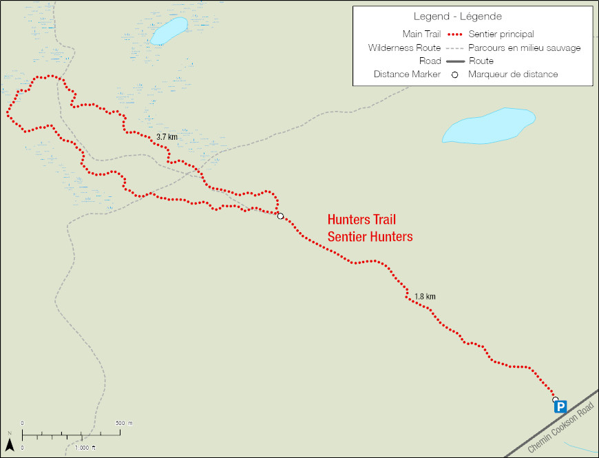
Hunters Trail
Prince Albert National Park
Striking contrast
This sandy looped trail will guide you through a site affected by the Rabbit creek Forest Fire in 2018. This dark scenery of burnt trees can feel gloomy. Don’t be fooled, post-fire forests are vibrant and very much alive. Visit in the spring to discover carpets of wildflowers, soaking in the sun through the newly open canopy.
The great range of vision offered by this contrasting landscape is ideal for birdwatching. Listen to songbirds or watch for waterfowl by the beaver ponds and small lakes.
Length: 7.3km loop
Time: 3 hours
Level of Difficulty:  Easy
Easy
Significant Features: Rolling hills and mixed wood forest of jack pine and trembling aspen.
Trailhead: 16km west of South Gate on Cookson Road
GPS Co-ordinates for Trailhead (in decimal degrees):
Lat.: 53.59015317 Long.: -106.27787738


Related links
- Trail conditions
- Amyot Lake Trail
- Treebeard Trail
- Routes to Grey Owl's Cabin
- Fisher Trail
- Grey Owl Trail
- Kingsmere River Trail
- Boundary Bog Trail
- Narrows Peninsula Trail
- Red Deer Trail
- Spruce River Highlands Trail
- Waskesiu River Trail
- Mud Creek Trail
- Shady Lake Trail
- Freight Tait Springs Trail
- Height-of-Land Lookout Tower
- Valleyview Trail Network
- Elk Trail
- Date modified :