
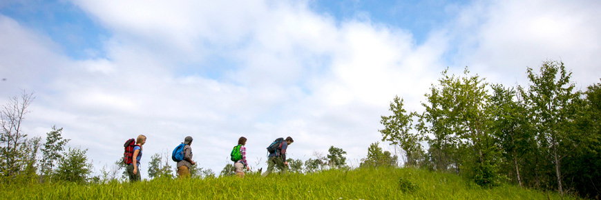
Red Deer Trail
Prince Albert National Park
Three loops totaling 19km travel around the town of Waskesiu and the east shore of Waskesiu Lake.
Length: 19km Loop
Time: 5 – 6 hours
Level of Difficulty:  Moderate, some steep sections.
Significant Features: The Red Deer Trail is a combination of three loops in and around the Town of Waskesiu.
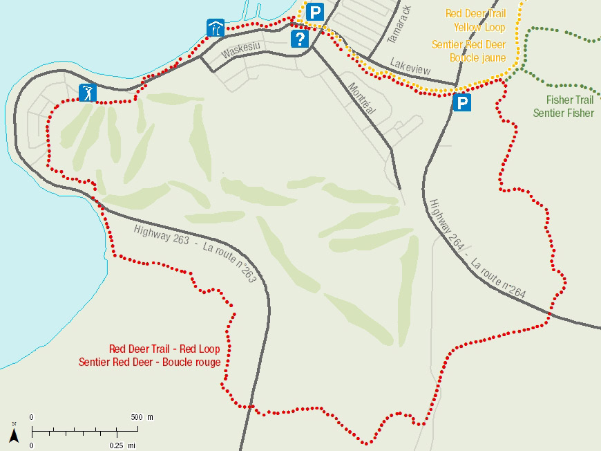
Trailhead: Starts at The Rock, located on the corner of Waskesiu Drive and Lakeview Drive in the town of Waskesiu.
GPS Co-ordinates for Trailhead (in decimal degrees):
Lat.: 53.92284117 Long.: -106.08168822


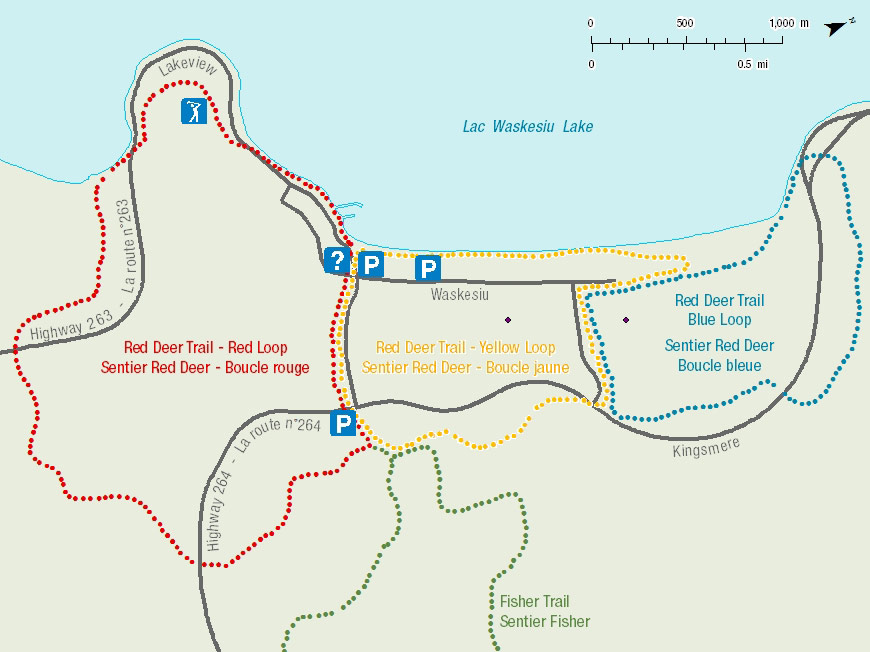
Red Deer Trail - Red Loop
The Red Loop begins with a stroll around Prospect Point, past the Waskesiu Lobstick Golf course and some of the oldest cabins in Waskesiu before entering the mixed wood forests south of town.
Length: 8.1km Loop
Time: 2 - 3 hours
Level of Difficulty: Moderate, some steep sections.
Significant Features: The Red Deer Trail, Red Loop takes you through a variety of habitats from town site to lakeshore and through the rolling hills South of Waskesiu.
Red Deer Trail - Yellow Loop
The Red Deer Trail, Yellow Loop takes you through a variety of habitats from town site through the community fuel break and back along the lakeshore.
Length: 5.8 km Loop
Time: 2 hours
Level of Difficulty:  Easy
Easy
Significant Features: The Yellow Loop travels through the Waskesiu community fuel break east of the town before turning back and following along the eastern shore of Waskesiu Lake.
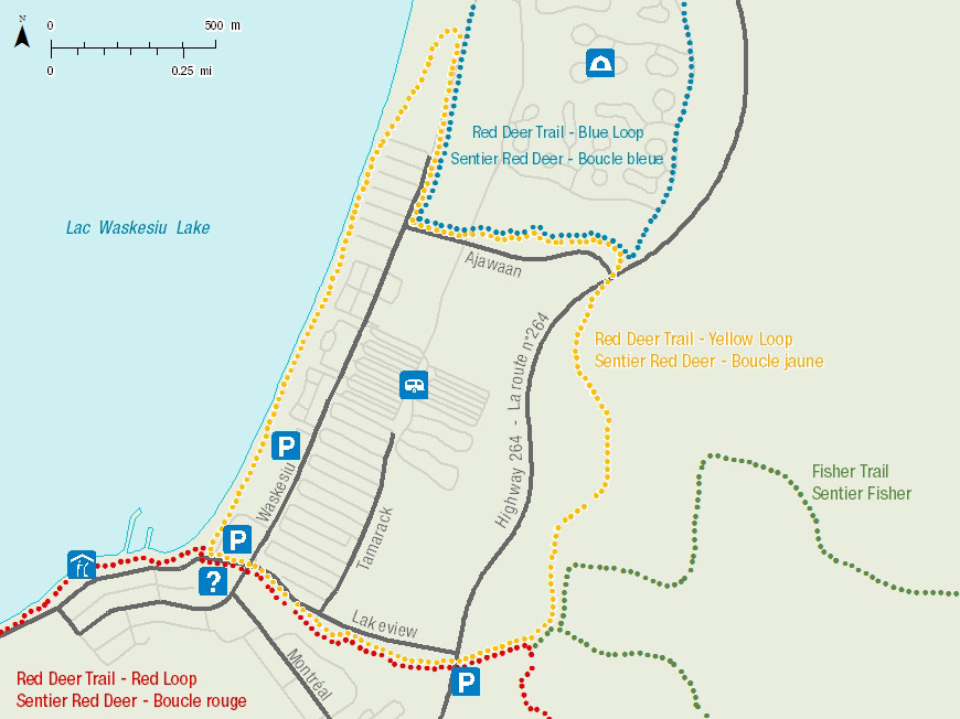
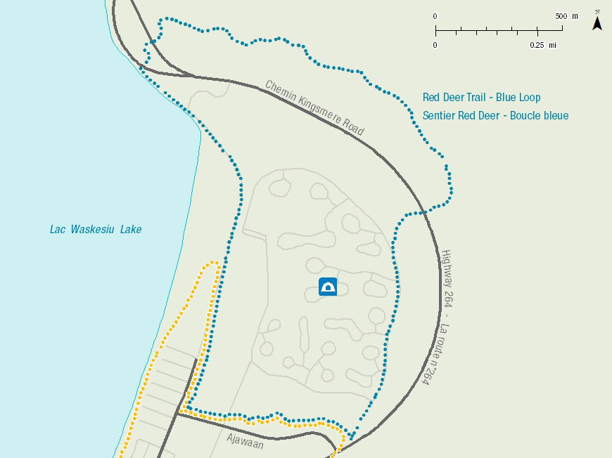
Red Deer Trail - Blue Loop
The Red Deer Trail, Blue Loop takes you around the Beaver Glen Campground, through the rolling hills north of Waskesiu, then back along the shore of Waskesiu Lake. If you are walking, you may choose to leave the trails and walk on the beach from Kapasiwin Bungalows to Orchid Street.
Length: 5.2km Loop
Time: 1.5 – 2 hours
Level of Difficulty: Moderate, some steep sections.
Significant Features: The Blue Loop travels around the Beaver Glen Campground and into the rolling hills and mix wood forests North of Waskesiu before returning along the lakeshore.
Trailhead: At the corner of Waskesiu Drive and Ajawaan Drive in the town of Waskesiu.
GPS Co-ordinates for Trailhead (in decimal degrees):
Lat.: 53.93256138 Long.: -106.07461948
Related links
- Trail conditions
- Amyot Lake Trail
- Treebeard Trail
- Routes to Grey Owl's Cabin
- Fisher Trail
- Grey Owl Trail
- Hunters Trail
- Kingsmere River Trail
- Boundary Bog Trail
- Narrows Peninsula Trail
- Spruce River Highlands Trail
- Waskesiu River Trail
- Mud Creek Trail
- Shady Lake Trail
- Freight Tait Springs Trail
- Height-of-Land Lookout Tower
- Valleyview Trail Network
- Elk Trail
- Date modified :