
Tracy Harvey
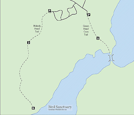
Malady Head trail
Terra Nova National Park
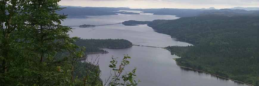
Begin hiking in a mature black spruce forest carpeted by a vibrant green moss rolling over the bumpy forest floor. The first steep climb reveals sections of forest badly damaged by past hurricanes and the island’s relentless wind. Keep climbing to reach the top of Malady Head. Watch your footing as you emerge from the forest but take the time to look up as the magnificent cliff-side view reveals itself. Catch a bird-eye view of Southwest Arm, the Eastport Causeway and Alexander Bay.
Trail details:
Level of Difficulty: Moderate to difficult
Length/Distance: 3.4 km return
Time: 1 - 1.5 hours
Location: Malady Head Trail is located in Malady Head Campground. Malady Head Campground is approximately 5km from Route 1 (TransCanada Highway) and is located on Route 310.
Habitat: mature black spruce forest carpeted by moss, wet in spots, steep climb, beautiful vista/look-off at the summit, spectacular view of Southwest Arm, Wings Pond, Eastport Causeway and Alexander Bay, lichens, Indian pipe plant
Trailhead/Access: The start of Malady Head Trail can be difficult to find. Drive up the hill at the entrance of malady Head Campground, turn right and follow the winding road through the campground past the tenting and oTENTik loops. There is a parking lot on the left. Follow the old road up to the trailhead.
GPS Coordinates: 48 38 49.97000 N, -53 55 17.48001 W
Trail Map:
- Date modified :