
Southwest Arm trail
Terra Nova National Park
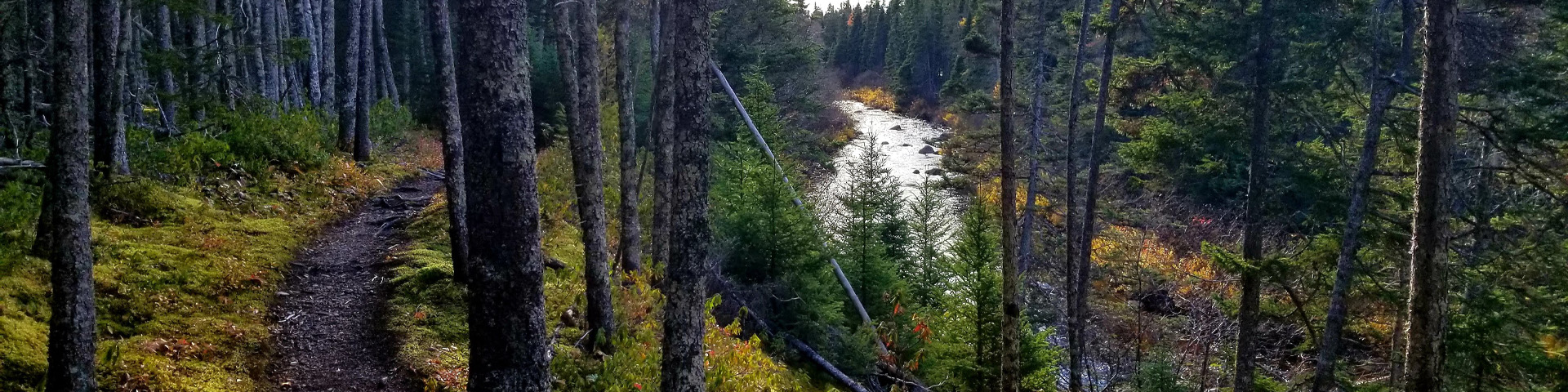
Starting from the Southwest Arm Brook Day Use Area (along TransCanada Highway), wander along the banks of the brook through a mature forest. Wind your way along a moss carpeted floor to the soundtrack of a rushing brook. Cross the suspension bridge and walk along the waters of Southwest Arm. For a different experience, start from the Southwest Arm Day Use Area and do this trail in reverse!
Camp at the backcountry sites available in Southwest Arm where you can watch the sun rise over Malady Head.
Trail details:
Level of Difficulty: Easy
Length/Distance: 4 km return
Time: 1 - 1.5 hours
Location: Southwest Arm Trail has two entry point, the first is Southwest Arm Brook Day Use Area on the side of the Route 1 (TransCanada Highway) and the second is down in the Southwest Arm Day Use Area. Southwest Arm Day Use Area is located less than 0.5km off Route 1 (TransCanada Highway).
Habitat: Mature balsam fir and black spruce forest, brook, estuary, beaver habitat, mosses
Trailhead/Access: There are two trailheads for the Southwest Arm Trail. The first is on the side of the Route 1 (TransCanada Highway) and the second is down in the Southwest Arm Day Use Area. Southwest Arm Day Use Area is located less than 0.5km off Route 1 (TransCanada Highway). The trailhead along Route 1 (TransCanada Highway) is approximately 3 km from the Visitor Centre and the trailhead in Southwest Arm Day Use Area is approximately 4 km from the Visitor Centre.
GPS Coordinates: 48 36 36.16999 N, -53 58 31.67998 W
Backcountry camping: YES. Reservable through the Parks Canada Reservation Service. Find out more.
- Date modified :