
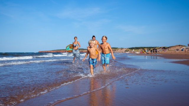
Swimming and beach activities
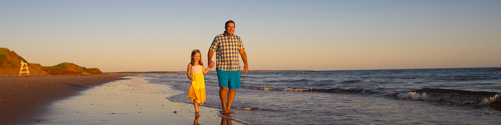
Prince Edward Island National Park
Take in the beauty of PEI National Park’s spectacular shoreline and experience the bliss of our picturesque beaches for yourself.
On this page
Features
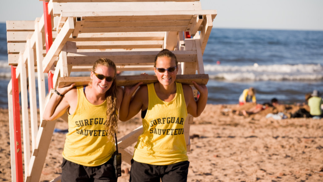
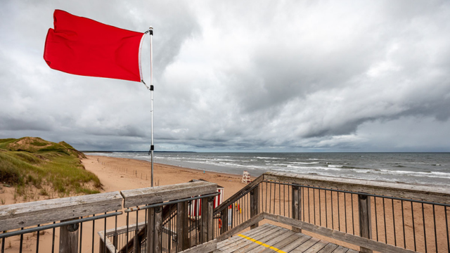
Supervised beaches
Surfguards are on duty at several beaches in the summer months for a safe experience.
PEINow: surf conditions
Before heading out, check out surf conditions and parking availability by visiting PEINow.
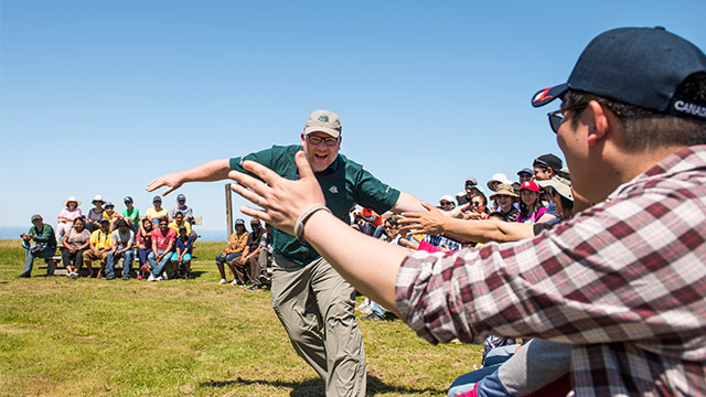
Summer fun schedule
Discover fun things to do this summer within Prince Edward Island National Park.
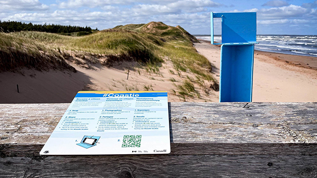
The Coastie Initiative
Take part in the Coastie Initiative, a community science program at Parks Canada administered places.
Find a beach
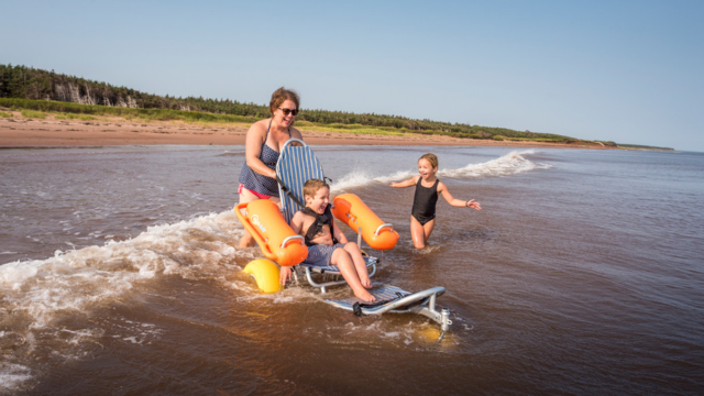
Splash around in the water in one of our supervised swimming areas or stroll along the sandy shore. Parks Canada now offers accessible beach access at some of our beaches, with ramps, beach wheelchairs, mobility mats, and universal washrooms at most locations.
For those seeking quiet evening serenity, finish your day along our national park coastline and enjoy the show of colours you’ll see here and nowhere else. Whether you prefer an active beach day or more laidback time by the water, PEI National Park beaches really do offer something memorable for everyone.
Cavendish-North Rustico beaches
Cavendish Main Beach
Services and amenities:
![]()
![]()
![]()
- Surfguard
- Washrooms
- Parking
- Ramp
- Mobility mat
- Beach wheelchairs
More information: Cavendish Beach webpage
North Rustico Beach
MacNeils Brook
1416 Gulf Shore Parkway, Cavendish
Services and amenities:
![]()
- Limited parking
- Stair access to the beach only
Brackley-Dalvay beaches
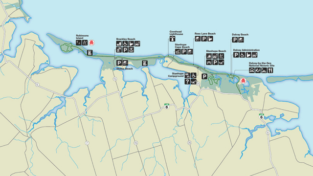
Robinsons Island
Location: 4020 Brackley Point Rd, North Rustico
Services and amenities:
![]()
![]()
![]()
- Facilities and parking are available at the Brackley beach complex
- Cars are not permitted on the Robinsons Island multi-use trail
- Walk or cycle to the beach on the multi-use trail: 3.2 km one way
More information about the Robinsons Island trail webpage
Brackley Beach
Location: 4020 Brackley Point Rd, North Rustico
Services and amenities:
![]()
![]()
![]()
![]()
![]()
- Surfguard
- Washrooms
- Parking
- Ramp
- Mobility mat
- Beach wheelchairs
More information: Brackley Beach webpage
Shaws Beach
2300 Gulf Shore Pkwy E, North Rustico
Services and amenities:
![]()
- Limited parking
- Stair access to the beach only
Covehead Lighthouse Beach
1430-1530 Gulf Shore Pkwy East
Services and amenities:
- Limited parking
- Walking through sand to access the beach
Stanhope Cape
Ross Lane
Stanhope Campground Beach
Stanhope Main
Services and amenities:
![]()
![]()
![]()
![]()
- Surfguard
- Washrooms
- Parking
- Ramp
- Mobility mat
- Beach wheelchairs
More information: Stanhope Beach webpage
Dalvay Beach
Services and amenities:
![]()
- Limited parking
- Stair access to the beach only
- Washrooms and EV chargers available at Gulf Shore trailhead
Greenwich beaches
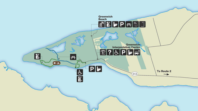
Greenwich Beach
29 Wild Rose Rd, Saint Peters Bay
Services and amenities:
![]()
![]()
![]()
- Surfguard
- Washrooms
- Parking
- Ramp
- Visitor information centre is close by
More information: Greenwich
Greenwich Dunes Beach
29 Wild Rose Rd, Saint Peters Bay
Services and amenities:
![]()
![]()
![]()
- Washrooms
- Parking
- Hike trails and climb over sand dunes to access this beach
- Visitor information centre is close by
More information: Greenwich trail system
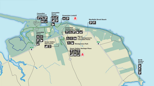
Map
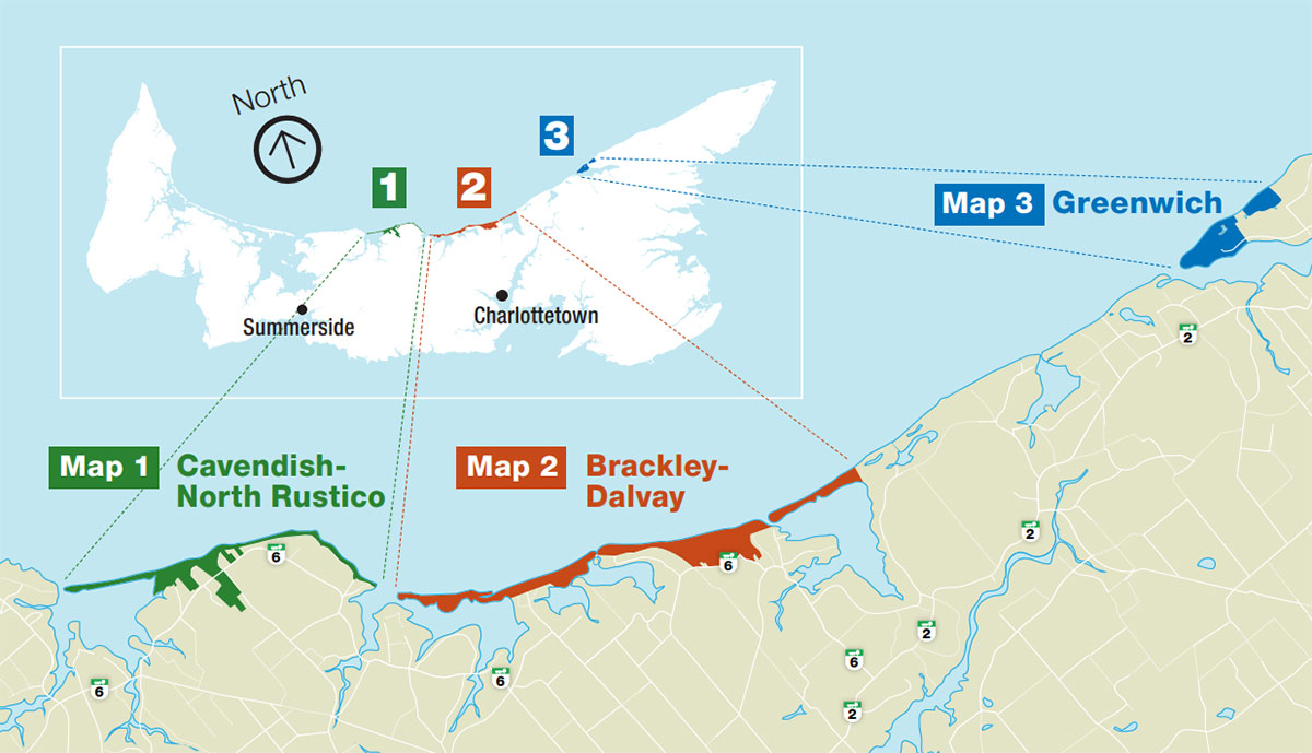
Map description
This map shows the north shore of Prince Edward Island and the locations of three sections of Prince Edward Island National Park, running west to east along the island’s northern coastline. A small inset map at the top displays the full outline of Prince Edward Island with a north arrow, indicating that the top of the map faces north. The national park areas are highlighted along the island’s north shore.
From west to east, the first section is Cavendish–North Rustico, shown in green. This area is located on the north shore, west of Charlottetown and east of Summerside. It follows the coastline near the communities of Cavendish and North Rustico and is accessed by Highway 6.
The second section is Brackley–Dalvay, shown in orange. This section is located on the north shore directly north of Charlottetown. It stretches east–west along the coast between Brackley Beach and Dalvay and is also accessed from Highway 6.
The third section is Greenwich, shown in blue. This area is located on the northeastern end of Prince Edward Island, east of Charlottetown. It lies inland from the coast along the northeastern shoreline and is accessed via Highway 2.
Dotted lines connect each detailed map area to its corresponding location on the inset island map. Major towns, rivers, roads, and coastal features are shown to indicate travel direction between park sections.
Discover maps, guides, and brochures for more details, or download the free Parks Canada app to find your next great adventure in PEI National Park.
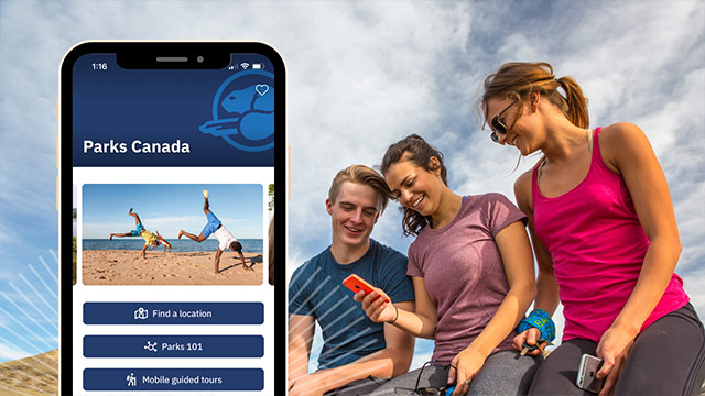
The Parks Canada App
Your pocket guide to the essentials, easy to use navigation, and exclusive access to self-guided tours on your mobile device.
- Date modified :