
Road biking
Jasper National Park
Most requested
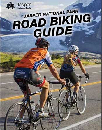 Road Biking Guide (PDF, 6.5 MB)
Some of the most spectacular views you will see in your lifetime will be in Jasper National Park. Sure, we may be a bit biased, but one of our major roadways, the Icefields Parkway, was voted one of top ten most scenic drives in the world.
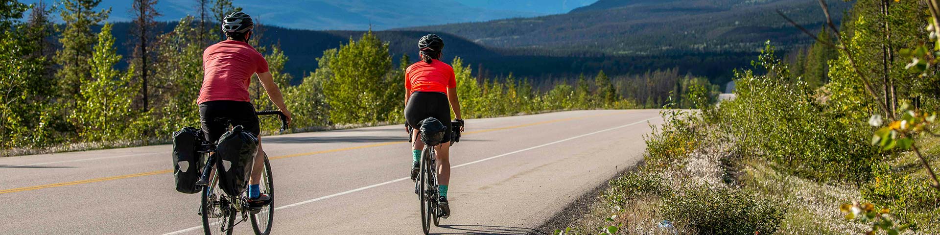
As a road cyclist you can capture all the elements of the road, while taking in the fresh mountain air with the wind in your face. Whether you are a novice cyclist or more advanced, our roadways will cater to your ability and comfort levels. If you are looking for a hill climb, a loop or an out and back, we have it covered! From short rides to full day trips, Jasper National Park is your oyster.
Are you touring the Icefields Parkway by bike? Check out Jasper National Park’s designated bike camping areas within Jonas and Honeymoon campgrounds.
Suggested itineraries
Quick tip: Ride your bike before 10 am and after 5 pm to avoid traffic congestion.
Short rides
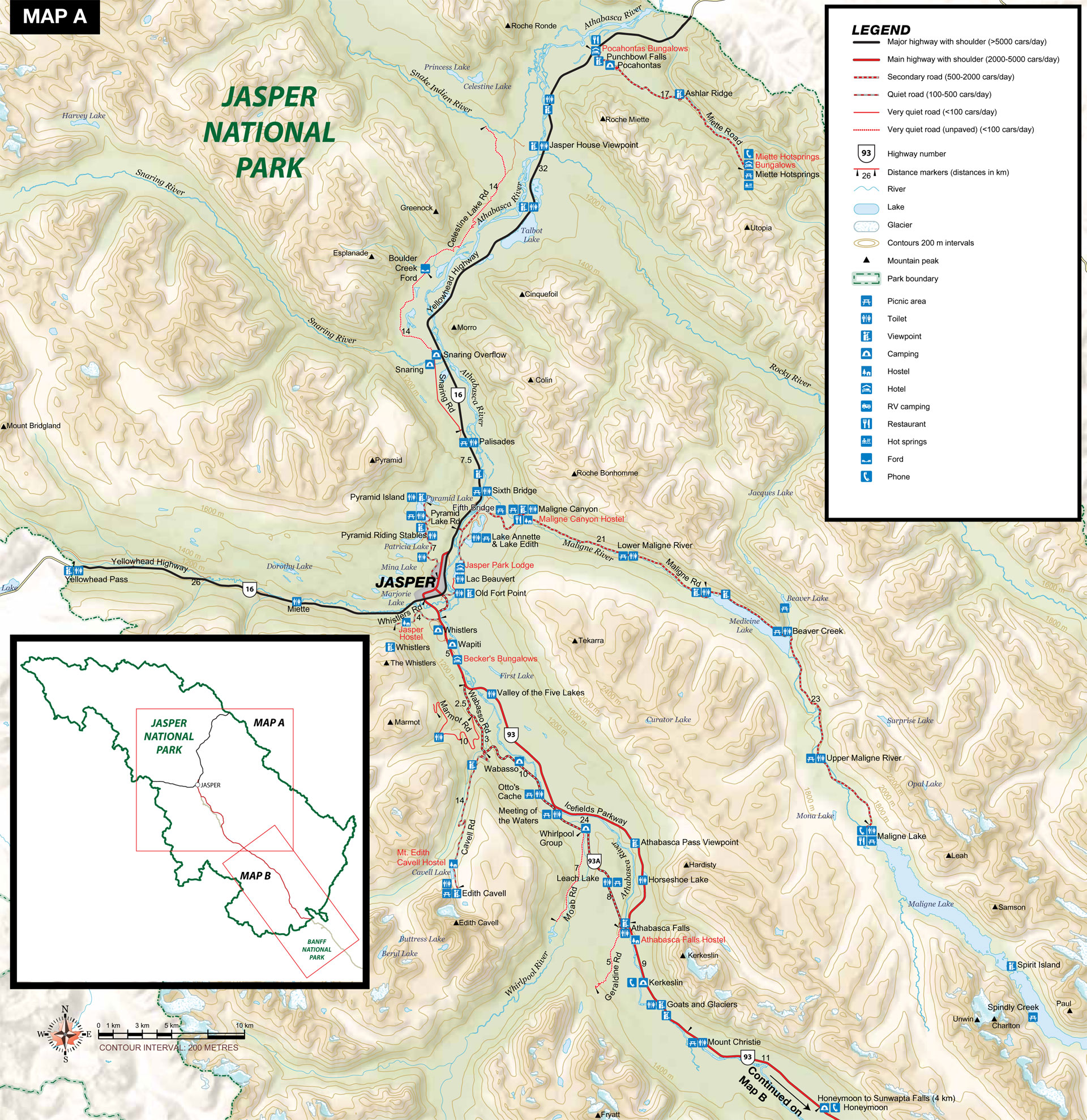
Pyramid Lake
Map: A
Distance: 14 km return
Elevation gain: 100 m
Take the beautiful ride to Pyramid Lake with stunning views of Pyramid Mountain at the top- a great out and back with a hill climb.
Whistlers Road
Map: A
Distance: 16.5 km return
Elevation gain: 210 m
Work up a sweat with a short but swift 4-km climb up to the base of the Jasper Skytram. Go for a ride up the tram or just turn back and go for a quick rip down to town.
Half day rides
The Falls Loop
Map: A
Distance: 63 km return
Elevation gain: 210 m
Head south on the famous Icefields Parkway. Take a right onto the 93A and head for Athabasca Falls. Loop back north onto Highway 93 and enjoy the views back home.
Marmot Road
Map: A
Distance: 38 km
Elevation gain: 603 m
Head south on the famous Icefields Parkway, take a right onto 93A and head uphill until you reach the Marmot Road. Take a right up this road to the base of the ski hill then turn back and enjoy the cruise home.
Full day rides
Maligne Road
Map: A
Distance: 96 km return
Elevation gain: 670 m
From town, head east on Highway 16 for the Moberly Bridge, then follow the signs for Maligne Lake Road. Gear down and get ready to roll the next 32 km to spectacular Maligne Lake. Once at the top, take in the view and prepare to turn back and rip home.
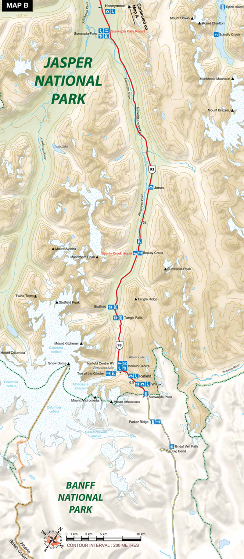
Icefields Parkway to Icefield Centre
Map: A AND B
Distance: 206 km return
Elevation gain: 903 m
From the Jasper townsite, follow the Icefields Parkway for 103 km to the Icefield Centre. Try stretching your legs at the toe of the glacier before heading back.
Road biking trip planning
Here are a few tips for you:
- Do your homework: Review a map of your chosen route and check the weather conditions before hitting the pavement.
- Be safe: Always wear a helmet and safety gear (reflectors), and bring a first aid kit. Keep an eye out for wildlife!
- Know your limit: Ride within your comfort zone and skill level. Some routes do not have shoulders. Respect the rules of the road.
- Prepare for the elements: A water resistant wind jacket is always a good idea. You are in the mountains, weather and temperature can change rapidly.
- Make sure to fuel up: With water and food that is.
- Be prepared: Bring a bike repair kit (spare tubes, pump, tools) and a cell phone. There is no cell service along the Icefields Parkway beyond Athabasca Falls, the Maligne Road or Highway 16 East.
- Make a trip out of it: Bring overnight gear and stay in one of Jasper National Park’s campgrounds along your route. Jonas and Honeymoon campgrounds feature shared bike camping areas for those on an unsupported bike tour. Visit the camping page for our list of campgrounds in Jasper National Park.
- Enjoy: Take in the incredible scenery of Jasper National Park—don’t forget your camera!
- Date modified :