
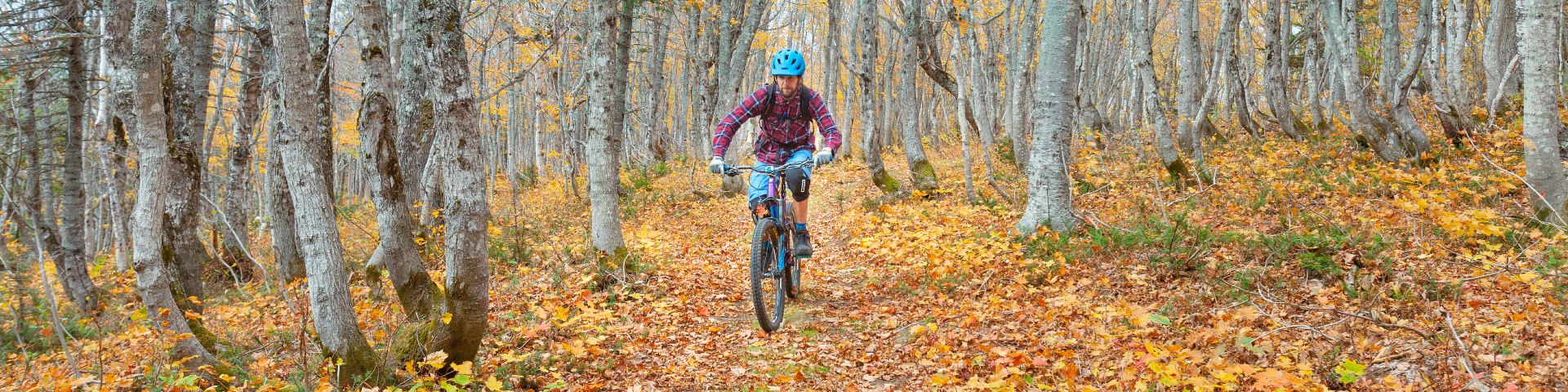
Cycling
Forillon National Park
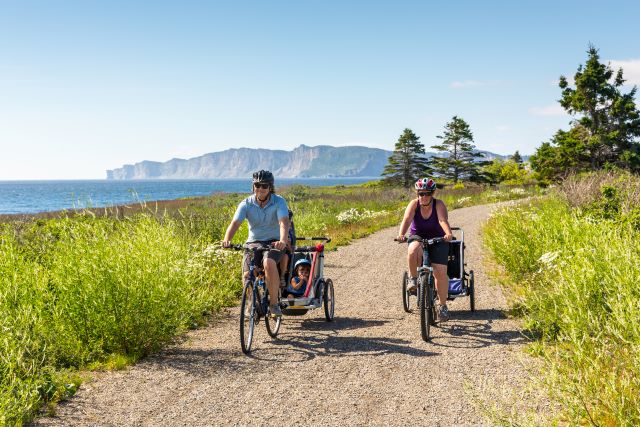
Whether you ride a hybrid or a mountain bike, Forillon has trails for every wheel! Some multi-use trails are wide and flat, providing a gentle ride along beaches; others are sporty and winding, crossing mountains and running alongside rivers. There are also trails to suit intermediate cyclists who like a bit of everything. Find out more about the park's cycling trails here.
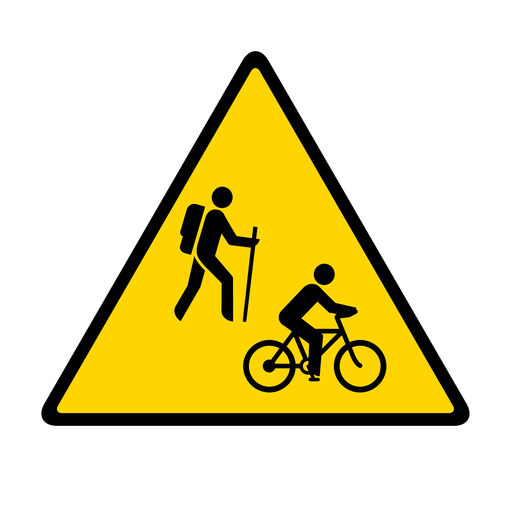
On the trails, cyclists must always yield to hikers and horseback riders.
Trails for every level
All cycle trails are multi-use, meaning that they are also used by walkers and horse riders. They have a variety of surfaces: asphalt, wood, gravel, grass, earth or roots. The park's secondary roads in the North and South sectors are also accessible by bike. For more experienced mountain bikers, there's the Les Lacs trail, also shared with hikers.
Download the Forillon Park trails map [PDF, 1 Mb].
 Easy trails
 Easy trails
 Penouille trail

.gif?h=24&w=24&hash=1A481E3090EFB788978D6D31CE9548F0)
.gif?h=24&w=24&hash=4A88DAE7DEC15C8891537DCA46DCCC37)
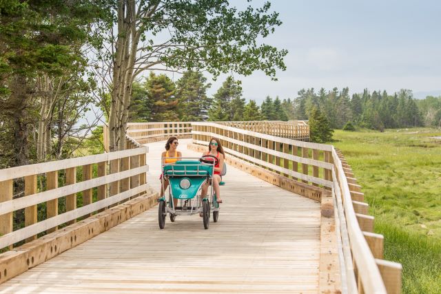
The Penouille multi-use trail is also shared by quadricycles.
Departure: Penouille parking lot
Length: 4 km (round trip)
Elevation gain: 1 m
Type of terrain: Flat, partly asphalted, wooden footbridge about 500 metres long at the start of the trail. Please note: there is a 10% gradient over a distance of 110 metres at the head of the trail.
In summer, the path runs alongside a sandy beach frequented by many bathers. A salt marsh and a small woodland are home to a variety of wildlife. Take the time to read the interpretation boards to learn more about this exceptional environment. At the very end of the point, near the service building, is a picnic area and playground. Walkers, in-line skaters, kick scooters and quadridycles can also enjoy this flat, accessible trail.
The La Taïga trail, which passes through a fragile environment, is prohibited to cyclists. Only walkers are allowed.
La Vallée trail

.gif)
.gif)
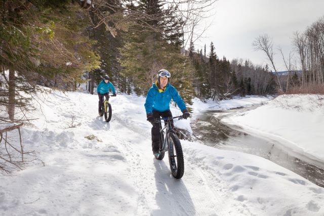
You can ride in La Vallée in winter too!
Departure: L'Anse-au-Griffon
Length: 9.2 km (roundtrip)
Elevation gain: 25 m
Type of terrain: gravel and dirt surface, forest path.
The L'Anse-au-Griffon river will guide you along this trail. Alongside it, you'll pass through a forest teeming with squirrels, grouse and the occasional moose. Keep your eyes peeled! This relatively flat trail has two picnic areas, one in a shelter and the other in a log cabin.
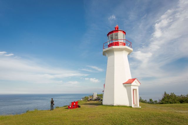
Du Banc trail

.gif?h=40&w=40&hash=96B9C337B13899FFECCCB92F77278C4F)
.gif?h=24&w=24&hash=1B156C354148BDC570A36859672B727E)
Drive through a landscape of sea and cliffs.
Departure: Cap-des-Rosiers parking lot (near the lighthouse) or Visitor information and discovery centre
Length: 4 km (roundtrip)
Elevation gain: 6 m
Type of terrain: A wooden footbridge for a distance of approximately 400 m, after that, a hard trail surfaced in stone dust.
Walk along the sea on the Banc trail, admiring the imposing cliffs of Forillon and the Cap-des-Rosiers lighthouse. Stop off at the Irish memorial (Carricks), in memory of the hundred or so shipwrecked passengers who ran aground off Cap-des-Rosiers in 1847.
 Intermediate Trails
 Intermediate Trails
L'Anse-aux Amérindiens trail
Drive to Cape Gaspé, our land's end!
.gif)
.gif)
Departure: L'Anse-aux-Amérindiens
Length: 6.4 km (roundtrip)
Elevation gain: 60 m
Type of terrain: Wide path, gravel and dirt surface, steep climb at the end of the route.
The Les Graves trail cuts through woodland and runs through fallow fields overlooking silvery coves. Marine mammals, bears and porcupines can sometimes be seen along the way. At Cap-Gaspé, perched on a 95-metre cliff, stands a white and red lighthouse. Powered by solar energy, it is fully automated. When you're there, enjoy it: the endless sea carries an air of rare and invigorating purity.
Some sections of the Les Graves trail are closed to cyclists. The descent to the Cap-Gaspé lookout near the lighthouse is also for the exclusive use of hikers. Please respect the signs.
Le Portage trail
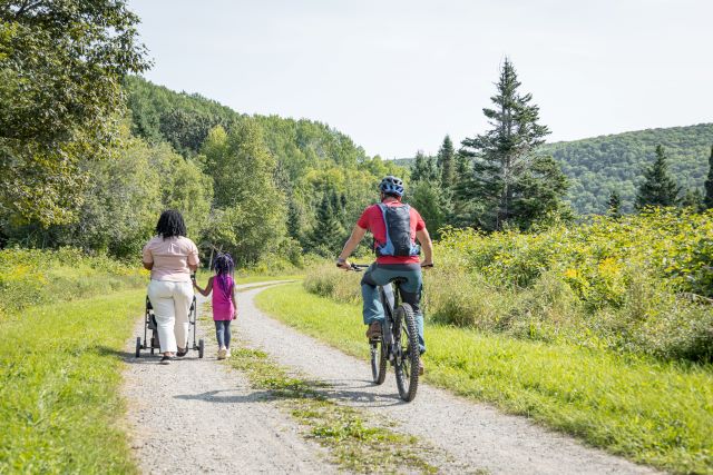
Remember to slow down in the presence of hikers.
Departure: near the administrative office (Peninsula) or L'Anse-au-Griffon
Length: 20 km (roundtrip)
Elevation gain: 155 m
Type of terrain: wide, rolling path. Gravel and dirt surface. Asphalt on the main slope at the halfway point.
This old road crosses the park from north (L'Anse-au-Griffon) to south (Penouille). Choose your starting point. Further south, you'll see a few streams running through the mixed forest. Further north, the trail wanders mainly through fallow fields. In this sector, you may be lucky enough to spot porcupine, black bear, hare or moose.
This trail is also shared by hikers and horse-riding enthusiasts.
 Difficult trail
 Difficult trail
Les Lacs trail
.gif)
.gif)
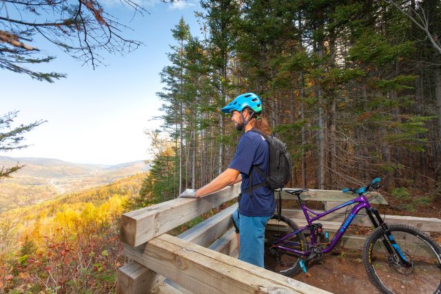
In Fall, the Appalachia are majestic!
Departure: from route 197 (Rivière-au-Renard) or near the administrative office (Peninsula)
Length: 36.6 km (roundtrip)
Elevation gain: 450 m
Type of terrain: narrow, winding path, several natural obstacles, steep hills and bog sections that are often muddy.
On this mountain bike outing, you'll pass the Penouille lakes, great places for wildlife watching. You'll remember these boreal forest landscapes for a long time to come, as well as the view over the valley of the Morris River. Take advantage of the lookouts to rest your legs and admire the scenery.
Note that there is a backcountry camping site and a lean-to shelter if you want to camp out and enhance your experience. Registration is required.
- Date modified :