
Behind the Scenes: How Pukaskwa Tracks Fire Conditions
Pukaskwa National Park
By Liana Hryniewicz
If you’ve spent time in Pukaskwa National Park, you know the weather can change in a heartbeat. Fog rolls in, winds shift, and rain could appear out of nowhere. That’s what happens when you are situated beside one of the world’s largest freshwater lakes. All this change also plays a big role in how fire behaves on the landscape. To stay prepared, park staff keep a close watch on the weather every single day during fire season. Here’s a behind-the-scenes look at how this is done and why it all matters.
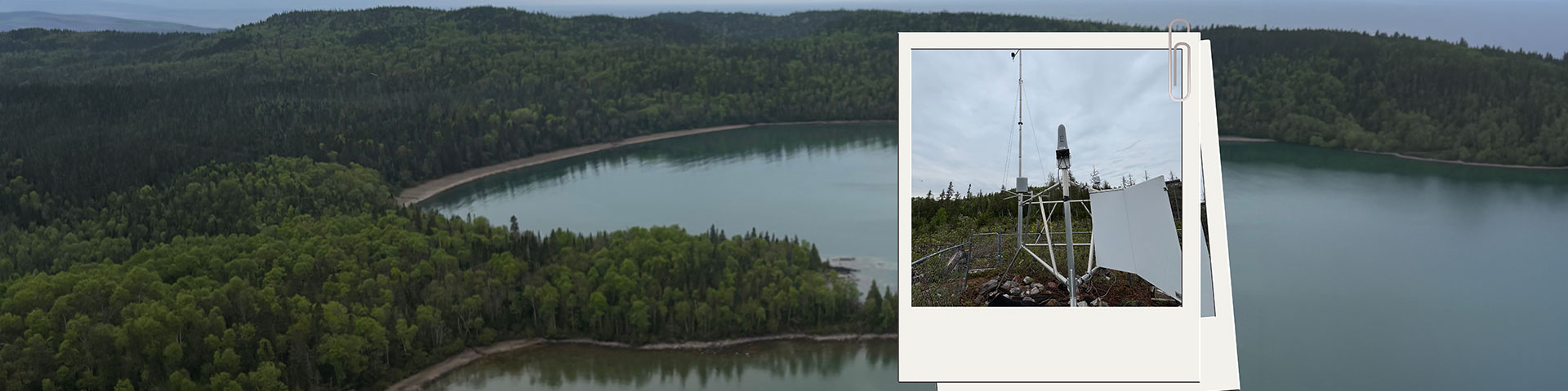
Spread across Pukaskwa’s vast landscape are three automated weather stations located at Hattie Cove, Lurch Lake, and Bonamie Cove. Each station sends in hourly readings telling staff weather details such as temperature, relative humidity, wind speed and direction, and rainfall. These details help to understand how dry the forest is, how quickly fuels might ignite, and how a fire might spread under current conditions. There is also a fourth portable weather station called the Quick Deploy weather station (QD). This can be situated at any desired location for the season. For example, if there is a planned prescribed fire occurring, the QD can be placed in that location to get more accurate readings of that specific site.
Every day at 1300 hours, staff gather the last 24 hours of weather information and calculate a set of national fire weather indices. These indices help determine the park’s daily fire hazard rating that you would see posted around the park: Low, Moderate, High, or Extreme.
These indices include:
- Fine Fuel Moisture Code (FFMC) – how easily small fuels ignite
- Duff Moisture Code (DMC) – moisture in the forest floor’s upper organic layers
- Drought Code (DC) – long-term dryness deeper in the soil
- Build-Up Index (BUI) – how much fuel is available to burn
- Initial Spread Index (ISI) – the potential speed of fire spread
- Fire Weather Index (FWI) – an overall measure of fire intensity
These indices feed into the Canadian Forest Fire Behaviour Prediction System, a national tool used to estimate how a fire might grow and behave in different forest types. Using the Fire Behaviour Prediction field book, staff can model how intense a fire could be, how quickly it might spread, and how terrain/vegetation could influence it. This information helps the crews plan, prepare, and respond effectively if a fire starts.
After calculating the day’s numbers, the fire team prepares situational reports that are sent to Parks Canada’s national office. When conditions are dry, these reports are submitted daily. When hazard levels are low, reporting scales back to three times a week.
Fire is a natural part of the boreal forest, but understanding the conditions helps protect visitors, communities, wildlife, and cultural sites. These weather stations, numbers, and daily routines provide essential insight into the health and safety of Pukaskwa’s landscapes. Whether you’re hiking the Coastal Trail or paddling through the backcountry, this science helps keep your experience safe and the park thriving.
- Date modified :