
Map of firewood drops
Kejimkujik National Park and National Historic Site
These maps show wood drop locations in the backcountry at Kejimkujik.
Wood supply may vary through the year and open fires may be banned in dry conditions.
Be prepared: Bring fuel and a portable camp stove for cooking. Gas camp stoves are always permitted. Be aware that charcoal is considered an open fire and may be banned in dry conditions.
Check important bulletins for current advisories and warnings.
Firewood drops
This downloadable map (PDF, 1 MB) shows the backcountry wood drop locations at Kejimkujik.
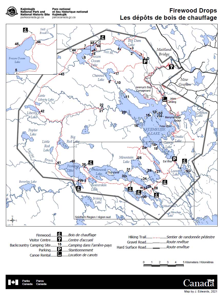
Legend


15 Backcountry camping site


Firewood drops – Southern Region
Firewood in the southern lake sites (Loon, Cobrielle, Lower Silver, Peskowesk and Peskawa Lakes) will be located in nearby centralized wood piles. This downloadable map (PDF, 622 KB) shows the backcountry wood drop locations in the southern region at Kejimkujik.
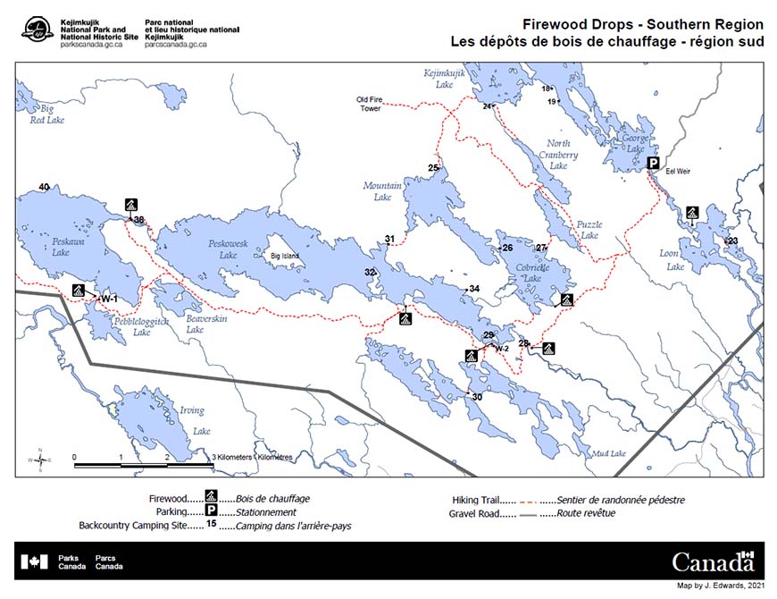
Legend
15 Backcountry camping site
- Date modified :