
Mill Falls Trail
Kejimkujik National Park and National Historic Site
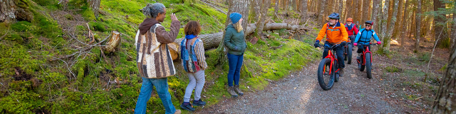
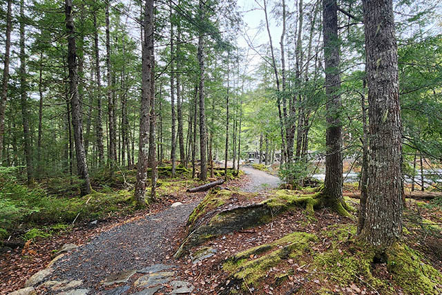
Big hemlocks calm the mind and Mill Falls lifts the spirit on the Mill Falls Trail. This shared-use trail for hikers and bikers is also a gateway to the Beech Grove Trail and the Ukme'k Trail.
On this page
- Overview
- Highlights
- Conditions, advisories, warnings, and closures
- Map
- How to get here
- Technical and accessibility details
- Regulations, safety, and etiquette
- Other trails
Overview
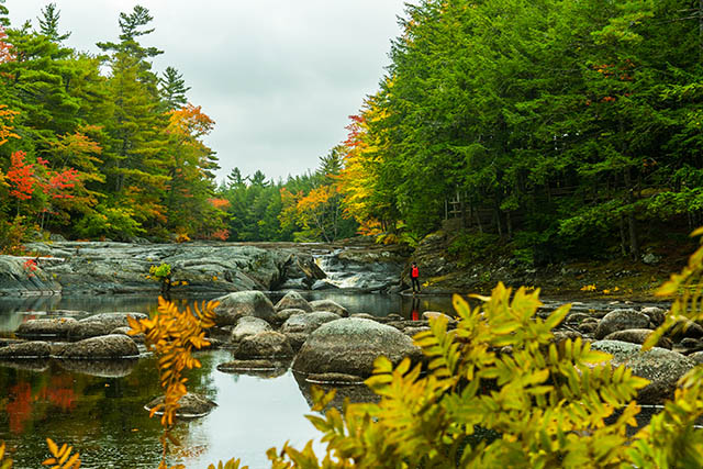
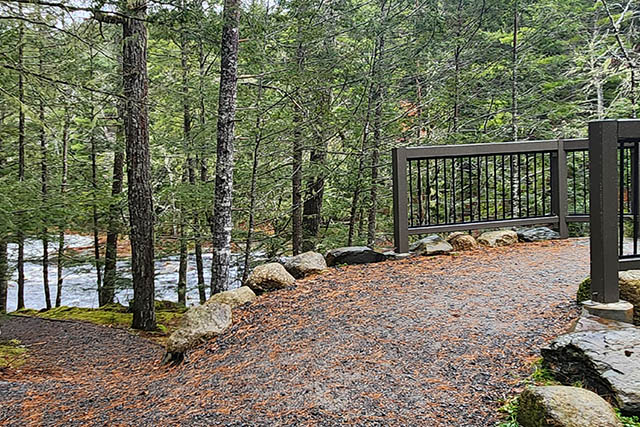
This is a shared-use trail so please be mindful of other trail users. Start behind the Visitor Centre and travel downstream along the bank of the Mersey River. Observe the sheer power of Mill Falls in the spring from the viewing area near the picnic shelter. Enjoy the Mill Falls picnic shelter year-round. Hike to the end of the trail to enjoy the quieter places along the river and find the Parks Canada red chairs.
| Permitted activities: |
|
|---|---|
| Difficulty (trail rating guide) |
Easy |
| Length |
1.3 km one way (2.6 km return) |
| Time (estimated) | 20 min one way |
| Profile |
31 m elevation gain/22 m elevation loss |
| Pets | Dogs allowed on leash |
Highlights
- Observe the sheer power of Mill Falls in the spring
- Enjoy the Mill Falls picnic shelter year-round
- Cross the Mill Falls pedestrian bridge to join the Beech Grove and Ukme'k Trails
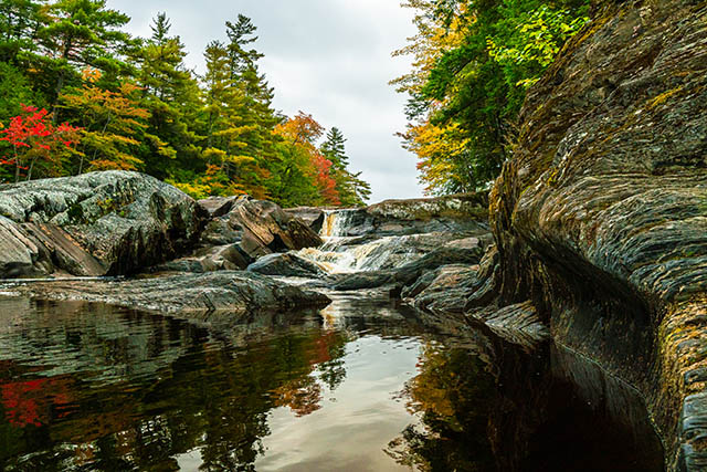
Mill Falls in autumn.
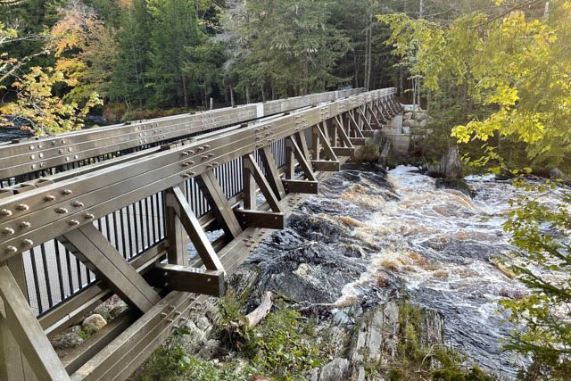
Cross the Mill Falls Bridge to join the Ukme'k Trail.
Mill Falls.

Follow the trail to find a set of Parks Canada red chairs.
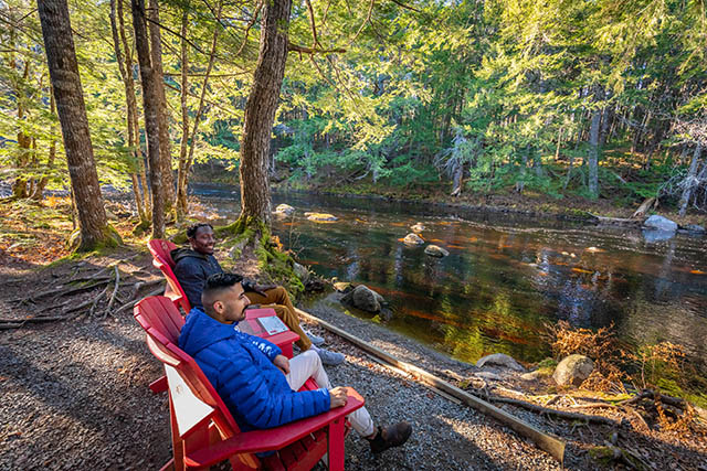
Enjoy an iconic view from the Parks Canada red chairs.
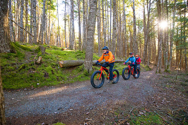
Mill Falls Trail is a shared-use trail so please watch for bikers.
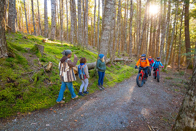
Mill Falls Trail is a shared-use trail so please watch for bikers and hikers.
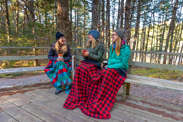
Relax outside the picnic shelter in any season.
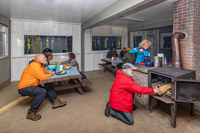
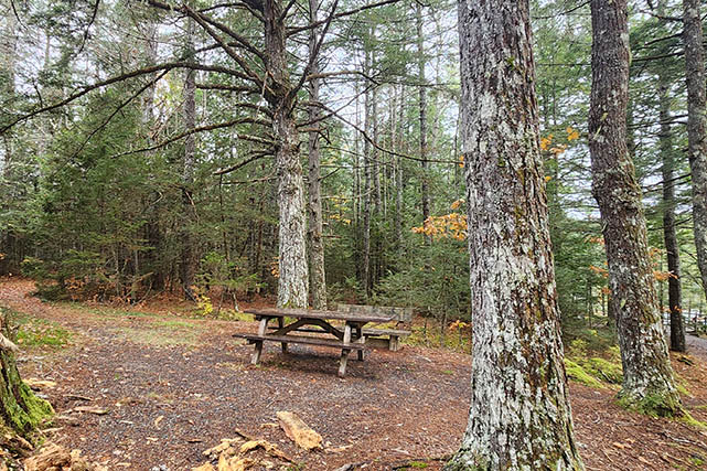
The Mill Falls picnic shelter is available for day use year-round.
Conditions, advisories, warnings, and closures
Fall, winter, and spring conditions
Note that trails are not maintained or patrolled between November 1 and Victoria Day weekend.
You may encounter washed out or flooded sections and/or downed trees.
Most facilities and services are closed at this time of year. More information
Emergencies: Call 911 and be prepared to have to wait for help to arrive.
Weather forecast
Current advisories, warnings, and closures
Important bulletins for Kejimkujik National Park and National Historic Site
Map of Mill Falls Trail
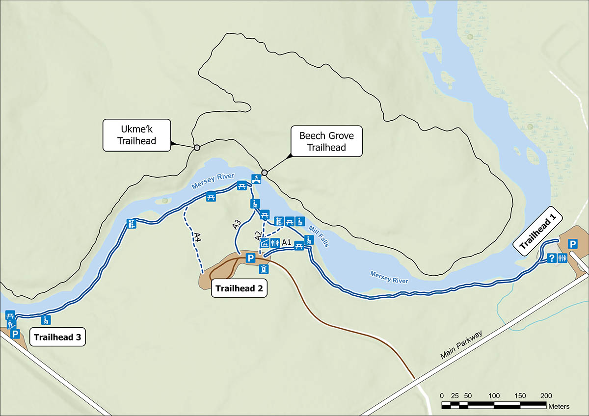
Map legend and text description
This map shows the Mill Falls Trail at Kejimkujik, including: trailheads, access trails, and facilities and services.
The Mill Falls Trail goes along the southern bank of the Mersey River and passes by Mill Falls near the half-way point of the trail.
- Trailhead 1 is upstream behind the Visitor Centre.
- Trailhead 2 is near the half-way point of the trail and closest to Mill Falls and the picnic shelter. There are four access trails at Trailhead 2.
- Trailhead 3 is downstream, and begins with descending a staircase.
Facilities and services
The Mill Falls picnic shelter and washrooms are located near Trailhead 2 access trail A2.
There is an outhouse near the Trailhead 2 parking lot near access trail A1.
There is a pedestrian bridge near the half-way point of the trail, allowing access to the Ukme'k and Beech Grove shared-use trails on the north side of the river. The shortest way to access the Mill Falls Bridge is Trailhead 2 access trail A3.
Legend
Trail slope
 10-12%
 5-9%
5-9%
 0-4%
0-4%
Standard ramp grade is 8.3%
Facilities and services
![]() Bench
Bench
![]() Look-out
Look-out
![]() Outhouse
Outhouse
![]() Parking
Parking
 Pedestrian bridge
![]() Picnic shelter
Picnic shelter
![]() Picnic table
Picnic table
 Stairs
![]() Visitor Centre
Visitor Centre
![]() Gender-specific washrooms
Gender-specific washrooms
Map of Kejimkujik day-use area (summer)
How to get here
The Visitor Centre and washrooms are closed from November 1 to Victoria Day weekend.
Trailhead 1 – Visitor Centre
| Topic | Details |
|---|---|
| Location |
Mill Falls Trailhead 1 is located at the Visitor Centre parking lot 3005 Main Parkway, Maitland Bridge, Nova Scotia Geographic coordinates (GPS): 44°26'18.7"N 65°12'31.9"W |
| Parking |
|
| Services and facilities (distance from Trailhead 1) |
|
| Access |
Start behind the Visitor Centre and travel downstream along the Mersey River. |
Trailhead 2 – Mill Falls and pedestrian bridge to Beech Grove and Ukme'k Trails
| Topic | Details |
|---|---|
| Location |
Mill Falls Trailhead 2 is at the Mill Falls picnic shelter Kejimkujik Main Parkway, Maitland Bridge, Nova Scotia Geographic coordinates (GPS): 44°26'17.1"N 65°12'59.2"W |
| Parking |
|
| Access |
At Trailhead 2 there are four access trails shown on the map: A1, A2, A3, A4. |
| A1 services and facilities (distance away) |
|
| A2 services and facilities (distance away) |
|
| A3 services and facilities (distance away) |
|
| A4 services and facilities (distance away) |
|
Trailhead 3 – Stairs
| Topic | Details |
|---|---|
| Location |
Mill Falls Trailhead 3 is a little further along Kejimkujik Main Parkway, Maitland Bridge, Nova Scotia Geographic coordinates (GPS): 44°26'12.4"N 65°13'18.8"W |
| Parking |
|
| Services and facilities (distance away) |
|
| Access: |
Descend a staircase and travel upstream along the Mersey River. The staircase has two flights of 14 steps, with a small landing in the middle. Ground cover is grass and gravel between the parking lot and Trailhead 3. |
Technical and accessibility details
Description
- Mostly flat, with maximum slope of 23.9% in the area near Mill Falls and the pedestrian bridge (31 m elevation gain/22 m elevation loss).
- In the spring, the trail can be soft and muddy due to higher water levels.
- Trail obstacles include multiple instances of roots, rocks, and pinch points (narrow parts of the trail), one rock crossing, and a set of stairs (two flights of 14 steps with a small landing in between).
Trail details
| Topic | Details |
|---|---|
|
Aggregate / gravel 93% of trail is hard, 7% of trail is firm |
|
|
144.8 cm Minimum: 90 cm |
|
|
The first obstacle you will encounter:
|
|
| Distance between rest areas varies | |
|
Typical: 4.1% Maximum: 23.9% (Note: Standard ramp grade is 8.3%) |
|
|
3.2% Maximum: 15.3% |
Trail assessed on 2022-06-22. Trail details may have changed.
Rest areas and points of interest
Distances to points of interest from trailheads and access trails
| Trailhead 1 |
Trailhead 2 (A1) |
Trailhead 2 (A2) |
Trailhead 2 (A3) |
Trailhead 2 (A4) |
Trailhead 3 |
|
|---|---|---|---|---|---|---|
| Visitor Centre with washrooms | 0 m | 691 m | 727 m | 805 m | 1002 m | 1323 m |
| Mill Falls | 650 m | 169 m | 120 m | 199 m | 404 m | 713 m |
| Picnic shelter and washrooms | 721 m | 29 m | 48 m | 199 m | 463 m | 732 m |
| Bench | 587 m | 113 m | 114 m | 82 m | ||
| Parks Canada red chairs | 1060 m | 280 m | ||||
| Pedestrian bridge to other trails | 756 m | 149 m | 583 m | |||
| Outhouse near Trailhead 2 parking lot (open year-round) | 726 m | 28 m | 34 m | 73 m | 150 m | 770 m |
Recommended routes
The easiest ways to access the trail include Trailhead 1 and Trailhead 2, follow access trail A1.
The easiest way to see Mill Falls is Trailhead 2, follow access trail A1 or A2 (right branch). Access trail A1 has the least slope. Access trail A2 (right branch) has a small slope and leads to the look-off area beside the falls.
The most challenging ways to access the trail include Trailhead 3 (due to staircase) and Trailhead 2, follow access trail A4 (slope 10-12%).
Preview of features and related facilities
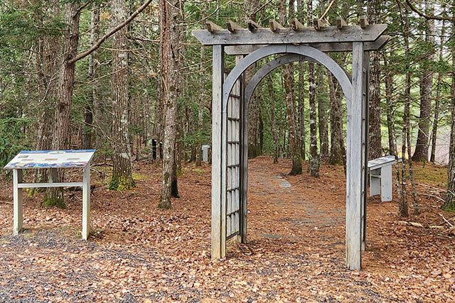
An arbour (45" across) creates a pinch point near the beginning of the trail at Trailhead 1.
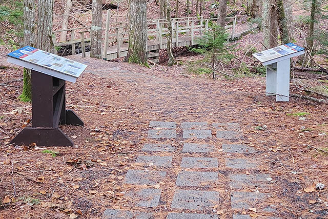
The Volunteer Walk of Fame features a path of paving stones with the names of volunteers.
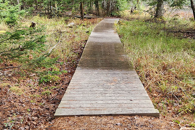
Trail transition to a boardwalk.
Accessible picnic table.
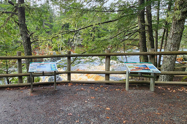
Mill Falls look off and interpretive panels.
Picnic shelter and outdoor seating area with picnic tables.
Trail passes over some rocks to the pedestrian bridge.
Small slope from the trail to the pedestrian bridge.
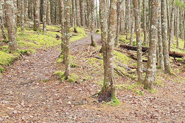
Trail.
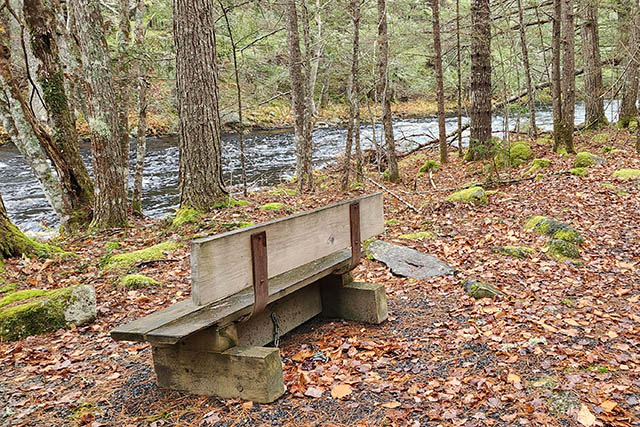
A bench next to the river.
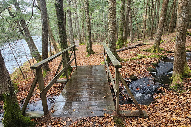
Small wooden bridge over a stream.
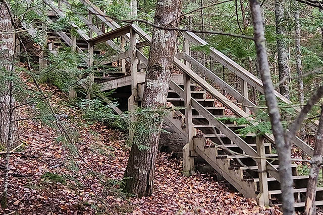
Two flights of stairs (28 steps total) to Trailhead 3 and parking lot.
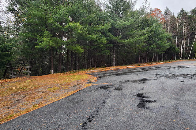
Trailhead 3 parking lot.
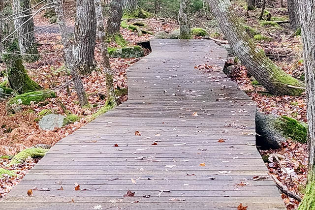
Boardwalk without railings.
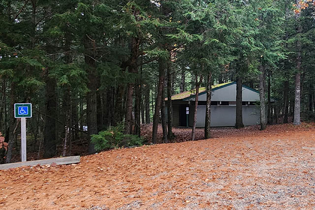
Accessible parking near picnic shelter at Trailhead 2.
Access to adaptive equipment
One hippocampe all-terrain wheelchair is available to borrow from the Visitor Centre. Available between Victoria Day weekend and October 31. More information about the wheelchair
Regulations, safety, and etiquette
Safety and guidelines
Hiking, biking, weather, wildlife, drinking water, essential items, AdventureSmart.
Regulations
Protected areas are unique places and require unique rules to protect them.
Pets
At all times, pets must be kept on a leash or in suitable confinement.
Other trails
- Date modified :