
The Forks
Fundy National Park


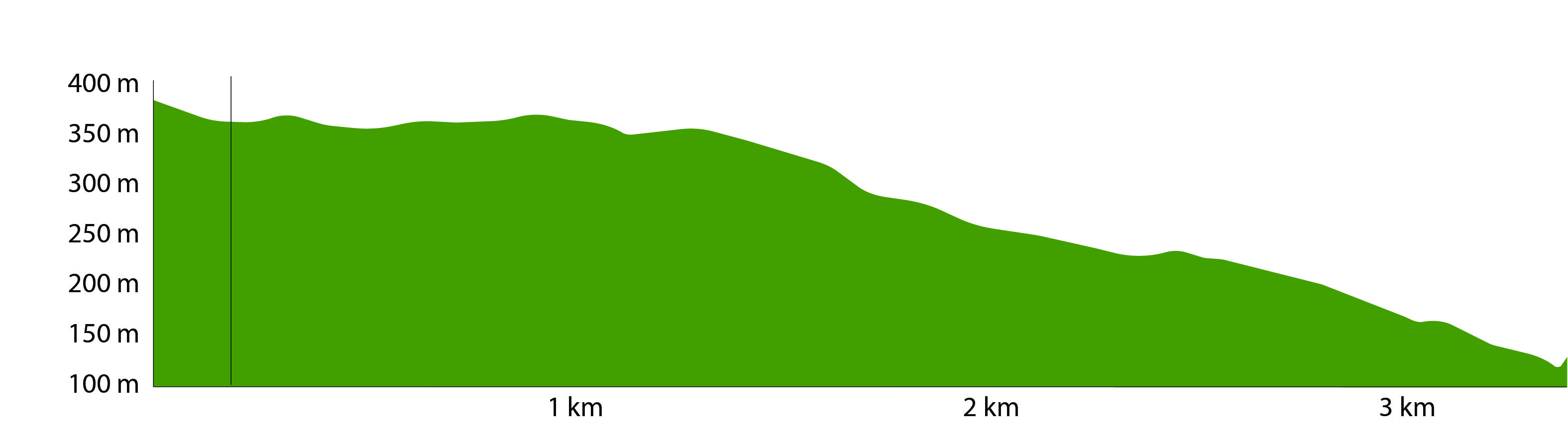
Distance: 3.2 km one way
Time: 1-2 hours
Difficulty: Difficult 
Steep Section(s): Yes
Habitat: Forest, River
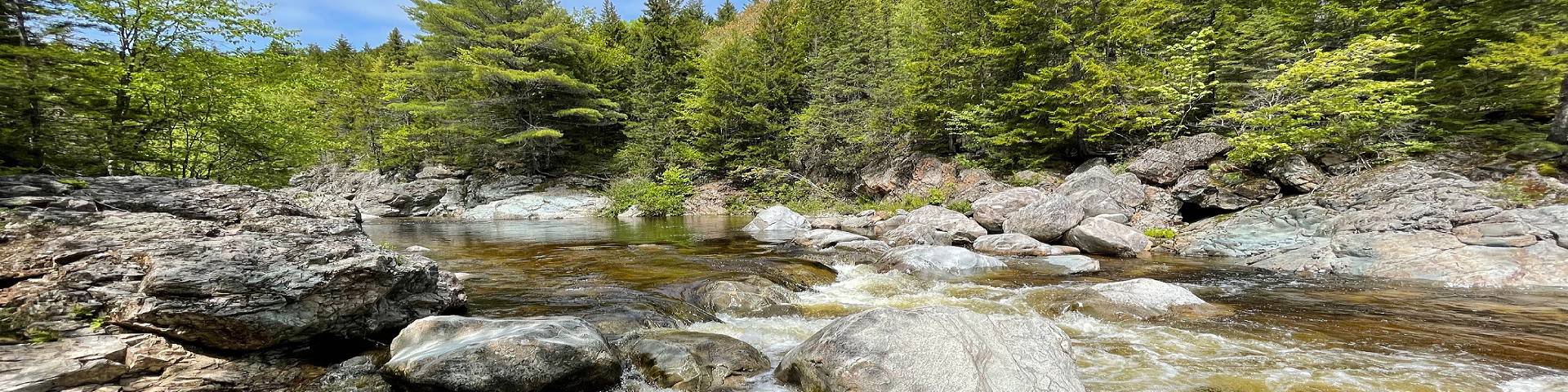
The Forks trail starts through a nice stand of hardwoods before descending steeply towards the Broad River where you will find remarkably deep pools, which create a great habitat for the Inner Bay of Fundy Atlantic Salmon to spawn in the fall.
Related links
- Maps and brochures
- Alma Beach
- The Fundy Circuit
- Caribou Plain
- Shiphaven
- East Branch
- MacLaren Pond Medicine Trail
- Kinnie Brook
- Matthews Head
- Coppermine
- Dickson Falls
- Herring Cove Beach
- Black Horse
- Maple Grove
- Pumptrack
- Dobson Link
- Laverty Falls
- Moosehorn
- Tracey Lake
- Third Vault Falls
- Coastal
- Goose River
- Bennett Brook
- Marven Lake
- Whitetail
- Tippen Lot
- Foster Brook
- Upper Salmon River Trail
- Date modified :