
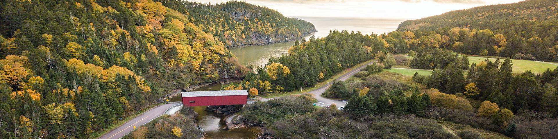
Covered bridge
Fundy National Park
Fundy National Park is the only national park in Canada in which you can journey back in time by passing through a covered bridge.
The bridge is located at Point Wolfe, in the southern region of the park.
Vehicle access
Due to clearance restrictions, access to the covered bridge is limited to a maximum vehicle/equipment length of 7.3 m (24 feet) and a height of 4.4 m (14.4 feet).
No bridge access to Point Wolfe Area from September 8, 2026 until December 2026
Starting on September 8th, Point Wolfe Covered Bridge will be closed until December 2026 while rehabilitation work is underway to extend the lifespan of the bridge. The bridge will be closed to both vehicle and foot traffic during repairs. The Point Wolfe Area will be effectively closed during this period and barricades ahead of the bridge will indicate the start of the closure.
Access limitations
The following facilities and amenities are only accessible using the bridge and will be effectively closed during repairs due to lack of alternative access routes:
- Point Wolfe Campground, shelter, and beach
- Backcountry campsites reached via Point Wolfe Bridge
- Trailheads for Shiphaven, Marven Lake, Coppermine, Goose River
- Sections of the Fundy Footpath and Trans Canada Trail
Detour map for hikers
For backcountry hikers, including those following the Fundy Footpath or the Trans Canada trail, alternative routes are available to access backcountry trails. Trail signage with detour routes for hikers will be posted.
Download the detour map (PDF, 1.57 MB)
Route details
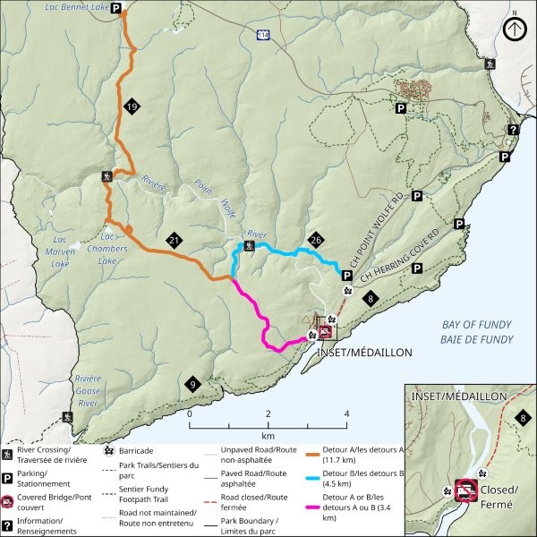
Detour map showing alternative routes for backcountry hikers to bypass Point Wolfe Covered Bridge, located in the southern area of Fundy National Park.
Detour A: Goose River trail to Bennett Lake parking lot (total 15.1 km)
- From the Goose River/Marven Lake trail intersection in Point Wolfe area, take Marven Lake trail until the intersection with Bennett Brook trail (7.7 km). Take Bennett Brook trail until exiting at the Bennett Lake parking lot (7.4 km).
Detour B: Goose River trail to Foster Brook parking lot (total 7.9 km)
- From the Goose River/Marven Lake trail intersection in Point Wolfe area, take Marven Lake trail until the intersection with Foster Brook (3.4 km). Take Foster Brook until the trail head (4.5 km) and exit at the parking lot off Point Wolfe Road.
Note: Hikers may reconnect with the Trans Canada trail at Matthew's Head trail or Goose River trail after exiting the detour (depending on the direction of travel).
Related links
- Fees
- Brochures and publications
- Hours of operation
- Visitor guidelines
- Visitor information centres
- Trail conditions at Fundy National Park
- Fundy's trail network
- Weather
- Tides
- Equipment rentals
- Meetings and event rentals
- Accessibility and easier access visits
- You and your pets
- Local attractions and tourism
- Date modified :