

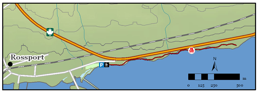
Rossport Coastal Trail
Lake Superior National Marine Conservation Area
Organization: Rossport Tourism Association
Classification: Difficult
Distance: 1.5 km (one way)
Elevation Gain: 2 m
Estimated Time: 1-2 hours
Description: A true coastal trail with plenty of opportunities to dip your feet in Superior. It is mainly flat, but does have some stretches crossing uneven surfaces such as a small creek and rocky shoreline. Enjoy breathtaking views of Lake Superior, beautiful beaches, and scenery of some of the many islands of the Rossport archipelago.
Directions: Starting at the east end of Rossport Village at Wardrope Park, the trail meanders east along the shore of Lake Superior to end at the rest area just east of Rossport on Highway 17. Follow the white painted boot prints to stay on track.
- Date modified :