
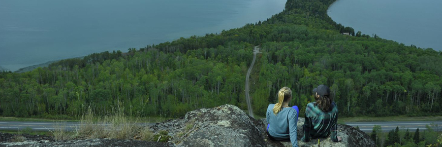
Kama Cliffs Trail
Lake Superior National Marine Conservation Area
Organization: Singletrack Society Trail Association
Classification: Difficult
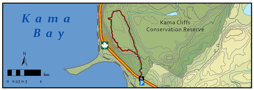
Distance: 7.3 km loop
Elevation Gain: 152 m
Estimated Time: 3-4 hours
Features: View of Lake Superior, the Kama Cliffs, Kama Point, and various islands.
Description: The majority of this mountain bike/hiking trail is rated as moderate with one section considered difficult. It offers some natural wonders that are sure to impress. As the name implies, this trail will bring you to the top of the Kama Cliffs, visible from Highway 17, overlooking Nipigon Bay and its many islands. This is one of the most ideal spots for a picnic, so be sure to give yourself enough time to sit back and enjoy the view from up top.
Directions: 25 km east of Nipigon along Highway 17, 0.5km west of the Jackpine River bridge. Enter Kama Bay Road and you will find a parking lot. Cross the highway and travel left (West) approximately 100 metres to locate the trailhead sign.
- Date modified :