
Wood Buffalo National Park wildfire updates
Wood Buffalo National Park
Report any wildfires or suspicious smoke to the Fire Duty Officer
867-621-0136
Safety is Parks Canada’s number one priority. Fire management personnel monitor Wood Buffalo National Park and surrounding areas for wildfire starts and are ready to respond if needed. Do your part and stay informed on the current fire danger status and park regulations.
Check this page regularly for updates on wildfire preparedness, response, and risk reduction activities in the park. Join our email notification lists to receive wildfire-related updates directly to your email. To be added, please email wbnpfire-feupnwb@pc.gc.ca.
Wildfire map and today's fire danger rating
Understanding fire information updates
The information below helps explain many of the terms and concepts commonly used in Wood Buffalo National Park’s fire information updates.
Understanding fire information updates
Types of wildfire response
There are three wildfire response types: full response, modified response, and monitored response. Wildfire response strategies vary depending on the level of risk to people, communities, infrastructure, and natural values.
- Full response: Immediate action is taken to contain and extinguish the wildfire as quickly as possible.
- Modified response: Fire crews use targeted suppression and monitoring to keep the fire within a predetermined area while protecting values at risk.
- Monitored response: Fire personnel closely monitor the wildfire's behaviour to minimize impacts to people and values while allowing ecological benefits.
There are many factors that fire specialists carefully consider when determining the appropriate response. These include:
- How close the fire is to communities, infrastructure, or neighbouring lands
- Current and forecasted fire weather conditions
- Time of year
- Current and potential fire load
- Current and anticipated resource availability
- Location and feasibility of nearby features for containment
Ultimately, safety is the top priority. It is important to note that response strategies can change as conditions evolve.
Fire and weather
Weather plays a major role in how a wildfire behaves. Hot, dry, and windy conditions can cause a fire to spread more quickly and burn more intensely. Cooler temperatures, higher humidity, and rain can help slow fire activity. Because weather can change quickly, fire behaviour can also change from day to day or even hour to hour.
When the relative humidity drops below the temperature in degrees Celsius, a condition called crossover occurs. Fires burn very intense during crossover. They can spread rapidly, especially if there is strong wind at the same time.
Typically, fires are less active in the morning when temperatures are lower and relative humidity is higher. As the day warms, activity increases. The most intense fire behaviour happens in the late afternoon and early evening.
Fire size
Fire size is the total area within a fire’s perimeter. This does not mean the entire area is burning. Within the perimeter, there may be areas that are actively burning, smouldering, already burned, or pockets of unburned vegetation.
Fire size is an estimate. Wildfires are constantly changing, and measuring their size in natural environments can be challenging. When conditions allow, crews may use GPS-equipped helicopters or satellite technology to map the fire perimeter and estimate the fire’s size.
Stages of control
Throughout the response, a wildfire will be assessed to determine its “stage of control.” This is the progress which has been made to contain or put out the wildfire.
- Out-of-control: A wildfire is out of control when firefighters have not yet stopped it from spreading. The fire perimeter is not secure, and the fire may continue to grow. Being out of control does not always mean a wildfire is dangerous to people or nearby communities. Even a small wildfire, such as one the size of a campfire, can be considered out of control if it is still spreading and has not been contained.
- Being held: A wildfire is being held when firefighters, equipment, and other resources are working on the fire, and it is not expected to spread beyond its current size under the current weather conditions. The actions being taken are helping keep the fire from growing.
- Under control: A wildfire is under control when firefighters have enough people, equipment, and plans in place to stop the fire from spreading. The fire is expected to stay within its current area.
- Fully extinguished: The wildfire is completely out. All wildfires must be monitored in some way to ensure that the fire is fully extinguished. Small fires may be assessed using a technique called cold trailing. This is where firefighters search for remaining heat in the ground using their hands. Large fires may require days, weeks or even months of monitoring before they can be considered fully extinguished.
Glossary of terms used in the daily wildfire update
Burnout
A burnout is a firefighting technique where crews light small, planned fires between a wildfire and a control line. A control line can be a natural barrier, such as a river or rocky area, or a human-made barrier, such as a road or fireguard.
These planned fires burn grass, shrubs, and other fuels before the wildfire can reach them. With less fuel to burn, the wildfire slows down and becomes easier for firefighters to control. This helps protect nearby areas and makes the control line stronger.
Direct attack
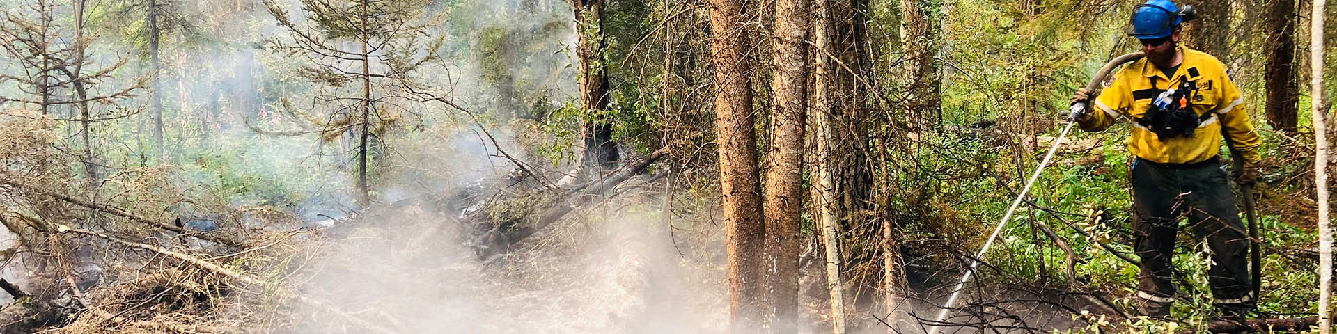
A direct attack is when firefighters work right at the edge of a wildfire to stop it from spreading. They may use pumps, hoses, and water. They often have support from helicopters or air tankers. In some cases, heavy equipment is used to build fireguards along the edge of the fire to help stop its advance.
Fire behaviour
Fire behaviour refers to the way trees, shrubs and grass ignites, how flames develop, and how a fire spreads. In short, it’s a reflection of how intensely a fire is burning.
In wildland fires, this behaviour is influenced by:
- the type of fuels that are burning (such as trees, needles, leaves and twigs)
- how dry they are
- the weather (wind, humidity, temperature, precipitation)
- the topography or physical features of the land (such as the slope of the land and what direction the slope faces)
Low fire behaviour can include smouldering, or slow-moving, short flames that creep along the ground.
Intense fire behaviour can include intermittent or continuous crown fire. This is when the flames spread from tree-top to tree-top. Flame lengths can exceed 30 metres.
Fireline
The area of the fire where firefighters are working. When fires are active, this is usually along the flanks of the fire, or areas where fire behaviour is less intense.
Flank
The flanks of a fire run along both sides of the fire as it spreads forward. Fires along the flanks usually burn less intensely and spread more slowly than the front, or "head," of the fire.
Fuel
Fuel refers to the organic material a fire burns. In Wood Buffalo fuel includes trees, bushes, shrubs, grasses and organic soil and muskeg. Each type of fuel can burn differently. Light fuels like grasses and bushes can ignite easily. It burns intense and quick. Heavier fuels can sustain fire for longer amounts of time. It can smoulder for long periods after the main fire front has passed.
Head
The front of the fire driven by wind direction. This is generally the area where the fire burns the most intensely.
Hectare
A hectare is a standard unit used to measure land area, including the size of wildfires. One square kilometre equals 100 hectares. Another way to think about it is one hectare is about the size of a football field. When a wildfire is reported as 100 hectares, it means the fire covers an area similar to about 100 football fields. Using hectares allows wildfire size to be described clearly and consistently, helping you understand the scale of a fire and the response required.
Hot spot
Hot spots refer to areas of the fire’s edge that still hold fire – heavy fuels like trees, tree roots, and organic soil and muskeg can smoulder for long periods of time. If not extinguished by firefighters, these hot spots can cause a fire to spread under hot, dry weather. Some hot spots can smoulder over the winter and cause fires to reemerge in spring.
Firefighters can use infrared drones, handheld infrared scanners, and careful inspection and feeling with hands to detect hot spots.
Rate of spread
Rate of spread refers to how fast a fire moves. This is influenced by a number of factors, including the type of fuel burning and how dry it fuel is, weather conditions like temperature, humidity and wind, and topography like if the fire is burning up a slope or in a canyon.
Surface fires burning under moderate conditions might travel less than a metre per minute, whereas crown fires burning under the most intense conditions have been observed travelling more than 200 metres per minute
Perimeter
The edge of the fire. In order to be contained and then ultimately controlled, firefighters have to extinguish hot spots along the entire perimeter of the fire. This work is done by firefighters who use pumps, hoses and water to soak hotspots.
- Contained perimeter
Contained perimeter is an area where hot spots within three metres of the fire’s edge have been extinguished. With monitoring and support from firefighters and aircraft, these areas of the fire are not expected to spread. - Controlled perimeter
Controlled perimeter has had all hot spots within 15 metres of the fire’s edge extinguished. Controlled perimeter will not spread.
Values-at-risk
Values at risk are anything on the land that have value for people to protect. Values at risk can include communities, roads, power lines, businesses, wildlife habitats, and cultural or historic sites. Identified values at risk help firefighters decide what to protect first during a wildfire.
Wildfire complex
A wildfire complex is a situation where two or more individual wildfires merge or are managed together under a single Incident Command structure within a specific geographic area.
2026 Wildfires
See photos and learn more about the 2026 Bear Creek and Klewi Wildfire Complexes
2026 fire information updates
Fire Information Update – Friday, August 14, 2026
There have been no new fires in Wood Buffalo National Park since the last update.
Fire Danger
The current fire danger level for Wood Buffalo National Park is: HIGH
Active wildfires
These fires remain under their previous classifications with no change in size, exhibiting low to no fire behaviour and showing no observed growth.
Being Monitored
2026WB016 and 2026WB018
Being Held
Bear Creek Complex (2026WB017, 2026WB019, 2026WB020), and 2026WB023
Under Control
2026WB003, Klewi Complex (2026WB004 and 2026WB004), 2026WB006, 2026WB007, 2026WB008, 2026WB009, and 2026WB022
Extinguished wildfires
These fires are classified as extinguished.
2026WB001, 2026WB002, 2026WB005, 2026WB010, 2026WB011, 2026WB012, 2026WB013, 2026WB015 and 2026WB021
Weather
Today, Fort Smith and Wood Buffalo National Park can expect highs near 24°C, light winds (around 10 km/h), and dry conditions with humidity dropping to 35%.
Looking ahead, a weak weather system may bring showers and isolated thunderstorms on Saturday. Periods of unsettled weather, including localized showers, are possible through early next week, with temperatures remaining seasonal in the high teens to mid-20s.
Contact
Fire information – Wood Buffalo National Park
867-872-0138
wbnpfire-feupnwb@pc.gc.ca
Report wildfires or suspicious smoke to the Fire Duty Officer at 867-621-0136.
For more information, visit: Wood Buffalo National Park Fire Status Dashboard.
Fire Information Update – Friday, August 7, 2026
There have been no new fires in Wood Buffalo National Park since the last update.
Fire Danger
The current fire danger level for Wood Buffalo National Park is: LOW
Bear Creek Wildfire Complex (2026WB017, 2026WB019, 2026WB020)
The total area burned is estimated to be 48,863 hectares. All three fires in the Bear Creek Complex are currently being held, meaning the wildfires are not likely to spread beyond existent or predetermined boundaries under current and forecasted conditions.
With containment and control objectives achieved, stabilization of the incident and minimal fire activity, out-of-area resources are currently demobilizing and travelling back to their home locations. Wood Buffalo National Park fire management personnel will now manage this incident and action any fire activity as required.
Moving forward, Wood Buffalo National Park will continue to issue fire information updates for the week on Fridays unless the situation changes. Updates are shared on Facebook and posted on the park website.
Other wildfires in Wood Buffalo National Park
Active wildfires
2026WB003, WB2026004, 2026WB006, 2026WB007, 2026WB008, 2026WB009, 2026WB016, 2026WB018, 2026WB022 and 2026WB023
Status: These fires remain under their previous classifications with no change in size.
Details: These fires are exhibiting low or no fire behaviour and no growth observed.
Extinguished wildfires
2026WB001, 2026WB002, 2026WB005, 2026WB010, 2026WB011, 2026WB012, 2026WB013, 2026WB015 and 2026WB021
These fires are classified as extinguished.
Weather
Cooler temperatures and a chance of showers are expected to continue through the weekend in the eastern regions of Wood Buffalo National Park, while central and western areas gradually warm into the low to mid-20s °C. A cold front may bring cooler temperatures and shifting winds late Saturday into Sunday. Warmer, drier, and more seasonal conditions are expected to return across the park early next week.
Contact
Fire information – Wood Buffalo National Park
867-872-0138
wbnpfire-feupnwb@pc.gc.ca
Report wildfires or suspicious smoke to the Fire Duty Officer at 867-621-0136.
For more information, visit: Wood Buffalo National Park Fire Status Dashboard.
Fire Information Update – Friday, July 31, 2026
There have been no new fires in Wood Buffalo National Park since the last update.
Fire Danger
The current fire danger level for Wood Buffalo National Park is: LOW
Bear Creek Wildfire Complex
There are currently 41 firefighters, seven helicopters, and a Parks Canada Incident Management Team assigned to the Bear Creek Wildfire Complex.
The complex is now classified as being held.
The area has received more than 100 mm of precipitation this month, and all fires within the complex are exhibiting low fire behaviour.
Improved mapping continues to refine fire perimeters, and the estimated total area burned has been updated to 48,862 hectares.
Highway 5
Some online maps show a false road closure for Highway 5. The highway is not closed.
Be alert for bison and other wildlife on or near the road. Always check road conditions before you travel at DriveNWT.
2026WB017
Location: This fire is located approximately 10.15 km south of Highway 5.
Status: This fire is estimated to be 14,856 ha in size and is receiving a modified response.
Details: The fire remains stable, with no observed fire activity for over a week. Fire behaviour remains low, and no resources have been assigned to the fire since July 17. Monitoring continues, and one additional overnight drone scan is planned within the next three to four days, conditions permitting.
One percent of Fire 2026WB017’s perimeter is considered contained and 99 percent is controlled.
2026WB019
Location: This fire is located approximately 2.6 km north of Highway 5, close to Mile 99.
Status: This fire is estimated to be 22,238 ha in size. The fire is receiving a modified response.
Details: This week crews have been completing work in the final priority areas with the goal of bringing the fire to controlled status. This work involves locating and extinguishing any remaining hotspots, including heat that may persist underground in ash pits. Suppression equipment and gear are expected to be removed from the fire line over the next one to two days. An overnight drone scan is planned for tomorrow evening to help identify any remaining hotspots.
Seven percent of Fire 2026WB019’s perimeter is considered contained and 93 percent is considered controlled.
2026WB020
Location: This fire is located approximately 6.8 km north of Highway 5 and approximately 48.3 km northwest of the Town of Fort Smith.
Status: This fire is estimated to be 11,769 ha in size. The fire is receiving a modified response.
Details: This week, crews focused on priority areas along the western flank of the fire, working to locate and extinguish remaining hotspots. While no open flames have been observed for several days, some deep-burning ash pits continue to hold heat and require ongoing suppression work. Three additional overnight drone scans are planned, beginning tonight, to help identify any remaining hotspots and guide suppression efforts.
Fourteen percent of Fire 2026WB020’s perimeter is considered contained and 83 percent is controlled.
Other wildfires in Wood Buffalo National Park
Parks Canada continues to monitor and respond to wildfires outside the Bear Creek Wildfire Complex in Wood Buffalo National Park.
Active wildfires
Wildfire Complex in Wood Buffalo National Park.
Active wildfires
2026WB015
This fire is now classified as being held.
2026WB006, 2026WB007, 2026WB008, and 2026WB023
These fires are now classified as under control.
2026WB003, WB2026004, 2026WB009, 2026WB016, 2026WB018, and 2026WB022
Status: These fires remain under their previous classifications with no change in size.
Details: These fires are exhibiting low or no fire behaviour and no growth observed.
Extinguished wildfires
2026WB001, 2026WB002, 2026WB005, 2026WB010, 2026WB011, 2026WB012, 2026WB013 and 2026WB021
These fires are classified as extinguished.
Weather
Warm temperatures are expected on Friday, with daytime highs of 25 to 26°C. Light southerly winds are forecast, and there is a chance of isolated showers or thunderstorms later in the day.
Looking ahead, unsettled weather with periodic chances of showers is expected through the weekend. Cooler temperatures are forecast to arrive late this weekend and into early next week, with daytime highs dropping into the teens.
Contact
Fire information – Wood Buffalo National Park
867-872-0138
pc-imt-information-information@pc.gc.ca
Report wildfires or suspicious smoke to the Fire Duty Officer at 867-621-0136.
For more information, visit:
Wood Buffalo National Park Fire Status Dashboard
Fire Information Update – Friday, July 24, 2026
Fire Danger
The current fire danger level for Wood Buffalo National Park is: Very high.
Bear Creek Wildfire Complex
Effective today, fire updates will be provided each Friday, unless conditions change and more frequent updates become necessary.
There are 11 helicopters, 60 firefighters, and a Parks Canada Incident Management Team responding to this complex.
At this time, the Bear Creek Wildfire Complex is not threatening any nearby Indigenous communities or the Town of Fort Smith.
Yesterday’s rainfall ranged from 12 mm to 60 mm across the complex.
Poor visibility grounded helicopters, which prevented crews from accessing the fire complex yesterday. Even when weather prevents access to the fire line, wildfire operations continue. Crews spent the day cleaning and refurbishing equipment and participated in an ignition workshop that included training on the Plastic Sphere Dispenser (PSD), an aerial ignition tool used to support wildfire management operations.
Improved mapping continues to refine the fire perimeters and the estimated total area burned has been revised to 48,892 hectares.
Overnight drone scans continue to assist firefighters in identifying hotspots in priority areas for containment and extinguishment. Wednesday night’s infrared scan of Fire 20, cut short by rain, covered 30 km of the western perimeter and identified approximately 1,300 hotspots. It’s important to keep in mind that the number of hotspots matters less than where they are, how much heat they're producing, and whether they pose a risk to containment efforts. Weather permitting, another scan will be conducted to complete the original mission tonight.
Highway 5
Some online maps show a false road closure for Highway 5. The highway is not closed.
Smoke from regional wildfires may create reduced visibility and rapidly changing driving conditions. Drive with caution. Reduce your speed, use headlights and maintain a safe following distance. Be alert for bison and other wildlife on or near the road.
Always check road conditions before you travel at DriveNWT.
2026WB017
Location: This fire is located approximately 10.15 km south of Highway 5.
Status: This fire is estimated to be 14,855 ha in size and is receiving a modified response.
Details: Crews have secured the fire's northwestern edge by reinforcing containment lines. While a few hotspots remain, the fire is staying well within the containment lines. Weather permitting, ground crews and bucketing helicopters will engage in hotspot suppression today, with a focus on a deep ash pit identified during an infrared scan. Efforts remain focused on bringing the fire to controlled status.
One percent of Fire 2026WB017’s perimeter is considered contained and 99 percent is controlled.
2026WB019
Location: This fire is located approximately 2.6 km north of Highway 5, close to Mile 99.
Status: This fire is estimated to be 22,240 ha in size. The fire is receiving a modified response.
Details: Strategic, small-scale ignitions conducted Wednesday afternoon produced mixed results, with some pockets of unburned fuel igniting and others remaining less receptive. Conducting strategic ignitions under favourable conditions helps strengthen and clean up the fire line, creating a more secure and continuous perimeter while reducing the potential for future fire spread.
In addition, crews, with support from bucketing helicopters, continue to make steady progress along the eastern flank. Containment efforts include connecting the fire's edge to the Klewi River, creating a natural barrier to help limit further spread.
Eleven percent of Fire 2026WB019’s perimeter is considered contained and 74 percent is considered controlled.
2026WB020
Location: This fire is located approximately 6.8 km north of Highway 5 and approximately 48.3 km northwest of the Town of Fort Smith.
Status: This fire is estimated to be 11,797 ha in size. The fire is receiving a modified response.
Details: Crews, supported by bucketing helicopters, continue to make good progress on extinguishing all hotspots along the eastern and southern perimeter with the goal of reaching controlled status.
Heat remains present in the northeastern corner of the fire. Weather permitting, crews will action hotspots on the northern finger of the fire by using direct attack today. Direct attack is a firefighting strategy where crews work directly at the fire's edge using hand tools and hose lines to contain and extinguish the fire. It is used when fire conditions are manageable, and it is safe for firefighters to work close to the flames. Danger tree assessors and danger tree fallers will work in the northern finger to create helipads. Helipads provide safe landing and staging areas for helicopters supporting wildfire operations. They enable the rapid transport of crews, equipment, and supplies, while supporting aerial monitoring and emergency response activities.
Thirteen percent of Fire 2026WB020’s perimeter is considered contained and 51 percent is controlled.
Other wildfires in Wood Buffalo National Park
Parks Canada continues to monitor and respond to wildfires outside the Bear Creek Wildfire Complex in Wood Buffalo National Park.
Active wildfires
2026WB023
Location: This fire is located approximately 20 km north of Garden River.
Status: This fire is estimated to be 23.3 ha in size, is classified as out of control, and is receiving a full response. Recent mapping efforts have improved the accuracy of the fire perimeter, resulting in a lower estimated fire size.
Details: On Wednesday, three fire crews supported by four helicopters continued suppression efforts along the fire perimeter and are making excellent progress on containment efforts. The fire has remained stable with no growth observed, and fire activity has remained low along containment lines.
Smoke from the fire may continue to be visible in the coming days. Depending on wind direction, particularly under north winds, smoke may be more noticeable in the Garden River area.
2026WB003, WB2026004, 2026WB006, 2026WB007, 2026WB008, 2026WB009, 2026WB015, 2026WB016, 2026WB018, and 2026WB022
Status: These fires remain under their previous classifications with no change in size.
Details: These fires are exhibiting low or no fire behaviour and no growth observed.
Extinguished wildfires
2026WB001, 2026WB002, 2026WB005, 2026WB010, 2026WB011, 2026WB012, 2026WB013 and 2026WB021
These fires are classified as extinguished.
Weather
A high of 24°C today. Winds south-southeast 25 km/h gusting to 40 km/h. Risk of scattered showers or thundershowers.
Smoke
Expect smoky conditions today. Visit Firesmoke Canada for more detailed information on where the smoke is coming from.
Take care when spending time outdoors during periods of wildfire smoke. Monitor the Air Quality Health Index (AQHI) for location-specific real-time air quality and health guidance.
Contact
Fire information – Wood Buffalo National Park
403-497-4989
pc-imt-information-information@pc.gc.ca
Report wildfires or suspicious smoke to the Fire Duty Officer at 867-621-0136.
For more information, visit:
Wood Buffalo National Park Fire Status Dashboard
Fire Information Update – Thursday, July 23, 2026
Fire Danger
The current fire danger level for Wood Buffalo National Park is: Very high.
Bear Creek Wildfire Complex
There are 11 helicopters, 60 firefighters, and a Parks Canada Incident Management Team responding to this complex.
At this time, the Bear Creek Wildfire Complex is not threatening any nearby Indigenous communities or the Town of Fort Smith.
An inversion is expected to last most of the day. A temperature inversion occurs when warm air sits above cooler air near the ground, acting like a lid that traps wildfire smoke close to the surface. This is likely to result in reduced visibility and poorer air quality.
Improved mapping continues to refine the fire perimeters and the estimated total area burned has been revised to 48,892 hectares.
Overnight drone scans continue to assist firefighters in identifying hotspots in priority areas for containment and extinguishment. Last night’s infrared scan of Fire 20, cut short by rain, covered 30 km of the western perimeter and identified approximately 1,300 hotspots. It’s important to keep in mind that the number of hotspots matters less than where they are, how much heat they're producing, and whether they pose a risk to containment efforts. Weather permitting, another scan will be conducted to complete the original mission.
Highway 5
Some online maps show a false road closure for Highway 5. The highway is not closed.
Smoke from regional wildfires may create reduced visibility and rapidly changing driving conditions. Drive with caution. Reduce your speed, use headlights and maintain a safe following distance. Be alert for bison and other wildlife on or near the road.
Always check road conditions before you travel at DriveNWT.
2026WB017
Location: This fire is located approximately 10.15 km south of Highway 5.
Status: This fire is estimated to be 14,855 ha in size and is receiving a modified response.
Details: Crews have secured the fire's northwestern edge by reinforcing containment lines. While a few hotspots remain, the fire is staying well within the containment lines. Weather permitting, ground crews and bucketing helicopters will engage in hotspot suppression today, with a focus on a deep ash pit identified during an infrared scan. Efforts remain focused on bringing the fire to controlled status.
Fifty-two percent of fire 2026WB017’s perimeter is considered contained and 46 percent is controlled.
2026WB019
Location: This fire is located approximately 2.6 km north of Highway 5, close to Mile 99.
Status: This fire is estimated to be 22,240 ha in size. The fire is receiving a modified response.
Details: Strategic, small-scale ignitions conducted yesterday afternoon produced mixed results, with some pockets of unburned fuel igniting and others remaining less receptive. Conducting strategic ignitions under favourable conditions helps strengthen and clean up the fire line, creating a more secure and continuous perimeter while reducing the potential for future fire spread.
In addition, crews, with support from bucketing helicopters, continue to make steady progress along the eastern flank. Containment efforts include connecting the fire's edge to the Klewi River, creating a natural barrier to help limit further spread.
Six percent of fire 2026WB019’s perimeter is considered contained and 80 percent is considered controlled.
2026WB020
Location: This fire is located approximately 6.8 km north of Highway 5 and approximately 48.3 km northwest of the Town of Fort Smith.
Status: This fire is estimated to be 11,795 ha in size. The fire is receiving a modified response.
Details: Crews, supported by bucketing helicopters, continue to make good progress on extinguishing all hotspots along the eastern and southern perimeter with the goal of reaching controlled status.
Heat remains present in the northeastern corner of the fire. Weather permitting, crews will action hotspots on the northern finger of the fire by using direct attack tomorrow. Direct attack is a firefighting strategy where crews work directly at the fire's edge using hand tools and hose lines to contain and extinguish the fire. It is used when fire conditions are manageable and it is safe for firefighters to work close to the flames. Danger tree assessors and danger tree fallers will work in the northern finger to create helipads. Helipads provide safe landing and staging areas for helicopters supporting wildfire operations. They enable the rapid transport of crews, equipment, and supplies, while supporting aerial monitoring and emergency response activities.
Thirteen percent of Fire 2026WB020’s perimeter is considered contained and 50 percent is controlled.
Other wildfires in Wood Buffalo National Park
Parks Canada continues to monitor and respond to wildfires outside the Bear Creek Wildfire Complex in Wood Buffalo National Park.
Active wildfires
2026WB023
Location: This fire is located approximately 20 km north of Garden River.
Status: This fire is estimated to be 23.3 ha in size, is classified as out of control, and is receiving a full response. Recent mapping efforts have improved the accuracy of the fire perimeter, resulting in a lower estimated fire size.
Details: Yesterday, three fire crews supported by four helicopters continued suppression efforts along the fire perimeter and are making excellent progress on containment efforts. The fire has remained stable with no growth observed, and fire activity has remained low along containment lines.
Smoke from the fire may continue to be visible in the coming days. Depending on wind direction, particularly under north winds, smoke may be more noticeable in the Garden River area.
2026WB003, WB2026004, 2026WB006, 2026WB007, 2026WB008, 2026WB009, 2026WB015, 2026WB016, 2026WB018, and 2026WB022
Status: These fires remain under their previous classifications with no change in size.
Details: These fires are exhibiting low or no fire behaviour and no growth observed.
Extinguished wildfires
2026WB001, 2026WB002, 2026WB005, 2026WB010, 2026WB011, 2026WB012, 2026WB013 and 2026WB021
These fires are classified as extinguished.
Weather
A high of 22°C today with scattered showers and a risk of thundershowers. Rain will taper off overnight.
Smoke
Dense smoke is expected to linger today.
A yellow air quality advisory is in effect for Fort Smith. Visit Firesmoke Canada for more detailed information on where the smoke is coming from.
Take care when spending time outdoors during periods of wildfire smoke. Monitor the Air Quality Health Index (AQHI) for location-specific real-time air quality and health guidance.
Contact
Fire information – Wood Buffalo National Park
403-497-4989
pc-imt-information-information@pc.gc.ca
Report wildfires or suspicious smoke to the Fire Duty Officer at 867-621-0136.
For more information, visit:
Wood Buffalo National Park Fire Status Dashboard
Fire Information Update – Wednesday, July 22, 2026
Fire Danger
The current fire danger level for Wood Buffalo National Park is: Very high.
Bear Creek Wildfire Complex
There are 11 helicopters, 60 firefighters, and a Parks Canada Incident Management Team responding to this complex.
At this time, the Bear Creek Wildfire Complex is not threatening any nearby Indigenous communities or the Town of Fort Smith.
Persistent regional smoke is expected again today.
Improved mapping continues to refine the fire perimeters and the estimated total area burned has been revised to 48,993 hectares.
Overnight drone scans continue to assist firefighters in identifying hotspots in priority areas for containment and extinguishment. Last night’s infrared scan of Fire 17 identified 112 hotspots along 110 km of the eastern perimeter. Tonight, weather permitting, crews will conduct a scan along the eastern perimeter of Fire 20.
Highway 5
Some online maps show a false road closure for Highway 5. The highway is not closed.
Reduced visibility due to smoke is anticipated for the next few days. Drive with caution, use low-beam headlights, increase your following distance, and build in extra travel time. Watch for bison. Current highway conditions are available at DriveNWT.
2026WB017
Location: This fire is located approximately 10.15 km south of Highway 5.
Status: This fire is estimated to be 14,855 ha in size and is receiving a modified response.
Details: Crews have secured the fire's northwestern edge by reinforcing containment lines. Firefighters will continue to monitor the area to ensure the fire remains within its current footprint.
Fifty-two percent of fire 2026WB017’s perimeter is considered contained and 46 percent is controlled.
2026WB019
Location: This fire is located approximately 2.6 km north of Highway 5, close to Mile 99.
Status: This fire is estimated to be 22,289 ha in size. The fire is receiving a modified response.
Details: Some smoke was seen on the fire yesterday. Crews, with support from bucketing helicopters, continue to make steady progress along the eastern flank. Containment efforts include connecting the fire's edge to the Klewi River, creating a natural barrier to help limit further spread. Efforts to secure the southern perimeter are nearing completion. Heat remains present in the northeastern corner of the fire. Crews will continue to monitor conditions and respond to any areas of concern if required.
Four percent of fire 2026WB019’s perimeter is considered contained and 82 percent is considered controlled.
2026WB020
Location: This fire is located approximately 6.8 km north of Highway 5 and approximately 48.3 km northwest of the Town of Fort Smith.
Status: This fire is estimated to be 11,795 ha in size. The fire is receiving a modified response.
Details: Crews, supported by bucketing helicopters, continue to make good progress along the fire's eastern flank as they work northward.
The fire displayed increased fire behaviour mid-afternoon yesterday, particularly on the south side of the fire’s northern finger. Crews are working to tie an area of the west side of the fire into favourable features to slow growth of the fire. With cooler, wetter weather expected as early as tomorrow night, fire management specialists are also exploring opportunities to conduct small-scale planned ignitions in the northeastern corner of the fire. This work would help connect the fire's edge to existing open features, creating a more secure perimeter.
Sixteen percent of Fire 2026WB020’s perimeter is considered contained and 57 percent is controlled.
Other wildfires in Wood Buffalo National Park
Parks Canada continues to monitor and respond to wildfires outside the Bear Creek Wildfire Complex in Wood Buffalo National Park.
Active wildfires
2026WB023
Location: This fire is located approximately 20 km north of Garden River.
Status: This fire is estimated to be 34 ha in size, is classified as out of control and is receiving a full response.
Details: Yesterday, three fire crews supported by four helicopters continued suppression efforts along the fire perimeter.
Smoke from the fire may continue to be visible in the coming days. Depending on wind direction, particularly under north winds, smoke may be more noticeable in the Garden River area.
2026WB003, WB2026004, 2026WB006, 2026WB007, 2026WB008, 2026WB009, 2026WB015, 2026WB016, 2026WB018, and 2026WB022
Status: These fires remain under their previous classifications with no change in size.
Details: These fires are exhibiting low or no fire behaviour and no growth observed.
Extinguished wildfires
2026WB001, 2026WB002, 2026WB005, 2026WB010, 2026WB011, 2026WB012, 2026WB013 and 2026WB021
These fires are classified as extinguished.
Weather
A high of 28°C is forecast for today. Light and variable winds this morning will become easterly at 5 to 10 km/h by midday. Scattered showers and thunderstorms are forecast for this evening.
Smoke
A yellow air quality advisory is in effect for Fort Smith. Visit Firesmoke.ca for more detailed information on where the smoke is coming from.
During heavy smoke conditions, it's extremely important to take actions to protect your health. Limit time outdoors. If you experience symptoms of wildfire smoke exposure, consider reducing or stopping strenuous outdoor activities. For more information, visit Wildfire smoke air quality and your health.
Contact
Fire information – Wood Buffalo National Park
403-497-4989
pc-imt-information-information@pc.gc.ca
Report wildfires or suspicious smoke to the Fire Duty Officer at 867-621-0136.
For more information, visit:
Wood Buffalo National Park Fire Status Dashboard
Fire Information Update – Tuesday July 21, 2026
Fire Danger
The current fire danger level for Wood Buffalo National Park is: Very high.
Bear Creek Wildfire Complex
Heavy smoke reduced visibility to unsafe flying levels yesterday morning, forcing the grounding of all helicopters. Crews made productive use of the downtime by refurbishing gear, maintaining equipment, and practicing essential firefighting skills while waiting for visibility and flying conditions to improve.
There are 11 helicopters, 60 firefighters, and a Parks Canada Incident Management Team responding to this complex.
At this time, the Bear Creek Wildfire Complex is not threatening any nearby Indigenous communities or the Town of Fort Smith.
Improved mapping continues to refine the fire perimeters and the estimated total area burned has been revised to 48,961 hectares.
Overnight drone scans continue to assist firefighters in identifying hotspots in priority areas for containment and extinguishment. Heat located deep inside a burned area is expected. Last night, crews scanned Fire 20 from the southeastern perimeter to the northernmost finger of the fire and identified 149 hotspots.
Highway 5
Some online maps show a false road closure for Highway 5. The highway is not closed.
Reduced visibility due to smoke which is anticipated for the next few days. Drive with caution, use low-beam headlights, increase your following distance, and build in extra travel time. Watch for bison. Current highway conditions are available at DriveNWT.
2026WB017
Location: This fire is located approximately 10.15 km south of Highway 5.
Status: This fire is estimated to be 14,855 ha in size and is receiving a modified response.
Details: Crews have secured the fire's northwestern edge by reinforcing containment lines. Some smoke from the interior of the fire was seen yesterday Firefighters will continue to monitor the area to ensure the fire remains within its current footprint. Fifty-two percent of fire 2026WB017’s perimeter is considered contained and 46 percent is controlled.
2026WB019
Location: This fire is located approximately 2.6 km north of Highway 5, close to Mile 99.
Status: This fire is estimated to be 22,312 ha in size. The fire is receiving a modified response.
Details: Crews, with support from bucketing helicopters, continue to make steady progress along the eastern flank. Containment efforts include connecting the fire's edge to the Klewi River, creating a natural barrier to help limit further spread. In addition, efforts to secure the southern perimeter are nearing completion. Four percent of fire 2026WB019’s perimeter is considered contained and 80 percent is considered controlled.
2026WB020
Location: This fire is located approximately 6.8 km north of Highway 5 and approximately 48.3 km northwest of the Town of Fort Smith.
Status: This fire is estimated to be 11,794 ha in size. The fire is receiving a modified response.
Details: Crews, supported by bucketing helicopters, continue to make good progress along the fire's eastern flank as they work northward.
Starting today, crews will begin using the new staging area, improving the efficient movement of personnel, equipment, and supplies to support ongoing operations. Twenty-three percent of fire 2026WB020’s perimeter is considered contained and 57 percent is controlled.
Other wildfires in Wood Buffalo National Park
Parks Canada continues to monitor and respond to wildfires outside the Bear Creek Wildfire Complex in Wood Buffalo National Park.
Active wildfires
2026WB023
Location: This fire is located approximately 20 km north of Garden River.
Status: This fire is estimated to be 34 ha in size, is classified as out of control and is receiving a full response.
Details: Suppression efforts continued yesterday, with operations beginning later than planned due to reduced visibility. Two Parks Canada fire crews continued work on the southern edge of the fire, with support from two helicopters conducting bucketing operations.
Smoke from the fire may continue to be visible in the coming days. Depending on wind direction, particularly under north winds, smoke may be more noticeable in the Garden River area.
2026WB003, WB2026004, 2026WB006, 2026WB007, 2026WB008, 2026WB009, 2026WB015, 2026WB016, 2026WB018, and 2026WB022
Status: These fires remain under their previous classifications with no change in size.
Details: These fires are exhibiting low or no fire behaviour and no growth observed.
Extinguished wildfires
2026WB001, 2026WB002, 2026WB005, 2026WB010, 2026WB011, 2026WB012, 2026WB013 and 2026WB021
These fires are classified as extinguished.
Weather
Cloudy skies are forecast with a high of 28 °C today. Variable west-southwest winds of 10km/h with gusts to 20km/h in the early afternoon. Slight possibility of crossing at the end of the afternoon. Crossover occurs when hot temperatures and low humidity combine to create conditions that can lead to more active fire behaviour. When crossing conditions are forecast, crews closely monitor the fire and adjust their tactics as needed to maintain safety and strengthen containment efforts.
Smoke
A yellow air quality advisory is in effect for Fort Smith. Persistent regional smoke is expected to affect much of the area over the coming days. Visit Firesmoke.ca for more detailed information on where the smoke is coming from.
Wildfire smoke can cause a variety of symptoms or health effects such as headaches, coughing, as well as irritated throat eyes and sinuses. Reduce the risk by limiting time outdoors, keeping windows closed and by using a high-quality air filter. For more information on reducing the risks from wildfire smoke, visit Health Canada.
Contact
Fire information – Wood Buffalo National Park
403-497-4989
pc-imt-information-information@pc.gc.ca
Report wildfires or suspicious smoke to the Fire Duty Officer at 867-621-0136.
For more information, visit:
Wood Buffalo National Park Fire Status Dashboard
Fire Information Update – Monday July 20, 2026
Fire Danger
The current fire danger level for Wood Buffalo National Park is: Very high.
Bear Creek Wildfire Complex
There are 11 helicopters, 60 firefighters, and a Parks Canada Incident Management Team responding to this complex.
At this time, the Bear Creek Wildfire Complex is not threatening any nearby Indigenous communities or the Town of Fort Smith.
Improved mapping continues to refine the fire perimeters and the estimated total area burned has been revised to 49,100 hectares.
Overnight drone scans continue to assist firefighters in identifying hotspots in priority areas for containment and extinguishment. Heat located deep inside a burned area is expected. Last night’s scan along the southern perimeter of fire 20 was cut short due to high winds. Of the 4.5 km scanned, no hotspots were detected. Weather permitting, another scan is planned for the same area to complete coverage of the portion that could not be surveyed.
Highway 5
Some online maps show a false road closure for Highway 5. The highway is not closed.
Northern winds will bring smoky conditions today which will reduce visibility. Drive with caution, use low-beam headlights, increase your following distance, and build in extra travel time. Current highway conditions are available at DriveNWT.
Heavy smoke has reduced visibility to unsafe levels, grounding all helicopters for the day. Firefighters will remain productive on the ground, using the time to refurbish gear, maintain equipment, and practice essential firefighting skills until flying conditions improve.
2026WB017
Location: This fire is located approximately 10.15 km south of Highway 5.
Status: This fire is estimated to be 14,855 ha in size and is receiving a modified response.
Details: Crews have secured the fire's northwestern edge by reinforcing containment lines. Some smoke from this fire was seen yesterday. Some hotspots remain active within the fire perimeter, but they are not a concern under current north wind conditions. Firefighters will continue to monitor the area to ensure the fire remains within its current footprint. Fifty-two percent of fire 2026WB017’s perimeter is considered contained and 46 percent is controlled.
2026WB019
Location: This fire is located approximately 2.6 km north of Highway 5, close to Mile 99.
Status: This fire is estimated to be 22,312 ha in size. The fire is receiving a modified response.
Details: Fire suppression activities were suspended early yesterday afternoon as thick smoke created unsafe conditions for firefighters and aircraft operations. Crews spent the remainder of the day refurbishing and cleaning equipment. Four percent of fire 2026WB019’s perimeter is considered contained and 83 percent is considered controlled.
2026WB020
Location: This fire is located approximately 6.8 km north of Highway 5 and approximately 48.3 km northwest of the Town of Fort Smith.
Status: This fire is estimated to be 11,465 ha in size. The fire is receiving a modified response.
Details: The south end of the fire received 9.5 mm of rain yesterday morning. Conditions along the south perimeter were cool enough for crews to remove equipment before visibility deteriorated and they were relocated for safety reasons.
Crews spent the remainder of the day cleaning and refurbishing equipment.
A new staging area has been established directly south of Fire 20 to facilitate timely and effective movement of crews and gear. Twenty-one percent of fire 2026WB020’s perimeter is considered contained and 53 percent is controlled.
Other wildfires in Wood Buffalo National Park
Parks Canada continues to monitor and respond to wildfires outside the Bear Creek Wildfire Complex in Wood Buffalo National Park. A patrol flight completed yesterday recorded no new fires.
Active wildfires
2026WB023
Location: This fire is located approximately 20 km north of Garden River.
Status: This fire is estimated to be 34 ha in size, is classified as out of control and is receiving a full response.
Details: Yesterday, Parks Canada worked jointly with Alberta Wildfire to continue suppression and containment efforts on this fire. Smoke from the fire may continue to be visible in the coming days. Depending on wind direction, particularly under north winds, smoke may be more noticeable in the Garden River area.
2026WB003, WB2026004, 2026WB006, 2026WB007, 2026WB008, 2026WB009, 2026WB015, 2026WB016, 2026WB018, and 2026WB022
Status: These fires remain under their previous classifications with no change in size.
Details: These fires are exhibiting low or no fire behaviour and no growth observed.
Extinguished wildfires
2026WB001, 2026WB002, 2026WB005, 2026WB010, 2026WB011, 2026WB012, 2026WB013 and 2026WB021
These fires are classified as extinguished.
Weather
Today’s high is 28 °C. Winds will remain light from the north at 10 km/h in the morning before shifting to the northwest early in the afternoon, with gusts up to 25 km/h. Chance of isolated convective showers with the possibility of brief downpours.
Smoke
An orange air quality warning is in effect for Fort Smith. Persistent regional smoke is expected to affect much of the area over the coming days. Visit Firesmoke.cafor more detailed information on where the smoke is coming from.
Taking care of mental health can help build resilience and support coping during wildfire smoke events. For additional details, visit Health Canada.
Contact
Fire information – Wood Buffalo National Park
403-497-4989
pc-imt-information-information@pc.gc.ca
Report wildfires or suspicious smoke to the Fire Duty Officer at 867-621-0136.
For more information, visit:
Wood Buffalo National Park Fire Status Dashboard
Fire Information Update – Sunday, July 19, 2026
Fire Danger
The current fire danger level for Wood Buffalo National Park is: Very high.
Bear Creek Wildfire Complex
There are 11 helicopters, 60 firefighters, and a Parks Canada Incident Management Team responding to this complex.
At this time, the Bear Creek Wildfire Complex is not threatening any nearby Indigenous communities or the Town of Fort Smith.
Improved mapping continues to refine the fire perimeters and the estimated total area burned has been revised to 48,494 hectares.
Overnight drone scans continue to assist firefighters in identifying hotspots in priority areas for containment and extinguishment. It is important to note that not all hotspots need to be actioned. Heat located deep inside a burned area is expected. Last night's scan occurred along a 42-km segment of the south perimeter. One hundred hotspots were detected. Weather permitting, the next scan is planned for the northwestern perimeter tonight.
Highway 5
Some online maps show a false road closure for Highway 5. The highway is not closed.
Northern winds will bring in smoke today. Use headlights and drive with caution as visibility may be reduced. Please visit DriveNWT for current highway conditions.
2026WB017
Location: This fire is located approximately 10.15 km south of Highway 5.
Status: This fire is estimated to be 14,858 ha in size and is receiving a modified response.
Details: Crews have secured the fire's northwestern edge by reinforcing containment lines. Firefighters will continue to monitor the area to ensure the fire remains within its current footprint. Fifty-one percent of fire 2026WB017’s perimeter is considered contained and 46 percent is controlled.
2026WB019
Location: This fire is located approximately 2.6 km north of Highway 5, close to Mile 99.
Status: This fire is estimated to be 22,171 ha in size. The fire is receiving a modified response.
Details: Yesterday, crews continued to make good progress in the bays along the mid-section of the northern perimeter. Today, crews will continue reinforcing containment efforts by tying a section of the fire into the Klewi River, using the waterway as a natural firebreak. Yesterday, some hotspots within the fire perimeter produced smoke that was visible from Highway 5, north of the Salt Shed yesterday. Similar smoke activity is expected again today. The hotspots remain inside the established perimeter and are being monitored by crews.
Four percent of fire 2026WB019’s perimeter is considered contained and 83 percent is considered controlled.
2026WB020
Location: This fire is located approximately 6.8 km north of Highway 5 and approximately 48.3 km northwest of the Town of Fort Smith.
Status: This fire is estimated to be 11,465 ha in size. The fire is receiving a modified response.
Details: Due to increased fire behaviour and safety concerns, firefighters were withdrawn from the northern and northwestern perimeter yesterday. Some fire growth occurred in this area, while safer conditions along the southeast perimeter allowed crews along with bucketing helicopters to continue their work. Twenty-five percent of fire 2026WB20’s perimeter is considered contained and 56 percent is controlled.
Other wildfires in Wood Buffalo National Park
Parks Canada continues to monitor and respond to wildfires outside the Bear Creek Wildfire Complex in Wood Buffalo National Park.
Active wildfires
2026WB0023
Location: This fire is located approximately 20 km north of Garden River.
Status: This fire is estimated to be 34 ha in size, is classified as out of control and is receiving a full response.
Details: Suppression efforts continue on this lightning-caused wildfire. Yesterday, Parks Canada crews, supported by two Alberta Wildfire crews and four bucketing helicopters, continued work to contain the fire and extinguish hotspots along the perimeter.
Smoke from the fire may continue to be visible in the coming days. Depending on wind direction, particularly under north winds, smoke may be more noticeable in the Garden River area.
2026WB003, WB2026004, 2026WB006, 2026WB007, 2026WB008, 2026WB009, 2026WB015, 2026WB016, 2026WB018, and 2026WB022.
Status: These fires remain under their previous classifications with no change in size.
Details: These fires are exhibiting low or no fire behaviour and no growth observed.
Extinguished wildfires
2026WB001, 2026WB002, 2026WB005, 2026WB010, 2026WB011, 2026WB012, 2026WB013 and 2026WB021.
These fires are classified as extinguished.
Weather
A high of 26°C is forecast for today. A weak low-pressure system may bring isolated showers, but precipitation amounts are expected to remain minimal. North-northwest winds will increase throughout the day, from 10 km/h to gusts of up to 40 km/h by late afternoon.
Smoke
A yellow air quality warning is in effect for Fort Smith.
The forecast calls for another smoky day today.
Smoke from the Bear Creek Complex, as well as other fires in the region resulted in smoke in the Fort Smith area. To learn more about where the smoke is coming from, visit Firesmoke.ca for more information.
During heavy smoke conditions, it's extremely important to take actions to protect your health. Limit time outdoors. If you experience symptoms of wildfire smoke exposure, consider reducing or stopping strenuous outdoor activities. For more information, visit Wildfire smoke air quality and your health.
Contact
Fire information – Wood Buffalo National Park
403-497-4989
pc-imt-information-information@pc.gc.ca
Report wildfires or suspicious smoke to the Fire Duty Officer at 867-621-0136.
For more information, visit the WBNP Fire Status Dashboard.
Fire Information Update – Saturday, July 18, 2026
Fire Danger
The current fire danger level for Wood Buffalo National Park is: Very high.
Bear Creek Wildfire Complex
There are 11 helicopters, 58 firefighters, and a Parks Canada Incident Management Team responding to this complex.
Thick smoke grounded helicopters and crews until early yesterday afternoon.
At this time, the Bear Creek Wildfire Complex is not threatening any nearby Indigenous communities or the Town of Fort Smith.
Improved mapping continues to refine the fire perimeters and the estimated total area burned has been revised to 48,440 hectares.
Overnight drone scans continue to assist firefighters in identifying hotspots in priority areas for containment and extinguishment. On Thursday night a 60-km infrared scan along the south perimeter of Fire 17 indicated 3 hotspots. Weather permitting, the next scan is planned for the northwestern perimeter tonight.
Highway 5
Some online maps show a false road closure for Highway 5. The highway is not closed.
Smoke is anticipated along the highway today, which may impact visibility. Drive with caution. Please visit DriveNWT before travelling.
2026WB017
Location: This fire is located approximately 10.15 km south of Highway 5.
Status: This fire is estimated to be 14,873 ha in size and is receiving a modified response.
Details: Crews supported by bucketing helicopters are progressing towards “buttoning up” the northwestern perimeter of the fire. This work includes extinguishing hotspots near the fire's edge, reinforcing containment lines, and securing any remaining areas where the fire could spread beyond established control lines.
Thirty-three percent of fire 2026WB017’s perimeter is considered contained and 5 percent is controlled.
2026WB019
Location: This fire is located approximately 2.6 km north of Highway 5, close to Mile 99.
Status: This fire is estimated to be 22,181 ha in size. The fire is receiving a modified response.
Details: Work continued on priority areas on the western flank yesterday. Crews with bucketing helicopters continued to work in the bays along the mid-section of the northern perimeter as they continue to hold heat and showed some growth yesterday.
In addition, some hotspots within the fire perimeter produced smoke that was visible from Highway 5, north of the Salt Shed yesterday. These hotspots remain inside the established perimeter and are being monitored by crews.
Eighty-one percent of fire 2026WB019’s perimeter is considered contained and 13 percent is considered controlled.
2026WB020
Location: This fire is located approximately 6.8 km north of Highway 5 and approximately 48.3 km northwest of the Town of Fort Smith.
Status: This fire is estimated to be 11,386 ha in size. The fire is receiving a modified response.
Details: Late Thursday afternoon, crews identified a spot fire estimated at 20 hectares outside the perimeter of the main fire. Air tankers responded quickly, dropping retardant to support containment efforts and limit further spread. Ground crews supported by bucketing helicopters worked in this area today. Late yesterday afternoon air tankers were called in again to the northwestern corner of the fire for additional retardant drops. This aerial support will cool the area, creating safer conditions for crews to continue suppression efforts on the ground tomorrow today. Fifty percent of fire 2026WB20’s perimeter is considered contained and 28 percent is controlled.
Other wildfires in Wood Buffalo National Park
Three helicopters and three fire crews continue to monitor and respond to wildfires outside the Bear Creek Wildfire Complex in Wood Buffalo National Park.
Active wildfires
2026WB0023
Location: This fire is located approximately 20 km north of Garden River.
Status: This fire is estimated to be 34 ha in size, is classified as out of control and is receiving a full response.
Details: Suppression efforts continued overnight Thursday and throughout the day Friday. On Thursday night, Alberta Wildfire's night vision-equipped helicopter supported suppression efforts. Yesterday, three fire crews, supported by three bucketing helicopters, continued work along the southern edge of the wildfire.
Smoke from the fire may continue to be visible in the coming days. Depending on wind direction, particularly under north winds, smoke may be more noticeable in the Garden River area.
2026WB003, WB2026004, 2026WB006, 2026WB007, 2026WB008, 2026WB009, 2026WB015, 2026WB016, 2026WB018, and 2026WB022
Status: These fires remain under their previous classifications with no change in size.
Details: These fires are exhibiting low or no fire behaviour and no growth observed.
Extinguished wildfires
2026WB001, 2026WB002, 2026WB005, 2026WB010, 2026WB011, 2026WB012, 2026WB013 and 2026WB021.
These fires are classified as extinguished.
Weather
A yellow heat warning is in effect for Fort Smith.
A high of 33°C is expected today. An upper ridge will bring in winds from the southeast 10 km/h to 15 km/h, gusting to 20 km/h.
Smoke
Smoke from the Bear Creek Complex was visible in the Fort Smith area yesterday and is likely to remain today.
Visit: Firesmoke.ca for more information.
During heavy smoke conditions, it's extremely important to take actions to protect your health. Limit time outdoors. If you experience symptoms of wildfire smoke exposure, consider reducing or stopping strenuous outdoor activities. For more information, visit Wildfire smoke air quality and your health.
A yellow warning, air quality advisory is in effect for Fort Smith.
Contact
Fire information – Wood Buffalo National Park
403-497-4989
pc-imt-information-information@pc.gc.ca
Report wildfires or suspicious smoke to the Fire Duty Officer at 867-621-0136.
For more information, visit the WBNP Fire Status Dashboard.
Fire Information Update – Friday, July 17, 2026
Fire Danger
The current fire danger level for Wood Buffalo National Park is: High
Bear Creek Wildfire Complex
There are 11 helicopters, 66 firefighters, and a Parks Canada Incident Management Team responding to this complex.
At this time the Bear Creek Wildfire Complex does not pose a threat to Town of Fort Smith.
Improved mapping continues to refine the fire perimeters and the estimated total area burned has been revised to 48,519 hectares.
Overnight drone scans continue to assist firefighters in identifying hotspots in priority areas for containment and extinguishment. A 60-km infrared scan along the south perimeter of Fire 17 indicated 3 hotspots. Hotspots are a normal part of wildfire behaviour and are often detected during suppression activities. Heat located deep inside a burned area is expected and the presence of hotspots does not necessarily indicate that a fire is spreading.
Highway 5
Some online maps show a false road closure for Highway 5. The highway is not closed.
Smoke is anticipated along the highway today and may impact visibility. Drive with caution. Please visit DriveNWT - before travelling.
2026WB017
Location: This fire is located approximately 13 km south of Highway 5.
Status: This fire is estimated to be 14,922 ha in size and is receiving a modified response.
Details: No visible smoke was observed on the yesterday today. Crews supported by bucketing helicopters, continue to address hotspots along the northwestern perimeter. Thirty-nine percent of fire 2026WB017’s perimeter is considered contained and 22 percent is controlled.
2026WB019
Location: This fire is located approximately 2.5 km north of Highway 5, close to Mile 99.
Status: This fire is estimated to be 22,211 ha in size. The fire is receiving a modified response.
Details: Crews with bucketing helicopters continue to action the northern perimeter. Some hotspots were observed burning inward within the fire perimeter yesterday. They do not pose a threat to containment lines. Five percent of fire 2026WB019’s perimeter is considered contained and 39 percent is considered controlled.
2026WB020
Location: This fire is located approximately 5 km north of Highway 5 and approximately 48.3 km northwest of the Town of Fort Smith.
Status: This fire is estimated to be 11,386 ha in size. The fire is receiving a modified response.
Details: Late yesterday afternoon, crews identified a spot fire estimated at 20 hectares outside the perimeter of the main fire. Air tankers responded quickly, dropping retardant to support containment efforts and limit further spread. Fifty-five percent of fire 2026WB20’s perimeter is considered contained and 4 percent is controlled.
Other wildfires in Wood Buffalo National Park
There is 1 new fire in Wood Buffalo National Park since the last update.
Two helicopters and two fire crews continue to monitor and respond to wildfires outside the Bear Creek Wildfire Complex in Wood Buffalo National Park.
Active wildfires
2026WB0023
Location: This fire is located approximately 20 km north of Garden River.
Status: This fire is estimated to be 34 ha in size and is classified as out of control and is receiving a full response.
Details: This new lightning-caused fire was confirmed yesterday by a Parks Canada fire crew during routine patrols.
Rainfall received yesterday has moderated fire activity, and a morning assessment found low fire behaviour. The fire remains under full suppression. Two helicopters are continuing bucketing efforts today.
Crews are expected to return to the fire today to continue suppression work, with a focus on securing the southern edge of the fire.
As winds shift to the west and northwest smoke may be visible from Garden River. The public may continue to see smoke in the coming days as suppression efforts progress.
2026WB003, WB2026004, 2026WB006, 2026WB007, 2026WB008, 2026WB009, 2026WB015, 2026WB016, 2026WB018, and 2026WB022.
Status: These fires remain under their previous classifications with no change in size.
Details: These fires are exhibiting low or no fire behaviour and no growth observed.
Extinguished wildfires
2026WB001, 2026WB002, 2026WB005, 2026WB010, 2026WB011, 2026WB012, 2026WB013 and 2026WB021.
These fires are classified as extinguished.
Weather
Today’s high is 28°C. Northwest winds of 15 km/h to 25 km/h, with gusts of 30 km/h to 40 km/h expected before easing in the late afternoon. Conditions may be conducive to crossover.
Smoke
Smoke from the Bear Creek Complex is anticipated in the Fort Smith area. For information on where smoke is coming from, visit: www.Firesmoke.ca
During heavy smoke conditions, it's extremely important to take actions to protect your health. Limit time outdoors. If you experience symptoms of wildfire smoke exposure, consider reducing or stopping strenuous outdoor activities. For more information, visit Wildfire smoke air quality and your health.
A yellow warning, air quality advisory is in effect for Fort Smith.
Contact
Fire information – Wood Buffalo National Park
403-497-4989
pc-imt-information-information@pc.gc.ca
Report wildfires or suspicious smoke to the Fire Duty Officer at 867-621-0136.
For more information, visit the WBNP Fire Status Dashboard.
Fire Information Update – Thursday, July 16, 2026
Fire Danger
The current fire danger in Wood Buffalo National Park is: High
Bear Creek Wildfire Complex
There are 11 helicopters, 66 firefighters, and a Parks Canada Incident Management Team responding to this complex.
At this time, the Bear Creek Wildfire Complex does not pose a threat to Town of Fort Smith.
Improved mapping continues to refine the fire perimeters and the estimated total area burned has been reduced to 48,519 hectares.
Overnight drone scans continue to assist firefighters in identifying hotspots in priority areas for containment and extinguishment. Last night, 200 hotspots were detected on the southern perimeter of fire 2026WB020. Hotspots are a normal part of wildfire behaviour and are often detected during suppression activities. Heat located deep inside a burned area is expected and the presence of hotspots does not necessarily indicate that a fire is spreading.
Highway 5
Some online maps show a false road closure for Highway 5. The highway is not closed. Incoming north winds could result in smoke along the highway. Please visit DriveNWT before travelling.
2026WB017
Location: This fire is located approximately 13 km south of Highway 5.
Status: This fire is estimated to be 14,922 ha in size and is receiving a modified response.
Details: No visible smoke was observed on the fire today. Crews, supported by bucketing helicopters, continue to address hotspots along the northwestern perimeter. An infra-red scan along the southeastern perimeter is planned for tomorrow. Thirty-nine percent of fire 2026WB017’s perimeter is considered contained and 22 percent is controlled.
2026WB019
Location: This fire is located approximately 2.5 km north of Highway 5, close to Mile 99.
Status: This fire is estimated to be 22,211 ha in size. The fire is receiving a modified response.
Details: Crews with bucketing helicopters continue to action the northern perimeter in preparation for forecast northern winds. Some hotspots were observed burning inward within the fire perimeter and do not pose a threat to containment lines. Five percent of fire 2026WB019’s perimeter is considered contained and 39 percent is considered controlled.
2026WB020
Location: This fire is located approximately 5 km north of Highway 5 and approximately 48.3 km northwest of the Town of Fort Smith.
Status: This fire is estimated to be 11,386 ha in size. The fire is receiving a modified response.
Details: Crews, supported by bucketing helicopters, continue conducting careful, targeted suppression work in bays along the western flank. While progress may appear slow, this detailed work is essential to locating and extinguishing lingering hotspots, reducing the risk of flare-ups, and increasing confidence in the security of the fire perimeter. Fifty-five precent of fire 2026WB020’s perimeter is considered contained and four precent is controlled.
Other wildfires in Wood Buffalo National Park
There is one new fire in Wood Buffalo National Park since the last update.
Two helicopters and two fire crew continue to monitor and respond to wildfires outside the Bear Creek Wildfire Complex in Wood Buffalo National Park.
Active wildfires
2026WB0023
Location: This fire is located approximately 20 km north of Garden River.
Status: This fire is estimated to be 34 ha in size and is classified as out of control.
Details: This new lightning-caused fire was confirmed yesterday by a Parks Canada fire crew during routine patrols.
Initial attack resources included two fire crews; however, crews were withdrawn due to increased fire behaviour. Two helicopters continued suppression efforts with bucketing operations through the evening.
Rainfall received today has moderated fire activity, and a morning assessment found low fire behaviour. The fire remains under full suppression, with Parks Canada working alongside Alberta Wildfire on air attack operations. Two helicopters are continuing bucketing efforts today.
Crews are expected to return to the fire tomorrow to continue suppression work, with a focus on securing the southern edge of the fire.
As winds shift to the west and northwest this evening smoke may be visible from Garden River. The public may continue to see smoke in the coming days as suppression efforts progress.
2026WB003, 2026WB004, 2026WB006, 2026WB007, 2026WB008, 2026WB009, 2026WB015, 2026WB016, 2026WB018, and 2026WB022
Status: These fires remain under their previous classifications with no change in size.
Details: These fires are exhibiting low or no fire behaviour and no growth observed.
Extinguished wildfires
2026WB001, 2026WB002, 2026WB005, 2026WB010, 2026WB011, 2026WB012, 2026WB013 and 2026WB021
These fires are classified as extinguished.
Weather
Friday's forecast calls for a high of 28°C. Northwest winds of 15km/h to 25 km/h, with gusts of 30km/h to 40 km/h expected before easing in the late afternoon. Conditions may be conducive to crossover.
Smoke
Smoke from other fires burning in the Northwest Territories has been visible in Wood Buffalo National Park and surrounding areas. With anticipated winds shifting Friday, smoke from the Bear Creek Complex is anticipated in the Fort Smith area. For information on where smoke is coming from: www.firesmoke.ca
Contact
Fire information – Wood Buffalo National Park
403-497-4989
pc-imt-information-information@pc.gc.ca
Report wildfires or suspicious smoke to the Fire Duty Officer at 867-621-0136.
For more information, visit:
Fire Information Update – Wednesday, July 15, 2026
Fire Danger
The current fire danger in Wood Buffalo National Park is: High
Bear Creek Wildfire Complex
There are 18 helicopters, 78 firefighters, and a Parks Canada Incident Management Team responding to this complex.
Improved mapping continues to refine the fire perimeters and the estimated total area burned has been reduced to 48,611 hectares.
Overnight drone scans continue to assist firefighters in identifying hotspots in priority areas for containment and extinguishment. Last night, infrared-scanning drones surveyed 102 km of perimeter on fires 2026WB019 and 2026WB020. The flights detected 187 hotspots on 2026WB019 and approximately 4,077 hotspots on 2026WB020. It is important to note that not all hotspots need to be actioned. Heat located deep inside a burned area is expected. What matters is not the total number of hotspots, but where they are located, how much heat they contain, and whether they have potential to spread beyond existing containment lines.
Highway 5
Some online maps show a false road closure for Highway 5. The highway is not closed. Impacts to Highway 5 traffic flow are not anticipated over the next few days. However, conditions could change quickly. Please visit DriveNWT before travelling.
2026WB017Location: This fire is located approximately 13 km south of Highway 5.
Status: This fire is estimated to be 14,922 ha in size and is receiving a modified response.
Details: Crews and bucketing helicopters continued persistent work on hot spots on the western and eastern perimeter of the fire.
Thirty-nine percent of fire 2026WB017’s perimeter is considered contained.
2026WB019
Location: This fire is located approximately 2.5 km north of Highway 5, close to Mile 99.
Status: This fire is estimated to be 22,315 ha in size. The fire is receiving a modified response.
Details: This fire in the complex exhibited the most active fire behaviour today, with some internal growth in unburned islands. Fingers on the northeast side of the fire remain hot. Crews and bucketing helicopters continue to action the eastern flank and are investigating the potential to conduct small-scale planned ignitions to remove unburned fuels should weather conditions be favourable.
Five percent percent of fire 2026WB019’s perimeter is considered contained and 39 percent is considered controlled.
2026WB020
Location: This fire is located approximately 5 km north of Highway 5 and approximately 66 km northwest of the Town of Fort Smith.
Status: This fire is estimated to be 11,374 ha in size. The fire is receiving a modified response.
Details: Work continued to extinguish hotspots and reinforce containment lines on the northwest perimeter. In preparation for winds shifting to the north on Friday, crews will spend some time along the southwestern perimeter to verify drone scans accurately indicate that the area is cold. Fifty-five precent of fire 2026WB020’s perimeter is considered contained.
Other wildfires in Wood Buffalo National Park
Two helicopters and two fire crew continue to monitor and respond to wildfires outside the Bear Creek Wildfire Complex in Wood Buffalo National Park.
Active wildfires
2026WB003, 2026WB004, 2026WB006, 2026WB007, 2026WB008, 2026WB009, 2026WB015, 2026WB016, 2026WB018, 2026WB022
Status: These fires remain under their previous classifications with no change in size.
Details: These fires are exhibiting low or no fire behaviour and no growth observed.
Extinguished wildfires
2026WB001, 2026WB002, 2026WB005, 2026WB010, 2026WB011, 2026WB012, 2026WB013 and 2026WB021
These fires are classified as extinguished.
Weather
High of29°C Thursday with winds coming from the south-southeast, 10 km/h gusting to 20 km/h. A cold front is forecast to arrive overnight, bringing north winds. Crossover conditions are expected late afternoon.
Smoke
Smoke from other fires burning in the Northwest Territories has been visible in Wood Buffalo National Park and surrounding areas. With anticipated winds shifting Friday, smoke from the Bear Creek Complex is anticipated in the Fort Smith area. For information on where smoke is coming from: www.firesmoke.ca
Contact
Fire information – Wood Buffalo National Park
403-497-4989
pc-imt-information-information@pc.gc.ca
Report wildfires or suspicious smoke to the Fire Duty Officer at 867-621-0136.
For more information,visit the WBNP Fire Status Dashboard.
Fire Information Update – Tuesday, July 14, 2026
Fire Danger
The current fire danger in Wood Buffalo National Park is: High
Bear Creek Wildfire Complex
There are 11 helicopters, 86 firefighters, and a Parks Canada Incident Management Team responding to this complex.
Improved mapping continues to refine the fire perimeters and the estimated total area burned has been reduced to 48,828 hectares.
Overnight drone scans continue to assist firefighters in identifying hotspots in priority areas for containment and extinguishment. Last night, infrared-scanning drones surveyed 168 km of perimeter on fires 2026WB017 and 2026WB019. The flights detected 46 hotspots on 2026WB017 and approximately 6,000 hotspots on 2026WB019. These hotspots are typically small pockets of residual heat, such as smouldering logs, stumps, and roots.
Highway 5
No impacts to Highway 5 traffic flow are anticipated over the next few days.
Some online maps show a false road closure for Highway 5. The highway is not closed. Make sure to check DriveNWT for current road conditions.
2026WB017Location: This fire is located approximately 13 km south of Highway 5.
Status: This fire is estimated to be 14,947 ha in size and is receiving a modified response.
Details: Crews and helicopters continued working to extinguish hot spots on the northern edge of the fire. Forty-two percent of fire 2026WB017’s perimeter is considered contained.
2026WB019
Location: This fire is located approximately 2.5 km north of Highway 5, close to Mile 99.
Status: This fire is estimated to be 22,517 ha in size. The fire is receiving a modified response.
Details: Crews supported by helicopter bucketing, continued to focus efforts extinguishing hot spots along the southeastern perimeter. Crews will continue reinforcing containment efforts by tying a section of the fire into the Klewi River, using the waterway as a natural firebreak.
Forty-two precent of fire 2026WB019’s perimeter is considered contained and 11 percent is considered controlled.
2026WB020
Location: This fire is located approximately 5 km north of Highway 5 and approximately 66 km northwest of the Town of Fort Smith.
Status: This fire is estimated to be 11,364 ha in size. The fire is receiving a modified response.
Details: Work continued along the fire perimeter to extinguish hotspots and reinforce containment lines. Yesterday, crews, along with helicopter bucketing, conducted a small, targeted hand ignition to remove un-burned fuels in a series of bays along the fire’s western perimeter. Additional small-scale strategic ignitions may occur should favourable conditions permit.
Fifty-one precent of fire 2026WB020’s perimeter is considered contained.
Other wildfires in Wood Buffalo National Park
One helicopter and one fire crew continue to monitor and respond to wildfires outside the Bear Creek Wildfire Complex in Wood Buffalo National Park.
Active wildfires
2026WB022
Location: This fire is located approximately 15 km southeast of 2026WB017.
Status: This fire is estimated to be 1 ha in size and is classified as under control.
Details: This lightning-caused fire was confirmed on Sunday by a Parks Canada fire crew during their daily patrols. Today, a fire crew continued actioning the fire, working to strengthen the established perimeter.
2026WB003, WB2026004, 2026WB006, 2026WB007, 2026WB008, 2026WB009, 2026WB015, 2026WB016, 2026WB018
Status: These fires remain under their previous classifications with no change in size.
Details: These fires are exhibiting low or no fire behaviour and no growth observed.
Extinguished wildfires
2026WB001, 2026WB002, 2026WB005, 2026WB010, 2026WB011, 2026WB012, 2026WB013 and 2026WB021
These fires are classified as extinguished.
Weather
Hot and dry weather is forecast for the foreseeable future. A high of 30°C with south winds 10 km/h gusting to 25 km/h to 30 km/h late in the afternoon. Slight chance of showers and thunderstorms. Increased fire behaviour is expected as crossover conditions are likely later in the day. Crossover is when the air temperature and relative humidity reach the same value.
Smoke
Smoke from other fires burning in the Northwest Territories has been visible in Wood Buffalo National Park and surrounding areas. With anticipated winds shifting later this week, smoke from the Bear Creek Complex is anticipated in the Fort Smith area. For information on where smoke is coming from: www.firesmoke.ca.
Contact
Fire information – Wood Buffalo National Park
403-497-4989
pc-imt-information-information@pc.gc.ca
Report wildfires or suspicious smoke to the Fire Duty Officer at 867-621-0136.
For more information, visit:
Fire Information Update – Monday, July 13, 2026
Fire Danger
The current fire danger in Wood Buffalo National Park is: High
Bear Creek Wildfire Complex
There are 11 helicopters, 86 firefighters, and a Parks Canada Incident Management Team responding to this complex.
Improved mapping continues to refine the fire perimeters and the estimated total area burned has been reduced to 48,832 hectares
Overnight drone scans continue to assist firefighters in identifying hotspots in priority areas for containment and extinguishment. Last night, scans located 58 hotspots for Fire 19 and 1152 for Fire 20. Many of these hotspots are small pockets of residual heat, such as smouldering roots, stumps, or logs.
Highway 5
No impacts to Highway 5 traffic flow are anticipated over the next few days.
Some online maps show a false road closure for Highway 5. The highway is not closed. Make sure to check DriveNWT for current road conditions.
2026WB017Location: This fire is located approximately 13 km south of Highway 5.
Status: This fire is estimated to be 15,052 ha in size and is receiving a modified response.
Details: Crews and helicopters continued working to extinguish hot spots on the northeastern edge of the fire. Forty-six percent of fire 2026WB017’s perimeter is considered contained
2026WB019
Location: This fire is located approximately 2.5 km north of Highway 5, close to Mile 99.
Status: This fire is estimated to be 23,563 ha in size. The fire is receiving a modified response.
Details: Crews supported by helicopter bucketing spent the day working the north and top western portion of the fire. An increase in fire behaviour this week is expected in the northeastern section of the fire, which continues to hold heat. Crews will explore opportunities for small, strategic, planned ignitions should winds switch to the north later this week.
Five percent of fire 2026WB019’s perimeter is considered contained and 23 percent is considered controlled
2026WB020
Location: This fire is located approximately 5 km north of Highway 5 and approximately 66 km northwest of the Town of Fort Smith.
Status: This fire is estimated to be 11,365 ha in size. The fire is receiving a modified response.
Details: Work continued along the fire perimeter to extinguish hotspots and reinforce containment lines. In the coming days, crews will assess opportunities for small, strategic, planned ignitions on the northwestern flank of the fire to help secure unburned bays and strengthen containment, if conditions permit. Numerous hotspots remain along the western edge of the fire.
Danger tree assessments and hazard tree removal operations are also progressing northeast of the fire. This work will help establish a secure connection between the river and the 2026WB004 (Klewi Complex) fire area, further supporting containment objectives.
Forty-eight precent of fire 2026WB020’s perimeter is considered contained.
Active wildfires
There is one new fire in Wood Buffalo National Park since the last update.
One helicopter and one fire crew continue to monitor and respond to wildfires outside the Bear Creek Wildfire Complex in Wood Buffalo National Park.
2026WB022
Location: This fire is located approximately 15 km southeast of 2026WB017’s.
Status: This fire is estimated to be 1 ha in size and is classified as being held.
Details: This new lightning-caused fire was confirmed yesterday by a Parks Canada fire crew during their daily patrols. Two fire crews, supported by two bucketing helicopters actioned the fire. Their suppression efforts were successful, and the fire is now classified as being held.
2026WB003, WB2026004, 2026WB006, 2026WB007, 2026WB008, 2026WB009, 2026WB015, 2026WB016, 2026WB018
Status: These fires remain under their previous classifications with no change in size.
Details: These fires are exhibiting low or no fire behaviour and no growth observed.
Extinguished wildfires
2026WB001, 2026WB002, 2026WB005, 2026WB010, 2026WB011, 2026WB012, 2026WB013 and 2026WB021
These fires are classified as extinguished.
Weather report
On Tuesday, the upper ridge will intensify, bringing in an increase in heat and the potential for thundershowers. High of 28°C, with light-to-moderate southwest winds, shifting to the south-southwest later in the afternoon. Conditions are anticipated to increase fire behaviour with the potential for crossover.
Smoke
Smoke from other fires burning in the Northwest Territories has been visible in Wood Buffalo National Park and surrounding areas. For information on where smoke is coming from: www.firesmoke.ca
Contact
Fire information – Wood Buffalo National Park
403-497-4989
pc-imt-information-information@pc.gc.ca
Report wildfires or suspicious smoke to the Fire Duty Officer at 867-621-0136.
For more information, visit:
Fire Information Update – Sunday, July 12, 2026
Today, Parks Canada’s National Incident Management Team Bravo will complete their transition with Team Alpha and will assume command of the incident for Parks Canada starting tomorrow. We’d like to thank Team Alpha for their work on the Bear Creek Complex and wish them safe travels home.
Fire Danger
The current fire danger in Wood Buffalo National Park is: High
Bear Creek Wildfire Complex
There are 13 helicopters, 88 firefighters, and a Parks Canada Incident Management Team responding to this complex.
Improved mapping continues to refine the fire perimeters and the estimated total area burned has been reduced to 48,942 hectares
Overnight drone scans continue to assist firefighters in identifying hotspots for extinguishment
Highway 5
Based on the recent precipitation, no impacts to Highway 5 traffic flow are anticipated over the next few days.
Google Maps is showing a false road closure for Highway 5 and is suggesting a detour onto an impassable route. The highway is not closed. Make sure to check DriveNWT for current road conditions.</a=href”https:>
2026WB017Location: This fire is located approximately 13 km south of Highway 5.
Status: This fire is estimated to be 15,052 ha in size and is receiving a modified response.
Details: Crews and helicopters continued working to extinguish hot spots on the northeastern edge of the fire. Forty-six percent of fire 2026WB017’s perimeter is considered contained
2026WB019
Location: This fire is located approximately 2.5 km north of Highway 5, close to Mile 99.
Status: This fire is estimated to be 23,539 ha in size. The fire is receiving a modified response.
Details: Crews continued working along the southern perimeter to extinguish hot spots and help prevent the possibility of further spread toward Highway 5. 15 percent of fire 2026WB019’s perimeter is considered contained and 12 percent is considered controlled
2026WB020Location: This fire is located approximately 5 km north of Highway 5 and approximately 66 km northwest of the Town of Fort Smith.
Crews continued working along the southern perimeter to extinguish hot spots and help prevent the possibility of further spread toward Highway 5. Seven percent of fire 2026WB019’s perimeter is considered contained and 15 percent is considered controlled.
Crews continued working along the fire perimeter to extinguish hot spots and strengthen containment lines. Firefighters create containment lines by clearing away vegetation and other fuels to create a break in the landscape that can help stop the fire from spreading. In some areas, crews are building this line about 10 feet inside the burned area, providing a safer place to work while strengthening containment efforts. Forty-one percent of fire 2026WB20’s perimeter is considered contained.
Other wildfires in Wood Buffalo National Park
Two helicopters and two fire crews continue to monitor and respond to wildfires outside the Bear Creek Wildfire Complex in Wood Buffalo National Park.
2026WB018, 2026WB016, 2026WB003, WB2026004, 2026WB006, 2026WB007, 2026WB008, 2026WB009, and 2026WB015
Status: These fires remain under their previous classifications with no change in size.
Details: These fires are exhibiting low or no fire behaviour and no growth observed.
2026WB001, 2026WB002, 2026WB005, 2026WB010, 2026WB011, 2026WB012, 2026WB013 and 2026WB021
These fires are classified as extinguished.
Weather Report
A mixture of sun and cloud today with isolated showers resulting in minimal precipitation. A low-pressure system will pass through the region on Monday with a slight risk of convective showers and a high of 26°C. Warmer dryer weather will intensify later in the week, with temperatures climbing into the upper 20s and low 30s.
Smoke
Smoke from other fires burning in the Northwest Territories has been visible in Wood Buffalo National Park and surrounding areas. For information on where smoke is coming from: www.firesmoke.ca
Contact
Fire information – Wood Buffalo National Park
403-497-4989
pc-imt-information-information@pc.gc.ca
Report wildfires or suspicious smoke to the Fire Duty Officer at 867-621-0136.
For more information, visit:
Fire Information Update – Saturday, July 11, 2026
This morning we paused to remember our friend Olivier “Oli” Lamy. Oli was a long-time member of the Parks Canada family, working as a fire crew member and crew leader in Wood Buffalo National Park until 2024. He lost his life in the line of duty, working as an Air Attack Officer in the Northwest Territories, on June 24, 2026.
Oli's passing reflects the personal sacrifices first responders offer to protect the people and places they care about. His contributions, dedication, and spirit will not be forgotten. Let our thoughts remain with Oli’s family, friends, colleagues, and all of those whose lives he touched as they grieve a loss that is difficult to convey in words.
Fire Danger
The current fire danger in Wood Buffalo National Park is: moderate
Bear Creek Wildfire Complex
There are 13 helicopters, 88 firefighters, and a Parks Canada Incident Management Team responding to this complex.
Improved mapping continues to refine the fire perimeters and the estimated total area burned has been reduced to 49,006 hectares
Overnight drone scans continue to assist firefighters in identifying hotspots for extinguishment
Highway 5
Based on the recent precipitation, no impacts to Highway 5 traffic flow are anticipated over the next few days.
Google Maps is showing a false road closure for Highway 5 and is suggesting a detour onto an impassable route. The highway is not closed. Make sure to check DriveNWT for current road conditions.</a=href”https:>
2026WB017Location: This fire is located approximately 13 km south of Highway 5.
Status: This fire is estimated to be 15,052 ha in size and is receiving a modified response.
Details: Crews and helicopters continued working to extinguish hot spots on the northeastern edge of the fire. 36 percent of fire 2026WB017’s perimeter is considered contained
2026WB019
Location: This fire is located approximately 2.5 km north of Highway 5, close to Mile 99.
Status: This fire is estimated to be 23,539 ha in size. The fire is receiving a modified response.
Details: Crews continued working along the southern perimeter to extinguish hot spots and help prevent the possibility of further spread toward Highway 5. 15 percent of fire 2026WB019’s perimeter is considered contained and 12 percent is considered controlled
2026WB020Location: This fire is located approximately 5 km north of Highway 5 and approximately 66 km northwest of the Town of Fort Smith.
Status: This fire is estimated to be 11,326 ha in size. The fire is receiving a modified response. The majority of the fire’s growth has occurred to the west, away from the community of Fort Smith.
Crews continued working along the perimeter to extinguish hot spots. 40 percent of fire 2026WB20’s perimeter is considered contained.
Other wildfires in Wood Buffalo National Park
Two helicopters and two fire crews continue to monitor and respond to wildfires outside the Bear Creek Wildfire Complex in Wood Buffalo National Park.
2026WB018, 2026WB016, 2026WB003, WB2026004, 2026WB006, 2026WB007, 2026WB008, 2026WB009, and 2026WB015
Status: These fires remain under their previous classifications with no change in size.
Details: These fires are exhibiting low or no fire behaviour and no growth observed.
2026WB001, 2026WB002, 2026WB005, 2026WB010, 2026WB011, 2026WB012, 2026WB013 and 2026WB021
These fires are classified as extinguished.
Weather Report
Warmer conditions today saw increased smoke visible from Fire 2026WB020. Tomorrow will be similar weather, with the possibility of trace amounts of scattered rain early in the evening.
Smoke
Smoke from other fires burning in the Northwest Territories has been visible in Wood Buffalo National Park and surrounding areas. For information on where smoke is coming from: www.firesmoke.ca
Contact
Fire information – Wood Buffalo National Park
403-497-4839
pc-imt-information-information@pc.gc.ca
Report wildfires or suspicious smoke to the Fire Duty Officer at 867-621-0136.
For more information, visit:
WBNP Fire Status Dashboard: https://parks.canada.ca/pn-np/nt/woodbuffalo/nature/science_nature/fire_management/feu-foret-fire/carte-GIS-mapFire Information Update – Friday, July 10, 2026
Fire Danger
The current fire danger in Wood Buffalo National Park is: moderate
Bear Creek Wildfire Complex
There are 13 helicopters, 88 firefighters, six pieces of heavy equipment and a Parks Canada Incident Management Team responding to this complex.
Improved mapping continues to refine the fire perimeters and the estimated total area burned has been reduced to 48,967 hectares
Highway 5
Based on the recent precipitation, no impacts to Highway 5 traffic flow are anticipated over the next few days.
Google Maps is showing a false road closure for Highway 5 and is suggesting a detour onto an impassable route. The highway is not closed. Make sure to check DriveNWT for current road conditions.</a=href”https:>
2026WB017Location: This fire is located approximately 13 km south of Highway 5.
Status: This fire is estimated to be 15,052 ha in size and is receiving a modified response.
Details: Heavy equipment has finished building fireguard along the sections of the perimeter where it was deemed necessary. Crews and helicopters continued working to extinguish hot spots on the northeastern edge of the fire. 25 percent of fire 2026WB017’s perimeter is considered contained
2026WB019
Location: This fire is located approximately 2.5 km north of Highway 5, close to Mile 99.
Status: This fire is estimated to be 23,539 ha in size. The fire is receiving a modified response.
Details: Crews continued working along the southern perimeter to extinguish hot spots and help prevent the possibility of further spread toward Highway 5. 10 percent of fire 2026WB019’s perimeter is considered contained.
2026WB020Location: This fire is located approximately 5 km north of Highway 5 and approximately 66 km northwest of the Town of Fort Smith.
Status: This fire is estimated to be 11,326 ha in size. The fire is receiving a modified response. The majority of the fire’s growth has occurred to the west, away from the community of Fort Smith.
Crews continued working along the southern perimeter to extinguish hot spots. 34 percent of fire 2026WB20’s perimeter is considered contained. The northern tip of Fire 20 received a drone scan overnight which has helped crews identify hot spots.
Other wildfires in Wood Buffalo National Park
Two helicopters and two fire crews continue to monitor and respond to wildfires outside the Bear Creek Wildfire Complex in Wood Buffalo National Park.
Today, a Parks Canada fire crew is on the ground conducting assessments to evaluate fire activity on wildfire 2026WB006.
2026WB018, 2026WB016, 2026WB003, WB2026004, 2026WB006, 2026WB007, 2026WB008, 2026WB009, and 2026WB015
Status: These fires remain under their previous classifications with no change in size.
Details: These fires are exhibiting low or no fire behaviour and no growth observed.
2026WB001, 2026WB002, 2026WB005, 2026WB010, 2026WB011, 2026WB012, 2026WB013 and 2026WB021
These fires are classified as extinguished.
Weather Report
Tomorrow will have moderate temperatures and humidity and a possibility of late day showers. This will continue to moderate fire behavior in the park tomorrow.
Smoke
Smoke from other fires burning in the Northwest Territories has been visible in Wood Buffalo National Park and surrounding areas. For information on where smoke is coming from: www.firesmoke.ca
Contact
Fire information – Wood Buffalo National Park
403-497-4839
pc-imt-information-information@pc.gc.ca
Report wildfires or suspicious smoke to the Fire Duty Officer at 867-621-0136.
For more information, visit:
Fire Information Update – Thursday, July 9, 2026
Fire Danger
The current fire danger in Wood Buffalo National Park is: Low
Bear Creek Wildfire Complex
There are 16 helicopters, 88 firefighters, six pieces of heavy equipment and a Parks Canada Incident Management Team responding to this complex. Yesterday, the Complex received between 5 and 13mm of rain, which has helped reduce fire activity to minimal levels. This is allowing crews to continue making good progress on containing the fires. Clearer satellite imagery allowed for more accurate mapping of the fires’ perimeters.
As a result, the estimated total area burned has been reduced to 49,588 hectares.
Highway 5
Based on the recent precipitation, no impacts to Highway 5 traffic flow are anticipated over the next few days.
Google Maps is showing a false road closure for Highway 5 and is suggesting a detour onto an impassable route. The highway is not closed. Make sure to check DriveNWT for current road conditions.</a=href”https:>
2026WB017Location: This fire is located approximately 13 km south of Highway 5.
Status: This fire is estimated to be 16,482 ha in size and is receiving a modified response.
Details: Heavy equipment has established ground access to the northern edge of the fire and is building fireguard along the perimeter. Crews and helicopters continued working to extinguish hot spots on the northeastern edge of the fire. 19 percent of fire 2026WB017’s perimeter is considered contained.
2026WB019
Location: This fire is located approximately 2.5 km north of Highway 5, close to Mile 99.
Status: This fire is estimated to be 23,924 ha in size. The fire is receiving a modified response.
Details: Crews continued working along the southern perimeter to extinguish hot spots and help prevent the possibility of further spread toward Highway 5. 8 percent of fire 2026WB019’s perimeter is considered contained.
2026WB020Location: This fire is located approximately 5 km north of Highway 5 and approximately 66 km northwest of the Town of Fort Smith.
Status: This fire is estimated to be 12, 522 ha in size. The fire is receiving a modified response. The majority of the fire’s growth has occurred to the west, away from the community of Fort Smith.
Details: Crews continued working along the southern perimeter to extinguish hot spots. 31 percent of fire 2026WB20’s perimeter is considered contained.
Other wildfires in Wood Buffalo National Park
Three helicopters and two fire crews continue to monitor and respond to wildfires outside the Bear Creek Wildfire Complex in Wood Buffalo National Park. Widespread rainfall was recorded across the park overnight, with weather stations reporting 5–13 mm of precipitation, contributing to reduced fire behaviour.
Following yesterday’s lightning activity in the southern portion of the park, fire crews conducted their daily patrols today and will continue to investigate the area for any new lightning-caused wildfire starts.
2026WB018, 2026WB016, 2026WB003, WB2026004, 2026WB006, 2026WB007, 2026WB008, 2026WB009, and 2026WB015
Status: These fires remain under their previous classifications with no change in size.
Details: These fires are exhibiting low or no fire behaviour and no growth observed.
2026WB001, 2026WB002, 2026WB005, 2026WB010, 2026WB011, 2026WB012, 2026WB013 and 2026WB021
These fires are classified as extinguished.
Weather Report
Tomorrow will have moderate temperatures and humidity, which combined with the recent precipitation will moderate fire behavior in the park tomorrow.
Smoke
Smoke from other fires burning in the Northwest Territories has been visible in Wood Buffalo National Park and surrounding areas. For information on where smoke is coming from: www.firesmoke.ca
Contact
Fire information – Wood Buffalo National Park
403-497-4839
pc-imt-information-information@pc.gc.ca
Report wildfires or suspicious smoke to the Fire Duty Officer at 867-621-0136.
For more information, visit:
Fire Information Update – Wednesday, July 8, 2026
Fire Danger
The current fire danger in Wood Buffalo National Park is: High
Bear Creek Wildfire Complex
There are 15 helicopters, 68 firefighters, four pieces of heavy equipment and a Parks Canada Incident Management Team responding to this complex.
Early this morning drone crews conducted infrared scans along the perimeters of fires 2026WB019 and 2026WB020 to locate hotspots.
Some moderate fire activity was observed today, however forecasted precipitation is expected to reduce fire behaviour again tomorrow.
The Bear Creek Complex has burned a total area of approximately 53, 590 hectares.
Highway 5
Based on the recent precipitation, no impacts to Highway 5 traffic flow are anticipated over the next few days.
Google Maps is showing a false road closure for Highway 5 and is suggesting a detour onto an impassable route. The highway is not closed. Make sure to check DriveNWT for current road conditions.</a=href”https:>
2026WB017Location: This fire is located approximately 13 km south of Highway 5.
Status: This fire is estimated to be 16,482 ha in size and is receiving a modified response.
Details: Heavy equipment established ground access to the northern edge of the fire and began work to construct fireguard. Crews and helicopters worked to extinguish hot spots on the northeastern edge of the fire. 12 percent of fire 2026WB017’s perimeter is considered contained.
2026WB019
Location: This fire is located approximately 2.5 km north of Highway 5, close to Mile 99.
Status: This fire is estimated to be 23,924 ha in size. The fire is receiving a modified response.
Details: Crews continued working along the southern perimeter to extinguish hot spots and help prevent the possibility of further spread toward Highway 5. 9 percent of fire 2026WB019’s perimeter is considered contained..
2026WB020Location: This fire is located approximately 5 km north of Highway 5 and approximately 66 km northwest of the Town of Fort Smith.
Status: This fire is estimated to be 12, 522 ha in size. The fire is receiving a modified response. The majority of the fire’s growth has occurred to the west, away from the community of Fort Smith.
Details Crews have been making good progress extinguishing hot spots on the eastern edge of the fire’s perimeter to help prevent spread east and have begun working on the southern perimeter. 26 percent of fire 2026WB20’s perimeter is considered contained.
Other wildfires in Wood Buffalo National Park
Four helicopters and two fire crews are monitoring and responding to wildfires outside of the Bear Creek Wildfire Complex in Wood Buffalo National Park. Widespread lightning in the south of the park will be investigated as soon as the weather lifts and crews can gain access.
2026WB018, 2026WB016, 2026WB003, WB2026004, 2026WB006, 2026WB007, 2026WB008, 2026WB009, 2026WB013, 2026WB021 and 2026WB015
Status: These fires remain under their previous classifications with no change in size.
Details: These fires are exhibiting low or no fire behaviour and no growth observed.
2026WB001, 2026WB002, 2026WB005, 2026WB010, 2026WB011 and 2026WB012
These fires are classified as extinguished.
Weather Report
Precipitation is expected overnight, which should moderate fire behavior in the park tomorrow.
Smoke
Smoke from other fires burning in the Northwest Territories has been visible in Wood Buffalo National Park and surrounding areas. For information on where smoke is coming from: www.firesmoke.ca
Contact
Fire information – Wood Buffalo National Park
403-497-4839
pc-imt-information-information@pc.gc.ca
Report wildfires or suspicious smoke to the Fire Duty Officer at 867-621-0136.
For more information, visit:
Fire Information Update – Tuesday, July 7, 2026
Fire Danger
The current fire danger in Wood Buffalo National Park is: High
Bear Creek Wildfire Complex
There are 15 helicopters, 49 firefighters, five pieces of heavy equipment and a Parks Canada Incident Management Team responding to this complex. More firefighters will be arriving in Fort Smith to assist in the response tomorrow.
Last night, drone crews conducted infrared scans along the southern perimeters of fires 2026WB019 and 2026WB020 identifying hotspots. Based on the scan results, firefighters have begun to extinguish these areas and increase the amount of contained fireline.
The recent precipitation continues to help moderate fire activity. Today, crews observed smouldering and creeping fire in some areas of the fireline.
The Bear Creek Complex has burned a total area of approximately 53, 920 hectares.
Highway 5
Based on the recent precipitation, no impacts to Highway 5 traffic flow are anticipated over the next few days.
Google Maps is showing a false road closure for Highway 5 and is suggesting a detour onto an impassable route. The highway is not closed. Make sure to check DriveNWT for current road conditions.</a=href”https:>
2026WB017Location: This fire is located approximately 13 km south of Highway 5.
Status: This fire is estimated to be 16,482 ha in size and is receiving a modified response.
Details: Heavy equipment continued to establish ground access to the northern edge of the fire. Crews and helicopters worked to extinguish hot spots on the northeastern edge of the fire. 11 percent of fire 2026WB017’s perimeter is considered contained.
2026WB019
Location: This fire is located approximately 2.5 km north of Highway 5, close to Mile 99.
Status: This fire is estimated to be 23,924 ha in size. The fire is receiving a modified response.
Details: Crews worked along the southern perimeter to extinguish hot spots and help prevent the possibility of further spread toward Highway 5. 5 percent of fire 2026WB019’s perimeter is considered contained..
2026WB020Location: This fire is located approximately 5 km north of Highway 5 and approximately 66 km northwest of the Town of Fort Smith.
Status: This fire is estimated to be 12, 522 ha in size. The fire is receiving a modified response. The majority of the fire’s growth has occurred to the west, away from the community of Fort Smith.
Details Crews have been making good progress extinguishing hot spots on the eastern edge of the fire’s perimeter to help prevent spread east. 15 percent of fire 2026WB20’s perimeter is considered contained.
Other wildfires in Wood Buffalo National Park
Four helicopters and two fire crews are monitoring and responding to wildfires outside of the Bear Creek Wildfire Complex in Wood Buffalo National Park.
2026WB016
Location: This fire is located approximately 30 km northeast of Garden River. Smoke may be visible from Garden River.
Status: This fire is estimated to be 1,489 ha in size and is receiving a modified response.
Details: Crews continue to actively monitor this lightning-caused fire. Structure protection remains in place on two nearby cabins as a precaution.
2026WB018
Location: This fire is in the Caribou Mountains, along the park boundary with Alberta. It is approximately 10 km from Caribou Tower.
Status: This fire is estimated to be 4,565 ha in size and is receiving a modified response.
Details Crews continue to monitor this lightning-caused fire. Structural protection remains in place at Caribou tower as a precaution.
2026WB003, WB2026004, 2026WB006, 2026WB007, 2026WB008, 2026WB009, 2026WB013, 2026WB021 and 2026WB015
Status: These fires remain under their previous classifications with no change in size.
Details: These fires are exhibiting low or no fire behaviour and no growth observed.
2026WB001, 2026WB002, 2026WB005, 2026WB010, 2026WB011 and 2026WB012
These fires are classified as extinguished.
Weather Report
Tomorrow weather will remain warm and dry, however the recent precipitation will continue to suppress fire behaviour.
Smoke
With hotter weather tomorrow, some smoke may be visible in the afternoon. The latest smoke forecasts can be found at: www.firesmoke.ca
Contact
Fire information – Wood Buffalo National Park
403-497-4839
pc-imt-information-information@pc.gc.ca
Report wildfires or suspicious smoke to the Fire Duty Officer at 867-621-0136.
For more information, visit:
Fire Information Update – Monday, July 6, 2026
A map of the Bear Creek Wildfire Complex and information on the current fire status can now be viewed in-person at the Wood Buffalo National Park office in Fort Smith.
Fire Danger
The current fire danger level for Wood Buffalo National Park is: Low
Bear Creek Wildfire Complex
There are 14 helicopters, 49 firefighters, five pieces of heavy equipment and a Parks Canada Incident Management Team responding to this complex. More aircraft, firefighters, and incident management personnel will be arriving in Fort Smith to assist in the response over the coming days.
Today, crews took advantage of the recent rain to make good progress on containing sections of the fires’ perimeter. While the rain has helped reduce fire activity, hot spots have burned deep into the ground and can re-ignite under hotter, drier conditions. Crews and helicopters are working to extinguish these areas.
The Bear Creek Complex has burned a total area of approximately 56,800 hectares.
Highway 5
Based on the recent precipitation, no impacts to Highway 5 traffic flow are anticipated over the next few days.
Google Maps is showing a false road closure for Highway 5 and is suggesting a detour onto an impassable route. The highway is not closed. Make sure to check DriveNWTfor current road conditions.</a=href”https:>
2026WB017Location: This fire is located approximately 13 km south of Highway 5.
Status: This fire is estimated to be 16,482 ha in size and is receiving a modified response.
Details: Heavy equipment continued to work toward establishing ground access to the northern edge of the fire. Crews and helicopters worked to extinguish hot spots on the northeastern edge of the fire.
2026WB019
Location: This fire is located approximately 2.5 km north of Highway 5, close to Mile 99.
Status: This fire is estimated to be 25,425 ha in size. The fire is receiving a modified response.
Details: Crews worked along the southern perimeter to extinguish hot spots and help prevent the possibility of further spread toward Highway 5.
2026WB020Location: This fire is located approximately 5 km north of Highway 5 and approximately 66 km northwest of the Town of Fort Smith.
Status: This fire is estimated to be 14,918 ha in size. The fire is receiving a modified response. The majority of the fire’s growth has occurred to the west, away from the community of Fort Smith.
Details Crews backed up by helicopter bucketing worked to extinguish hot spots on the eastern edge of the fire’s perimeter to help prevent spread east.
Other wildfires in Wood Buffalo National Park
Four helicopters and two fire crews are monitoring and responding to wildfires outside of the Bear Creek Wildfire Complex in Wood Buffalo National Park.
2026WB016
Location: This fire is located approximately 30 km northeast of Garden River. Smoke may be visible from Garden River.
Status: This fire is estimated to be 1,489 ha in size and is receiving a modified response.
Details: Crews continue to actively monitor this lightning-caused fire. Structure protection remains in place on two nearby cabins as a precaution.
2026WB018
Location: This fire is in the Caribou Mountains, along the park boundary with Alberta. It is approximately 10 km from Caribou Tower.
Status: This fire is estimated to be 4,565 ha in size and is receiving a modified response.
Details Crews continue to monitor this lightning-caused fire. Structural protection remains in place at Caribou tower as a precaution.
2026WB003, WB2026004, 2026WB006, 2026WB007, 2026WB008, 2026WB009, 2026WB013, 2026WB021 and 2026WB015
Status: These fires remain under their previous classifications with no change in size.
Details: These fires are exhibiting low or no fire behaviour and no growth observed.
2026WB001, 2026WB002, 2026WB005, 2026WB010, 2026WB011 and 2026WB012
These fires are classified as extinguished.
Weather Report
Tomorrow weather will remain warm and dry, however the recent precipitation will continue to suppress fire behaviour.
Smoke
With hotter weather tomorrow, some smoke may be visible in the afternoon. The latest smoke forecasts can be found at: www.firesmoke.ca
Contact
Fire information – Wood Buffalo National Park
403-497-4839
pc-imt-information-information@pc.gc.ca
Report wildfires or suspicious smoke to the Fire Duty Officer at 867-621-0136.
For more information, visit:
Fire Information Update – Sunday, July 5, 2026
Fire Danger
The current fire danger level for Wood Buffalo National Park is: Low
Bear Creek Wildfire Complex
There are 14 helicopters, 49 firefighters, five pieces of heavy equipment and a Parks Canada Incident Management Team responding to this complex. More aircraft, firefighters, and Incident Management personnel will be arriving in Fort Smith to assist in the response over the coming days Today, 25-40mm of rain was reported across the fire area, this amount of rain will likely cause self-extinguishment in some areas. The rain also grounded helicopters, which prevented crews from accessing the fireline.
The Bear Creek Complex has burned a total area of approximately 56,800 hectares.
This change in area burned reflects a more accurate mapping of the fires’ sizes. No significant fire activity was observed today.
Highway 5
Based on the recent precipitation, the ignition plan for Fire WB2026019 has been postponed. No impacts to Highway 5 traffic flow are anticipated over the next few days.
2026WB017
Location: This fire is located approximately 13 km south of Highway 5.
Status: This fire is estimated to be 16,482 ha in size and is receiving a modified response.
Details: Heavy equipment continued to create fireguard and establish ground access to the northeastern perimeter of the fire. Crews were unable to access the fire as aircraft were grounded by weather.
2026WB019
Location: This fire is located approximately 2.5 km north of Highway 5, close to Mile 99.
Status: This fire is estimated to be 25,425 ha in size. The fire is receiving a modified response.
Details: Crews were unable to access the fire as aircraft were grounded by weather. They spent time brushing and clearing around critical infrastructure along Highway 5.
2026WB020Location: This fire is located approximately 5 km north of Highway 5 and approximately 66 km northwest of the Town of Fort Smith.
Status: This fire is estimated to be 14,918 ha in size. The fire is receiving a modified response. The majority of the fire’s growth has occurred to the west, away from the community of Fort Smith.
Details Crews were unable to access the fire as aircraft were grounded by weather.
Other wildfires in Wood Buffalo National Park
Four helicopters and two fire crews are monitoring and responding to wildfires outside of the Bear Creek Wildfire Complex in Wood Buffalo National Park.
Today, cooler temperatures and widespread precipitation across the park has helped reduce fire behaviour.
2026WB016
Location: This fire is located approximately 30 km northeast of Garden River. Smoke may be visible from Garden River.
Status: This fire is estimated to be 1,489 ha in size and is receiving a modified response.
Details: Crews continue to actively monitor this lightning-caused fire. Structure protection remains in place on two nearby cabins as a precaution.
2026WB018
Location: This fire is in the Caribou Mountains, along the park boundary with Alberta. It is approximately 10 km from Caribou Tower.
Status: This fire is estimated to be 4,565 ha in size and is receiving a modified response.
Details Crews continue to monitor this lightning-caused fire. Structural protection remains in place at Caribou tower as a precaution.
2026WB003, WB2026004, 2026WB006, 2026WB007, 2026WB008, 2026WB009, 2026WB013, 2026WB021 and 2026WB015
Status: These fires remain under their previous classifications with no change in size.
Details: These fires are exhibiting low or no fire behaviour and no growth observed.
2026WB001, 2026WB002, 2026WB005, 2026WB010, 2026WB011 and 2026WB012
These fires are classified as extinguished.
Weather Report
Lower temperatures, higher relative humidity and the possibility of precipitation will continue to supress fire behaviour tomorrow and allow crews to continue making progress on containing sections of the fire perimeter.
Smoke
Recent precipitation should reduce smoke in the area. The latest smoke forecasts can be found at www.firesmoke.ca
Contact
Fire information – Wood Buffalo National Park
403-497-4839
pc-imt-information-information@pc.gc.ca
Report wildfires or suspicious smoke to the Fire Duty Officer at 867-621-0136.
For more information, visit:
Fire Information Update – Saturday, July 4, 2026
Today, members of the Bear Creek Wildfire Complex Incident Management Team alongside colleagues from Wood Buffalo National Park remembered our friend and colleague David ‘Yogi’ Heron at his funeral service in Fort Smith.
Yogi had a long history with Parks Canada’s fire program. He began his 53-year career working for the park and, more recently, responded to several notable Parks Canada fires including to the 2023 fires in Wood Buffalo National Park, the 2024 Jasper wildfire and the 2025 fires in Prince Albert National Park.
He was a friend and mentor to many of us and will be greatly missed.
Fire Danger
The current fire danger level for Wood Buffalo National Park is Very High
Bear Creek Wildfire Complex
There are 13 helicopters, 49 firefighters, four pieces of heavy equipment and a Parks Canada Incident Management Team responding to this complex. More aircraft, firefighters, and Incident Management personnel will be arriving in Fort Smith to assist in the response over the coming days.
Recent precipitation and higher relative humidity helped reduce fire behaviour and limited fire growth today.
The Bear Creek Complex has burned a total area of 55,100 hectares.
Highway 5
Based on the recent precipitation totals, this work is being considered for mid-next week. Parks Canada will be monitoring the highway for impacts and travellers may encounter short-term traffic stoppages or the use of pilot vehicles to ensure the safety of crews working along the road and the public.
More details will be shared once ignition plans have been finalized.
2026WB017
Location: This fire is located approximately 13 km south of Highway 5.
Status: This fire is estimated to be 14,162 ha in size and is receiving a modified response.
Details: Today, crews and helicopters continued working along the fire’s northeastern perimeter. They are working to contain the fire to help prevent spread north towards Highway 5. Heavy equipment was staged and is ready to begin creating ground access to the fire’s edge tomorrow, where they will begin work to build fireguard to assist with containment efforts.
2026WB019
Location: This fire is located approximately 2.5 km north of Highway 5, close to Mile 99.
Status: This fire is estimated to be 25,425 ha in size. The fire is receiving a modified response.
Details: Fireguard was completed between Highway 5 and the fire’s edge in preparation for using ignition to remove forest fuels like tress, brush and shrubs between the current edge of the fire and the highway corridor to help contain this section of the fire perimeter.
2026WB020
Location: This fire is located approximately 5 km north of Highway 5 and approximately 66 km northwest of the Town of Fort Smith.
Status: This fire is estimated to be 15,500 ha in size. The fire is receiving a modified response. The majority of the fire’s growth has occurred to the west, away from the community of Fort Smith.
Details Today, fire crews supported by helicopter bucketing continued to work on securing the northeast section of the fire perimeter to help prevent the likelihood of further spread east toward the park boundary.
Fire managers also assessed the possibility of using indirect attack methods like ignition to contain sections of the fire perimeter
Other wildfires in Wood Buffalo National Park
Four helicopters and two fire crews are monitoring and responding to wildfires outside of the Bear Creek Wildfire Complex in Wood Buffalo National Park.
2026WB016
Location: This fire is located approximately 30 km northeast of Garden River. Smoke may be visible from Garden River.
Status: This fire is estimated to be 1,489 ha in size and is receiving a modified response.
Details: Crews continue to actively monitor this lightning-caused fire. Structure protection remains in place on two nearby cabins as a precaution.
2026WB018
Location: This fire is in the Caribou Mountains, along the park boundary with Alberta. It is approximately 10 km from Caribou Tower.
Status: This fire is estimated to be 4,565 ha in size and is receiving a modified response.
Details Crews continue to monitor this lightning-caused fire. Structural protection remains in place at Caribou tower as a precaution.
2026WB003, WB2026004, 2026WB006, 2026WB007, 2026WB008, 2026WB009, 2026WB013, 2026WB021 and 2026WB015
Status: These fires remain under their previous classifications with no change in size.
Details: These fires are exhibiting low or no fire behaviour and no growth observed.
2026WB001, 2026WB002, 2026WB005, 2026WB010, 2026WB011 and 2026WB012
These fires are classified as extinguished.
Weather Report
Lower temperatures, higher relative humidity and the possibility of precipitation will continue to supress fire behaviour tomorrow and allow crews to continue making progress on containing sections of the fire perimeter.
Smoke
Cooler temperatures and precipitation should reduce smoke in the area. The latest smoke forecasts can be found at : www.Firesmoke.ca
Contact
Fire information – Wood Buffalo National Park
403-497-4839
pc-imt-information-information@pc.gc.ca
Report wildfires or suspicious smoke to the Fire Duty Officer at 867-621-0136.
For more information, visit:
Fire Information Update – Friday, July 3, 2026
The current fire danger level for Wood Buffalo National Park is Very High
Bear Creek Wildfire Complex
Yesterday, the Bear Creek Wildfire Complex received a significant number of new resources. There are now thirteen helicopters, 50 firefighters, three pieces of heavy equipment and a Parks Canada Incident Management Team responding to this complex. More aircraft, firefighters, and Incident Management personnel will be arriving in Fort Smith to assist in the response over the coming days.
Rain gauges at Mile 99 recorded 11mm of rain today, which combined with lower temperatures and higher relative humidity reduced fire activity. This downturn in conditions has allowed crews to gain access to the fires and begin work on containing the perimeters.
The Bear Creek Complex has burned a total area of 54,700 hectares.
Highway 5
Parks Canada is planning to use ignition to secure the southern perimeter of fire 2026WB0019 to Highway 5 when conditions allow. This work will entail using ground and aerial ignition to burn off the trees, shrubs and brush between the highway and the fire’s current edge.
Based on the current forecast this work could begin as early as Monday, July 6th. Parks Canada will be monitoring the highway for impacts and travellers may encounter short-term traffic stoppages or the use of pilot vehicles to ensure the safety of crews working along the road and the public.
More details will be shared once ignition plans have been finalized.
2026WB017Location: This fire is located approximately 13 km south of Highway 5.
Status: This fire is estimated to be 13,435 ha in size and is receiving a modified response.
Details: Today heavy equipment was used to begin constructing fireguard between Highway 5 and the fire perimeter in preparation for a potential ignition operation. The Complex’s Incident Management Team plans use ignition to remove forest fuels like tress, brush and shrubs between the current edge of the fire and Highway 5 to help contain this section of the fire perimeter.
2026WB019
Location: This fire is located approximately 2.5 km north of Highway 5, close to Mile 99.
Status: This fire is estimated to be 25,100 ha in size. The fire is receiving a modified response.
Details: Today heavy equipment was used to begin constructing fireguard between Highway 5 and the fire perimeter in preparation for a potential ignition operation. The Complex’s Incident Management Team plans use ignition to remove forest fuels like tress, brush and shrubs between the current edge of the fire and Highway 5 to help contain this section of the fire perimeter.
As a precautionary measure, crews continued installing structure protection on cabins and other facilities in the vicinity of Highway 5. This work is expected to be complete tomorrow.
2026WB020Location: This fire is located approximately 5 km north of Highway 5 and approximately 66 km northwest of the Town of Fort Smith.
Status: This fire is estimated to be 13,800 ha in size. The fire is receiving a modified response. The majority of the fire’s growth has occurred to the west, away from the community of Fort Smith.
Details: : Today, fire crews supported by helicopter bucketing continued to work on securing the northeast section of the fire perimeter to help prevent the likelihood of further spread east toward the park boundary.
Fire managers also assessed the possibility of using indirect attack methods like ignition to contain sections of the fire perimeter .
This fire saw substantial growth today on the west side.
Other wildfires in Wood Buffalo National Park
Three helicopters and two fire crews are monitoring and responding to wildfires outside of the Bear Creek Wildfire Complex in Wood Buffalo National Park.
Today, a Parks Canada fire crew is working alongside Alberta Wildfire to respond to a new lightning-caused wildfire in Alberta, located across the Slave River from the park.
2026WB016
Location: This fire is located approximately 30 km northeast of Garden River. Smoke may be visible from Garden River.
Status: This fire is estimated to be 1,489 ha in size and is receiving a modified response.
Details: Crews continue to actively monitor this lightning-caused fire. Structure protection remains in place on two nearby cabins as a precaution. Park staff continue to assess opportunities to use ignition and helicopter bucketing to contain key sections of the fire’s perimeter and reduce the potential for spread to the southwest.
2026WB018
Location: This fire is in the Caribou Mountains, along the park boundary with Alberta. It is approximately 10 km from Caribou Tower.
Status: This fire is estimated to be 4,565 ha in size and is receiving a modified response.
Details: This fire received intermittent precipitation yesterday, no growth towards the tower has been observed. Structural protection remains in place at Caribou tower as a precaution. Crews continue to monitor fire behaviour and ensure protection measures remain effective.
2026WB003, WB2026004, 2026WB006, 2026WB007, 2026WB008, 2026WB009, 2026WB013, 2026WB021 and 2026WB015
Status: These fires remain under their previous classifications with no change in size.
Details: These fires are exhibiting low or no fire behaviour and no growth observed.
2026WB001, 2026WB002, 2026WB005, 2026WB010, 2026WB011 and 2026WB012
These fires are classified as extinguished.
Weather Report
Cooler temperatures and precipitation should reduce fire behaviour and smoke in the area. The latest smoke forecasts can be found at : www.Firesmoke.ca
Contact
Fire information – Wood Buffalo National Park
403-497-4839
pc-imt-information-information@pc.gc.ca
Report wildfires or suspicious smoke to the Fire Duty Officer at 867-621-0136.
For more information, visit:
Fire Information Update – Thursday, July 2, 2026
The current fire danger level for Wood Buffalo National Park is Extreme
Bear Creek Wildfire Complex
There are seven helicopters, four fire crews and a Parks Canada Incident Management Team responding to this complex. More aircraft, firefighters, and Incident Management personnel will be arriving in Fort Smith to assist in the response over the coming days.
Due to the hot, dry and windy conditions, Fire 2026WB019 merged with Fire 2026WB014 overnight. Going forward they will be reported on together as Fire 2026WB019.
Highway 5
Please exercise caution when travelling on Highway 5, as you may encounter increased traffic from responders and changing visibility due to smoke conditions.
2026WB017Location: This fire is located approximately 13 km south of Highway 5.
Status: This fire is estimated to be 11,750 ha in size and is receiving a modified response.
Details: 2026WB017 is a result of lightning and was confirmed by Wood Buffalo fire crew members on Thursday June 25. Today, crews supported by three medium helicopters continued working on securing the Northeast perimeter of the fire to mitigate spread toward Highway 5. Crews had to be pulled from the line mid-afternoon due to a change in fire conditions.
2026WB019
Location: This fire is located approximately 2.5 km north of Highway 5, close to Mile 99.
Status: This fire is estimated to be 8,700 ha in size. The fire is receiving a modified response.
Details: 2026WB019 is a result of lightning and was confirmed by Wood Buffalo fire crew members on Thursday June 25. The fire is growing towards the northeast, running mostly parallel to Highway 5. Driven by winds and low relative humidity overnight last night, the fire merged with the eastern flank of fire 2026WB014. The burned area of fire 202WB014 has acted as a fireguard and helped to limit additional spread to the northeast.
As a precautionary measure, crews began installing structure protection on cabins and other facilities in the vicinity of Highway 5 today and are expected to complete this work tomorrow.
2026WB020Location: This fire is located approximately 5 km north of Highway 5 and approximately 66 km northwest of the Town of Fort Smith.
Status: This fire is estimated to be 8,500 ha in size. The fire is receiving a modified response. The majority of the fire’s growth has occurred to the west, away from the community of Fort Smith.
Details: Parks Canada fire crews detected this lightning-caused fire on Friday June 26. There is currently no threat to communities. Today, fire crews supported by a helicopter began to secure the northeast section of the fire perimeter to help prevent the likelihood of further spread east toward the park boundary.
This fire saw substantial growth today on the west side.
Other wildfires in Wood Buffalo National Park
Three helicopters and two fire crews are actioning wildfires outside of the Bear Creek Wildfire Complex in Wood Buffalo National Park.
2026WB016
Location: This fire is located approximately 30 km northeast of Garden River. Smoke may be visible from Garden River.
Status: This fire is estimated to be 1,489 ha in size and is receiving a modified response.
Details: Crews continue to actively monitoring this lightning-caused fire. Structure protection remains in place on two nearby cabins as a precaution. Park staff continue to assess opportunities to use ignition and helicopter bucketing to contain key sections of the fire’s perimeter and reduce the potential for spread to the southwest.
2026WB018
Location: This fire is in the Caribou Mountains, along the park boundary with Alberta. It is approximately 10 km from Caribou Tower.
Status: This fire is estimated to be 4,565 ha in size and is receiving a modified response.
Details: Structural protection remains in place at Caribou tower. Crews continue to monitor fire behaviour and ensure protection measures remain effective.
2026WB021
Location: This fire is located approximately 30 km west of 2026WB017 on the NWT/AB border within the park, and estimated to be 0.3 hectares in size.
Details: 2026WB021 is now classified as under control.
2026WB003, WB2026004, 2026WB006, 2026WB007, 2026WB008, 2026WB009, 2026WB013, and 2026WB015
Status: These fires remain under their previous classifications with no change in size.
Details: These fires are exhibiting low or no fire behaviour and no growth observed.
2026WB001, 2026WB002, 2026WB005, 2026WB010, 2026WB011 and 2026WB012
These fires are classified as extinguished.
Weather Report
Weather in the region is entering a downtrend, with lower temperatures, higher relative humidity and the possibility of precipitation. There is some uncertainty about the amount of precipitation and the likelihood of thunderstorms.
Smoke
Smoke has been present at times in Fort Smith as a result of fires burning east of the community in the NWT, Saskatchewan and Manitoba. Smoke can also be trapped by inversions, which keep smoke low to the ground.
Smoke forecasts can be found at: www.Firesmoke.ca
Contact
Fire information – Wood Buffalo National Park
403-497-4839
pc-imt-information-information@pc.gc.ca
Report wildfires or suspicious smoke to the Fire Duty Officer at 867-621-0136.
For more information, visit:
Fire Information Update – Wednesday, July 1, 2026
The current fire danger level for Wood Buffalo National Park is Extreme
Bear Creek Wildfire Complex
There are six helicopters, four fire crews and a Parks Canada Incident Management Team responding to this complex. More aircraft, firefighters, and Incident Management personnel will be arriving in Fort Smith to assist in the response over the coming days.
Highway 5
Fires in the Bear Creek Complex are burning vigorously due to the hot, dry conditions and smoke will be visible along Highway 5. At times, smoke conditions may impact visibility.
As response activity increases, motorists may encounter increased traffic from incident personnel and equipment, particularly around the Mile 99 area. Please exercise caution when travelling.
2026WB017Location: This fire is located approximately 13 km south of Highway 5.
Status: This fire is estimated to be 9,300 ha in size and is receiving a modified response.
Details: 2026WB017 is a result of lightning and was confirmed by Wood Buffalo fire crew members on Thursday June 25. Today, crews supported by three medium helicopters continued working on securing the Northeast perimeter of the fire to mitigate spread toward Highway 5.
2026WB019
Location: This fire is located approximately 2.5 km north of Highway 5, close to Mile 99.
Status: This fire is estimated to be 8,700 ha in size. The fire is receiving a modified response.
Details: 2026WB019 is a result of lightning and was confirmed by Wood Buffalo fire crew members on Thursday June 25. An ignition specialist from Alberta Wildfire arrived today. When conditions allow ignition may be used to help mitigate impacts to the Highway 5 corridor.
2026WB020Location: This fire is located approximately 5 km north of Highway 5 and approximately 66 km northwest of the Town of Fort Smith.
Status: This fire is estimated to be 6,800 ha in size. The fire is receiving a modified response. The majority of the fire’s growth has occurred to the west, away from the community of Fort Smith.
Details: Parks Canada fire crews detected this lightning-caused fire on Friday June 26. There is currently no threat to communities. Today, fire crews supported by a helicopter began to secure the northeast section of the fire perimeter to help prevent the likelihood of further spread east toward the park boundary.
2026WB014
Location: This fire is located approximately 13 km north of Highway 5. A smoke column may be visible from Fort Smith and along Highway 5.
Status: This fire is estimated to be 2,400 ha in size. The fire is receiving a modified response.
Details: 2026WB0014 is a result of lightning. It was confirmed by Wood Buffalo fire crew members on Wednesday 24 June. Smoke from the other three fires in the Bear Creek Complex have helped reduce fire behaviour and reduce the spread of this fire.
Other wildfires in Wood Buffalo National Park
Three helicopters and two fire crews are actioning wildfires outside of the Bear Creek Wildfire Complex in Wood Buffalo National Park.
2026WB021
Location: This fire is located approximately 30 km west of 2026WB017 on the NWT/AB border within the park, and estimated to be less than 1 hectare in size.
Details: 2026WB021 is now classified as being held.
2026WB016
Location: This fire is located approximately 30 km northeast of Garden River. Smoke may be visible from Garden River.
Status: This fire is estimated to be 2,659 ha in size and is receiving a modified response.
Details: Crews are actively monitoring this lightning-caused fire. Structure protection remains in place on two nearby cabins as a precaution. Today, park staff assessed opportunities to use ignition and helicopter bucketing to contain key sections of the fire’s perimeter and reduce the potential for spread to the southwest. If conditions allow, ignition operations may occur as soon as tomorrow. Residents in Garden River may notice more smoke and helicopter activity as a result of these planned operations.
2026WB018
Location: This fire is in the Caribou Mountains, along the park boundary with Alberta. It is approximately 10 km from Caribou Tower.
Status: This fire is estimated to be 4,730 ha in size and is receiving a modified response.
Details: 2026WB018 is a result of lightning in the Province of Alberta and was confirmed to have entered the park by Wood Buffalo fire crew members on Thursday June 25. Structural protection remains in place at Caribou tower. Crews continue to monitor fire behaviour and ensure protection measures remain effective.
2026WB008
Location: This fire is located 28 km southwest of Peace Point, burning along the edge of the Peace River and is approximately 1,350 hectares in size.
Status: This wildfire is receiving a modified response.
Details: 2026WB008 had been monitored after exhibiting low fire behaviour and no growth. There has been no growth observed on this fire. Today, fire crews continued to suppress recently observed fire activity.
2026WB015, 2026WB013, 2026WB007 and 2026WB006
Status: These fires remain under their previous classifications with no change in size.
Details: These fires are exhibiting low or no fire behaviour and no growth observed.
2026WB001, 2026WB002, 2026WB005, 2026WB010, 2026WB011 and 2026WB012
These fires are classified as extinguished.
Weather Report
High temperatures are expected to continue tomorrow. Forecasts show the possibility of small amounts of precipitation later in the day and a reduction in temperatures.
Precipitation totals alone are not expected to make a significant impact on the fires. However, they may lower the intensity of the fire’s behaviour, assisting the suppression activities done by crews and aircraft.
Smoke
Smoke has been present at times in Fort Smith as a result of fires burning east of the community in the NWT, Saskatchewan and Manitoba. Smoke can also be trapped by inversions, which keep smoke low to the ground.
Smoke forecasts can be found at: www.Firesmoke.ca
Contact
Fire information – Wood Buffalo National Park
403-497-4839
pc-imt-information-information@pc.gc.ca
Report wildfires or suspicious smoke to the Fire Duty Officer at 867-621-0136.
For more information, visit:
Fire Information Update – Tuesday, June 30, 2026
The current fire danger level for Wood Buffalo National Park is Extreme
There is 1 new fire in Wood Buffalo National Park.
2026WB021
Location: This fire is located approximately 30 km west of 2026WB017 on the NWT/AB border within the park, and estimated to be less than 1 hectare in size.
Details: 2026WB021 was detected this afternoon by a Parks Canada fire crew on their daily patrol. A crew, assisted with helicopter bucketing has been responding to the fire.
Bear Creek Wildfire Complex
There are 6 helicopters, 2 fire crews and a Parks Canada Incident Management Team responding to this complex. More aircraft and firefighters will be arriving to Fort Smith to assist in the response over the coming days.
Highway 5
Fires in the Bear Creek Complex are burning vigorously due to the hot, dry conditions and smoke will be visible along Highway 5. At times, smoke conditions may impact visibility, and drivers are asked to exercise caution.
The Parks Canada Incident Management Team is developing plans to ensure the safe flow of traffic in the event smoke conditions cause prolonged impacts to the highway corridor.
2026WB017
Location: This fire is located approximately 13 km south of Highway 5.
Status: This fire is estimated to be7,200 ha in size and is receiving a modified response.
Details: 2026WB017 is a result of lightning and was confirmed by Wood Buffalo fire crew members on Thursday June 25. Today, crews supported by three medium helicopters attempted to begin work on securing the Northeast perimeter of the fire. Crews had to be pulled from the line in the early afternoon when fire behaviour increased and conditions became unsafe to continue direct suppression. Helicopters continued to bucket throughout the afternoon
2026WB019
Location: This fire is located approximately 3.5km north of Highway 5, close to Mile 99.
Status: This fire is estimated to be 5,700 ha in size. The fire is receiving a modified response.
Details: 2026WB019 is a result of lightning and was confirmed by Wood Buffalo fire crew members on Thursday June 25. Incident management personnel are assessing this fire for opportunities to use planned ignition to help mitigate impacts to the Highway 5 corridor.
2026WB020Location: This fire is located approximately 5 km north of Highway 5 and approximately 66 km northwest of the Town of Fort Smith.
Status: This fire is estimated to be 6,100 ha in size. The fire is receiving a modified response. The majority of the fire’s growth has occurred to the west, away from the community of Fort Smith.
Details: Parks Canada fire crews detected this lightning-caused fire on Friday June 26. There is currently no threat to communities.
2026WB014
Location: This fire is located approximately 13 km north of Highway 5. A smoke column may be visible from Fort Smith and along Highway 5.
Status: This fire is estimated to be 2,300 ha in size and is classified as out of control. The displayed relatively little growth over the weekend as smoke from fires 19 and 20 reduced fire activity. Incident managers were able to get a revised estimate of the perimeter. Fire sizes for all the fires in the Bear Creek Complex may fluctuate as more accurate mapping is completed.
Details: 2026WB0014 is a result of lightning. It was confirmed by Wood Buffalo fire crew members on Wednesday 24 June. Smoke from the other three fires in the Bear Creek Complex have helped reduce fire behaviour and reduce the spread of this fire.
Other wildfires in Wood Buffalo National Park
Three helicopters and two fire crews are actioning wildfires outside of the Bear Creek Wildfire Complex in Wood Buffalo National Park.
2026WB016
Location: This fire is located approximately 30 km northeast of Garden River. Smoke may be visible from Garden River.
Status: This fire is estimated to be 2,659 ha in size and is receiving a modified response.
Details: Crews are actively monitoring this lightning-caused fire. Structure protection remains in place on two nearby cabins as a precaution. Work is ongoing to assess conditions and determine appropriate suppression actions through developing a fire analysis. There remains no threat to communities or infrastructure at this time.
2026WB018
Location: This fire is in the Caribou Mountains, along the park boundary with Alberta. It is approximately 10 km from Caribou Tower.
Status: This fire is estimated to be 4,730 ha in size and is receiving a modified response.
Details: 2026WB018 is a result of lightning in the Province of Alberta and was confirmed to have entered the park by Wood Buffalo fire crew members on Thursday June 25. Structural protection is now in place on Caribou Tower, and crews conducted small scale ignition work around the tower over the weekend to remove grass and other light fuels.
2026WB008
Location: This fire is located approximately 1,350 km southwest of Peace Point, burning along the edge of the Peace River.
Status: This wildfire is receiving a modified response.
Details: 2026WB008 had been monitored after exhibiting low fire behaviour and no growth. Over the weekend, hot, dry conditions increased fire activity near the fire’s edge along the Peace River. Some smoke was observed from hot spots and a helicopter and crew worked today to suppress this fire activity.
2026WB015, 2026WB013, 2026WB007 and 2026WB006
Status: These fires remain under their previous classifications with no change in size.
Details: These fires are exhibiting low or no fire behaviour and no growth observed.
2026WB001, 2026WB002, 2026WB005, 2026WB010, 2026WB011 and 2026WB012
These fires are classified as extinguished.
Weather Report
High temperatures and low relative humidity are expected to continue until mid-week. Forecasts show the possibility of small amounts of precipitation and a reduction in temperature on Wednesday afternoon.
Precipitation totals alone are not expected to make a significant impact on the fires. However, they may lower the intensity of the fire’s behaviour, assisting the suppression activities done by crews and aircraft.
Contact
Fire information – Wood Buffalo National Park
403-497-4839
pc-imt-information-information@pc.gc.ca
Report wildfires or suspicious smoke to the Fire Duty Officer at 867-621-0136.
For more information, visit:
Fire Information Update – Monday, June 29, 2026
The current fire danger level for Wood Buffalo National Park is Extreme
Today, a Parks Canada Incident Management Team assumed command of the response to fires 2026WB014, 2026WB017, 2026WB019 and 2026WB020, which have been labeled the “Bear Creek Wildfire Complex”
Updates on the Bear Creek Wildfire Complex will be provided daily, until further notice.
There is currently no risk to communities from these fires.
Highway 5
Fires in the Bear Creek Complex are burning vigorously due to the hot, dry conditions and smoke will be visible along Highway 5. At times, smoke conditions may impact visibility, and drivers are asked to exercise caution.
Bear Creek Wildfire Complex
There are 2 helicopters, 2 fire crews and a Parks Canada Incident Management Team responding to this complex. More aircraft and firefighters will be arriving to Fort Smith to assist in the response over the coming days.
2026WB017Location: This fire is located approximately 13 km south of Highway 5.
Status: This fire is estimated to be 5, 300 ha in size and is receiving a modified response.
Details: 2026WB017 is a result of lightning and was confirmed by Wood Buffalo fire crew members on Thursday June 25.
2026WB019
Location: This fire is located approximately 5km north of Highway 5, close to Mile 99. Status: This fire is estimated to be 3,500 ha in size. The fire is receiving a modified response. Details: 2026WB019 is a result of lightning and was confirmed by Wood Buffalo fire crew members on Thursday June 25. 2026WB020Location: This fire is located approximately 5 km north of Highway 5 and approximately 66 km northwest of the Town of Fort Smith.
Status: This fire is estimated to be 4,400 ha in size. The fire is receiving a modified response. The majority of the fire’s growth has occurred to the west, away from the community of Fort Smith.
Details: Parks Canada fire crews detected this lightning-caused fire on Friday June 26. There is currently no threat to communities.
2026WB014
Location: This fire is located approximately 20 km north of Highway 5. A smoke column may be visible from Fort Smith and along Highway 5.
Status: This fire is estimated to be 1,200 ha in size and is classified as out of control. The displayed relatively little growth over the weekend as smoke from fires 19 and 20 reduced fire activity. Incident managers were able to get a revised estimate of the perimeter. Fire sizes for all the fires in the Bear Creek Complex may fluctuate as more accurate mapping is completed.
Details: 2026WB0014 is a result of lightning. It was confirmed by Wood Buffalo fire crew members on Wednesday 24 June. This fire is classified as out of control and is receiving modified response.
Other wildfires in Wood Buffalo National Park
Four helicopters and two fire crews are actioning wildfires outside of the Bear Creek Wildfire Complex in Wood Buffalo National Park.
2026WB016
Location: This fire is located approximately 30 km northeast of Garden River. Smoke may be visible from Garden River.
Status: This fire is estimated to be 557 ha in size and is receiving a modified response.
Details: 2026WB016 is a result of lightning and was confirmed by Wood Buffalo fire crew members on Thursday June 25. There is no threat to communities or infrastructure at this time.
Parks Canada fire crews have been monitoring the fire closely by aircraft and have installed structure protection on two cabins in the area as a proactive precautionary measure. A fire analysis is being developed that will provide strategic direction to firefighters.
2026WB018
Location: This fire is in the Caribou Mountains, along the park boundary with Alberta. It is approximately 10 km from Caribou Tower.
Status: This fire is estimated to be 1,920 ha in size and is receiving a modified response.
Details: 2026WB018 is a result of lightning in the Province of Alberta and was confirmed to have entered the park by Wood Buffalo fire crew members on Thursday June 25. Structural protection is now in place on Caribou Tower, and crews conducted small scale ignition work around the tower over the weekend to remove grass and other light fuels.
2026WB008
Location: This fire is located approximately 1,350 km southwest of Peace Point, burning along the edge of the Peace River.
Status: This wildfire is receiving a modified response.
Details: 2026WB008 had been monitored after exhibiting low fire behaviour and no growth. Over the weekend, hot, dry conditions increased fire activity near the fire’s edge along the Peace River. Some smoke was observed from hot spots and a helicopter and crew worked today to suppress this fire activity.
2026WB015, 2026WB013, 2026WB007 and 2026WB006
Status: These fires remain under their previous classifications with no change in size.
Details: These fires are exhibiting low or no fire behaviour and no growth observed.
2026WB001, 2026WB002, 2026WB005, 2026WB010, 2026WB011 and 2026WB012
These fires are classified as extinguished.
Weather Report
High temperatures and low relative humidity are expected to continue until mid-week. Forecasts show the possibility of small amounts of precipitation and a reduction in temperature on Wednesday afternoon.
Precipitation totals alone are not expected to make a significant impact on the fires. However, they may lower the intensity of the fire’s behaviour, assisting the suppression activities done by crews and aircraft.
Contact
Fire information – Wood Buffalo National Park
403-497-4839
pc-imt-information-information@pc.gc.ca
Report wildfires or suspicious smoke to the Fire Duty Officer at 867-621-0136.
For more information, visit:
Fire Information Update – Friday, June 26, 2026
The current fire danger level for Wood Buffalo National Park is Very High.
There are five new fires in Wood Buffalo National Park.
2026WB016
Location: This fire is located approximately 30 km northeast of Garden River. Smoke may be visible from Garden River.
Status: This fire is estimated to be 380 ha in size and is receiving a modified response.
Details: 2026WB016 is a result of lightning and was confirmed by Wood Buffalo fire crew members on Thursday June 25. There is no threat to communities or infrastructure at this time.
2026WB017
Location: This fire is located approximately 15 km south of Highway 5. Smoke may be visible from the highway.
Status: This fire is estimated to be 1528 ha in size and is receiving a modified response.
Details: 2026WB017 is a result of lightning and was confirmed by Wood Buffalo fire crew members on Thursday June 25. There is no threat to infrastructure at this time. Air attack has been dispatched from Alberta to action this fire.
2026WB018
Location: This fire is located in the south of the park, across the boundary within Alberta. It is approximately 10 km from Caribou Tower.
Status: This fire is estimated to be 3000 ha in size and is receiving a modified response.
Details: 2026WB018 is a result of lightning and was confirmed by Wood Buffalo fire crew members on Thursday June 25. Structural protection is now in place on Caribou Tower.
2026WB019
Location: This fire is located approximately 7km north of Highway 5, close to Mile 99.
Status: This fire is estimated to be 322 ha in size and is receiving a modified response.
Details: 2026WB019 is a result of lightning and was confirmed by Wood Buffalo fire crew members on Thursday June 25. There is currently no threat to infrastructure.
2026WB020
Location: This fire is located approximately 7 km north of Highway 5 and approximately 66 km northwest of the Town of Fort Smith.
Status: This fire is estimated to be 100 ha in size and is classified as out of control.
Details: Parks Canada fire crews detected and actioned this new lightning-caused fire today, Friday June 26. The fire sits to the west of a large 2023 burn scar that separates it from the town of Fort Smith. There is no threat to communities or infrastructure at this time.
2026WB014
Location: This fire is located approximately 20 km north of Highway 5. A smoke column may be visible from Fort Smith and along highway 5.
Status: This fire is estimated to be 1980 ha in size and is classified as out of control.
Details: 2026WB0014 is a result of lightning. It was confirmed by Wood Buffalo fire crew members on Wednesday 24 June, who immediately initiated suppression activities. This fire is receiving modified response.
2026WB015, 2026WB013, 2026WB008, 2026WB007 and 2026WB006
Status: These fires remain under their previous classifications with no change in size.
Details: These fires are exhibiting low or no fire behaviour and no growth observed.
2026WB001, 2026WB002, 2026WB005, 2026WB010, 2026WB011 and 2026WB012
These fires are classified as extinguished.
Weather Report
Wide spread and scattered lightning throughout the region, with temperatures in the high 20s and low 30s, have contributed to the intensity of fire behaviour in Wood Buffalo National Park. Hot and dry conditions are expected to last through the weekend and into next week.
Contact
Fire information – Wood Buffalo National Park
867-621-0136
wbnpfire-feupnwb@pc.gc.ca
Report wildfires or suspicious smoke to the Fire Duty Officer at 867-621-0136.
For more information, visit:
Fire bans and restrictions
Fire bans
There is currently no fire ban. Campfires are permitted in designated fire pits or fireboxes.
Closures and restrictions
For the most up-to-date detailed information on closures and restrictions, visit the important bulletins page. For up-to-date road information visit the road conditions page.
What's closed
Due to significant changes in the landscape from the 2023 wildfire season, some hiking trails remain closed. For more information visit the hiking page.
What's open
- Salt River Day Use Area
- All stops along Highway 5 in the Northwest Territories
- Angus Day Use Area
- Pine Lake Road
- Pine Lake Campground and Day Use Area (opens seasonally May 17)
- Kettle Point Road and Group Camp (opens seasonally May 17)
For information on NWT Highway 5 closures, please visit Government of the Northwest Territories highway conditions.
Weather forecast
Smoke forecasts and air quality
- Current fire forecast – firesmoke.ca
- Canada’s Wildfire Smoke Prediction System (FireWork)
- Environment Canada Air Quality Health Index
To stay informed, turn to official sources of information
Wood Buffalo National Park
- Wood Buffalo National Park Facebook
Northwest Territories
- Town of Fort Smith Protective Services Facebook
- NWT Fire
- NWT Fire Ban and related safety information
Alberta
- Alberta Wildfire
- Alberta Emergency Alert
- Alberta Fire Ban Information
- Regional Municipality of Wood Buffalo (Fort Chipewyan)
- Regional Municipality of Wood Buffalo Emergency Services Facebook and Twitter
Wood Buffalo National Park Indigenous organizations’ websites
Local radio stations
Local and regional news outlets
- Date modified :