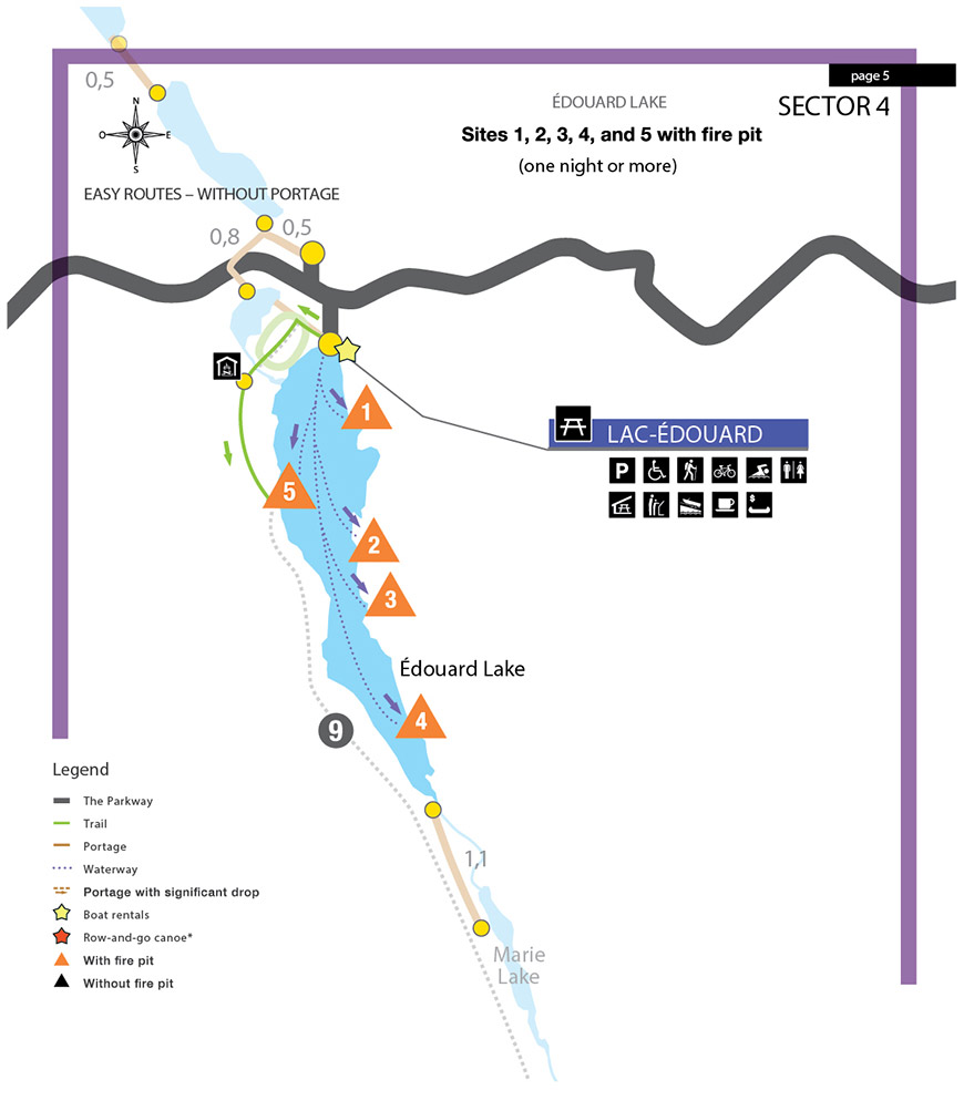
Edouard Lake sector map
La Mauricie National Park
Download the Lac-Édouard sector map in printable version. (PDF, 102 KB)

|
Departure from the LAC-ÉDOUARD picnic Area |
|
|
Édouard Lake |
|
| .......... | 0.6 km of canoeing (10 minutes) |
| 1 | Site 1 |
| .......... | 1.4 km of canoeing (20 minutes) |
| 2 | Site 2 |
| |
|
| .......... | 2.3 km of canoeing (30 minutes) |
| 3 | Site 3 |
| |
|
| .......... | 3.4 km of canoeing (50 minutes) |
| 4 | Site 4 |
| |
|
| .......... | 1.4 km of canoeing (20 minutes) |
| 5 | Site 5 |
| |
|
| _____ | 2.4 km of hiking (1 hour 10 minutes) |
| 5 | Site 5 |
Related links
- Park and sectors map
- Wapizagonke Lake sector map
- Lac à la Pêche sector map
- Lac du Caribou sector maps
- Marie and Isaïe Lakes sector maps
- Waber, Anticagamac, Dauphinais Lakes and Lac des cinq...
- St-Gérard, Lac-Édouard and Rivière-à-la-Pêche sector maps
- Wapizagonke, du-Caribou, de-la-Halte, Maréchal and Tessier...
- Appendix 1
- Date modified :