
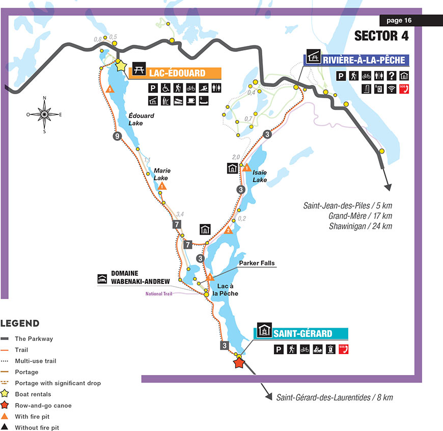
St-Gérard, Lac-Édouard and Rivière-à-la-Pêche sector maps
La Mauricie National Park
Download the St-Gérard, Lac-Édouard and Lac-à-la-Pêche sector map in printable version. (PDF, 2,5 MB)
IMPORTANT INFORMATION—When using the Saint-Gérard entrance:
Registration at the Saint-Mathieu or Saint-Jean-des-Piles Visitor Reception Centre is REQUIRED before heading to your campsite.
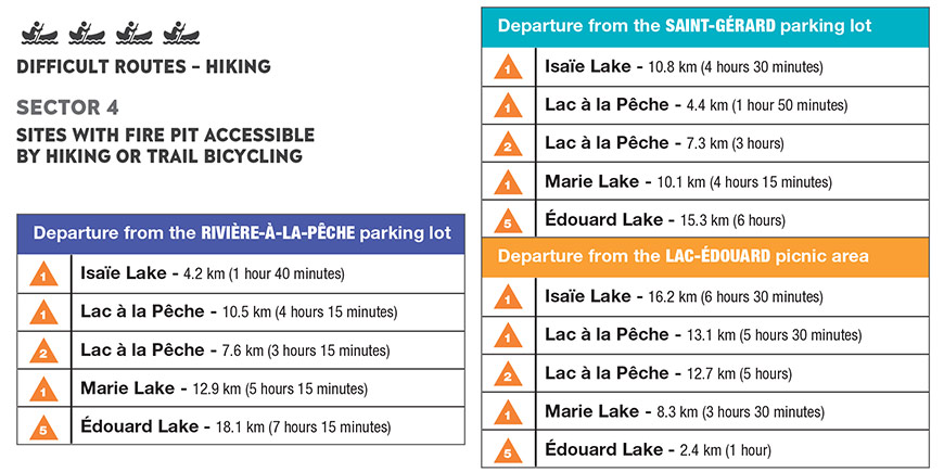
* It is possible to depart from Saint-Gérard parking lot, Rivière-à-la-Pêche parking lot or the Lac-Édouard Picnic Area.
** Several routes are possible depending on the distance you plan to travel and the time you have during the day. You can create your own itinerary with the map.
Do not hesitate to contact us for more information.
*** The following sites are accessible by hiking or by trail bicycling: Isaïe Lake #1, lac à la Pêche #1 and #2, Marie Lake #1 and Édouard Lake #5.
Related links
- Date modified :