
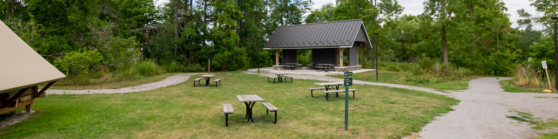
Black Walnut Day Use Area
Rouge National Urban Park
![]()
Discover the Rouge at the Black Walnut Day Use Area! This location is a new trail hub with 3 route options to choose from. Take the new 10.5 km Central Trail that takes you through agriculture and restored wetland, head out on the 10.7 km Northeast Trail with a state-of-the-art fiberglass boardwalk, or take the 5.1 km Trail that connects to the 19th Avenue Day Use Area.
Accessible washrooms, water bottle fill stations and an electric vehicle charger are available on site at this location.
| Location 10725 Reesor Road Google Maps |
| Parking Free, but limited. The parking lot will be closed and locked at 9 pm daily for community safety and security. Lots will reopen between 7 am and 7:30 am daily. |
| Washrooms Available (May long weekend to October 31st : 8:00 am - 8:00 pm, November 1st to May long weekend: 8:00 am - 5:00 pm) |
Trails
Directions
By Car
From downtown Toronto (Note: directions start at one of two downtown highways, the Gardiner Expressway or the Don Valley Parkway).
Distance: 45 kilometres (35 minutes without traffic)
Via the Gardiner Expressway/Don Valley Parkway/Highway 401
- - Gardiner Expressway East to Don Valley Parkway North
- - Merge onto Don Valley Parkway North
- - Don Valley Parkway North to 401 East
- - Merge onto 401 East
- - Take exit 389 for Meadowvale Road
- - Continue on Meadowvale to Old Finch Road
- - Turn left onto Old Finch Road
- - Turn right onto Reesor Road
- - Continue to 10725 Reesor Road.
By Public Transit
Whether you’re travelling from Toronto, Markham, Pickering, Mississauga or Hamilton, you can use public transit to visit Rouge National Urban Park. Plan your trip today at Citymapper.com.
Popular Transit Routes
By Bus/Subway
From downtown Union Station, take GO Transit Bus 71 towards Uxbridge. Get off at Main Street at Stouffer Street. Take York Region Transit Bus 9 towards Stouffville (3 stops). Get off at Tenth Line/Hoover Park Drive. Walk south along Tenth Line to Reesor Road for approximately 45 minutes (Tenth Line becomes Reesor Road). Destination will be on left.
By Commuter Train/Bus
Sorry, there is no direct GO Transit link to this site.
By Bike
Distance from downtown Toronto: Approximately 53 km.
Plan your route to the park by using Google Maps cycling directions or OpenStreetMap.
Note: Both the TTC and GO Transit allow you to bring bikes onto their trains and buses or have bike racks, though some restrictions apply at peak travel times. Consult their websites for more information and to help plan your route.
CAUTION! Please note that biking to the park and between park areas can involve cycling on busy roads, many of which do not have dedicated cycling lanes. Please exercise caution and cycle safely.
- Date modified :