
© Epekwitk Assembly of Councils
Frequently asked questions
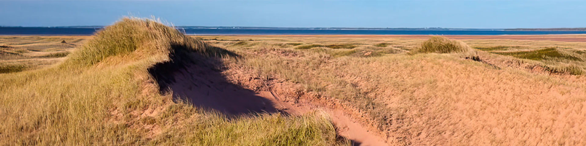
Pituamkek, which means ‘At the Long Sand Dune’, has been an important location for the Mi’kmaq for thousands of years and has significant cultural, historical, and spiritual value to the Epekwitnewaq Mi’kmaq. This connection is as strong today as ever.
Where is this new national park reserve in Prince Edward Island?
The new national park reserve is a string of barrier islands located on the northwestern shore of Prince Edward Island. Also known as Hog Island and the Sandhills, Pituamkek is home to important ecosystems and cultural sites. The Sandhills form one of eastern Canada’s most ecologically significant coastal dune complexes.
Proposed national park reserve priority area and area of interest

Text version
A map of the proposed Pituamkek National Park Reserve and Area of interest. The new national park reserve is a string of barrier islands located on the northwestern shore of Prince Edward Island.
The Priority Area is identified in green and contains lands of cultural and ecological significance which could be appropriate for inclusion in Pituamkek National Park Reserve. Not all lands within the priority area are suitable or desired for inclusion.
The Area of Interest is identified in yellow and contains lands which are also of ecological or cultural significance to Pituamkek, and which could be considered for eventual inclusion. Not all lands within the area of interest will be suitable or be considered for future inclusion.
Any privately owned lands considered for inclusion will only be acquired on a willing seller - willing buyer basis.
The following locations are labelled on the map: (from northwest to southeast): Kwesawe'k (Oulton's Island), Cascumpec Sandhills, Conway Sandhills, Lennox Island First Nation (identified in white, the area outside the Pituamkek proposed national park reserve boundary), Hog Island, Te'pljewe'katik (Bird Island), Nikani-ika'taqank (Ram Island), Kji-mniku (Courtin Island), Ewle'jkl mniku'l (Little Courtin Island).
There is a measurement scale in the bottom right corner.
Why is it important to protect this area through a national park reserve?
Working together, the Government of Canada and the Mi’kmaq Epekwitnewaq Kapmntemuow, are taking action to protect this iconic natural and cultural landscape for future generations. Through this government-to-government agreement, the Government of Canada and the Mi’kmaq Epekwitnewaq Kapmntemuow are hopeful that this marks an important step toward meaningful reconciliation.
The establishment of Pituamkek NPR will help to protect the ecology of the area, as well as its rich Mi’kmaw heritage, and ongoing traditions. Protecting Pituamkek means ensuring that the Mi’kmaq connection to these lands is celebrated and fostered.
Protecting this area with a national park reserve also means the protection of a 50-kilometre-long string of barrier islands along the northwestern coast of P.E.I., which is home to several threatened or endangered species including the little brown bat, northern long-eared bat, the piping plover, and the Gulf of St. Lawrence aster.
How would you describe Pituamkek to someone who’s never heard of it or been to the area?
Known in the Mi’kmaw language as Pituamkek - which means ‘at the long sand dune’-, is an archipelago and coastal area found on the northwestern shores of Prince Edward Island. The area is home to one of the most ecologically significant coastal dune complexes in Eastern Canada. Pituamkek is deeply important to the Epekwitnewaq Mi’kmaq, the Mi’kmaq of Prince Edward Island. It is home to ancient archaeological sites and an ongoing tradition of Mi’kmaw land use. The barrier islands of Pituamkek stretch for 50 kilometres from east to west and form a protective barrier to the north of Malpeque and Cascumpec Bays, which are known around the world for their rich fisheries.
In addition to its rich Mi’kmaq history, the landscapes of Pituamkek are remarkable. These range from coastal dune systems to old-growth forests to Prince Edward Island’s only igneous rock formations. The location known as Iron Rock is home to a rare geological feature: P.E.I.’s only igneous rock formation–a volcanic incursion more than 240 million years old.
Will there be any benefits for the local Mi’kmaq communities in protecting this area?
The establishment agreement considered, among other things, the social, environmental, and economic benefits and impacts of establishing a protected area in this location. The establishment of a protected area will protect an important ecological region and the wildlife that calls it home, and important Mi’kmaq cultural and archaeological sites for future generations.
Furthermore, a national park reserve will create opportunities for local Mi’kmaq people to participate in the establishment and management of the protected area.
What is a national park reserve?
A national park reserve is an area that is managed like a national park but is subject to one or more Indigenous land claims being negotiated between the federal, provincial/territorial and Indigenous governments. The Canada National Park Act applies to national park reserves and provides the same protections to those of national parks.
Can you tell me about the Guardians program? Or the Pituamkek Conservation Program?
There are dozens of unique Guardians programs in protected areas and national parks across Canada. Guardian programs supported by Parks Canada are led by Indigenous communities and based in places that are currently, or may be, administered by Parks Canada in the future. While each program is unique in its offerings, they all place strong emphasis on ecological conservation, cultural heritage, and Indigenous leadership.
The 2023 Pituamkek Conservation Program ran as an interim Guardians program at Pituamkek. The team worked in partnership with other conservation organizations to undertake work to study and conserve the natural and cultural resources of Pituamkek. This program created training and development opportunities for four Mi’kmaq community members who worked to study and conserve the natural and cultural resources of Pituamkek. Blending Mi’kmaq traditional knowledge and modern science, this program also develops capacity among the participants and builds on community partnerships.
What do Guardians do on the land?
A Guardian program looks different in every place and each may have a different starting point in developing capacity and community experience to maintain an ongoing presence on the land. These programs are a vital component of an integrated approach to stewardship within Parks Canada heritage places. Guardian programs are developed to nurture the relationship between Indigenous Knowledge systems, cooperative management, shared decision-making, and Indigenous uses of heritage places.
Common activities include the identification, conservation, and interpretation of cultural heritage, ecological monitoring, water quality testing, restoring habitats, training and learning, administration, relationship building.
Can you describe the establishment process used by Parks Canada when proposing a potential new protected area? What makes an area a good site?
A range of factors are reviewed when considering an area as a candidate for a new national park. These include: cultural significance, biodiversity, landscape connectivity, level of representation within the current system plan, support of Indigenous communities and governments, and support of relevant provincial or territorial governments.
There is no rigid process for establishing new national parks. Each proposed project is unique and reflects local circumstances. The standard sequence, however, is framed by 5 steps:
- Identifying representative natural areas
- Selecting a potential area
- Assessing the feasibility of a national park, including consultations
- Negotiating agreements
- Establishing a national park under the Canada National Parks Act
Each step in the sequence is its own process and takes a varying amount of time. As well, a project may be stopped at any point before reaching step-5.
The Pituamkek process has been very unique because it was proposed and has been championed by the Mi’kmaq throughout.
How did Parks Canada acquire the lands/parcels which make up the NPR?
The work on assembling the park reserve lands to date has been a partnership involving L’nuey, Parks Canada, as well as Island Nature Trust, the Nature Conservancy of Canada, and the Province of Prince Edward Island. All have been major contributors to the process, and it is thanks to them that many of these parcels are included in the protected area. Some additional lands have also been identified as being of conservation interest for Pituamkek. Any lands of interest for inclusion within Pituamkek’s protected area will be strictly acquired on a willing buyer-willing seller basis.
While visitation is limited at this time, you may also be interested in the following:
- Date modified :