
Kelp Forests
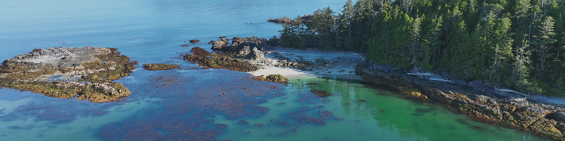
Pacific Rim National Park Reserve
Overview
Pacific Rim National Park Reserve is made up of 44% marine environments, including subtidal waters and intertidal zones. It stretches over 125 kilometres of coastline and supports a rich diversity of coastal habitats, including kelp.
Much like land-based forests, kelp forests create habitat underwater which produce oxygen, store carbon, and help reduce the impacts of climate change. Kelp habitats drive marine ecosystem diversity and support the recovery of culturally important species and species at risk, such as the Sea Otter (k̓ʷak̓ʷaƛ), Northern Abalone (ʕapy̓in), Chinook Salmon (suuḥaa), and Rockfish (ƛiḥapiiḥ).
For First Nations, kelp forests are critical to economic development, food security, and connection to ḥaḥuułi (territory). Guided by the Nuu-chah-nulth principle hišukma c̓awaak “everything is one, everything is connected”— Pacific Rim National Park Reserve recognizes kelp forests as a vital link between the marine environment below and people above.
Stressors
Kelp forests are declining in Bakley Sound, including the Broken Group Islands Unit of Pacific Rim National Park Reserve, according to research, Indigenous knowledge, and local knowledge. A combination of environmental change and shifting ecosystem dynamics has altered canopy kelp distributions in the region and across the Pacific Coast.
Climate change
Kelp forests are increasingly at risk of marine heatwave events. These periods of unusually warm ocean temperatures are becoming more intense and frequent with climate change. Two major heatwaves have affected the region in the past decade: the 2013–2016 event known as “the Blob” and the 2019–2021 marine heatwave. In some areas, these events caused significant losses in canopy kelp, changes in species distributions, and reductions in ecosystem health.
Ecosystem imbalance
Kelp forests are also changing due to ecological factors as ocean waters warm. Overgrazing by sea urchins transforms once-diverse kelp forests into barrens. The overabundance of urchins is linked to the loss of predator species that once controlled their populations, as well as the absences of traditional practices, such as the harvesting of urchin (t̓uc̓up), by local First Nations.
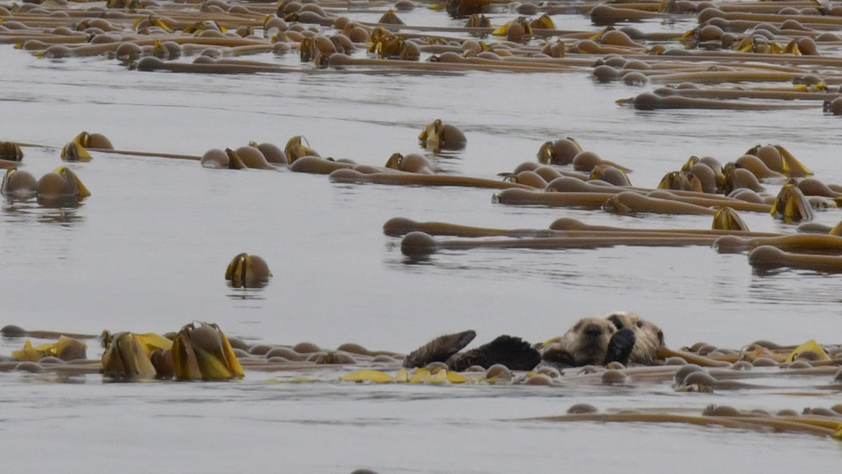
Sea Otter (Enhydra lutris)
The Sea Otter (k̓ʷak̓ʷaƛ) is a keystone species that eats a quarter of its body weight in food daily. They are drivers of kelp forest ecosystem dynamics along the north Pacific coast. Once extirpated (locally extinct) from British Columbia during the fur trade, and subsequently reintroduced in the 1980s, Sea Otters are now recovering and expanding their range.
Sunflower Star (Pycnopodia helianthoides)
The 2013 marine heatwave event coincided with the emergence of Sea Star Wasting Disease, a bacteria strain that caused widespread mortality among sea star species. The Sunflower Star was hardest hit. This predator is up to a meter across and was once a major predator of sea urchins in the Broken Group Islands. According to SCUBA surveys before and after the Blob marine heatwave, Sunflower Star numbers dropped sharply, while Red Sea Urchin densities increased tenfold.
How is Parks Canada monitoring kelp forests?
Pacific Rim National Park Reserve implemented a kelp monitoring program in 2022, with the following goals:
- Report on the ecological integrity of the national park reserve using canopy kelp as an indicator of marine ecosystem health.
- Determine the status and trend of kelp habitats and identify drivers of change.
- Work in partnership with Indigenous communities, incorporating both cultural and ecological knowledge into monitoring initiatives.
- Inform co-management actions and restoration efforts.
For more detailed information on kelp monitoring methods and tools, visit the Parks Canada Case Study on Hakai Institute's Coast Connect.
Kelp mapping from the air
Pacific Rim National Park Reserve uses Unmanned Aerial Systems (drones) to annually collect data on the health of kelp forests. Monitoring methods co-developed by the Marine Planning Partnership (MaPP) are part of the protocols for kelp monitoring on the west coast of Vancouver Island.

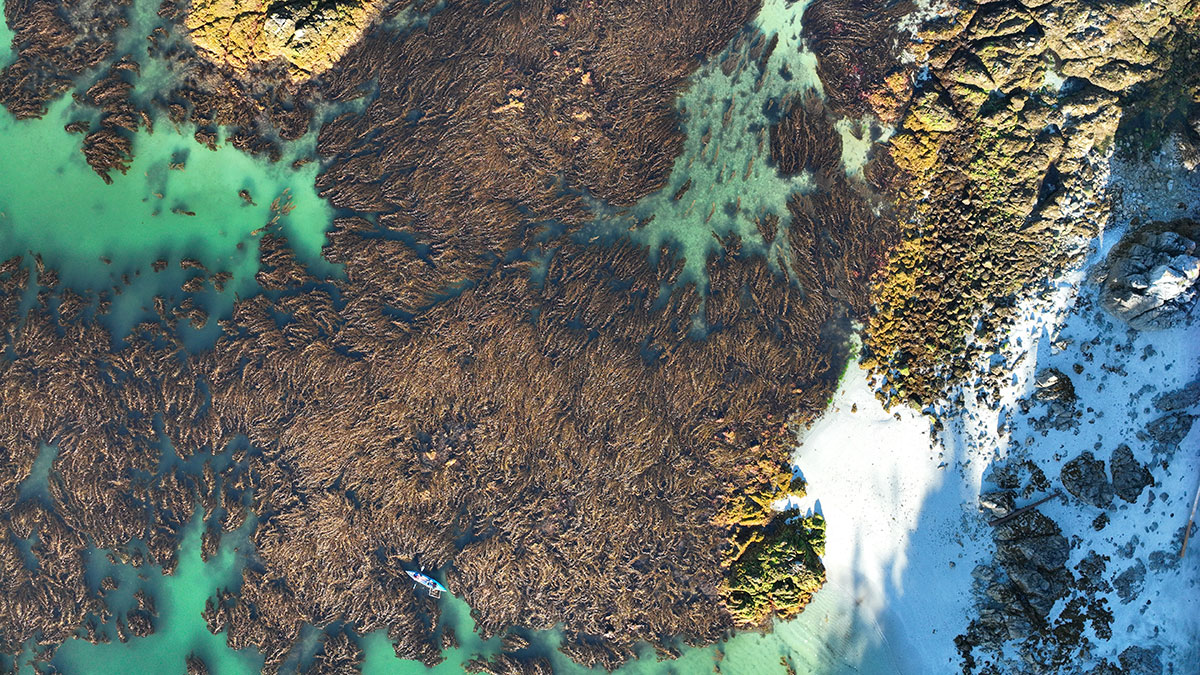
Collecting high resolution images at consistent times and tides provides information about where kelp forests occur, and how they are changing over time. Aerial photos taken in with the drones are stitched into a larger geo-referenced image called an orthomosaic that can then be analyzed using GIS software. Through collaboration with the Hakai Institute, this process is automated by the Habitat Mapper segmentation tool. Kelp area is used as an ecological indicator to determine the status and trend of kelp habitat within Pacific Rim National Park Reserve.
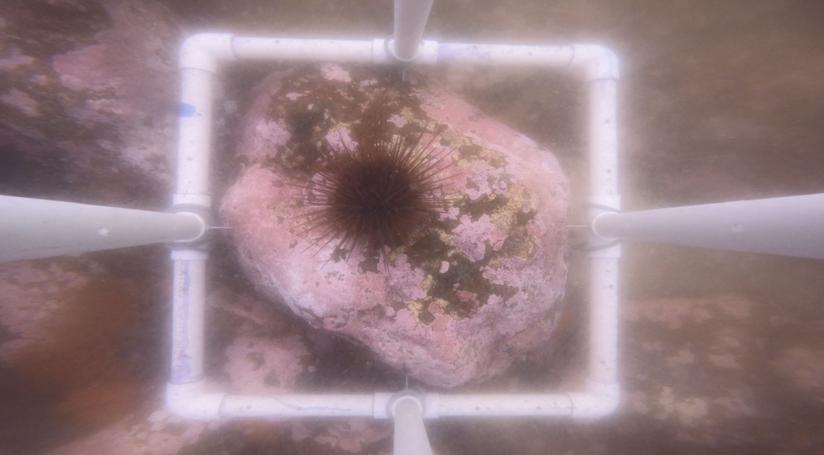
Collecting information from the water
In conjunction with drone mapping, information is collected from the water.
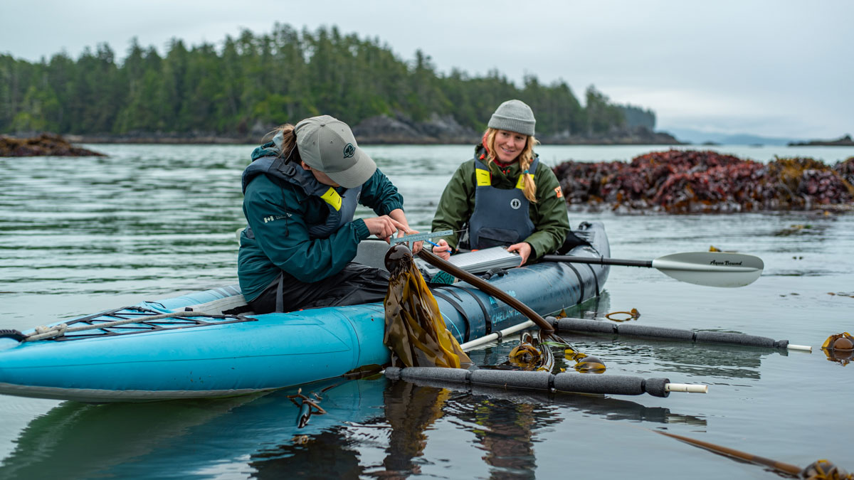
Measuring kelp density, condition, and the presence of epiphytes such as bryozoans.
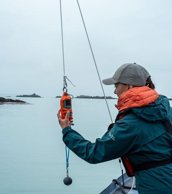
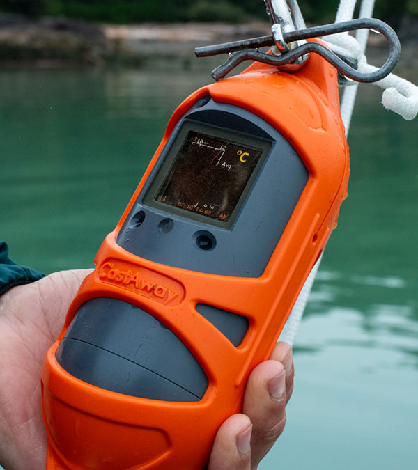
Collecting oceanographic information, such as temperature and salinity.
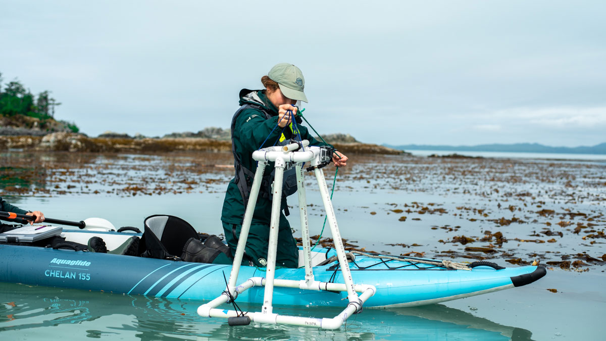
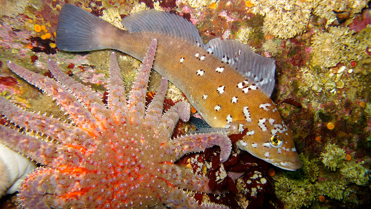
Identifying subtidal communities (invertebrates, fish, urchin density) and substrate type using underwater video.
Working Together
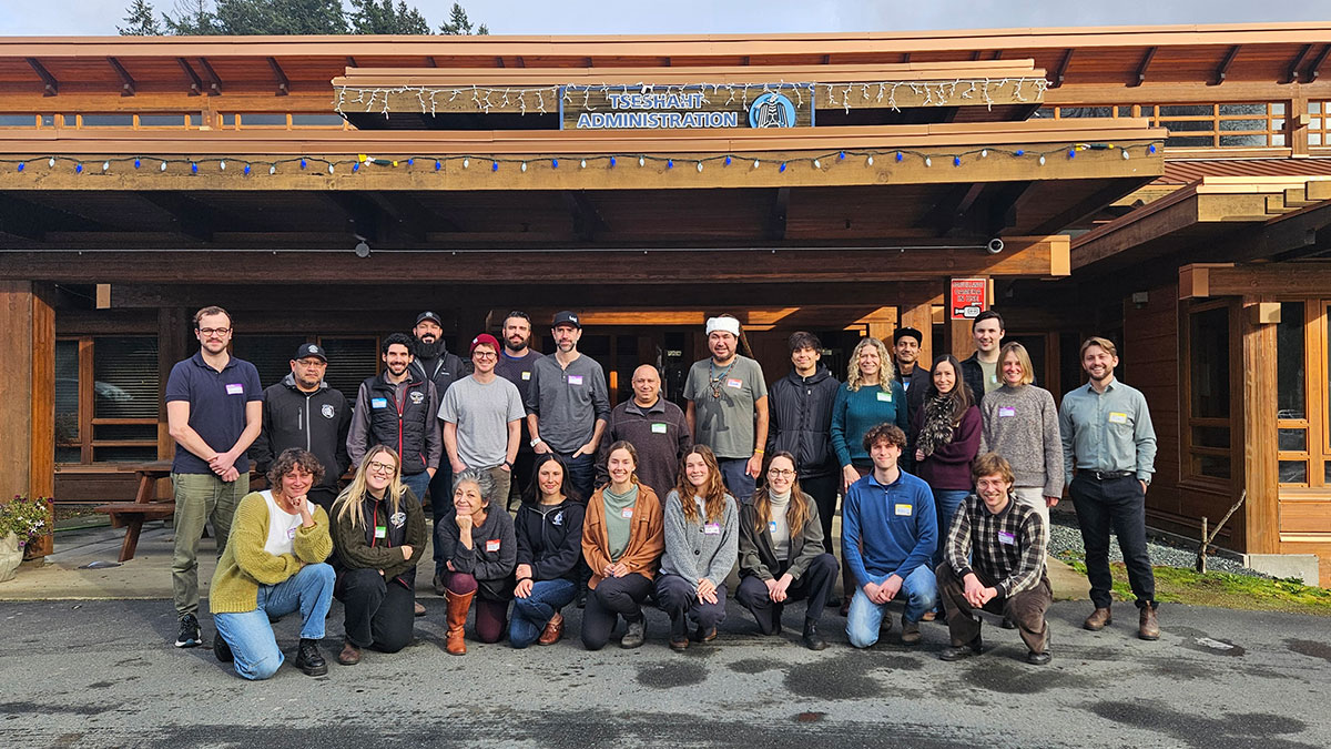
The kelp monitoring program at Pacific Rim National Park Reserve was developed in close collaboration with First Nation partners. In addition to scientific monitoring data, the kelp ecological integrity indicator incorporates Indigenous and local knowledge. This was a central goal of the Barkley Sound Kelp Roundtable, which was co-organized by Parks Canada and the Kelp Rescue Initiative, and hosted by Tseshaht First Nation. This gathering brought together First Nations, researchers, and conservation and restoration organizations, to share knowledge, and advance collaborative approaches to kelp research and recovery.
- Date modified :