
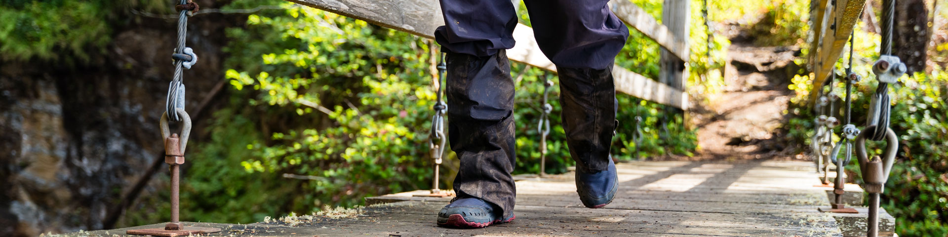
Hiking is the best way to explore Pacific Rim National Park Reserve
Hiking
Pacific Rim National Park Reserve
Learn more about safely sharing the national park reserve with wildlife.
A complete list of ongoing closures and restrictions.
Check the local weather before heading out. Be prepared.
Get up-to-date information on trail conditions.
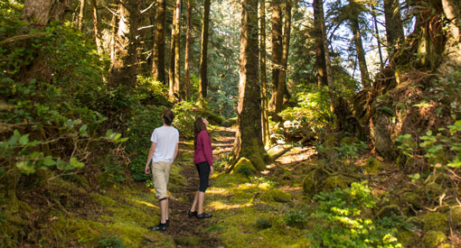
Hiking in the Long Beach Unit
The Long Beach Unit is ideal for casual strolls through the temperate rainforest and along sandy beaches. There are approximately 22 km of beaches and 12 km of trails.
Two tides come in and out each day, making Pacific Rim’s seashore one of the most dynamic places in the national park reserve.
Whether you prefer to walk on the beach or hike a nature trail, there is always something new to discover.
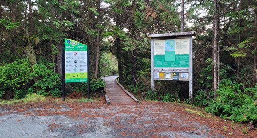
Important information
- Be aware of tides, swells, and other water hazards.
- Creeks in the Long Beach Unit may be impossible to cross at high tide and after heavy rain.
- A National Park Entry Pass is required.
- Overnight camping is only permitted at Green Point Campground. Reservations are required.
- Vehicle parking is limited to designated areas only. Roadside parking is prohibited including in front of access gates.
- Dogs are permitted in the Long Beach area of Pacific Rim National Park Reserve, except for Combers Beach from April 1 to October 1. In areas where dogs are permitted, they must be on a leash and under physical control at all times. This includes beaches, trails, parking lots and in the water.
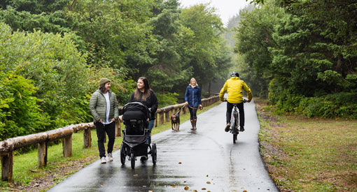
ʔapsčiik t̓ašii (pronounced ups-cheek ta-shee)
Length: 25 km one way (50 km there and back)
Level of difficulty: Moderate
What to expect
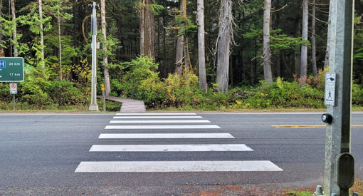
The pathway is paved along its entirety and is mostly flat, however, there are a few short, steep hills with a slope of greater than 10% at km 9 and km 14. The pathway is 3.2 m wide with 1 m wide shoulders, providing room for cyclists and pedestrians to pass safely. There is one uncontrolled crossing (with no lights) on Wick Road and two pedestrian-controlled crossings on Highway 4: one at Radar Hill Road and one at Rainforest Trails. There are several benches placed along the pathway to take a rest.
ʔapsčiik t̓ašii is best enjoyed from mid-April to mid-October.
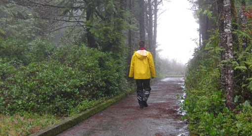
A Winter Conditions Warning is in effect on the ʔapsčiik t̓ašii during the winter as the area experiences regular rain, wind, and some snow events. As the pathway is not maintained during the winter, debris, including fallen trees, leaves and sometimes snow and ice may be present, and travel is not recommended.
Beach access
The pathway runs through the forest and along the beach at Long Beach. The pathway provides access to:
- Wickaninnish Beach
- Long Beach
Trailhead locations
The pathway extends from the southern to the northern boundary of the Long Beach Unit. It connects to the Tofino Multi-Use Path on the northern end and the Ucluelet Multi-Use Path on the southern end.
Parking
The ʔapsčiik t̓ašii can be accessed from most parking lots in the Long Beach Unit.
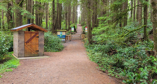
Washrooms
There are washroom facilities at the day use areas along the pathway:
- Wickaninnish Day Use Area
- Rainforest Trails - There are two outhouses at the Rainforest parking lot.
- Comber Beach Day Use Area - There are two large outhouses with ample room for visitors who use mobility devices.
- Long Beach South and North Day Use Areas
- Incinerator Day Use Area
Points of interest
ʔapsčiik t̓ašii translates to “going in the right direction on the path.” The name has many layers of meaning depending on how the phrase is used. It can refer to our personal journeys in life: "going in the right direction". It can also be a reminder to stay on the path and being mindful of the environment and all living things.
The pathway runs along Highway 4 and Wick Road, weaving through the forest, which provides a buffer between visitors and the road. The pathway provides access to viewpoints, day use areas, beaches and facilities along the way.
The pathway was built in consultation and partnership with Tla-o-qui-aht First Nations and Yuułuʔiłʔatḥ.
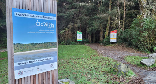
Combers Beach Trail
Length: 500 m one way (1 km there and back)
Level of difficulty: Moderate
What to expect
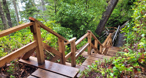
This trail consists of a 2 m wide gravel section with steep slopes greater than 10%. The remainder of the trail is 1.2 m wide wooden boardwalk with 2.5 cm gaps between boards. There are several steps on the boardwalk section.
Beach access
This trail leads from the parking lot down to Combers Beach.
Winter storms and erosion make beach access difficult in the winter. The beach access from the trail is not maintained in the winter and early spring and visitors can encounter steep banks and driftwood piles at the beach access. Beach access is dependent on tides, currents, and erosion.
Trailhead location
Along Highway 4, on the ocean side, approximately 3 km south of Green Point Campground.
Parking
There is a large parking lot with room for RVs and buses. An Automated Park Use Machine is available for credit card purchases only.
Washrooms
There are two large outhouses with ample room for visitors who use mobility devices.
Points of interest
This trail winds through cedar-hemlock forest and then into a spruce fringe forest. Once you reach the bottom of the boardwalk trail, the view opens to the Pacific Ocean and an expansive sandy beach that is a favourite resting spot for shorebirds.
As you arrive on the beach, you will find Sandhill Creek to the left. This creek changes its path throughout the year and can be quite deep and run strong. Be cautious if you decide to cross the creek and try to do so closer to the ocean as it will be shallower.
Between April 1 and October 1 every year, there is a dog ban on this trail and from where the trail meets the beach all the way to Green Point.
Halfmoon Bay Trail
Length: 1.8 km one way (3.6 km there and back), including Willowbrae Trail
Level of difficulty: Moderate
What to expect
This trail has steep sections and long flights of stairs. The trail consists of an 80 cm wide wooden boardwalk with numerous steps and long staircases. There are handrails on the staircases and on elevated sections of the boardwalk. In between boardwalk sections, there are muddy trail surfaces with poor footing. The trail ends at a sandy beach with driftwood piles and changing conditions. The trail is well marked.
Beach access
This trail leads to a small, remote beach on Halfmoon Bay.
Trailhead location
The Halfmoon Bay Trail branches from the Willowbrae Trail, 1.3 km from the Willowbrae Trailhead parking lot.
The parking lot is located off Willowbrae Road, which intersects Highway 4, 2 km south of the Ucluelet-Tofino junction. The trailhead is not signed from the highway. Turn west onto Willowbrae Road. Follow the gravel road up for approximately 250 m until you reach the parking lot.
Parking
Parking for Pacific Rim National Park Reserve visitors is located on the right-hand side of the parking lot and is minimal. Please note that other parking is for the Wya Point Resort. There is no parking for RVs or buses.
Washrooms
There is a composting outhouse located at the Willowbrae Trailhead parking lot.
Points of interest
This trail winds through an old growth cedar-hemlock forest where fallen trees serve as nurseries for seedlings. This gives way to a spruce fringe forest on the steep climb down to the sheltered bay and sands of Halfmoon Bay.
This is one of the less frequented trails and beaches in the area.
Nuu-chah-nulth Trail
Length: 2.5 km one way (5 km there and back)
Level of difficulty: Moderate
What to expect
This trail is a mix of boardwalk, packed soil, gravel, and asphalt. The trail width varies from less than 1 m to 2 m. There are wooden boardwalks that are either 80 cm or 1.2 m wide, with staircases and steps. There is a steep 70 m ramp with slats for traction. A large portion of the trail is packed soil with muddy braided conditions. During the rainy season, water ponding can occur on the trail. The trail is well marked for route finding.
Beach access
The southern end of the trail empties out into the Florencia Bay North parking lot which has access to Florencia Bay Beach North.
Trailhead location
Accessed off Wick Road, the trailheads are located at Florencia Bay North and behind the Kwisitis Visitor Centre.
Parking
Parking is available at Florencia Bay North parking lot and at the Kwisitis Visitor Centre.
Please note: Florencia Bay North is a popular day use area and parking spaces can be limited or the lot may be full. Do not park on the side of this narrow road as it impedes access for emergency vehicles and will destroy habitat. RVs and busses must use the Kwisitis Visitor Centre parking lot.
Washrooms
There is an outhouse at the Florencia Bay North parking lot and washrooms at the Wickaninnish Day Use Area. The Kwisitis Visitor Centre has washrooms available when the centre is open.
Points of interest
The Nuu-chah-nulth people have lived along the west coast of Vancouver Island for millennia and continue to be a vibrant community that is actively managing their lands and territories. Their culture is deeply interwoven with the temperate rainforest, islands, beaches and waterways of this area.
The Nuu-chah-nulth trail offers a glimpse into this culture. Learn the guiding principle of Hishuk ish ts’awalk (everything is one),how this principle influences the lives of the Nuu-chah-nulth-aht, and how you can visit these lands with Isaak (respect).
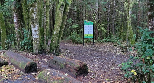
Rainforest Trail A
Length: 1 km loop
Level of difficulty: Moderate
What to expect
This trail is mostly composed of an 80 cm wide wooden boardwalk, intermixed with gravel parts. There are many staircases and steps up and down the ravine, as well as wide decks with interpretive panels. The staircases and elevated sections have handrails. The trail is well marked.
Beach access
There is no beach access.
Trailhead location
Trail A is located on the opposite side of the highway from the parking lot. There is a pedestrian-controlled crosswalk. Press the button to activate and use caution when crossing.
Parking
There is a small parking lot on the ocean side of Highway 4, between Green Point Campground and Wick Road.
This is a very small parking lot and RVs and buses are not permitted. RVs and buses can park at the Combers parking lot north of the Rainforest trails and walk along the ʔapsčiik t̓ašii (2 km) to access. An Automated Park Use Machine is available for credit card purchases only.
Washrooms
There are two outhouses at the Rainforest parking lot.
Points of interest
Following a boardwalk trail through the temperate rainforest, look up to see the gigantic western red cedar and western hemlocks. Scan the upper canopy for birds, listen to the trickle of water and smell the life of this active forest. This is a great experience rain or shine.
Don’t forget to also do Rainforest Trail B.
Rainforest Trail B
Length: 1 km loop
Level of difficulty: Moderate
What to expect
The trail is mostly composed of an 80 cm wide wooden boardwalk and some sections with a gravel surface. There are many staircases and box steps up and down ravines, as well as wide decks with interpretive panels. The staircases and elevated sections have handrails. The trail is well marked.
Beach access
There is no beach access.
Trailhead location
Trail B is located at the very back section of the parking lot.
Parking
There is a small parking lot on the ocean side of Highway 4, between Green Point Campground and Wick Road.
This is a very small parking lot and RVs and buses are not permitted. RVs and buses can park at the Combers parking lot north of the Rainforest trails and walk along the ʔapsčiik t̓ašii (2 km) to access. An Automated Park Use Machine is available for credit card purchases only.
Washrooms
There are two outhouses at the Rainforest parking lot.
Points of interest
Following a boardwalk trail through the temperate rainforest, look up to see the gigantic western red cedar and western hemlocks. Scan the upper canopy for birds, listen to the trickle of water and smell the life of this active forest. This is a great experience rain or shine.
Don’t forget to also do Rainforest Trail A.
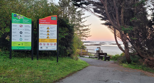
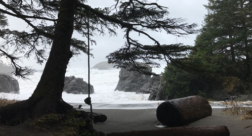
South Beach Trail
Length: 800 metres one way (1.6 km there and back)
Level of difficulty: Moderate
What to expect
The South Beach Trail has a mix of asphalt, gravel, and boardwalk surfaces. The trail width varies from 0.8 m to 2 m. There is a steep 1.2 m ramp with slats. At the Nuu-chah-nulth South Beach junction, the trail narrows to a 0.8m wide wooden boardwalk with steps and staircases. All staircases and elevated sections have handrails. Beach access at south beach can be eroded and steep with driftwood present. Trail is well marked.
Beach access
This trail accesses South Beach.
Trailhead location
This trail branches off from the Nuu-chah-nulth Trail. The trailhead is located behind the Kwisitis Visitor Centre.
Parking
Parking is available at the Kwisitis Visitor Centre. An Automated Park Use Machine is available for credit card purchases only.
Washrooms
There are washrooms available at the Wickaninnish Day Use Area. The Kwisitis Visitor Centre has washrooms available when the centre is open.
Points of interest
South Beach offers spectacular, but potentially dangerous, wave watching. Very large waves and strong currents form at this pebble beach. Water activities are not recommended. When the weather and waves are less dramatic, it is a popular beach to listen to the sound of water washing over the stones.
Shorepine Bog Trail
Length: 800 m loop
Level of difficulty: Moderate
What to expect
The 1.2 m wide trail is a wooden boardwalk loop with bumpers and 0.5-to-1-inch gaps between treads. Several benches are located at wide pull-out decks. While there is minimal slope change (less than 5 degrees) and there are no stairs, the boardwalk floats on top of a bog and can be uneven.
Beach access
There is no beach access.
Trailhead location
On Wickaninnish Road, 300 m south of the Florencia Bay North turnoff.
Parking
There is a small parking lot with access to a picnic table. An Automated Park Use Machine is available for credit card purchases only.
Washrooms
There are no outhouse or washrooms. The closest restrooms are located at Wickaninnish Day Use Area.
Points of interest
You can experience an old growth coastal temperate rainforest with a twist. Often referred to as the “broccoli forest”, the trees are small, the soil damp and one can almost imagine being in a Dr. Seuss storybook.
Bogs are characterized by poor drainage, acidic soils, and a thick build-up of Sphagnum moss. The soil in a bog provides little food for its inhabitants hence their small stature. The small size of these trees may hide many years of survival.
Willowbrae Trail
Length: 1.4 km one way (2.8 km there and back)
Level of difficulty: Moderate
What to expect
This 2-3 m wide trail is a gravel path. There are some slopes that are greater than 10 degrees. To access Florencia Bay South visitors must use a long boardwalk staircase which descends in a steep drainage greater than 10%.
Beach access
This trail accesses Halfmoon Bay and Florencia Beach South
Trailhead location
The Willowbrae Trailhead is located off the parking lot. The parking lot is located off Willowbrae Road which intersects Highway 4, 2 km south of the Ucluelet-Tofino junction. The trailhead is not signed from the highway. Turn west onto Willowbrae Road. Follow the gravel road up for approximately 250 m until you reach the parking lot.
Parking
The parking for Pacific Rim National Park Reserve visitors is located on the right-hand side of the parking lot and is minimal. Please note that other parking is for the Wya Point Resort. There is no parking for RVs or buses.
Washrooms
There is a composting outhouse located at the Willowbrae Trailhead parking lot.
Points of interest
This historic trail was part of a two-day travel route between Ucluelet and Tofino prior to the establishment of a road in 1942.
This trail winds through an old growth cedar-hemlock forest where fallen trees serve as nurseries for seedlings, giving way to a spruce fringe forest on the steep climb down to the sheltered bay and sands of Halfmoon Bay and Florencia Bay South.
Radar Hill Trail
Length: 500 m one way (1 km there and back)
Level of difficulty: Moderate
What to expect
The trail is paved, with a very steep incline. There are observation decks that have ramp access.
Beach access
There is no beach access,
Trailhead location
The trailhead is located at the upper parking lot of Radar Hill. Radar Hill is accessed by turning onto Radar Road off Highway 4, at the northern boundary of the national park reserve. There is a pedestrian-controlled crossing across Highway 4.
Parking
The parking lot is located at the top of Radar Hill. An Automated Park Use Machine is available for credit card purchases only at the lower parking lot.
Washrooms
There is a large outhouse with ample room for visitors who use mobility devices.
Points of interest
Radar Hill was the site of a radar station during World War II. This short trail takes you past the Kapyong memorial which commemorates the battle of Kapyong in the Korean War. It then takes you further up to a viewing platform that has the highest vantage point in the Long Beach Unit.
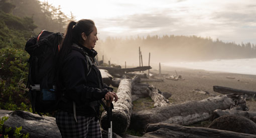
Hiking the West Coast Trail
The West Coast Trail is an iconic backcountry, multi-day backpacking trail that is a bucket list challenge for many hikers. It is an experience that can bring even the most experienced hikers to their knees. Those who are well prepared physically, mentally, and equipment-wise, come away with tales of grit.
Hikers climb more than 100 ladders with a heavy pack, trudge through deep mud, wade through mountain-fed rivers in fast-flowing hip-deep waters and push through whatever weather the wild West Coast delivers — often driving wind and rain.
Important information
Is this hike right for you?
Before you decide to make a West Coast Trail reservation for yourself, learn what you are signing up for and make sure this hike is right for you and your party.
Before you make a reservation:
- Read about the hike on our website.
- Watch the WCT Hiker Preparation Guide Video
Hiking in the Cape Beale Headlands
Located near Bamfield, this rugged section of shoreline is home to the historic Cape Beale lighthouse. Cape Beale Headlands provide an opportunity for visitors to sample the same terrain as the 75 km West Coast Trail. These challenging hikes wind through temperate rainforest to spectacular west coast beaches. All day users and overnight users of the Cape Beale Headlands are required to register at the West Coast Trail Information Office at Pachena Bay.
Cape Beale Lighthouse Trail
Length: 7 km one way (14 km there and back)
Level of difficulty: Route
What to expect
This is a strenuous hike through fairly flat terrain. Expect mud, bare roots, log crossing and slippery sections. A 1.8 m tide (or lower) is required to cross the tidal flats on the way to the Cape Beale Lighthouse. There is no camping at Cape Beale Lighthouse so leave plenty of time for the return trip. There is no reliable freshwater sources along the Cape Beale Lighthouse Trail. Bring an adequate amount of freshwater with you.
Beach access
This trail accesses Topaltos Beach.
Trailhead location
Cape Beale trailhead road is located at the end of South Bamfield Road. Follow the trail to the junction and then take the right trail west to Topaltos Beach. From Topaltos, hike to the southwest end of the beach and watch for the trailhead marked with floats hanging from the tree. The trail passes through a swampy bog, then rises over a steep, rocky hill with drier vegetation and dwarfed trees. At the end of the trail, the lighthouse can be reached by crossing the sand flats at tides below 1.8 m.
Parking
Parking is well marked and is 400 metres up the road from the trailhead.
Washrooms
There are no outhouses on the Cape Beale Lighthouse Trail. Backcountry etiquette for the disposal of human waste: dig a hole 20 centimetres (7 inch) deep, at least 30 metres (three bus lengths) away from water sources, campsites, or the trail. Bury the human waste. Pack out all toilet paper and feminine hygiene products.
Points of interest
Built in 1874, the Cape Beale Lighthouse is located close to the West Coast Trail. In fact, the trail from Topaltos Beach to Cape Beale Lighthouse is part of the same telegraph route that the West Coast Trail follows. Observant hikers can still see remnants of the old line while they are hiking.
The Cape Beale Lighthouse Trail has linked the community of Bamfield to the lighthouse for over a century.
Keeha Beach Trail
Length: 3.5 km one way (7 km there and back)
Level of difficulty: Route
What to expect
Fairly flat terrain, bare roots, and slippery sections with precarious footing are common. Although this is a short hike, make sure you allow plenty of time for the return trip or plan to camp overnight at Keeha Beach.
Potable water: Kichha Lake and its outflow creek at Keeha Beach provide fresh water but all water must be treated prior to drinking.
Camping areas: There is designated camping at Keeha Beach. A back-country camping permit and National Park Entry Pass are required. Please register at Pacheena Trailhead.
Beach access
This trail accesses Keeha Beach.
Trailhead location
Cape Beale trailhead road is located at the end of South Bamfield Road. Follow the trail to the junction and take the trail to the left, which follows the east side of Kichha Lake.
Parking
Parking is well marked and is 400 m up the road from the trailhead.
Washrooms
A composting toilet is available at the south end of Keeha Beach.
Points of interest
Keeha is a beautiful crescent shaped beach with rocky headlands at both ends, crashing waves, tidal pools, sea arches and a spectacular open ocean view. The trail passes through hemlock and cedar groves.
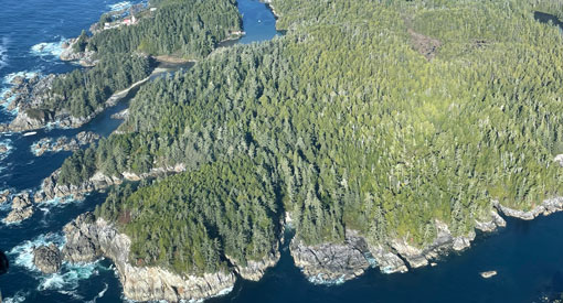
Hiking in the Broken Group Islands
This archipelago of over 100 islets is located in Barkley Sound, south of Ucluelet. The Broken Group Islands are part of the Tseshaht First Nation’s traditional territory. Explore the unique character of each island.
Various trails throughout the Broken Group Islands
Length: Up to 0.5 km one way, depending on location
Level of difficulty: Route
What to expect
You can expect bare roots, mud, and some slopes.
Designated camping areas are located on Hand, Turret, Gibraltar, Willis, Dodd, Clarke and Gilbert islands.A
Trails in the Broken Group Islands are not maintained by Parks Canada.
Beach access
There is beach access throughout the Broken Group Islands.
Trailhead location
These islands are accessible by boat only. See a map of the islands and our list of licensed business operators to book a boat ride.
Parking
There is no parking as the islands are only accessible by boat.
Washrooms
Solar composting outhouses are available at designated camping areas located on Hand, Turret, Gibraltar, Willis, Dodd, Clarke and Gilbert islands.
Points of interest
The rocky shorelines and lush forests of the Broken Group Islands are home to a large diversity of plants and animals. Benson Island is a great destination for walking. Enjoy a self-guided tour and learn about the archeological research that dates use of the island back over 5,000 years.
Related links
- Broken Group Islands
- ʔapsčiik t̓ašii (Multi-use pathway)
- Long Beach Unit
- West Coast Trail Unit
- Birding
- Boating
- Camping
- Cycling, mountain biking, and e-biking
- First Nations cultural experiences
- Fishing
- Geocaching
- Hiking: West Coast Trail
- Kapyong Memorial at Radar Hill
- Kwisitis Visitor Centre
- Red Chairs
- School and group programs
- Storm watching
- Surfing
- Volunteer opportunities
- Licensed operators
- Date modified :