
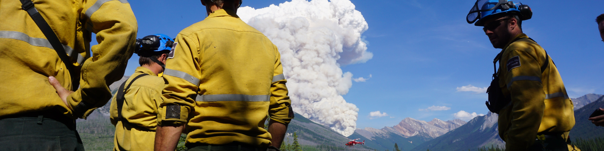
Current wildfire status
Kootenay National Park
Safety is Parks Canada's top priority. We actively monitor Kootenay National Park for new wildfires and are ready to respond quickly when they occur.
Report any wildfires, illegal campfires or suspicious smoke to Parks Canada Emergency Dispatch: 403-762-4506.
2026 wildfire details
Only wildfires of note are listed. A wildfire of note is a fire that is highly visible or posing a threat to public safety.
Wildfire 2026-KO-06
Wildfire update – August 31, 2026
Status: EXTINGUISHED
Details:
Over the weekend, Kootenay National Park received between 6 mm and 20 mm of precipitation in different areas of the park.
Wildfire 2026KO06, which was burning on the lower slopes of Mount Harkin northeast of Dog Lake, is now extinguished.
This will be the last update for this wildfire.
Additional Information:
To report a wildfire, illegal campfire, or suspicious smoke, contact Parks Canada Emergency Dispatch at 403-762-4506.
Wildfire update – August 27, 2026
Parks Canada is using a modified response on the two small fire starts (2026KO05 and 2026KO06) that were detected in Kootenay National Park following the storm that passed through the area on August 23. Both fires continue to exhibit minimal fire behaviour and have shown no notable growth since being detected.
There is currently no threat to public safety or infrastructure from either wildfire.
Details:
2026KO06 is burning on the lower slopes of Mount Harkin, northeast of Dog Lake.
It is approximately 0.1 ha.
Current weather forecasts indicate some rainfall in Kootenay National Park over the weekend, though amounts are expected to be minimal.
Motorists travelling along Highway 93 South may see smoke near Dog Lake from this fire.
We will provide an update on August 31 unless the situation significantly changes.
Additional Information:
You can report any wildfires, illegal campfires or suspicious smoke to Parks Canada Emergency Dispatch: 403-762-4506.
Wildfire update – August 25, 2026
Two small lightning-caused wildfires (2026KO05 and 2026KO06) were detected in Kootenay National Park following the storm that passed through the area on August 23. Rainfall recorded across the park during the storm ranged from 10 mm to 33 mm resulting in low fire behaviour on both fires.
There is currently no threat to public safety or infrastructure from either wildfire.
Details:
2026KO06 is burning on the lower slopes of Mount Harkin, northeast of Dog Lake.
It is approximately 0.1 ha.
Motorists travelling along Highway 93 South may see smoke near Dog Lake from this fire.
Response:
Fire crews are actively monitoring 2026KO06 and are prepared to respond if conditions change. Parks Canada will continue to assess risks and apply the response strategy that best supports public safety, neighbouring lands, infrastructure, firefighter safety, and ecological objectives.
Parks Canada fire management personnel consider many factors when determining the appropriate response to a wildfire, including weather conditions, fire behaviour, location, terrain, values at risk, ecological value and available resources.
2026KO06 is burning within a green wildfire response zone, where wildfires may be monitored and assessed to determine the response that best minimizes impacts while supporting ecological and resource management objectives.
Firefighter safety is always a top priority. In backcountry areas with steep or hazardous terrain, fire management personnel carefully evaluate whether suppression actions can be carried out safely and effectively. In green wildfire response zones when fire behaviour is low and there is minimal risk to public safety, infrastructure, neighbouring lands, or other values at risk, monitoring may be the most appropriate response option.
Safety is Parks Canada's top priority. Should some of the above conditions not be favorable, full suppression may be implemented to reduce the risk of negative impacts of the fire.
We will provide an update on August 28 unless the situation significantly changes.
Additional Information:
You can report any wildfires, illegal campfires or suspicious smoke to Parks Canada Emergency Dispatch: 403-762-4506.
Wildfire 2026-KO-05
Wildfire update – August 31, 2026
Over the weekend, Kootenay National Park received between 6 mm and 20 mm of precipitation in different areas of the park.
Fire personnel continue to use a modified response on 2026KO05, which remains low in activity and is burning in a remote backcountry area away from public use areas.
There is currently no threat to public safety or infrastructure from either wildfire.
Details:
On August 30, the fire received approximately 11 mm of rain, helping keep fire behaviour low.
Smoke may still be visible as the fire burns in sparse fuels within an area that burned in 2003.
The fire is estimated at 12 hectares.
The fire is located in the backcountry above Verendrye Creek in steep, difficult-to-access terrain, away from public areas.
A modified response is being used, which means crews are monitoring the fire and responding as needed while considering firefighter safety, weather conditions, and the fire's location on the landscape.
Current weather forecasts indicate additional rainfall could occur this week in Kootenay National Park.
Motorists travelling along Highway 93 South may see smoke from 2026KO05 near Vermilion Crossing.
This will be the last update for this wildfire 2026KO06. We will provide an update on 2026KO05 if there are any significant changes.
Additional Information:
To report a wildfire, illegal campfire, or suspicious smoke, contact Parks Canada Emergency Dispatch at 403-762-4506.
Wildfire update – August 27, 2026
Parks Canada is using a modified response on the two small fire starts (2026KO05 and 2026KO06) that were detected in Kootenay National Park following the storm that passed through the area on August 23. Both fires continue to exhibit minimal fire behaviour and have shown no notable growth since being detected.
There is currently no threat to public safety or infrastructure from either wildfire.
Details:
2026KO05 is in the backcountry, burning in steep terrain above Verendrye Creek and is difficult to access.
It is approximately 0.1 ha and burning within an area that burned in 2003.
Current weather forecasts indicate some rainfall in Kootenay National Park over the weekend, though amounts are expected to be minimal.
Motorists travelling along Highway 93 South may see smoke near Vermilion Crossing from this fire.
We will provide an update on August 31 unless the situation significantly changes.
Additional Information:
To report a wildfire, illegal campfire, or suspicious smoke, contact Parks Canada Emergency Dispatch at 403-762-4506.
Wildfire update – August 25, 2026
Two small lightning-caused wildfires (2026KO05 and 2026KO06) were detected in Kootenay National Park following the storm that passed through the area on August 23. Rainfall recorded across the park during the storm ranged from 10 mm to 33 mm resulting in low fire behaviour on both fires.
There is currently no threat to public safety or infrastructure from either wildfire.
Details:
2026KO05 is in the backcountry, burning in steep terrain above Verendrye Creek and is difficult to access.
It is approximately 0.1 ha and burning within an area that burned in 2003.
Motorists travelling along Highway 93 South may see smoke near Vermilion Crossing from this fire.
Response:
Fire crews are actively monitoring 2026KO05 and are prepared to respond if conditions change. Parks Canada will continue to assess risks and apply the response strategy that best supports public safety, neighbouring lands, infrastructure, firefighter safety, and ecological objectives.
Parks Canada fire management personnel consider many factors when determining the appropriate response to a wildfire, including weather conditions, fire behaviour, location, terrain, values at risk, ecological value and available resources.
2026KO05 is burning within a green wildfire response zone, where wildfires may be monitored and assessed to determine the response that best minimizes impacts while supporting ecological and resource management objectives.
Firefighter safety is always a top priority. In backcountry areas with steep or hazardous terrain, fire management personnel carefully evaluate whether suppression actions can be carried out safely and effectively. In green wildfire response zones when fire behaviour is low and there is minimal risk to public safety, infrastructure, neighbouring lands, or other values at risk, monitoring may be the most appropriate response option.
Safety is Parks Canada's top priority. Should some of the above conditions not be favorable, full suppression may be implemented to reduce the risk of negative impacts of the fire.
We will provide an update on August 28 unless the situation significantly changes.
Additional Information:
To report a wildfire, illegal campfire, or suspicious smoke, contact Parks Canada Emergency Dispatch at 403-762-4506.
Wildfire 2026-KO-04
Wildfire update – August 17, 2026
Status:
The 2026KO04 wildfire is now UNDER CONTROL. This means that suppression efforts have ensured that the fire will not spread beyond its current perimeter.
This will be the last wildfire update for this wildfire.
Details:
A fire crew is patrolling the fire and will action hotspots as needed. Parks Canada is also beginning demobilization, which is the release of personnel, equipment, and other resources as they are no longer required on the fire. This reflects the progress made in bringing the fire under control and the reduced need for resources.
This fire was caused by lightning on the evening of August 8, 2026.
There is currently no threat to public safety or infrastructure.
There are currently no additional wildfires burning in Kootenay National Park.
Additional Information:
To report a wildfire, illegal campfire, or suspicious smoke, contact Parks Canada Emergency Dispatch at 403-762-4506.
Wildfire update – August 13, 2026
Despite limited precipitation on the fire, cooler temperatures over the past two days have helped reduce fire activity, and Parks Canada fire crews continue to make good progress on containment efforts.
There is currently no threat to public safety or infrastructure.
Details:
More accurate mapping has been completed. As a result, the fire size has been reduced to an estimated 7 hectares.
Three crews assisted by two helicopters continue direct suppression efforts along the fire's edge. Crews are using pumps and hoses on the south flank of the fire, while two helicopters assist with water bucketing on the east and west flanks.
The fire continues to exhibit low fire behaviour under current weather conditions.
Motorists travelling along Highway 93 South may notice increased helicopter activity at Kootenay Crossing, which is serving as a staging location for helicopters supporting this wildfire.
The fire was caused by lightning on the evening of August 8, 2026.
There are currently no additional wildfires burning in Kootenay National Park.
With reduced fire activity expected to continue through the weekend, the next update will be provided on Monday, August 17, unless conditions change.
Additional information:
You can report any wildfires, illegal campfires or suspicious smoke to Parks Canada Emergency Dispatch: 403-762-4506.
About wildfire management:
Parks Canada manages wildfires using a zoning system that balances public safety, ecological benefits, and impacts to people and infrastructure. Fires in red zones receive a full suppression response, while fires in green zones may be monitored and allowed to burn when conditions are appropriate. Yellow zones fall between these approaches and can allow for a modified response.
Wildfire 2026KO04 is burning in a yellow zone. For this fire, crews are using a modified response strategy focused on containing the fire within its current perimeter and, with the assistance of current weather conditions, supporting natural extinguishment.
Ultimately, response decisions are based on ongoing assessments of factors such as weather, proximity to communities and infrastructure, fuel conditions, available resources, and containment opportunities. Public safety remains the top priority and guides all wildfire management decisions.
Wildfire update – August 11, 2026
Parks Canada fire crews continue to respond to the wildfire in the Ottertail Pass backcountry of Kootenay National Park (2026KO04).
There is currently no threat to public safety or infrastructure.
Details:
The fire is approximately 11.5 hectares in size.
Two four-person Type 1 fire crews are actively responding to the wildfire. Conditions have allowed crews to begin direct suppression efforts along the fire's edge. Crews are using pumps and hoses on the south flank of the fire, while two helicopters assist with water bucketing on the east and west flanks.
Forecasted weather conditions include cooler temperatures, precipitation, and a chance of thunderstorms over the coming days. These conditions may help reduce fire behaviour. Parks Canada has an initial attack crew on standby to respond to any new fire starts as required.
The wildfire continues to exhibit primarily low-intensity behaviour, with some candling and increased fire activity during the afternoon and early evening when temperatures are highest and humidity is lowest. This period is referred to as the peak burning period.
Motorists travelling along Highway 93 South may notice increased helicopter activity at Kootenay Crossing, which is serving as a staging location for helicopters supporting this wildfire.
The fire was caused by lightning from a storm that moved through the area on the evening of August 8, 2026.
Most of the smoke currently visible in Kootenay National Park is from wildfires burning elsewhere in British Columbia and the United States. If regional smoke conditions improve, smoke from this fire may become visible from Highway 93 South near the Paint Pots area and from portions of the Rockwall Trail.
There are currently no additional wildfires burning in Kootenay National Park.
We will provide updates as new information becomes available.
Additional information:
To report a wildfire, illegal campfire or suspicious smoke, contact Parks Canada Emergency Dispatch: 403-762-4506.
Please do not call dispatch for wildfire updates. Keeping phone lines clear helps ensure emergency resources remain available when needed. Updates will be shared through the Kootenay National Park Facebook page as new information becomes available.
Wildfire update – August 9, 2026
During a routine smoke flight, Parks Canada fire crews detected a small wildfire in the Ottertail Pass backcountry area of Kootenay National Park.
There is currently no threat to public safety or infrastructure.
Details:
The fire is approximately 6 hectares in size.
Parks Canada is responding to the fire with two four-person Type 1 fire crews working indirectly, supported by two helicopters.
The fire was caused by lightning from a storm that moved through the area on the evening of August 8, 2026.
The fire is currently showing low-intensity fire behaviour and is primarily smouldering or burning with small, low-intensity flames along the ground, resulting in slow fire spread. During warmer afternoon conditions, some increase in fire activity, such as isolated tree candling and darker smoke, could occur.
Most of the smoke currently visible in Kootenay National Park is from wildfires burning elsewhere in British Columbia and the United States. If regional smoke conditions improve, smoke from this fire may become visible from Highway 93 South near the Paint Pots area and from portions of the Rockwall Trail.
We will provide updates as new information becomes available.
Additional information:
You can report any wildfires, illegal campfires or suspicious smoke to Parks Canada Emergency Dispatch: 403-762-4506.
Please do not call dispatch for wildfire updates. Keeping phone lines clear helps ensure emergency resources remain available when needed. Updates will be shared through the Kootenay National Park Facebook page as new information becomes available.
Current provincial wildfire situation
The provinces of British Columbia and Alberta maintain special wildfire websites:
British Columbia
Wildfire Situation Map (BC Wildfire Service)
Alberta
- Date modified :