
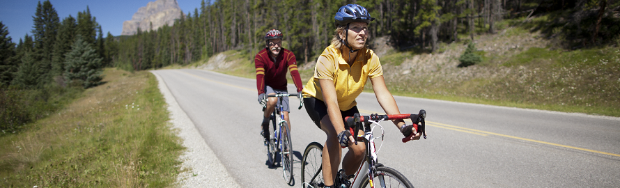
Road rides in the Lake Louise area
Banff National Park
Important information:
Road rides in the Lake Louise area:
| Trail | Distance |
|---|---|
 Great Divide Great Divide |
10.5 km one way |
 Bow Valley Parkway Bow Valley Parkway |
28 km one way |
 Moraine Lake Road Moraine Lake Road |
15 km one way |
| Icefields Parkway |
230 km one way |
Easy Rides
Great Divide
10.5 km one way
Minimal elevation gain
Starting Point: Parking lot at 3.6 km mark of Lake Louise Drive
This route (formerly the 1A Hwy) is closed to vehicles. Though paved, the surface is rough. It winds past the Great Divide at 7.5 km and continues to the Trans-Canada Highway in Yoho National Park. About 500 m west of the Divide, a challenging 1.3 km trail up along Ross Creek connects to the Ross Lake Trail. It allows an alternative return to the trailhead for advanced mountain bikers.
Moderate Rides
Bow Valley Parkway
28 km one way
Minimal elevation gain
Starting Points: Lake Louise Visitor Centre
From Lake Louise to Castle Junction, the Bow Valley Parkway (1A) winds through montane forest near the Bow River. This is a busy road with narrow shoulders; consider riding midweek when traffic is lighter. Numerous short hikes, viewpoints and interpretive signs are accessible from the road. The Bow Valley Parkway continues farther eastward towards the town of Banff and reconnects with the Trans-Canada Highway or the Banff Legacy Trail, after an additional 21 km, making the entire Bow Valley Parkway 49 km in length or 98 km return to Lake Louise
Difficult Rides
Moraine Lake Road
14 km one way
Elevation gain: 527 m
Elevation loss: 202 m
Starting Point: Lake Louise Visitor Centre
This narrow, mountain road has no shoulders and heavy mixed traffic. While personal vehicle traffic is restricted along the Moraine Lake Road, cyclists will encounter steady commercial vehicle traffic from June to October. Cyclists who wish to avoid traffic should consider riding early or late in the day.
The distance to Moraine Lake from the community of Lake Louise is approximately 14km one way with 527 m elevation gain and 202 m elevation loss. From the turnoff at the 3 km mark of Lake Louise Drive, Moraine Lake Road climbs to views of Consolation Valley and the Valley of the Ten Peaks. Mountain bikers can create a loop by combining with the challenging Moraine Lake Highline Trail. Bike racks are provided at Moraine Lake.
Important notes:
- Moraine Lake is considered backcountry. If you choose to bike there, you must be prepared to be self-sufficient. There is no cell service, Wi-Fi, running water or other services including lighting along the road. Pit toilets are available at the lake. There is cell phone reception available approximately 5km away from the lake on Moraine Lake Road.
- There is very limited all day parking in the community of Lake Louise. There is no parking in the Great Divide parking lot or at the Moraine Lake junction.
Icefields Parkway
230 km one way
Moderate to difficult (depending on section or length of ride)
Starting Point: Lake Louise Visitor Centre. (You can access the start of the parkway by crossing the pedestrian bridge over the Trans-Canada Highway, near the western end of Sheol Road, then riding along the bike path beside Highway 1 westward, until it connects with the Icefields Parkway)
Whether it’s for a short ride or a bike tour over several days, the Icefields Parkway has a lot to offer. Hailed by many as one of the most beautiful scenic roads in the world, this route is famous for its bike touring opportunities. The Icefields Parkway follows the continental divide as it leads riders over two mountain passes. En route, cyclists will peddle past beautiful lakes, towering mountains, thundering waterfalls and awesome glaciers. Be cautious, this is a busy road in the summer. Fortunately, there is a wide shoulder in most places. If you just want to ride a section of the parkway, you can always drive to your chosen starting point. For more information, ask for the Icefields Parkway brochure at the Lake Louise Visitor Centre.
Related links
- Date modified :