
Jones Falls Lockstation Walking Tour
Rideau Canal National Historic Site
Jones Falls was first called Long Falls and was later renamed for property and mill owner Charles Jones.The masonry contractor chosen for the difficult works at Jones Falls was a Scot named John Redpath, whose work on Montreal's Lachine Canal in 1821 had attracted Col. By's attention. Redpath, in co-operation with Thomas MacKay, had contracted a section of that canal and later worked together on the Notre Dame Church on Place D'Armes in Montreal and the stone storehouse at the foot of the Ottawa Locks, the first Rideau Canal building and the first stone building in Ottawa. His work at Jones Falls began in 1827 and continued until the canal opening in 1832. Redpath, through shrewd investments and real estate purchases, became a wealthy pillar of the Montreal establishment and then embarked on his next venture. In August, 1854, he began the Canada Sugar Refinery, which, to this day exists as Redpath Sugar.
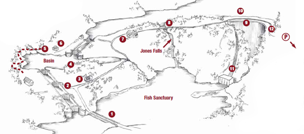
Site Attractions
1 – Long Bridge: This is the main entrance to the Jones Falls Lockstation. Beginning at the Hotel Kenney, it extends 246 ft to the base of the flight lock. Originally built in 1883, it carried road traffic through the village until the present similar structure was built in the 1930s. This timber frame structure has a planked deck and spans the end of Whitefish Lake.
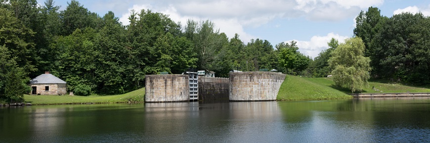
2 – Flight Lock and Swing Bridge: These three interconnected locks share common mitred lock gates like the type originally designed by Leonardo da Vinci. They are more than a metre deeper than any previously built by the British Engineers and therefore have significantly greater water pressure because of their 15 ft depth. The old county road swing bridge approaches are still visible at the centre lock, although the king-post bridge structure was abandoned in 1974 and dismantled in 1985.
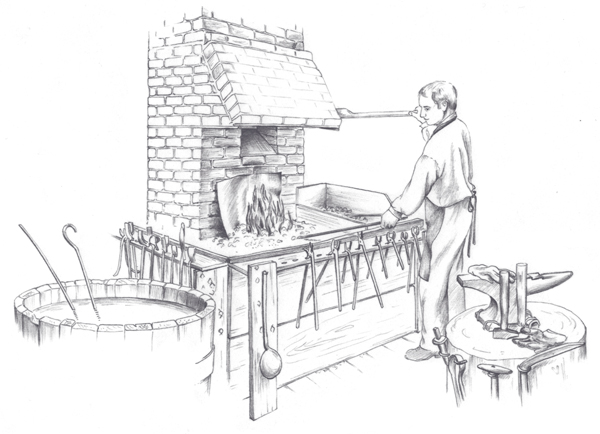
3 – Visitor Centre: Originally built as a storehouse around the turn of the century, it was later used as a maintenance depot for the canal's southern area. Currently, it is a visitor centre/ washroom/orientation centre which contains an audio/video site presentation and stone cutting exhibit.
5 – Basin (Smithy) Trail: (approx. 1/3 km) Take care as you traverse this rugged trail. The path exhibits the rugged, irregular bedrock and thin layer of acidic soil characteristic of the geological area of the Canadian Shield called the Frontenac Axis. This trail shows the typical terrain confronting the canal builders, with its rugged landscape covered with white pine, red and white oak, hemlock, ferns and moss.
8 – Waste Weir: This was constructed as an indispensable addition for the security of the horseshoe (stone arch) dam. Originally, excess water was to overflow the dam but erosion at the base was feared. The weir was cut through very hard rock to provide a water control mechanism and is still used to discharge excess water and maintain levels in Sand Lake.
9 – Stone Arch Dam: This keystone arch dam, constructed of interlocking tapered vertical stones, is one of the first of its type in the world. Workers during construction called it the "Seventh Wonder of the World", and is easily the most spectacular engineering structure on the Rideau Canal.
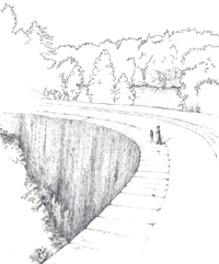
Originally designed to be 17 m (48 ft) in height, it was increased by 2.5 m (8 ft) at the bottom (to find solid bedrock in the river bed) and 2 m (7 ft) at the top (to prevent overflow). It extends 107 m (350 ft) across the gorge and was the tallest dam in North America when it was built. It consists of three sections. First, a masonry face that is 8.5 m (27" 6") wide at the base, then, a clay puddle core for watertightness in the middle and lastly, earth fill on top, extending 39 m (127 ft) upstream. Like the locks, all the stones were carted from a quarry 10 km (6 mi) away. The old riverbed at the base of the dam supports a unique and fragile plant community. The protected southern exposure and fertile soil that is moistened by seepage from the dam supports mosses, liverworts, sedges, mint, touch-me-not, turtle head and Jack-in-the-pulpit. The dam has often been called the "whispering dam" because its acoustics allow the sound of someone speaking at one end of the face to be heard at the other. A viewing platform and interpretive display panel are at the western end.
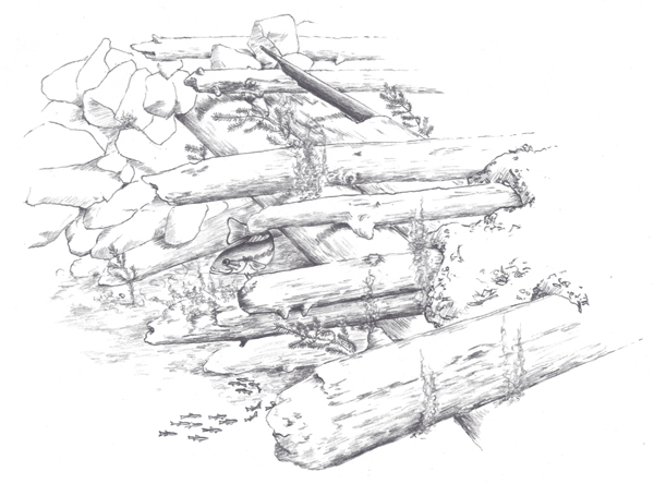
10 – Submerged Deck Beam Bridge: This is a recently explored class 'A' artifact dating from the construction of the canal. It consists of four piers supporting an 18 ft-wide roadway with a deck surface covered with clay mixed with small rocks, sticks and leaves. Called a wood timber multi-span deck beam bridge, it spans an intermittent water passage once called the MacDonald Snie. This bridge extends from in front of the penstocks, to a point half way across the present channel, where it connects with a 61m (200 ft) road that joins with the far shore. It was probably used to transport clay used in waterproofing the dam. Similar road construction was also used by the Royal Engineers in the Canadian Rockies.
11 – Powerhouse and Penstocks: It was first constructed in 1947 and consists of three - 800 kilowatt generators. Jones Falls is the first of four hydro generating plants from here to Kingston Mills and is owned and operated by Granite Power Corp. with water rights leases from the Rideau Canal.
12 – Redpath Trail: (approx. 1 km ) This trail loops from the main parking lot to the long bridge and then through the site past the flight lock, visitor centre, Sweeney House, stone arch dam and then back through another wooded area to its originating point. It is a fine example of varied vegetation, from cleared fields to old pine forests. Near the dam is the northernmost stand of pitch pines in North America.
Related links
- Date modified :