
Burritts Rapids - Tip to Tip Trail
Rideau Canal National Historic Site
The trail is an easy walk with a round trip length of four kilometres, taking about one hour to complete. Numbered trail markers along the path go with the following texts. They highlight features along the trail that were either influenced by or important in the construction of the Rideau Canal.
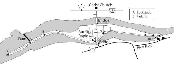
Stop No. 1: A Changed Environment
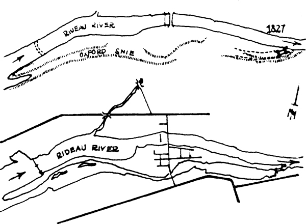
The canal channel you are walking beside did not exist before the Rideau Canal was built. The channel was originally a natural depression in the riverbank, known locally as the ‘Oxford Snye'. Colonel By excavated the snye and used the dug material to build this embankment. This was done to prevent water from the canal channel from entering the natural river course. The eastern white cedar growing in the forest here is a tree species well suited to this area of moist soils and limestone rock. It is typical of many wetland forest habitats along the canal.
Stop No. 2: Surveying a New Land
Before the canal could be constructed, maps and surveys of its route had to be made. Some of the forests along the route were so thick that standard surveying techniques of taking sightings and bearings could not be used. The surveyors had to invent new techniques. One was to find a tree on a high point of land and set it on fire at night to take a bearing.
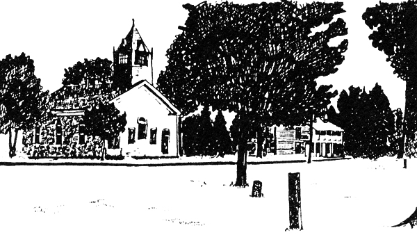
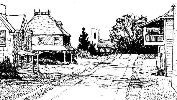
Stop No. 3: The Founding of Burritts Rapids
Welcome to the village of Burritts Rapids. It was first settled in 1793 by Colonel Stephen Burritt, a United Empire Loyalist from Vermont. After the American Revolution, many Loyalists fled the United States to Canada. Many of them received land grants and settled along the Rideau and Cataraqui Rivers. Colonel Burritt was attracted to this site because of the water power from the rapids, which could be used to operate a sawmill. When Colonel By surveyed the canal in 1826, there was already a small village here.
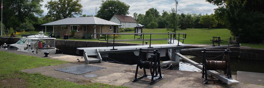
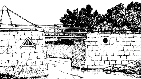
Stop No. 4: Bridges and Bridgemasters
The excavation of the canal channel made it necessary to build a bridge to accommodate both villagers and boats. Several bridges have been built here since 1826. The present steel truss swing bridge was installed in 1897.
The bridge is opened by turning a crank in the pivot at this end of the bridge. Counter weights and a set of roller wheels mounted on a circular track underneath allow the bridge to be swung open with little effort.
The library across the street was originally the bridgemaster's home, and was used as the bridge office during the canal's navigation seasons earlier in the century. Swinging the bridge is done by lock staff today.
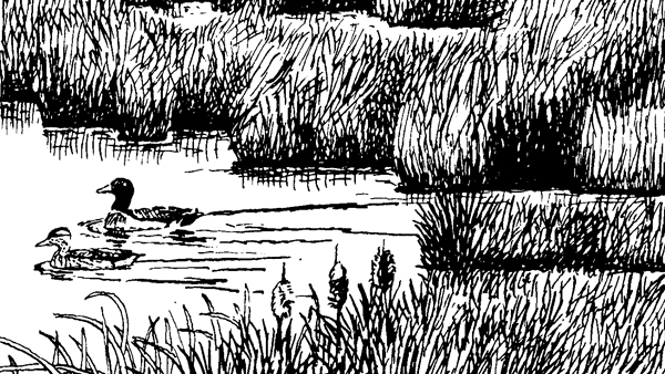
Stop No. 5: From Woodland to Wetland
To make a navigable waterway between Kingston and Ottawa, Colonel By had to raise water levels along the canal to flood out the rapids, waterfalls, and small areas of land. This marsh is an example of the variety of wetlands created along the Rideau Canal following construction.
Wetlands are important for many reasons. They provide habitats for many plants and animals. During periods of high water levels, wetlands act like giant sponges, holding water and helping to prevent flooding. They also filter out pollutants and sediments from the water. Because of the wetlands' importance to the whole ecosystem, Parks Canada regulates and manages the Rideau Canal to help protect them.
Stop No. 6: Controlling the River Flow
Most of the water for the Rideau Canal comes from a number of reservoir lakes. The flow of water from these lakes and along the canal is controlled by a series of waste weirs and dams. Like Colonel By over 170 years ago, Parks Canada uses these dams to raise or lower water levels. This is done by adjusting the number of stop logs in the dams. These water levels are regulated to meet a wide variety of needs, from navigation and natural habitat conservation, to hydro-electric and municipal water supplies. WARNING: DAMS CAN BE DANGEROUS. BE CAREFUL!

Stop No. 7: The Tip
It took only six years to construct the Rideau Canal. The canal's effects on the human and natural history of the surrounding area are innumerable. It changed the natural environment it passed through and affected the lives of the settlers who were already here. It brought new settlers and commerce into areas which had been nothing but forests and wild rivers. Relax here awhile and try to imagine how this area must have looked over 170 years ago, before Colonel By's men tamed rapids and cleared the forest. Consider the feat Colonel By accomplished in building the Rideau Canal.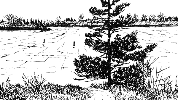
Related links
- Date modified :