
Map of the Districts of Mi'kma'ki (Kjipuktuk aq Mi'kma'ki)
Halifax Citadel National Historic Site
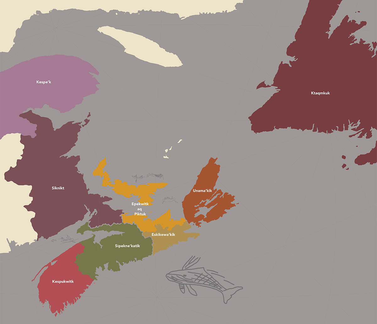
This map shows the Districts of Mi'kma'ki, the ancestral and unceded territory of the Mi’kmaq. Mi'kma'ki encompasses Nova Scotia, Prince Edward Island, the island of Newfoundland, and parts of New Brunswick and Quebec.
| Mi'kmaw place name | English interpretation |
|---|---|
| Epekwitk aq Piktuk | cradled above land; explosion place |
| Ktaqmkuk | across the waves |
| Unama’kik | Mi'kmaw territory |
| Eskikewa’kik | meaning uncertain |
| Kespukwitk | end of flow |
| Siknikt | drainage area |
| Kespe’k | end of land |
| Sɨpekne'katik | area of wild potato/turnip |
Indigenous content in these maps and throughout the new Fortress Halifax exhibit was developed in collaboration with our partners at Mi’kmawey Debert. Map content draws upon the Mi’kmaw Place Names Digital Atlas and Trudy Sable and Bernie Francis, The Language of This Land, Mi’kma’ki (Sydney, NS: Cape Breton University Press, 2012).
Related links
- Date modified :