
A Picnic with a View
L'Anse aux Meadows National Historic Site
“Take-out” takes on a whole new meaning!
Everything tastes better when you eat it outside.
1,000 year old Viking sod huts, waves lapping the shore, sunsets over the ocean – a picnic doesn’t get much better than this! Choose your spot from our “insider’s list” and enjoy a picnic with a view.
It's as easy as 1, 2, 3!
- Grab your blanket, some binoculars and your camera … and don’t forget your reusable fork, knife and spoon!
- Pack a lunch or place an order at a local restaurant
- Choose your spot from our “insider’s list” of the best picnic locations at L’Anse aux Meadows National Historic Site, and bon appétit!
 Birchy Nuddick
Spread your blanket on a hill overlooking the ghostly heaths of the interior barrens. Carpets of partridgeberry and Labrador tea make a perfect picnic environment. Parking lot nearby.
How to get there - From the Visitor Centre parking lot, walk 400m on Birchy Nuddick trail and climb the small set of stairs.
Coordinates 51.587768, -55.534530
 Red Chairs
There is nothing like a hike to make you hungry!
How to get there - Follow the Birchy Nuddick trail to a secluded cove overlooking Epaves Bay and Great Sacred Island. You may see Eider ducks frolicking in the foam or Northern gannets plunging into the sea.
Coordinates 51.592524, -55.544325
 Harry Houdin’s Cove
Set your table in the lee of shale cliffs overlooking a Norse village. You may see the crags of Belle Isle peaking up on the horizon. Parking and washrooms 200m away.
How to get there - Continue on route 436 past the Visitor Centre parking lot to the next turn on your left. You can park by the washroom building. Follow the boardwalk to the beach and follow the trail to the left around the cove.
Coordinates 51.594831, -55.536896
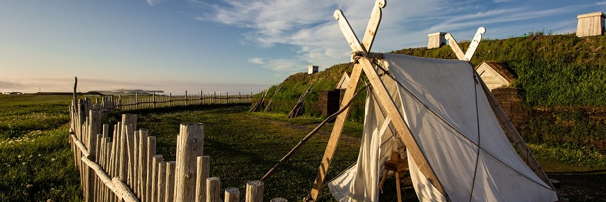
 Beach at the Norse village
Sit near the cold-water coral in front of the Norse longhouse. You will have beautiful views of Ship Cove and the hills of Labrador across the Strait of Belle Isle. Parking and washrooms nearby.
How to get there - Continue on route 436 past the Visitor Centre parking lot to the next turn on your left. You can park by the washroom building. Follow the boardwalk to the Norse village and descend to the beach.
Coordinates 51.596575, -55.534325
 Muddy Cove
Tucked into the tuckamore. This is the perfect picnic location for better shelter on windy days. Dine with views of Cape Raven and Quirpon Island, the northernmost points of the island of Newfoundland. Picnic table and outhouse on site.
How to get there - Continue on route 436 past the Visitor Centre parking lot to the bottom of the hill. Your perfect picnic location is on the left.
Coordinates 51.594453, -55.521374
- Date modified :