
Trail conditions
Kluane National Park and Reserve
Conditions and Comments are based upon the most up-to-date information available at time of posting. Be aware that conditions can change quickly.
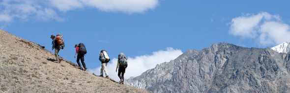
Overnight hikes
Backcountry permits/registration and de-registration is mandatory for all overnight use in Kluane National Park and Reserve between April 1 and November 15. The use of approved bear-resistant food canisters is mandatory.
Useful links
Trails
| Rating | Trail | Condition | Comment | Links |
|---|---|---|---|---|
 Easy Easy |
Soldier's Summit | Good. | 11-10-2024: Mainly dry; | Trail details |
 Moderate Moderate |
Sheep Creek | Fair. | 11-10-2024: Mainly dry; | Trail details |
| Moderate |
Bullion Plateau | Fair. | 11-10-2024: Detours due to mud slide, follow the markers; | Trail details |
 Difficult Difficult |
Ä’äy Chù (Slim's River) West: Ä’äy Chù (Slim's River) West (km 0 - 5.8) | Good. | 11-10-2024: Flat packed; | Trail details |
| Difficult |
Ä’äy Chù (Slim's River) West: Ä’äy Chù (Slim's River) West (km 5.8 - 22.5) | Fair. | 11-10-2024: Freeze / thaw cycle; | Trail details |
| Difficult |
Ä’äy Chù (Slim's River) West: Observation Mtn Plateau/Summit Route | Be prepared for the possibility of winter conditions at higher elevations. | 11-10-2024: Be careful fording rivers and streams; | Trail details |
| Easy |
Alsek Valley: Alsek Valley (km 0 - 6.1) | Fair. | 11-10-2024: Mainly dry; | Trail details |
| Easy |
Alsek Valley: Alsek Valley (km 6.1 -15.4) | Good. | 11-10-2024: Flat packed; | Trail details |
| Easy |
Alsek Valley: Alsek Valley (km 15.4 - 26) | Fair. | 11-10-2024: Mainly dry; | Trail details |
| Easy |
Spruce Beetle | Unknown conditions. | 11-10-2024: This trail is not maintained by Parks Canada; | Trail details |
| Easy |
Dezadeash River | Good. | 11-10-2024: Flat packed; | Trail details |
| Moderate |
Auriol | Fair. | 11-10-2024: Snow at high elevation ; | Trail details |
| Easy |
Kokanee | Good. | 11-10-2024: Mainly dry; | Trail details |
| Moderate |
King's Throne: King's Throne Trail | Be prepared for the possibility of winter conditions at higher elevations. | 11-10-2024: Snow at high elevation ; | Trail details |
| Difficult |
King's Throne: King's Throne Summit Route | Snow at higher elevations. | 27-06-2024: Challenging route ; | Trail details |
| Easy |
Rock Glacier | Good. | 27-06-2024: Dogs on leash permitted; Free of brush; Free of downed trees; | Trail details |
| Moderate |
Shorty Creek | Unknown conditions. | 27-06-2024: Bridge(s) out; | Trail details |
| Moderate |
Mush Lake Road: Mush Lake Road (km 0 - 7.5) | Mainly Dry. | 27-06-2024: Free of brush; Free of downed trees; Flat packed; | Trail details |
| Moderate |
Mush Lake Road: Mush Lake Road (km 7.5 - 16.5) | Warning | 27-06-2024: Be careful fording rivers and streams; High water levels at stream crossings; | Trail details |
| Moderate |
Mush Lake Road: Mush Lake Road (km 16.5 - 22.4) | Water on trail in some sections. | 27-06-2024: High water levels at stream crossings; | Trail details |
| Difficult |
Cottonwood: Cottonwood (km 16.5 - 33) | Unknown conditions. | 27-06-2024: Be careful fording rivers and streams; | Trail details |
| Difficult |
Cottonwood: Cottonwood (km 33 -49) | Unknown conditions. | 27-06-2024: Be careful fording rivers and streams; | Trail details |
| Difficult |
Cottonwood: Cottonwood (km 49 - 67) | Early season conditions. | 21-05-2024: A few downed trees.; | Trail details |
| Difficult |
Cottonwood: Cottonwood (km 67 - 85) | Unknown conditions. | 27-06-2024: Be careful fording rivers and streams; | Trail details |
| Moderate |
St. Elias Lake | Fair. | 07-06-2024: Dogs on leash permitted; Free of brush; Free of downed trees; | Trail details |
Routes
| Rating | Trail | Condition | Comment | Links |
|---|---|---|---|---|
 Route Route |
Dän Zhùr (Donjek) Route | Early season conditions. | 21-05-2024: A few downed trees.; | Trail details |
| Difficult |
Thechàl Dhâl (Sheep Mountain) Ridge Route | Early season conditions. | 21-05-2024: A few downed trees.; | Trail details |
| Difficult |
Ä’äy Chù (Slim’s River) East | Early season conditions. | 21-05-2024: A few downed trees.; | Trail details |
| Difficult |
Mount Decoeli Route | Early season conditions. | 21-05-2024: A few downed trees.; | Trail details |
| Difficult |
Kimberley Meadows Route | Early season conditions. | 21-05-2024: A few downed trees.; | Trail details |
| Difficult |
Quill Creek Route | Early season conditions. | 07-06-2024: Not applicable; | Trail details |
Related links
- Date modified :