
Maps of the Alsek River
Kluane National Park and Reserve
U.S. Geological Survey Map Store/Alaska Geographic Topographic maps
1:50,000 for the Canadian portion of the Alsek River
Kluane National Park and Reserve
Tatshenshini-Alsek Park
Canadian Topographic Maps are available for purchase through Canada Map Office distributors.1:63,360 for the U.S. portion of the Alsek River
Glacier Bay National Park and Preserve
Maps for the U.S. portion are available from:
4230 University Drive, Rm. 208
Anchorage, Alaska, 99508 USA
Phone: (907) 786-7047
-
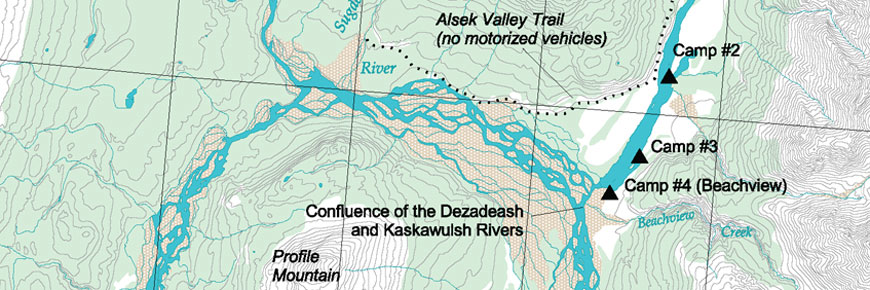
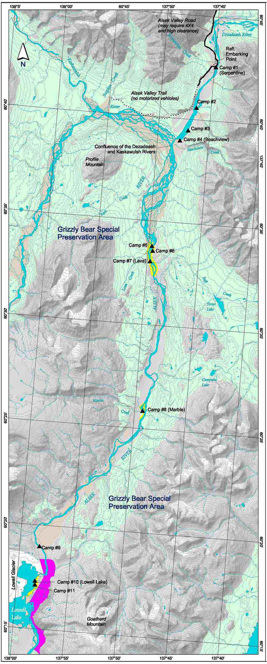
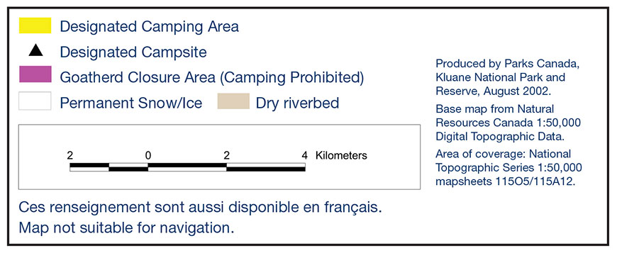
Map: Map of the Special Preservation Area
- Date modified :