
Wetlands
La Mauricie National Park
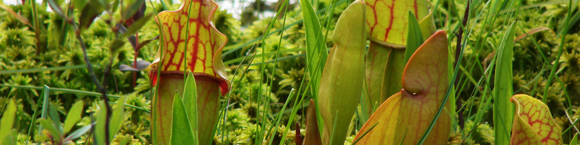
Wetlands, such as peat bogs, swamps, ponds and marshes, are transition zones between terrestrial and aquatic environments. Although wetlands are less suited to outdoor activities than lakes or forests and are often not appreciated, these areas of rich biodiversity are actually fascinating.
La Mauricie National Park has approximately 27 km2 of wetlands (5% of the park). To make sure that the wetlands remain ecologically stable and healthy, five important ecological indicators are monitored closely:
1. Aquatic frogs
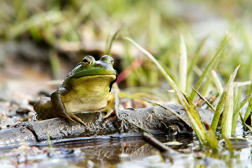
Frogs are excellent indicators of environmental health, as they are very sensitive to changes in their habitat, both on land and beneath the water’s surface (e. g. variation in the quantity of insects available or change in water quality). The frog monitoring program is therefore an excellent tool for checking the health of the park’s wetlands.
At La Mauricie National Park, the pickerel frog is tracked every summer by our team, which goes around the shores of lakes and into wetlands to record its presence and abundance. Every five years, a full inventory of frog species and their abundance is conducted.
The method of capture and observation makes it possible to accurately detect all species of frogs living in aquatic environments, even those that make very little sound, such as the pickerel frog.
Did you know that frog populations are decreasing everywhere in the world? Some known causes include the following:
- Increased ultraviolet rays
- Pollution
- Habitat destruction
- Climate change
- The presence of exotic species
- The spread of disease and fungi
Without a proper monitoring program, the decline of a species can go unnoticed, making restoration efforts even more difficult.
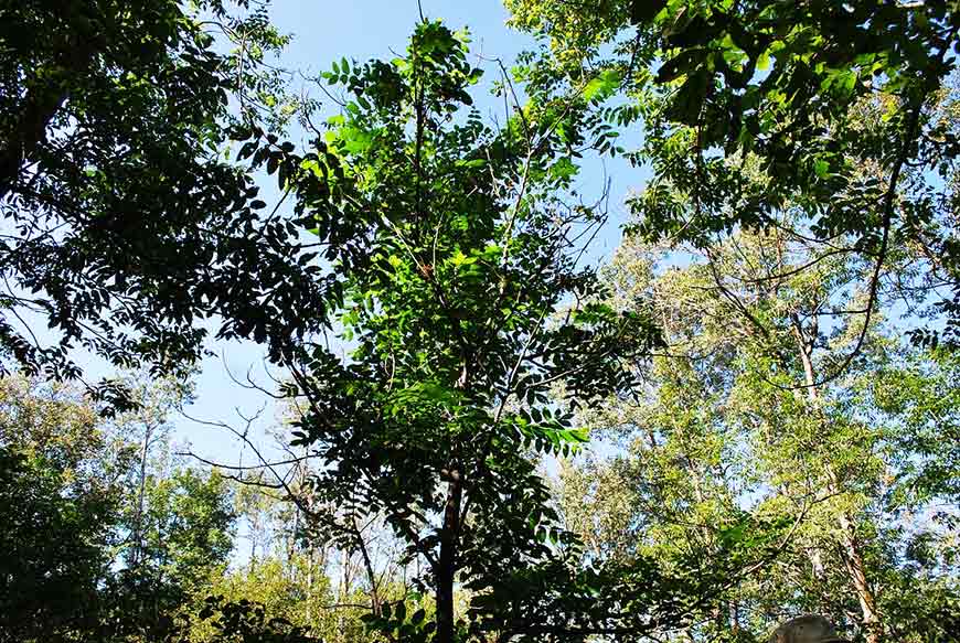
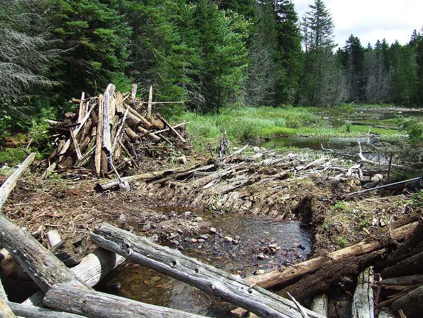
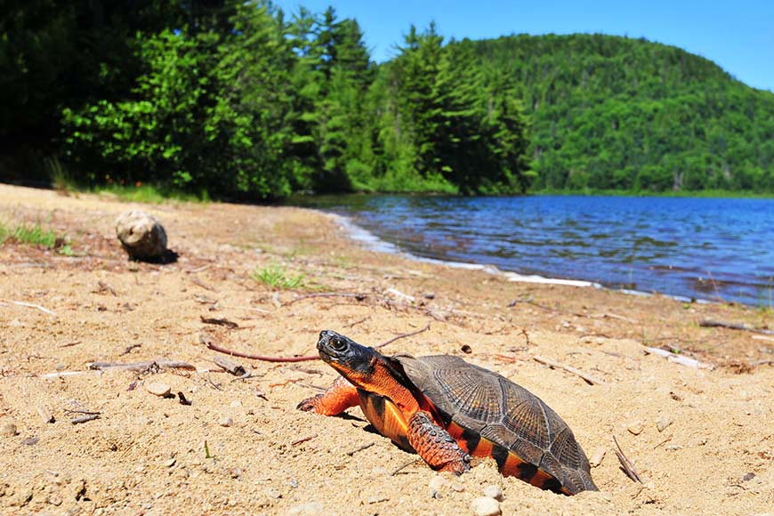
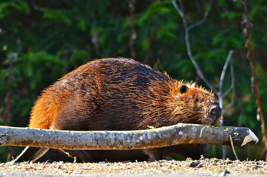
The butternut and silver maple are two tree species that are linked to rare wetland forest stands within the park. The latest data confirm that the decline of the butternut in La Mauricie National Park has been caused mainly by the butternut canker (Sirococcus clavigignenti-juglandacearum). This infection caused by a fungus threatens the survival of the species because there is no way to fight it and butternut trees are not resistant to the disease. Due to its fragility, the butternut has now been listed as a species at risk across Canada. The silver maple stand located in the Matawin River Valley is closely linked to the wetlands. Silver maples are more prevalent in the lowlands of the Saint-Lawrence, where flooding is common. The threats to the butternut, the unique nature of the silver maple stand in the Matawin River Valley, the close link between these forest species and wetlands and their northern location make them important species to conserve. Each summer, on selected parcels of land, our team measures the quantity of fallen leaves (defoliation), the general condition of the trees monitored and the number of dead trees. In La Mauricie National Park, logging and log driving have had a significant impact on the water level of the lakes and wetlands. Old dams have altered 34% of the surface area of the wetlands. Even today, many log driving dams still affect water levels. Dams are removed to restore the ecological integrity of wetlands and aquatic ecosystems with the objective of reducing this percentage to zero. Before being removed, each dam must first be inspected by Parks Canada archaeologists. The archaeologists collect as much information as possible about the structure in order to determine its age. This data is crucial to gaining a clear understanding of the park’s history. The wood turtle is a species at risk in Canada. Habitat destruction, poaching, predators, human interference and pollution have strongly affected this fragile reptile. Every year since 1996, our team has been visiting egg-laying sites to monitor egg hatching. Outside the boundaries of the park, monitoring is carried out every 5 years to estimate population abundance. A major study conducted between 1994 and 2004 revealed more about the wood turtle and made it possible to implement protective measures. During the study, 21 turtles were fitted with transmitters. The data collected by telemetry made it possible to track their movements and habitats. Egg-laying sites have been identified and are now being given special attention. The number of turtles sighted, of nests and of eggs per nest are used as indicators of the state of the wood turtle population and consequently of the wetlands in La Mauricie National Park. While hiking on trails through La Mauricie National Park, you may catch glimpses of gnawed trunks of fallen trees, huts made of branches, dams and gnawed branches floating in the water, but no wonder—you’re in the middle of the beaver’s habitat! The beaver is an important species in La Mauricie National Park because of its key role in changing ecosystems and the impact of its colonies on the park’s infrastructure. At La Mauricie National Park, this resourceful rodent is monitored every 10 years to assess its population density. For three days, employees fly over rivers and lakes aboard a helicopter with a very specific flight plan searching for food piles left by beavers. It would be a bad time to get airsick! Ideally, the inventory is carried out after the leaves have fallen, but before the lakes freeze, around the end of October. Beavers are most active at this time of year and leave the food they are gathering for winter in plain sight. These piles of branches of varying sizes are the most reliable way to identify the presence of an active beaver colony. The number of beaver colonies in the park has hardly varied since its creation in 1970. According to the most recent inventory carried out in 2018, there are 2.9 colonies per 10 km2 on average.2. Rare wetland forest stands
3. Wetlands and old dams
4. Wood turtles
5. Status of the beaver
Related links
- Date modified :