
Herd Connectivity
Nahanni National Park Reserve
The Nahanni Resource Conservation team spends time researching how the herds that roam within Nahanni National Park Reserve are connected.
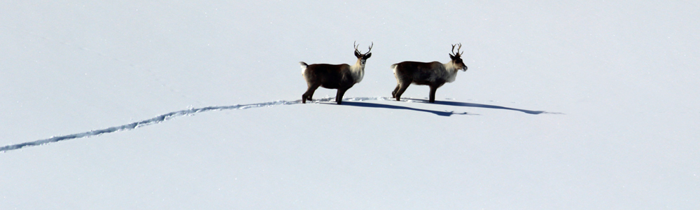
Nahanni is home to northern mountain populations of woodland caribou. At least one herd (Redstone) and one herd complex (Nahanni Complex) travel within the park. The Nahanni Complex may include up to three herds (South Nahanni, Coal River, and La Biche). This is known from previous and ongoing studies with collaring.
Check out these herds ranges in relation to the park boundaries

Map from: HEGEL, T., K. RUSSELL, W. J. RETTIE, AND D. P. TATE. 2016.
South Nahanni and Coal River Northern Mountain Caribou herds:
Population status and demographic characteristics.
Yukon Fish and Wildlife Branch Report TR-14-06. Whitehorse, Yukon, Canada.
Studying herd connectivity (done using genotyping) helps determine and define herds more accurately. Herds are classified differently based on gene flow, so studying caribou DNA is important in figuring out how many herds there are and how many animals there are in each herd.
How do they get the DNA from the caribou?
They collect samples in the form of scat (poop!) from the different caribou herds and do genotyping on the DNA they pull from the samples. The results from the genotyping can show where there is genetic overlap among the herds.
This project is part of a national caribou genetics project led by Environment and Climate Change Canada and Trent University. You can read more about the national project here.
Proper and accurate herd classification is important because it enables more accurate tracking of herd health, helps to determine if they’re at risk or not, and allows for better conservation efforts and decisions to be made.
This research works in tandem with collaring and remote camera work to give a well-rounded look at what the caribou populations look like, where they go and what their health is.
Here’s how it works:
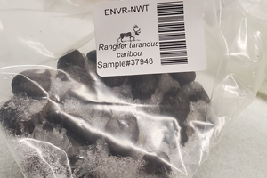
To examine the genetic overlap of the herds found within Nahanni, Parks Canada researchers collect caribou scat (poop) samples and send them to a lab so they can be genotyped.
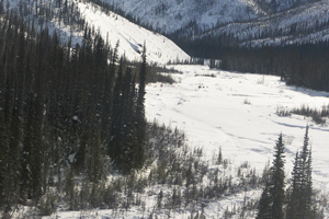
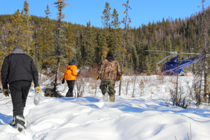
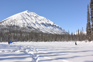
Since 2012, scat samples have been collected by park staff opportunistically, and in dedicated winter helicopter flights. During these surveys, they fly to areas of the park where they expect caribou to be (based on movement maps generated from collaring data, aerial surveys, and incidental sightings) and look for tracks and holes or craters in the snow from foraging.
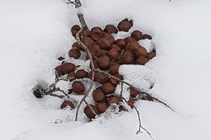
The researchers land at these locations and have to wade through 2-4 feet of snow to find scat piles.They take waypoints at any locations where scat is collected (in Ziploc bags or whirl-pak bags) so that they know where the samples came from.
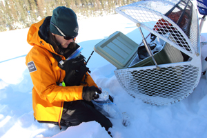
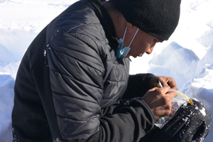
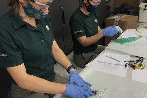
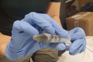
Back at the office, the Parks Canada team members store scat samples in the freezer until they can ‘swish’ them.
The pellets are ‘swished’ one sample at a time by:
- transferring four pellets from the sample bag to a 15 ml tube that contains a lysis buffer – that’s a mixture that helps lysis occur. Lysis is the breaking down of a cell, and that is what’s needed in order to access the DNA!
- swirling and moving the pellets upside down and around the tube for 1.5 minutes
This process extracts DNA from the mucosal layer of the fecal pellets.
After swishing is complete, we ship the extracted DNA samples to Trent University’s Natural Resources DNA Profiling & Forensic Centre, where the samples are amplified and genotyped at 15 microsatellite loci (specific sections of a genetic sequence).
What does all that mean, and what does it look like when the DNA is genotyped?
Graphic of genotypes showing overlapping gene pools
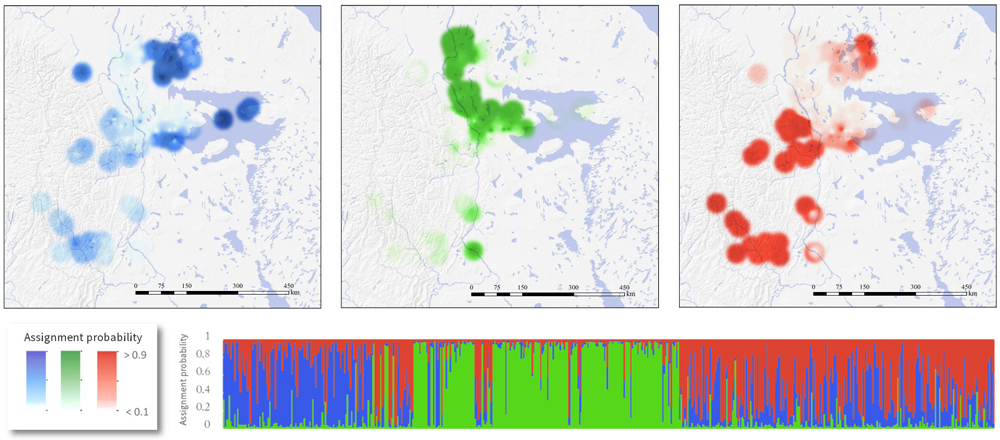
(Example of results that include NNPR samples from: Polfus, J. L., M. Manseau, D. Simmons, M. Neyelle, W. Bayha, F. Andrew, L. Andrew, C. F. C. Klütsch, K. Rice, and P. Wilson. 2016. Łeghágots'enetę(learning together): the importance of indigenous perspectives in the identification of biological variation. Ecology and Society 21(2):18. http://dx.doi.org/10.5751/ES-08284-210218)
These graphics show how microsatellite data from the genetic samples (collected throughout the Sahtu region of the Northwest Territories and Nahanni National Park Reserve from 2012 to 2014) is used to map and infer where genetic clusters occur.
In this example, three populations are displayed, barren-ground caribou is shown by blue clusters, boreal woodland caribou are the green clusters, and mountain woodland caribou (Nahanni National Park Reserve’s sub-set) are the red clusters.
When do we do this?
Nahanni has been collecting samples for genetic analysis since 2012, but the national project started before that.
Most recently, Nahanni National Park Reserve staff did two scat collection flights in March 2021 and sent these along with other recent samples to the lab for analysis (from 2018-2020). We are also re-analyzing old samples at additional loci (in previous years, some samples were only genotyped at 10 loci).
Updated genetic results are anticipated in spring or summer 2021, so stay tuned to this page for more information as it comes in. The analyses are being done by a grad student at Trent University, with support from Environment and Climate Change Canada.
Parks Canada and Nahanni National Park Reserve collaborate with the following organizations to make this research and study happen: Environment and Climate Change Canada, Trent University, Government of Yukon, Government of Northwest Territories
- Date modified :