
GeoPDF map of Sable Island
Sable Island National Park Reserve
Before you travel to Sable Island, download the Avenza Maps app and this geoPDF map to your smart phone.
Use the Avenza Maps app to open the geoPDF and navigate your way around Sable Island. When you arrive on Sable Island, your location will appear as a little blue dot on the map – no cell service, Wi-Fi, or data required!
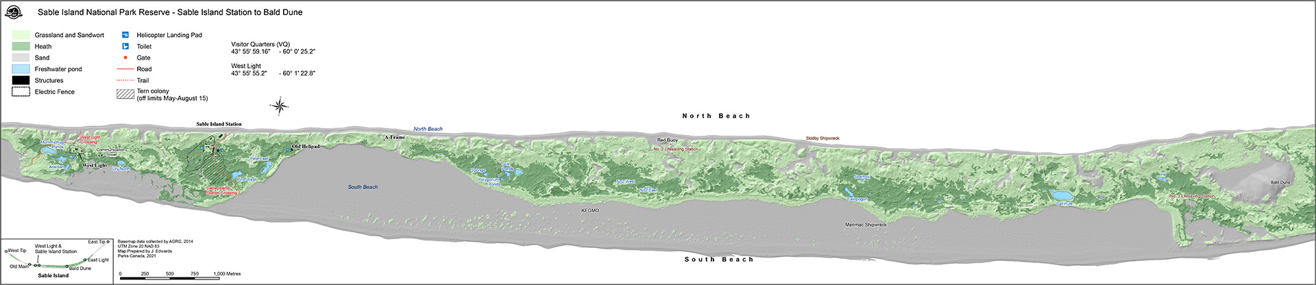
This interactive geoPDF map shows the area around Main Station to Bald Dune. It shows the topography and points of interest including the helicopter landing pad and washrooms.
How to access the map
- Download or import the geoPDF map (free)
- Download the Avenza Maps app (free)
- Use the Avenza Maps app to open the geoPDF and navigate your way around Sable Island.
- Date modified :