
Nature and science
Torngat Mountains National Park
“ At the northern extremity of the Labrador coast, a range of high barren mountains with sharp precipices extending inland from the sea was known to traditional Inuit as the abode of the master spirit in their mythology. Their name for the region, Torngait meaning a place of spirits, derived from the presence of Torngarsoak who was believed to control the life of sea animals and took the form of a huge polar bear .” 1( 1 This quote is from GSC Memoir 91 : The Labrador Eskimo by Ernest W. Hawkes, an anthropologist who visited Labrador in 1914 with the Geological Survey of Canada. )
National parks protect the ecological and cultural integrity of landscapes and wildlife representative of Canada's vastness and diversity. Parks Canada is grateful to share the responsibility of conservation, management, and caring for Torngat Mountains National Park with Inuit, researchers, and visitors.
Parks Canada recognizes and honors the special historical and cultural relationship Inuit have with the land. At Torngat Mountains National Park, an all-Inuit co-operative management board advises the federal Minister of the Environment on all matters related to park management, ensuring that Inuit traditional knowledge is incorporated in all decisions.
Each season, a variety of researchers and scientists travel to the park. Geologists, natural scientists, and archaeologists work together with Inuit Elders, youth, and visitors to increase our collective understanding of the land and the stories it holds. This is a place where science and Inuit knowledge meet, and the sharing of personal experiences and scientific expertise creates rich opportunities for enhanced understanding.
By respecting regulations and recommended conservation practices, all visitors help to ensure the continued protection of Torngat Mountains National Park's natural and cultural heritage for future generations.
Learn More
 Artefact from a thule sod house, Nachvak Fjord
A cultural landscape
The Torngats have been home to Inuit and their predecessors for thousands of years. There are hundreds of archaeological sites in the park, some dating back almost 7,000 years. There is evidence of occupation by the Maritime Archaic Indians, Pre-Dorset and Dorset Paleo-eskimos, and the Thule culture that merged into modern day Inuit. These sites, which include tent rings, stone caribou fences, food caches, and burial sites tell the story of the people and cultures that have made this special part of Canada their home over the millennia. The Ramah chert quarry was for thousands of years a source of glass-like tool material used by indigenous peoples and traded over a wide area, as far south as Maine.
 Ramah chert
Before contact with Europeans, Inuit in this area had a religion and set of spiritual beliefs of their own. This religion centred around Torngarsoak , the most powerful of the Inuit spirits. AngajukKât and shamans would communicate with Torngarsoak on behalf of Inuit to grant good weather and bountiful hunting. Like any other religion there were rules to follow and if the rules were not followed then there were consequences. The consequences were usually storms, winds, or periods of unsuccessful hunting. Today Inuit in this area have been converted to Christianity and there are no active AngajukKât to collectively invoke the powers of Torngarsoak . However Inuit still have a strong spiritual connection to these ancient beliefs and to Torngait - the Torngat Mountains – as the place where spirits dwell.
 Inuit youth around an ancient grave
Evidence of more recent history includes the remains of Moravian Mission sites, Hudson Bay Company trading posts in Saglek and Nachvak fjords, a World War II German remote control meteorological station on the Hutton Peninsula put in place by a German submarine in October 1943, and two early warning system radar sites from the Cold War.
In spite of its extensive history of human use and occupation, the land retains the feel of pristine wilderness. Inuit continue to use this area for hunting, fishing, and travelling throughout the year, but there is no year-round human occupation within the boundaries of the national park today.
 North Arm Saglek Fjord
The physical landscape
This region contains two distinct, contrasting landscapes: the George Plateau and the spectacular Torngat Mountains.
The George Plateau is a level bedrock plain cut by deep river valleys sloping gently to Ungava Bay. The effects of glaciation are everywhere: drumlin fields, kame terraces (ridges of water-born sediments deposited by melting glaciers), erratics and eskers that snake over the plateau. The Torngat Mountains, among the highest, most rugged mountains in eastern North America and one of the world's most beautiful wild coastlines, provide a spectacular counterpoint to the gentle George Plateau.
Torngat geology - “Where the rocks revel in their freedom” 2
( 2 This quote is from Oscar M. Lieber, geologist who visited Labrador as part of the U.S. Coast Guard Eclipse Expedition in 1860.)
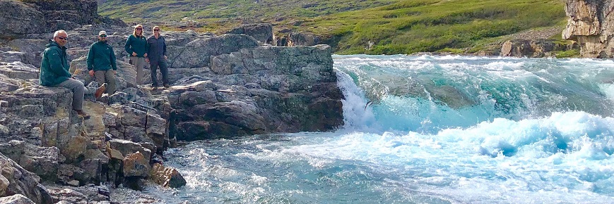
There are few places on earth where such an array of geological features and processes can be observed in a single landscape. The limited vegetation cover, high mountains, coastal cliffs, deeply incised fjords, and sheer cliffs that cut perpendicular to the rock fabric, provide some of the best exposures of the earth’s geologic history.
 Saglek Fjord
The age of the Torngats encompasses eighty percent of the earth’s geologic history. The rocks of the park have preserved, in their fabric and minerals, textbook examples of the cycles of mountain building events. Over the past 3.9 billion years (3.9 Ga) there have been at least 5 major events – three in the Archean (before 2.5 Ga), one in the early Proterozoic (1.6 – 2.5 Ga) and one as recently as the late Jurassic to Tertiary (after 200 Ma). These events represent a synopsis of plate tectonics from initial continental rifting, ocean formation and spreading, through ocean closure and destruction, erosion, and deposition before rifting begins again, culminating in the formation of the Labrador Sea and the Atlantic Ocean. This slow repetition of tectonic events is called the Wilson Cycle, and there are few places where it can be seen as clearly in the rock record as in the Torngat Mountains.
The Nanok gneiss in Saglek Bay, has been dated at 3.9 Ga. Only two places in the world can claim rocks older than those in the Torngats; they are in the Northwest Territories in Canada, and Australia. There are also remarkably well preserved sedimentary rocks known as the Ramah Group (1.9 Ga) with primary sedimentary features, such as ripple marks and cross bedding, that look the same as the day they were formed. Contemporary examples can be found in shallow marine environments such as estuaries.
 Torngat Mountains
Along the outer coastline, cliffs rise straight from the sea, sometimes reaching 600 m. Their wind and wave-scoured faces reveal the intricate patterns of geologic processes long completed. Cutting through these ancient rocks, the black tentacles of younger dykes were injected into the surrounding rocks during the last mountain building event.
These mountains also provide natural resources that humans have relied upon for thousands of years. Starting with the Maritime Archaic people, chert was gathered for tools and exported to others as far south as New England. Soapstone was quarried to make oil lamps. Quartzite, pyrite, slate, steatite, nephrite, mica and graphite were used for a variety of purposes, and a mineral called labradorite has been used for adornment. Stone is still quarried for carving, jewellery and other uses that previous generations could not have imagined.
 Southwest Arm, Saglek Fjord
A glaciated landscape
The highest mountains in Canada east of the Rockies can be found within this beautiful land. Some of the peaks reach to over 1538 metres (5000 ft). The highest is Mt Caubvick/D’Iberville at 1652 m. Classic U-shaped glacier-carved valleys, hanging valleys, nunataks, horns and arêtes surround the mountains. Over 40 small glaciers, nestled in the cirque valleys of these mountains, cling to their very existence in the face of a warming climate. These remnants of the last ice age are the only glaciers left in eastern continental North America. The detritus of modern glaciation blankets valley bottoms and lower slopes. Landforms such as moraines, drumlins, eskers, kames, kettle lakes and outwash plains are stark reminders of the erosional power of glaciers.
Numerous bays and fjords slice through the outer coast and extend great distances into the interior mountain ranges. These fjords provide some of the most breathtaking views in the park. Deep within Nachvak and Saglek fiords, cliffs rise abruptly out of the sea. Some cliffs are more that 900 m high.
At the head of the fiords, huge deposits of marine sediments and gravels stretch many kilometres inland and tell the story of a time when the sea reached even deeper into these valleys. Raised beaches and outwash plains far inland attest that the effects of glaciation are still being felt through isostatic rebound of the land.

Nachvak, looking into Tallik Arm

Small glacier near Mt Caubvick/D'Iberville.
Climate
There are four climatic regions in the park:
Mountain alpine climate: The highest points of land separating Labrador and Quebec define the boundary in the southern half of the park – between Seven Islands Bay and Saglek Bay. The peaks along this portion of the park boundary are dominated by mountain alpine weather. The terrain is rock controlled, exposed, cool and windy with little vegetation. Snow, low cloud, and extremely high winds can be expected in any month of the year, and sudden fluctuations in local weather create dangerous challenges for visitors on the mountains. Sudden wind shifts can produce “ghost winds” that barrel down from the peaks at high velocity and from any direction, catching visitors unaware and unprepared. These winds have blown people off their feet. However on calm sunny days in mid-summer, temperatures can reach into the high twenties (Celsius) and travelling can be very warm.

Park warden looking at Mt. Caubvick

Islands at the mouth of Saglek Bay
Coastal fjords and headlands climate: The south-eastern portion of the park is dominated by high rugged coastline and deeply cut fjords. The presence of the cold Labrador Current provides a cooling effect that brings cold air and moisture on to the land throughout the summer. Pack ice may persist along the coast well into July, and icebergs dot the ocean all summer long.
Temperatures near sea level can often be 10 °C cooler than over the inland valleys and meadows. During storm cycles, east and northeast winds bring the cold maritime air into the park creating prolonged periods of fog, low cloud, rain, drizzle and possibly snow. These weather conditions can persist for days.
 Iceberg
 Hikers in Stecker Valley
Southern interior valleys climate: Between the coast and the western park boundary (southern half of the park) the landscape is influenced by both the mountain and coastal climates. This landscape is characterized by high peaks (up to 1500 m asl ) and mountains, deeply carved U-shaped glacial valleys, extensive ridgelines, numerous small remnant cirque glaciers in north and east facing cirques, and lush rolling meadows on the mountain slopes and valley bottoms. During stable weather events temperatures can exceed 20 °C (68 °F)under a hot summer sun. However winds, from the mountain snowcaps and glaciers in the west or from the coast in the east, can drop the temperature by more than 10 °C within minutes.
 Looking west from Cape Kakkiviak
Northern Torngat Mountains climate The northern half of the park above Seven Islands Bay is characterized by mountainous terrain (300-900 m asl ), wide river valleys, numerous smaller fiords and bays, and abundant rocky offshore islands. Vegetation is sparse compared to the south and the climate is noticeably cooler. The main influence on the climate comes from the cold water that surrounds this part of the park on three sides– Labrador Sea to the east, Ungava Bay to the west and Hudson Strait to the north. Cold winds and fog can persist for extended periods of time.
Arctic flora
For millennia, the Inuit and their predecessors knew and used the plants of the Torngat Mountains, and scientists started to study the plants here in the late 1700s. About 330 species of vascular plants (including ferns and flowering plants) and 220 species of mosses and liverworts are known to grow in the park area. Almost nothing is known yet about lichens and fungi, but there are probably hundreds of species.
There is no real forest in the park, except for dwarf spruce close to the Quebec border, but wildflowers are one of the spectacular attractions of the Torngats. At the heads of fjords, raised beaches and terraces are covered in sedge and grass meadows, often showing signs of long human habitation. Coastal species such as lyme (or basket) grass, oysterleaf, roseroot, and seabeach sandwort spread along the upper beach. Low-growing arctic tundra shrubs hug rocky headlands and valleys. Wiry green alder and willow thickets line streamsides, and the gravelly floodplains of rivers are bright with the flowers of harebell, river beauty and yellow mountain-saxifrage. During the short summer, plants here must grow, flower, and produce seeds fast. Most are short, taking advantage of the warmth and wind shelter that they find close to the ground.
The richest vegetation is found along streams that flow through limestone, in coastal meadows, and on old raised beaches. The poorest is on boulder fields and dry rock knobs. An ankle-deep turf of tundra shrubs covers rolling highlands, looking like a well-mowed lawn. Many of the shrubs are berry plants, such as low bilberry, mountain cranberry, bearberry, and crowberry, and bears graze on these in late summer. Mushrooms of different sizes and colours grow wherever there is organic soil, and on the shrub turf they often tower over the surrounding vegetation.
 Hikers and Tundra Vegetation
 River beauty in bloom beside Kangalaksiorvik Lake
Mountaintops sprout patches and circles of tiny plants that survive at the edges of stone rings and other kinds of frost-churned patterned ground. Even the highest summits, such as Mount Caubvik (1,652 metres high), have some vegetation; a crust of lichens coats rock surfaces, and small patches of moss struggle to live where there is moist soil. Spiders and small insects inhabit these tiny high-altitude “forests”.
As one travels farther north in the park, the shorter and less diverse the vegetation becomes. Because wood takes so much energy to produce, almost all of the shrubs disappear along the coast in the northern quarter of the park, leaving only grasses, sedges, herbs, lichens, and mosses. Even there the bright yellow flowers of arctic poppy rise above the surrounding vegetation, hardy survivors in the struggle for life.
“The scene is beyond the possibility of my pen, and I shall not attempt it. The rocks were entirely barren, except here and there, on the lower ranges, where the slopes were gradual, and patches of heather, or bog, or stunted vegetation of some kind, relieved the dullness of their uniform colour. Higher up near the clouds, on the giant precipices, we could see, here and there, a rough broken garment of moss, the growth, probably, of a thousand years. The summits were capped with perpetual snow in many places, that sparkled and glowed in the morning sun, as its rays broke through the parting clouds, like crowns of glory. The prospect was strange and wild - strange in the angularity of the steep declivities, bold, rugged, barren and desolate, yet altogether, as one passes within the entrance, continuing to inspire a sense of security.” 3
( 3 This quote is from C.R. Tuttle (1885), describing entering Nachvak Fiord, in Our North Land: Being a full account of the Canadian North-west and Hudson’s Bay Route, together with a narrative of the experiences of the Hudson’s Bay Expedition of 1884.)
 Mountain Cranberry (Redberry)
 Arctic poppy in bloom
 Polar bear and young
Wildlife crossroad
With its rugged barren mountains, rocky tundra valleys, deep cold fjords and stormy maritime climate, Torngat Mountains National Park provides a serious challenge for wildlife. Despite these challenges, the park has a variety of boreal and arctic species.
Many southern boreal species seek out patches of suitable habitat as they move northward to take advantage of the brief summer season. Some boreal species reach their northern limit in the park.
 Caribou
Arctic species are similarly able to find habitats that suit their needs, particularly when winter arrives, bringing with it the sea ice that the animals depend on. For many arctic species, the park lies along their annual migration route to or from the Arctic. As spring arrives, a pulse of wildlife surges north by land, sea and air, only to reverse itself in the fall. Some species stop and take up temporary residence; others are merely transients.
Thus, as the seasons change, boreal and arctic species alike engage in a variety of movements that more than anything characterize the changing nature of wildlife in the Torngat Mountains. The Inuit have long understood those movements, and built a semi-nomadic culture based on the seasonal appearance of the animals that were their livelihood. Today, knowledge of those seasonal movements can give you an idea of what to expect to see when you visit the national park.
 Black bear
Spring brings on a rich period of plant and animal productivity, both on land and in the sea, and many species arrive to exploit the bounty. Barren-ground black bears emerge from their dens after a six-month hibernation. Torngat Mountain caribou return from their wintering grounds along Ungava Bay to calve in the upper mountain barrens. Bands of George River caribou may wander into the park after calving to the south in June. Wolves follow the caribou. Voles and lemmings emerge from a winter under the snow. Red foxes and Arctic foxes, which have eked out a living over winter, now pursue the summer bounty of rodents.
Dozens of bird species arrive to breed. In the bays and fjords, seals and whales move northward along the coast, chasing the summer flush of food as it moves north. Ringed seals and hooded seals follow the retreating ice northward. Harp seals follow a month or so later, but harbour seals may linger along the coast. Minke whales also tend to linger in bays and fiords, but larger fin and humpback whales may stay offshore. Arctic char move into the more productive coastal saltwater from their freshwater spawning grounds where they spend the first years of their life. Summer ends all too quickly, and soon the migrations reverse themselves. By the time winter arrives and the land is deep under snow, most summer residents are gone or are hibernating. But Arctic hares and rock ptarmigan remain, and the ice-bound coast now hosts a new set of residents. Polar bears hunt ringed seals along the ice edge, and Arctic foxes scavenge a safe distance behind.
Among the park’s resident species are several species at risk. Harlequin ducks nest along rivers in the southern part of the park, and the northern coast is an important moulting area. Peregrine falcons also nest within the park. Barrow’s goldeneye and short-eared owls are also found within the park.
 Arctic Hare
No matter how long you stay, encounters with wildlife are sure to be part of your experience in the Torngat Mountains National Park Reserve.
Parks Canada is developing a database of wildlife sightings, and we hope that you will contribute. Copies of our bird checklists and wildlife observation cards are available from the Parks Canada office in Nain. You may pick them up in person or have them mailed to you. By sharing your observations with us, you add to our knowledge of the park and help us to understand the distribution and abundance of various species.
- Date modified :