
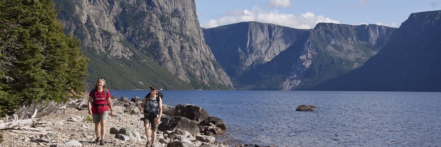
Snug Harbour
Gros Morne National Park
Follow an unmarked route to scenic Snug Harbour on the shores of Western Brook Pond. This secluded cove is located at the base of the escarpment of the Long Range Mountains where you can enjoy a close-up view of Western Brook Pond’s 650 metre cliffs.
Route Information
Follow the Western Brook Pond trail and take the side loop to Western Brook and the start of the Snug Harbour route. To access the route, you will need to ford or wade across Western Brook. Hikers are advised to head up stream and ford the brook just above the outflow from the pond where the water is at its shallowest and the current at its weakest. Caution: The water in the brook can be very deep after a rainfall. During periods of high water, hikers can expect water depths of up to 1 metre. Do not attempt to cross when water is high, currents are strong, or water is cold. From Western Brook to Snug Harbour, the route is unmarked and requires wilderness navigation skills. The route follows a combination of shoreline and an unmaintained and unmarked trail. The trail is in poor condition and in places is very muddy and overgrown with vegetation. The route ends at the Snug Harbour primitive campsite. Return by the same route.
Terrain: Unmarked route; Difficult Elevation Gain: 170 m Distance: 15 km Duration: 6-8 hours Access and Exit Points: Start: Western Brook Pond Trail head Finish: Western Brook Pond Trail head
Trip Planning Information
- Date modified :