
Research and monitoring
Wapusk National Park
Research and monitoring programs are important tools that can be used to gain an understanding of ecological resources and processes in the park.
Research projects enable scientists to study conditions and species within the park. For example, to determine whether they are unique or specific to this landscape or are behaving in a way that has not been documented elsewhere or that has not previously been observed in the park.
Research projects for 2025-26 include:
Andrew Berry (Bernheim Forest and Arboretum): Monitoring Golden Eagle nesting in Wapusk National Park
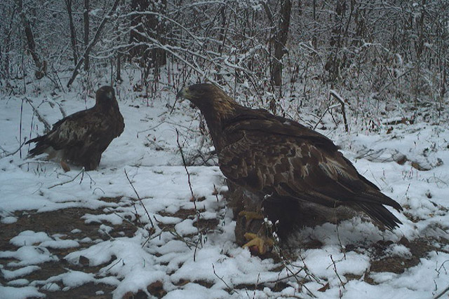
Photo: Bernheim Forest and Arboretum
Since 2015, Bernheim Forest and Arboretum and partners have been tracking Golden Eagles that nest in Wapusk National Park. The focus of this international collaboration is to better understand the behaviour of these raptors. They migrate each year, starting from their winter habitat at Bernheim Forest and Arboretum in Kentucky. The journey ends, for the summer, at their nesting territory in Wapusk until they migrate back to Kentucky for the winter. Many questions remained about their nests and behaviour during their time in the park, which extends from April to October.
We use GPS telemetry to track the eagles’ flight path during migration and movement within Wapusk and the greater Churchill area. Trail cameras, mounted in trees near their nests, provide information on breeding behaviour and success. We continuously tracked Athena, an adult female Golden Eagle, throughout 2025. Her transmitter recorded 21,003 GPS locations and documented 6,455 miles of travel during the 2025 season. This includes migrations from Kentucky to Manitoba and return, winter, and summer nesting season. Athena used at least 95 protected areas across the United States and Canada. This underscores the importance of large, connected landscapes. Her movements in Wapusk showed strong site fidelity to the nest site. These movements centred on coastal lowlands, tundra-boreal transition zones, lakes, wetlands, and forest edges.
This research contributes to understanding migration ecology, seasonal habitat use, and conservation challenges across international boundaries. It expands Parks Canada’s knowledge about Golden Eagles in Wapusk National Park. It also provides critical information on their migratory behaviour and habitat use throughout their annual cycle.
Dr. Frédéric Bouchard (Université de Sherbrooke): Reconstructing lake and peatland dynamics during the industrial era in Wapusk National Park near Churchill, Manitoba
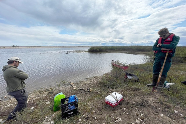
Photo: Nicole Rogowsky
Prior studies have documented reduced water levels in lakes in Wapusk National Park and the Churchill area. Some lakes have dried up. It is unclear, though, if these events are new since the pre-Industrial period. This project aims to determine if these lower water levels are a result of permafrost thaw and changes in water flow patterns caused by recent climate warming. The project also examines if there is an increase in the transfer of carbon from terrestrial to aquatic ecosystems.
From June to August 2025, a probe in the Broad River collected hourly data on the water’s chemical and physical properties. These included water temperature, water level, pH, conductivity, and turbidity (the clarity of the water). The probe also measured the dissolved organic carbon content of the water. During this period, we also collected three water samples for lab analysis.
This research takes place in collaboration with:
- Laure Gandois and Maialen Barret (Centre de recherche sur la biodiversité et l'environnement, France)
- Sylvain Ferrant (Centre d’études spatiales de la biosphère, France)
- Julien Arsenaul and Lucile Cosyn-Wexsteen (Dept. of Applied Geomatics, Université de Sherbrooke)
- Michelle Garneau and Tiina Kolari (Dept. of Geography, UQAM)
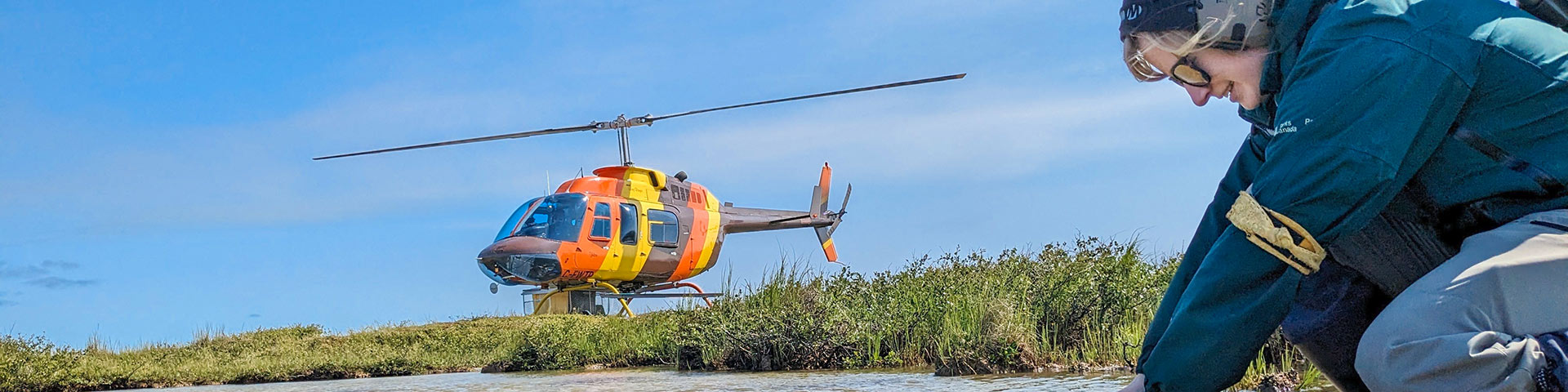
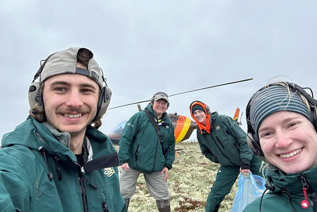
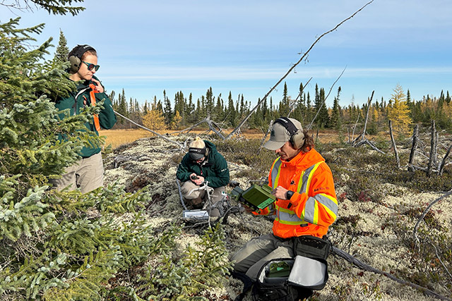
Dr. Ryan Brook (University of Saskatchewan): Wildlife research and Wapusk National Park-University of Saskatchewan August field school
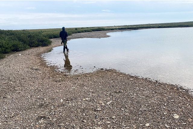
Photo: Ryan Brook
Since 2005, University of Saskatchewan students have participated in this field school program in Wapusk National Park. The program welcomes up to 20 students each year. The students contribute to long-term ecological research projects by collecting permafrost active-layer thickness, soil moisture, and vegetation cover measurements, and conducting their own mini projects. The university also maintains 42 trail cameras in the park to document caribou and polar bear behaviour.
Studies in 2025 included:
1. Characterizing temporal and spatial patterns of polar bear family group occurrences in the Cape Churchill area;
2. Evaluating options for muskox reintroduction (not in Wapusk);
3. Quantifying the timing of arrival and departure of migratory caribou on summer range;
4. Developing a quantitative approach to measuring polar bear size in trail camera photos;
5. Quantifying berry production and availability for grizzly bears;
6. Analyzing the ecology of lichens and tardigrades;
7. Mapping and evaluating frog occurrences in fens; and
8. Determining caribou feeding behaviour in fen habitat.
Dr. Douglas Clark (University of Saskatchewan): The Arctic bears project
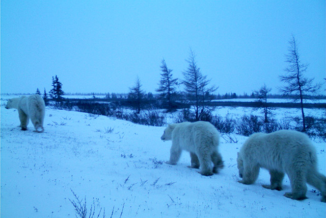
Photo: University of Saskatchewan
Park and wildlife managers across the Arctic need to understand why polar bears approach people. Possible reasons include human activities, a lack of sea ice, or a combination of both. This knowledge gap makes it hard to plan how to prevent conflicts between polar bears and people. This is especially true with sea-ice conditions changing rapidly because of a warming Arctic climate.
There have been trail cameras placed at various locations in Wapusk National Park since 2011. They are at three camps on the park’s west coast, one research station in the park, and sites outside the park chosen by community members. Images captured by these cameras determine how often polar bears visit certain sites, and why. Additionally, satellite images are used to collect information on sea-ice breakup and freeze-up dates every year.
Recently published results show some unexpected outcomes. The more time that passed since sea-ice breakup in any given year, the more often polar bears visited the study sites. Human activity made no difference. Those visits weren’t from hungrier bears that were visibly thinner, which is what was expected. Instead, the more time bears were off the ice, the more likely all bears were to approach the study sites. This means that sea-ice loss probably doesn’t lead to more interactions between polar bears and people just because bears are thinner. We need to do more research to better understand what could cause interactions to escalate into more dangerous situations.
Answering these questions gives Wapusk National Park, and other agencies around the Arctic, a solid base for planning and implementing polar bear-human conflict prevention measures, especially as sea ice continues to change.
Dr. Douglas Clark (University of Saskatchewan): Navigating changing bear-human relationships in a warming arctic
This ongoing project aims to gain insights into grizzly and polar bear ecology and bear-human interactions in Wapusk National Park and the surrounding region. We suspect that the effects of climate change are at least partially causing apparent changes in the onshore areas occupied by these two bear species, including where they den. In turn, these changes to bear ecology might affect how they interact with humans. Community members in Churchill and surrounding areas want to understand how climate change affects bears and their ecosystems. They also want to know how these changes might create new risks for their communities and livelihoods, and how to reduce those risks.
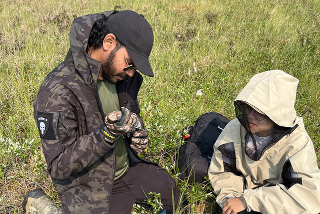
We have established sampling sites, using remote cameras and hair snags, along the Hudson Bay coast to detect grizzly bears. We conduct aerial surveys for grizzly and polar bear dens each year, then, measure the dens to understand how or if they are being affected by climate change. We collect hair samples for analysis of diet and genetic relatedness. We also monitor changes to snow and sea ice distribution and timing of freeze-up and break-up. This data helps us understand if these factors help cause changes in polar bear and polar bear den distribution.
Logistical constraints limited field activity in 2025 to a pilot effort. We deployed four hair snags, with associated remote cameras, in the north end of the park from June 13 to 24. No bears were photographed, and no bear hair samples were obtained, though we observed plenty of curious foxes and caribou. We set up hair snags and cameras at the same sites in April 2026. They are being monitored biweekly by Parks Canada staff. Similar efforts, working with the Churchill Northern Studies Centre, are also underway outside the park.
LeeAnn Fishback (Parks Canada): Finventory – An eDNA fisheries inventory for Wapusk National Park
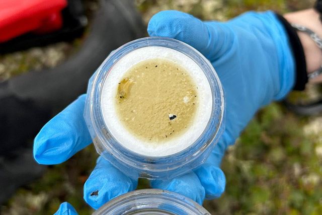
Wapusk National Park protects landscapes and ecosystems of the Hudson Bay Lowlands. Thousands of freshwater ponds, lakes, rivers, and creeks cover this landscape. Traditional and local knowledge have confirmed 10 fish species at eight different locations. Still, there is a knowledge gap surrounding the extent and structure of the fish community.
This project’s goal is to complete a detailed inventory of fish species in the park. To do this, we will sample Wapusk’s largest lakes and major river and creek systems using eDNA techniques. Monitoring fish communities is vital to the assessment of overall ecological health of the aquatic systems and terrestrial life they support.
In 2024, Parks Canada completed fish community assessments along the major river and creek systems within the park:
- White Whale River
- Thompson Creek
- Broad River
- Owl River, and
- Rupert Creek
Results from a pilot study in 2023, and the findings from 2024, provided information on fish species present throughout Wapusk’s largest lakes and rivers. This work has documented 13 species of fish, including the presence of three species not previously recorded in the park.
In 2025, we conducted additional sampling at the north end of the park to fill in spatial gaps in sampling. We also targeted small creeks and ponds across the park for sampling. When our analysis is complete, the park will have information on a more complete spatial scale across Wapusk and across a greater variety of fish habitat.
LeeAnn Fishback (Parks Canada): Hydroecology of lakes in Wapusk National Park – Sustainable ecological integrity monitoring and research
Lake sampling in Wapusk National Park can track outcomes of two main causes of aquatic ecosystem change within park boundaries:
1. changes to the movement and distribution of water due climate warming and changing precipitation patterns; and
2. changes in lake nutrient cycling because of disturbance by Lesser Snow Geese.
Water composition provides data to assess changes in hydrological conditions. We track this information at 16 lakes located in the main ecozones of the park (coastal fen, interior peat plateau bog, and boreal spruce forest). To assess the consequences of Lesser Snow Goose disturbance, we monitor 31 lakes in the northern half of the park. This area is where the geese nest and migrate.
We also observe lakes ranging from non-disturbed to highly disturbed. We measure them for air and water temperatures, pH, and conductivity. We also take samples to study water chemistry and isotope composition. This allows Parks Canada to understand where the water is coming from and to assess changes in water quality.
This project supports knowledge transfer between research partners and Parks Canada. We achieve this through direct training and the development of monitoring protocols. It supports the development, implementation, sustainability and review of the park’s Ecological Integrity Monitoring Plan. This project also contributes to understanding the impacts of Lesser Snow Geese on habitats and on other species. The results also support the development of a management strategy for this overabundant species.
Dr. Steven Mamet (University of Saskatchewan): Microclimate, snowpack, treeline dynamics, and permafrost degradation in Wapusk National Park, Manitoba
Ongoing since 2004, this research focuses on developing a long-term record of environmental and ecological conditions. We use this research to evaluate recent climate-driven changes.
We collect tree foliage and analyze it for water retention. This helps us to assess the relative effects of summer warmth and winter stressors on tree health. Permanent microclimate stations monitor weather parameters year-round. Wildlife cameras mounted on the stations provide information on snowpack and vegetation dynamics. We also conduct mid-winter snowpack surveys to collect information about snowpack characteristics.
In 2025, we sampled 12 mid-winter snowpack sites. Measurements included snow depth, density, snow water equivalent, thermal insulation, and hardness. Analysis of tree branch tips collected across an exposure gradient is ongoing.
We also continue to collect data from climate monitoring stations at Mary and Roberge lakes. At these sites, sensors measure snow depth, precipitation, wind speed and direction, air temperature, relative humidity, and near-surface soil and permafrost temperatures. Wildlife cameras installed in 2014 document snow conditions during winter and vegetation development during the snow-free season.
This long-term dataset provides a critical baseline for detecting and interpreting ecosystem change. It supports Parks Canada and other conservation organizations in understanding ongoing environmental shifts. It also improves the ability to model and predict future change in the region.
Dr. John Markham (University of Manitoba): Influence of snow enhancement and nutrient additions by Arctic foxes on tundra plants at the Arctic’s edge
Arctic foxes (Vulpes lagopus) act as ecosystem engineers in areas of the tundra with low-lying vegetation and no trees. They increase nutrients in the soil near their dens through their waste and prey leftovers. These nutrients cause vegetation to grow taller. Leaf litter that is rich in nutrients decomposes faster than vegetation in other areas of the tundra. This creates more productive conditions for future vegetative growth. This taller vegetation also traps more snow in the winter, providing a unique habitat for both plants and animals.
This research seeks to understand the effects of increasing soil nutrients and snow depth around fox dens. We constructed snow fences and/or added fertilizer to plots in areas where foxes typically den. We then compared snow depth and vegetation cover in these plots are compared to each other. We also compared them to control plots with no fences or fertilizer.
Our results show that adding fertilizer has an effect. Adding fertilizer results in some species producing more flowers and larger, thinner leaves. This holds true for plots with or without snow fencing. We observed an increase in lemmings grazing on low-lying shrubs in plots with both fertilizer and fences. These plots were also invaded by sea lyme-grass. Sea lyme-grass increases plant productivity and is often found on fox dens. Using trail cameras, we observed that some wildlife, geese in particular, feed in the fertilized plots. Other examples are Arctic hares and ptarmigan, in years where their population numbers are high.
Understanding how Arctic foxes enhance biodiversity will help researchers predict effects on vegetation. One is how vegetation may respond to potential population decline. Another is how it may respond to changes in soil nutrients caused by climate change.
Dr. Emily A. McKinnon (University of Manitoba/Windsor): Migratory connectivity and breeding biology of subarctic songbirds
This research seeks to understand the resilience of northern ecosystems to climate change. In particular, we will study songbirds across northern latitudes. Songbirds are ideal models for understanding landscape-scale changes in the environment. They are highly mobile, interacting with predators, competitors, and people around the world. They are responsive to weather and resource abundance across vast scales. Songbirds also connect terrestrial and aquatic ecosystems.
We conducted a pilot season during the summer of 2025 in the area surrounding Nester 1 research camp in Wapusk National Park. It assessed the abundance, catchability, and breeding status of songbirds. Future years will involve field observations, marking songbirds with numbered and coloured bands, and installing tracking tags. This will take place in the area around Churchill, including in Wapusk National Park. We will also monitor songbird nests to assess survival of chicks. The main species that will be studied is the Lapland Longspur (Calcarius lapponicus). This species breeds in Wapusk, but there is currently no information on where it migrates to during the non-breeding season.
Research results will help us understand how northern ecosystems respond to climate change. Also, tracking tags will provide data for maps of wintering locations and migration routes for the Lapland Longspur. These tags will allow us to assess year-round threats to this species. Together, these factors will be extremely valuable for prioritizing conservation actions in Wapusk National Park and other protected areas.
Janet Ng (Environment and Climate Change Canada): Breeding and migrating shorebird ecology in Wapusk National Park
Wapusk National Park provides important breeding and migration habitat for Arctic shorebirds. Arctic habitats are rapidly changing due to climate change. Many species of Arctic breeding shorebirds are also rapidly declining. We are conducting this research to develop a shorebird monitoring program. It will contribute to a broader monitoring program that tracks shorebird populations on regional and continental levels. We will use the program to identify and map important migration and breeding habitats in Wapusk. The program will also detect changes in abundance and distribution. These changes can result from the direct and indirect effects of climate change.
We will also try to determine where and when shorebirds face the greatest threats to their reproduction and survival. To do this, we are studying habitat use, population trends, the full life cycle of declining bird species, and the factors impacting each stage.
An aerial survey in the spring of 2025 observed thousands of shorebirds using the Manitoba coastline for migration, including Wapusk. One species we observed in this survey was the endangered Red Knot (rufa subspecies).
We also completed fall ground surveys at the Broad River, Owl River, and Nelson River estuaries. We observed 17 species of shorebirds on their migration south. We also collected benthic invertebrate samples that we will inventory over the winter.
Dr. Tim Papakyriakou (University of Manitoba): Assessing land to ocean carbon delivery at the northern extent of the Hudson Bay Lowlands
This project contributes to the understanding of carbon cycling and transport in the continuous permafrost zone of the Hudson Bay area. Rivers and streams from peat uplands in the interior, where permafrost is common, transform and transport carbon to estuarine and coastal wetlands systems. These areas store carbon in sediments and vegetation, which may provide a source of carbon to the marine system of Hudson Bay.
There was no fieldwork for this project in 2025. We conducted some analysis on the water samples collected in and near the park in 2024. This analysis compared pH, dissolved organic carbon (DOC), and total dissolved nitrogen (TDN) spatially across three study areas in the Hudson Bay Lowlands. We compared results from samples taken in Wapusk to those taken at Winisk and Moose rivers. Preliminary results show that DOC and TDN concentrations are higher in Wapusk. This is especially true for the Owl River, Broad River, and Rupert Creek sampling locations. We have not yet interpreted these results. We will also plan to analyze and interpret the samples’ other water properties in 2026.
The seawater transport of carbon is a major carbon loss for the terrestrial peatland system. This project aims to measure that loss to better understand the carbon cycle in the Hudson Bay area.
Tabatha Rahman (Université Laval): Ice-wedge distribution, development, and impacts on landscape evolution in the Barrens of the Hudson Bay Lowlands, Northern Manitoba
Photo: Alyce Morel
The Barrens of Northern Manitoba are home to some of Canada's southernmost continuous permafrost and wedge ice. Wedge ice is a type of ground ice that forms during particularly cold winters. With continued climate warming, the Barrens' wedge ice is likely to melt. Losing wedge ice will have negative impacts on the Hudson Bay Railway and vital polar bear denning habitat.
This project looks to determine the volume and distribution of wedge ice. It also studies wedge ice’s impacts on landscape evolution in the Barrens. Having this information improves our ability to predict and mitigate risks. This data will also be useful for administering infrastructure and managing wildlife.
Our results show that 88% of the Barrens' wedge ice is located on peat plateaus. Overall, ice-wedge polygon density increases towards the north, with decreasing air temperatures.
These ice wedges are at the top of the permafrost, making them vulnerable to permafrost thaw. Increasing winter air temperature in the Barrens has likely contributed to a decrease in ice-wedge growth over the past century. This trend will continue to do so, as temperatures continue to increase. Results also show that permafrost in regions with a thick peat cover (≥ 1m) appears to be resilient to climate warming and fires.
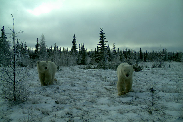
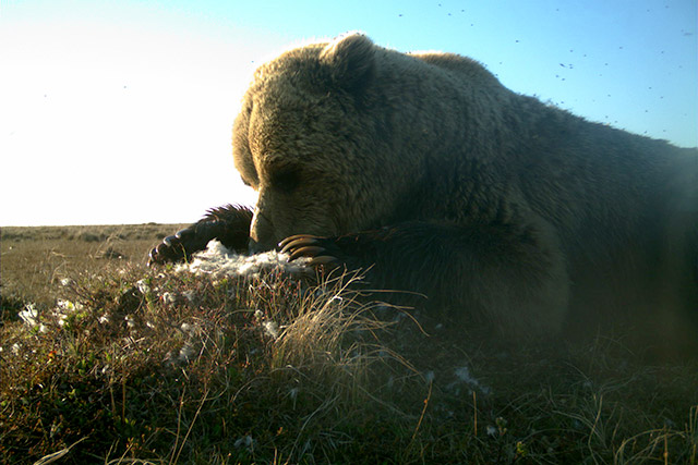
Dr. Evan Richardson (Environment and Climate Change Canada): The ecology, population dynamics, and status of polar bears (Ursus maritimus) in relation to environmental change
Photo: Joanie Kennah
This research, ongoing since 1980, investigates the ecology, population dynamics, health, and status of polar bears in Western Hudson Bay. Research techniques include satellite tracking and blood, hair, claw, fat, and skin-sample collection. We track information on polar bear habitat use, migration timing, and the extent of the population. We also assess shifts in polar bear foraging habits and patterns. Additionally, we collect information on the amount of regional sea ice. We use this data for modelling changes over time.
In the future, we plan to use new genetic tools, that are currently in development, for aging polar bears. They will assess potential stressors such as contaminants and disease factors.
In March 2025, we sampled 15 family groups (44 bears in total) in and near Wapusk National Park. We also saw 3 family groups that had collars installed in 2024. The oldest female captured in the spring with cubs was 22 and the youngest was five years old. The average litter size was two cubs. In August and September, we handled 100 bears of all age- and sex-classes. On a five-point fatness scale, most bears were average, followed by fat, and thin.
We put GPS satellite collars on 10 adult female polar bears accompanied by cubs. We also removed three collars that had been in use. Additionally, we collected 63 blood samples (30cc), 52 skin samples, 61 fat samples, 61 hair samples, 62 claw samples, and 100 swab samples.
This research increases knowledge about changes to the Western Hudson Bay polar bear population. It furthers understanding of barriers to this population’s potential recovery. This work also helps inform effective conservation efforts.
Julie Rogers (The Park School of Baltimore): Long-term monitoring of permafrost-vascular plant-soil moisture and habitat in and around Wapusk National Park
In the International Student-led Arctic Monitoring and Research program (ISAMR), students and teachers take part in climate change research. Participants are primarily from Churchill, Manitoba and Baltimore, Maryland. This research studies changes to permafrost active layer thickness (ALT), measured by the depth to frost line. ALT should increase in arctic regions as the climate warms and permafrost decays. This is because of changes in plant species cover, soil moisture, pH, snowpack and microbiome. The program uses research sites in Wapusk National Park and the Churchill Wildlife Management Area, near the park.
For the last five years, ISAMR students have traveled into Wapusk with Parks Canada staff. Once there, they measure ALT and vegetation cover and analyze soil samples. The data shows an increase in ALT in both bog and fen environments since 2019. It also identifies that ALT is deeper in fen environments than in bog environments.
The data, combined with Parks Canada’s permafrost monitoring at seven other sites in the park, creates a long-term dataset. This helps improve monitoring efforts to track changes in vegetation and permafrost ALT due to climate change.
Dr. James Roth (University of Manitoba): Investigating Arctic fox food web interactions
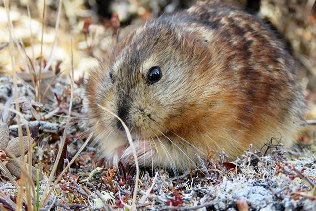
This long-term monitoring project takes place in and around Wapusk National Park. It investigates changes in how species interact in Arctic food webs. Arctic foxes prey on cyclic lemmings, geese, and seals. Changes in the numbers of these species can affect how foxes hunt them. As southern species, such as red foxes and meadow voles, become more common on the tundra, it can affect the hunting patterns and success of Arctic foxes. Understanding these interactions helps predict effects of future species loss or environmental changes.
In 2025, we conducted surveys in and near Wapusk National Park to estimate the numbers of lemming and voles. We estimated Canada goose nest density, clutch size and the start date of each nest. In the spring, we surveyed Arctic fox and red fox use of dens in the park to understand den use by the different species. We also surveyed the dens in late summer to measure reproductive success.
Results show that peak lemming numbers have continued to decrease in this area since the 1930s. This is also happening in many parts of the low Arctic, possibly because of a decrease in snow quality related to climate warming. However, earlier snow melt may allow geese to start nesting sooner. This reduces nest predation and increases hatch success.
Dr. James Roth (University of Manitoba): Examining fox interactions and movements at tundra-taiga transition
Red foxes (Vulpes vulpes) are expanding into areas that used to be more commonly occupied by Arctic foxes (Vulpes lagopus). This can threaten the survival of Arctic fox populations. This project uses location information from satellite collars attached to both species of foxes to better understand this threat. The location information shows how foxes use the landscape in and around Wapusk National Park.
In April 2025, we captured 12 foxes in the park: two red foxes and 10 Arctic foxes. All foxes were at dens near the Nester One research station and Broad River. We put satellite collars on all the foxes, except for one that had already received a collar in 2024. We continued to monitor the movements of three foxes whose collars from the April 2024 trapping season remained active. Preliminary data exploration revealed that some collared red foxes maintained larger home ranges than Arctic foxes. Some red foxes took long-distance trips into the Churchill town area. We also observed a few short sea-ice excursions by red foxes, although Arctic foxes made more sea-ice excursions.
Predators such as foxes play an important role in arctic and subarctic food webs. Changes in the numbers and types of predators, and how they use ecosystems, may also impact other species. A warming environment may also increase the range of species into new territories like the Arctic tundra. Understanding the interactions between these two species might help understand why species normally found in the boreal forest may be found in more northern tundra ecosystems and how that might affect ecosystems in the park.
Jesse Shirton (Parks Canada): Eyes on the skies: arctic shorebird monitoring in Wapusk National Park
Shorebirds that breed in the Arctic are currently experiencing population declines. There are significant knowledge gaps about shorebird migration patterns. However, research shows that the shoreline in Wapusk National Park is critical to more than a dozen shorebird species during their migration.
In 2022, Parks Canada deployed three Motus Wildlife Tracking System towers. Two are in Wapusk National Park and one is at York Factory National Historic Site. These towers support the designation of the park’s coastline as a shorebird conservation area. Dr. Erica Nol from Trent University also has one seasonal Motus tower deployed at Nester 1 research camp. The towers have detected seven different species, including the endangered Red Knot.
This project helps Parks Canada better understand how Arctic-breeding shorebirds use Wapusk during their spring and fall migrations. Tracking data collected by the Motus towers is available on www.motus.org. It includes data for birds in Dr. Nol's project, as well as other Motus projects.
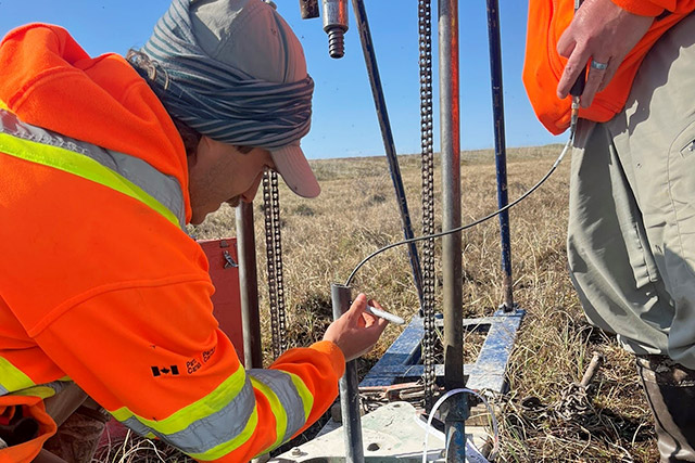
Jesse Shirton (Parks Canada): Sustaining permafrost monitoring to assess state of the park in Wapusk National Park, Manitoba
Permafrost is the foundation that supports Wapusk National Park’s ecosystems, biodiversity, and hydrologic function. Wapusk exists at the transition between continuous and discontinuous permafrost. This is where permafrost is most susceptible to climate warming. It is critical to monitor ground temperature directly at multiple depths. This helps us understand how permafrost conditions may be changing. As such, Parks Canada has operated permafrost monitoring stations, called wells, since 2007. The wells measure ground temperatures at depths up to 11 metres below ground. A network of soil surface and air temperature sensors are paired with the wells. Additionally, a network of weather stations collects meteorological data throughout Wapusk.
However, since 2007, all permafrost wells have failed. Causes include aging equipment and damage from wildlife. The network of air and soil surface temperature sensors originally paired with these wells continue to function. This allows us to bridge data gaps. However, unlike the wells, these sensors do not provide information on how the depth of permafrost changes.
In June 2025, Parks Canada installed two new permafrost cables in the coastal region of Wapusk. To do this, Parks Canada worked with a retired Geological Survey of Canada geologist, who installed the original permafrost wells. However, there are currently no operational permafrost wells in the inland peat region. In this region, impacts of permafrost thawing appear more consequential and may be accelerating. Parks Canada will install a new permafrost well in June 2026 to fill this gap in the peatland region.
This project’s data supports other research in the area. This work covers topics like carbon sequestration, greenhouse gas emissions, and spatial changes of permafrost. These projects operate in collaboration with academic and government researchers. This project also supports understanding how permafrost thaw in a warming climate impacts ecological processes. The breadth of this information represents a key long-term dataset. This project’s data also contributes directly to Wapusk’s Ecological Integrity monitoring program.
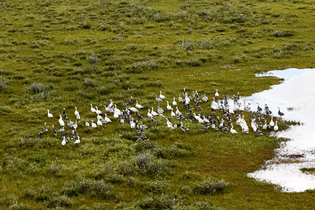
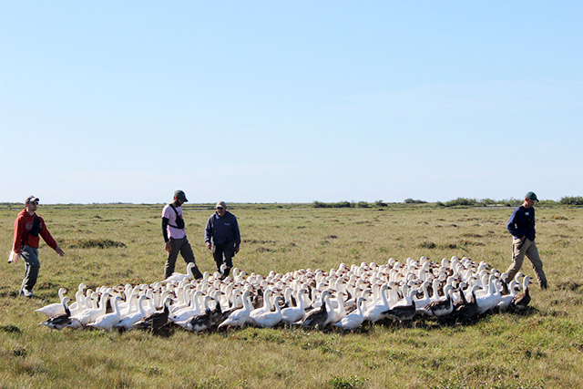
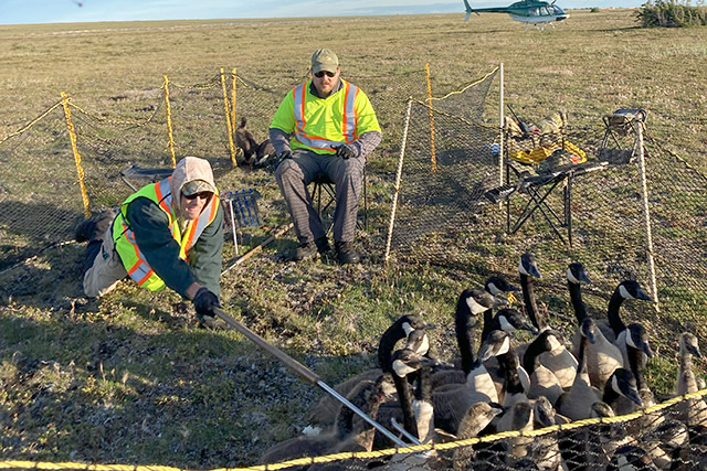
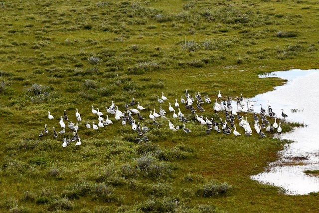
Jillian St. George (Government of Manitoba): Management of subarctic Canada and snow geese in Wapusk National Park
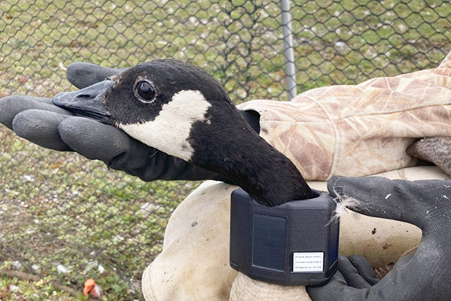
This project is part of an annual monitoring program dating back to the 1950s. The program takes place both inside and outside of Wapusk National Park. It consists of an annual aerial survey to estimate the size of the Southern Hudson Bay Canada goose population as well as the age and sex of the geese. The project also includes the banding of flightless interior Canada goose (Branta canadensis maxima) and lesser Snow goose (Anser caerulescens caerulescens). We band adults and young to estimate harvest and survival rates.
This project is part of a larger effort in the Mississippi Flyway. The flyway is a major north-south bird migration route extending from the southern Mississippi River to the north of Baffin Island. Each year, researchers and staff in states and provinces in this region contribute to the study. Project results provide information for the management of geese populations along this route.
In 2024, we banded 635 adult and 1,297 juvenile Canada geese along the Manitoba Hudson Bay coastline. Of these, 1,909 were interior Canada geese, 22 were giant Canada geese, and one was a Cackling goose. In early June, there was an aerial survey along the coastlines of Ontario and Wapusk National Park.
In 2025, we banded 641 adult and 1,609 juvenile Canada geese along the Manitoba Hudson Bay coastline. 2,250 were interior Canada geese, 23 were giant Canada geese, and 25 were cacking geese. We also attached GPS neck collars on 10 interior Canada geese to collect information on migration timing and movement. We also banded 936 lesser snow geese: 700 adults and 236 goslings. The aerial survey of breeding interior Canada geese took place over Ontario and Wapusk National Park between June 2 and 5.
Results from the survey show where, and how densely, breeding Canada geese are found in the coastal areas of Wapusk National Park. The banding program’s results show how many geese hatch each year within the park. They also show where the geese are raised. The banding of lesser Snow geese supports long-term population and habitat monitoring within the park. The long-term goal is to recover habitats damaged by this overabundant population. Results are also used to inform the management plans for Mississippi Flyway Canada geese and snow geese.
Russell Turner (Parks Canada): Wapusk National Park scat (fecal) monitoring for caribou
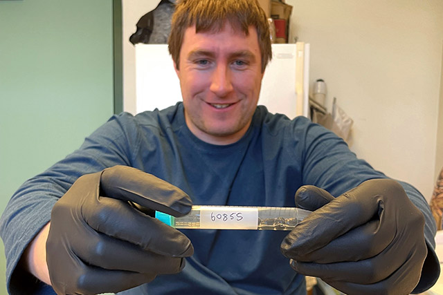
Three different caribou herds are commonly found in Wapusk National Park. The Cape Churchill herd and the Penn Island herd are from the Eastern Migratory population. The Qamanirjuaq caribou herd is from the barren-ground population. However, how and when these herds use the landscape is unknown. This research uses scat (fecal) samples, to collect caribou DNA in different seasons and areas. We can then use the samples to identify which herd is using what area of the park and how often. DNA from caribou scat identifies individual animals and can help track the movement of herds. The samples will also help support the national database on caribou research as part of the EcoGenomics Canada group.
In 2024-25, we collected 171 samples from 12 different sites in and near the park. Samples have had their DNA extracted and shipped to research partners for genetic analysis. We expect to receive results in summer 2026. In March 2026, the plan is to collect more scat samples from caribou calving areas in the park.
Russell Turner (Parks Canada): Wapusk snow goose breeding survey: mapping colonies and estimating abundance
For many years, Wapusk National Park has grappled with the adverse impacts of an overabundant snow goose population. The threat that snow geese pose to the park's ecological integrity has become increasingly evident. The main concern is the destructive feeding habits of snow geese irreversibly alter the landscape. There is a lack of information about the current distribution and population size of the breeding snow goose population in the park. Data from other research suggests that nesting density has decreased as habitat conditions change. As their habitat conditions worsen, the geese disperse to other areas of the park.
In response to these concerns, we conducted an aerial survey in 2024 in the north section of Wapusk, where the geese are most common. The survey’s goal was to photograph the geese nesting in these areas. Thousands of photos from the survey were then sorted and their locations georeferenced on the landscape. Parks Canada staff are counting the nests and individual geese in the photos to get an updated breeding populating estimate for the park.
We will use the results to understand the current ecological footprint of these migratory birds. The results will also help us predict potential changes in their numbers over time. This information will then be used to develop a snow goose management plan for Wapusk. The plan will address current and long-term conservation and management efforts in Wapusk National Park.
Russell Turner (Parks Canada): Candid Caribou: documenting migratory habitat use for caribou in Wapusk National Park
Photo: Russell Turner, 2024.
This research uses a network of trail cameras to monitor wildlife in Wapusk. The cameras are placed along the eastern edge of the park from Cape Churchill to Broad River. The locations run north to south and are equally divided into fen and beach ridge habitat. The goals are to document when and where caribou are in the park throughout the year. We also aim to identify which habitat caribou prefer on their summer range.
Non-invasive trail cameras are an excellent tool for collecting data and monitoring wildlife populations in remote settings. Their use also aligns with Parks Canada’s mandate and research priorities to better understand the ecology of Wapusk.
After three years, we have captured more than 130,000 images of caribou for analysis. The images, paired with Indigenous and local knowledge, documented how raised gravel beach ridges are important migration routes for caribou accessing their calving grounds.
In 2020 and 2021, Parks Canada organized the Beyond Borders Caribou Workshop series. The workshops provided a forum for knowledge exchange. This exchange created a space to weave together Western science and Indigenous knowledge systems as equals. Participants then co-developed strategies to sustain healthy caribou herds in Northern Manitoba. This project was one of the workshop series’ outcomes.
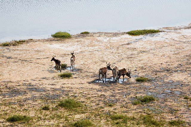
Russell Turner (Parks Canada): Aerial caribou population monitoring
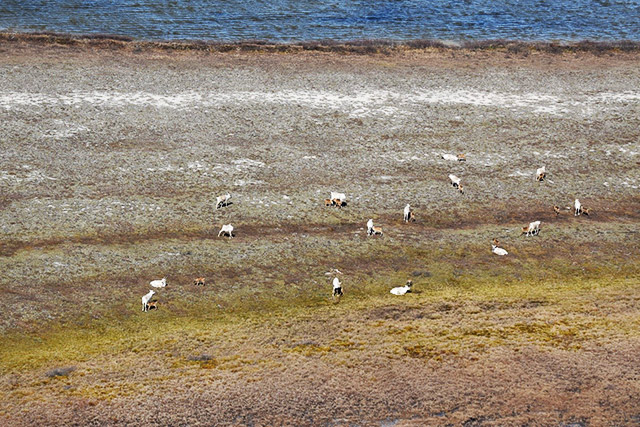
Aerial surveys help us better understand how many caribou are on the landscape and how their populations are changing over time. During these surveys of Wapusk National Park, observers fly over key areas. They record the number of caribou they see, along with information on group size and composition. These surveys are often timed to align with important periods in the caribou life cycle. This timing helps provide a clearer picture of reproduction and survival.
The information collected helps track whether caribou populations are stable, increasing, or declining. We use calf counts to estimate recruitment, which is an important indicator of population health. Over time, this data supports better decision making in Wapusk and across the broader region. It helps identify trends, understand pressures on the population, and guide conservation actions.
In 2025, an opportunistic calving ground survey observed more than 1,300 caribou near Cape Churchill. In the fall of 2025, a systematic survey along the Hudson Bay coast documented 140 caribou. We also recorded incidental observations of wolves and polar bears.
This work provides a stronger understanding of the Cape Churchill caribou herd ecology. It can also help inform ongoing conservation and monitoring decisions.
Steven Van Wilgenburg (Environment and Climate Change Canada): Boreal landbird monitoring program
The key objective of this research is to better understand the distribution, abundance, and population trends of migratory birds across Canada’s boreal zone. Environment and Climate Change Canada (ECCC) oversees conservation of nearly 400 regularly occurring migratory bird species in Canada. However, there are major information gaps about birds in the boreal zone. This is because of poor survey coverage in the remote areas of northern Canada. To address these gaps in survey coverage, ECCC started new surveys to determine the status of boreal forest bird populations. Regional staff are conducting surveys across Canada’s boreal forest. They collaborate with local communities and organizations wherever possible.
To date, we have deployed autonomous recording units (ARUs) at 45 unique locations in and around Wapusk National Park. In 2024, we deployed ARUs at 20 locations, where they recorded the bird communities in 2025. We deployed ARUs at 25 more locations in 2025. In fall 2025, we replaced the ARUs installed in 2024 at Lee Lake, Owl River, Hinterland and Thompson Creek. Swapping the units allows us to gather multiple years of data. We will also swap the ARUs at Owl River and Athena in winter 2025-26.
So far, we have detected 88 species on the recordings. These include 84 species of bird, two species of amphibian, and two species of mammal. The species are representative of a broad array of habitat uses. The range of species includes forest birds such as Yellow-rumped Warbler and wetland species such as Yellow Rail. It also includes species associated with tundra habitats, such as Smith’s and Lapland Longspurs. We have also detected 15 species of shorebird, the second-most rapidly declining group of birds in Canada (The State of Canada’s Birds, 2024). Of the species detected, eight are currently listed by either COSEWIC and/or on Schedule 1 of the Species at Risk Act (SARA) as either Special Concern or Threatened.
The Government of Canada uses this information in a variety of ways: in species status and trend assessment, Species at Risk listing and recovery planning, and to support local land-use planning, impact assessment, and protected area designation. ECCC also collaborates with other researchers in using the data to assess long-term risks to migratory birds from factors such as climate change.
Archives
2024-25
Dr. Frédéric Bouchard (Université de Sherbrooke): Reconstructing lake and peatland dynamics during the industrial era in Wapusk National Park near Churchill, Manitoba

Previous studies have documented a reduction of water levels in lakes, including the drying up of lakes in the Wapusk/Churchill area. However, it is not known if these events are new since the pre-Industrial period. This project seeks to understand if permafrost thaw and variations in water flow patterns, caused by recent climate warming, have resulted in these changes. It also examines if there is an increase in the transfer of carbon from terrestrial to aquatic ecosystems.
In August 2024, a series of ponds/lakes and their sediments were sampled in Wapusk National Park. Sampling spanned the Coastal Fen in the Northeast, through the Interior Peat Plateau, to the Boreal Spruce Forest in the Southwest. Lake water was surveyed for physical properties such as temperature, conductivity, dissolved oxygen, and pH. Water samples were collected to be analyzed for physico-chemical properties. This includes nutrients, dissolved organic carbon, and stable isotope tracers. Lake sediment cores were collected and will be dated to cover the last few centuries. To help describe recent trends, these reconstructions will also be compared to aerial photographs and satellite images.
This research takes place in collaboration with:
- Laure Gandois and Maialen Barret (Centre de recherche sur la biodiversité et l'environnement, France)
- Sylvain Ferrant (Centre d’études spatiales de la biosphère, France)
- Julien Arsenaul and Lucile Cosyn-Wexsteen (Dept. of Applied Geomatics, Université de Sherbrooke)
- Michelle Garneau and Tiina Kolari (Dept. of Geography, UQAM)
Dr. Ryan Brook (University of Saskatchewan): Wildlife and Habitat Research and Wapusk National Park University of Saskatchewan August Field School
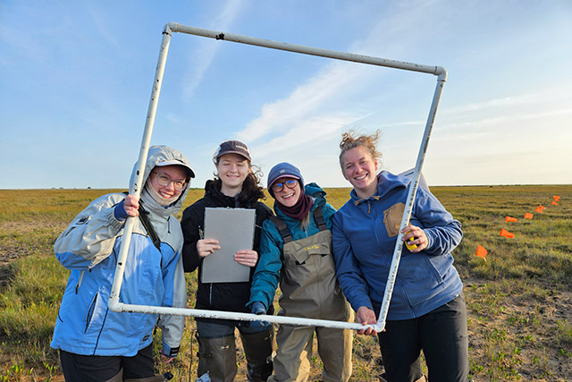
Photo: Ryan Brook
Since 2005, up to 20 students from the University of Saskatchewan have participated annually in this field school program in Wapusk National Park. The students contribute to long-term ecological research projects by collecting permafrost active layer thickness, soil moisture, and vegetation cover measurements as well as their own mini projects.
Studies in 2024 included:
- investigating activity patterns and variations in colouring patterns of grey wolves (Canis lupus). This supports the development of conservation strategies for grey wolf populations in the face of environmental and human-induced challenges;
- identifying trends in caribou (Rangifer tarandus) behaviour on beach ridges, as well as vegetation availability and coverage. This helps identify important migration pathways for caribou populations based on food availability and behaviour;
- recording the ratio of caribou calves per cow, and the relationship between this ratio and vegetation cover to understand population trends;
- investigating willow and day bed Polar bear (Ursus maritimus) habitats to understand their effectiveness as cooling sources for bears; and
- evaluating long-term changes in permafrost active layer thickness at fen sites and in nearby vegetation. This helps assess the impact of permafrost thaw.
Alison Cassidy (Parks Canada): Hudson–James Bay Lowlands Biodiversity Conservation and Sequestration Initiative
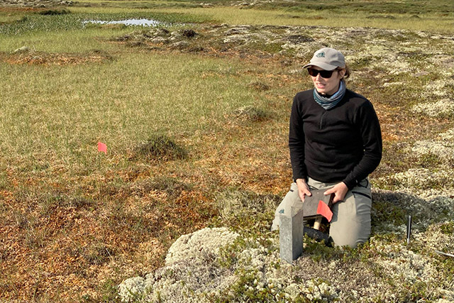
Photo: Michelle Garneau
The goal of this research is to advance the understanding of how much carbon is stored and removed from the atmosphere by terrestrial and coastal ecosystems in the Hudson-James Bay Lowlands area. Co-developed by the leadership of the Mushkegowuk Council, Weenusk First Nation, and Wapusk National Park, this project also blends knowledge systems and provides training. Results will contribute information towards the potential establishment of new national marine conservation areas in this region as well as for potential conservation and restoration actions in Wapusk.
Current work is focused on bringing together and analyzing results from the first two sampling seasons and planning work for the last season in 2025. So far, sampling has been conducted in various locations in and along La Perouse Bay and in peatland areas of the park and also along the Hayes and Nelson rivers near York Factory National Historic Site. Sampling activities included vegetation surveys and mapping, collecting soil cores in various types of thawed and frozen ground, collecting water chemistry and volume measurements, measuring permafrost characteristics, and the collection of landscape imagery using drones and remote sensing. Lab work has included the analysis of soil properties and will also focus on the calculation of carbon accumulation rates and total carbon volume.
Dr. Douglas Clark (University of Saskatchewan): Arctic Grizzly Bear Range Expansion: A Community-Oriented Approach
Grizzly bears have expanded their Arctic and sub-Arctic Canadian range in recent decades. Causes are unknown, though climate warming may be a reason. What this range expansion means for people, and the environments the bears use, is not well understood. These research questions are being investigated in the Northwest Territories, northern Manitoba, and regions of Nunavut using a community-led combination of:
- Documenting traditional and local knowledge and Inuit Qaujimajatuqangit as well as ongoing observations to provide cultural, historic, and geographic context,
- Remote camera images to better understand the distribution of grizzlies on the land, and
- Collecting hair and scat samples for diet and DNA analyses to understand what these grizzlies eat, where they’re from, and if their numbers are growing along with their range.
From 2022 to 2024, den surveys were conducted in and near Wapusk National Park, along the Seal, Caribou, Churchill, Knife, Broad, Owl, and Weir rivers in springtime, before polar bears came ashore. Two bear-sized dens which didn’t resemble polar bear dens were located in 2022 and two suspected grizzly bear dens were located very close to each other in 2023: all within the park. Remote cameras were placed near the dens found in 2023, obtaining photos of a large male grizzly bear, as well as black and polar bears. But there was no definitive proof of continued bear denning at that site. Brown hair collected from one of the 2022 dens was unable to be identified genetically because the DNA had degraded, which it commonly does in the warm, high-humidity environment of a den. Hair microanatomy methods are now being used on the remaining hair from that sample to determine what species it belonged to.
Local organizations and community members play important roles in collecting and interpreting data about grizzlies in and around Wapusk. Communities and wildlife co-managers continue to assess the situation to determine if grizzly bears pose threats, nuisances, or opportunities, as well as to understand potential effects on other wildlife. In a March 2024 workshop, community members expressed that understanding grizzly bear diet in the area should be a future research priority and we continue working collaboratively towards that. We are also working on better ways to tell grizzly bear dens apart from the much more common polar bear dens in the park and region.
LeeAnn Fishback (Parks Canada): Finventory – An eDNA Fisheries Inventory for Wapusk National Park
Wapusk National Park protects landscapes and ecosystems of the Hudson Bay Lowlands. Thousands of freshwater ponds, lakes, rivers, and creeks cover this landscape. Traditional and local knowledge have confirmed 10 fish species at 8 different locations but there remains a gap in knowledge surrounding the extent and structure of the fish community.
The goal of this project is to complete a detailed inventory of fish species in the park using eDNA techniques, achieved by completing eDNA sampling of the largest lakes and major river and creek systems within the park. Monitoring fish communities is vital to the assessment of overall ecological health of the aquatic systems and terrestrial life they support.
In 2024, Parks Canada completed fish community assessments along the major river and creek systems within the park: White Whale River, Thompson Creek, Broad River, Owl River, Rupert Creek. Results from a pilot study in 2023 and the findings from 2024 will inform future sampling efforts and target locations to address remaining gaps in knowledge about fish assemblages and diversity within the park.
LeeAnn Fishback (Parks Canada): Hydroecology of lakes in Wapusk National Park – Sustainable ecological integrity monitoring and research
Lake sampling in Wapusk National Park can track outcomes of two main causes of aquatic ecosystem change within park boundaries:
- changes to the movement and distribution of water due climate warming and changing precipitation patterns; and
- changes in lake nutrient cycling because of disturbance by Lesser Snow Geese.
Water composition, measured at 16 lakes located in the main ecozones of the park (coastal fen, interior peat plateau bog, and boreal spruce forest), provide data to assess changes in lake hydrological conditions. To monitor the consequences of Lesser Snow Goose disturbance, 31 lakes are monitored in the northern half of the park where the geese nest and migrate. A range of highly-disturbed to non-disturbed lakes are measured for air and water temperatures, pH, and conductivity, and sampled for water chemistry and isotope composition. This allows Parks Canada to understand where the water is coming from and to assess changes in water quality.
This project supports knowledge transfer between research partners and Parks Canada. This is achieved through direct training and the development of monitoring protocols. It supports the development, implementation, sustainability and review of the park’s Ecological Integrity Monitoring Plan. It also contributes to understanding the impacts of Lesser Snow Geese on habitats and on other species and the development of a management strategy for this over abundant species.
Dr. Peter M. Kotanen (University of Toronto): Understanding limitations to invasions by non-native plants at high latitudes
Photo: Peter M. Kotanen
This study seeks to understand why non-native plants are not common in northern ecosystems and if environmental changes may increase their presence. It investigates why non-native plants are restricted to inhabited areas and why they are not found in nearby tundra and treeline habitats. Most of this work takes place in the town of Churchill and at the nearby Churchill Northern Studies Centre. Nester One and Nestor Two research camps in Wapusk National Park, and commonly visited areas of the Prince of Wales Fort National Historic Site (including Cape Merry), are also being surveyed.
In July and August 2024, four visits were made to the park to survey Nestor I and II for non-native plants, with particular emphasis on searching for species that are well-established in Churchill. No non-native plants were detected. These results strongly imply that visitors to these camps are not currently bringing invasive plants into Wapusk.Dr. John Markham (University of Manitoba): Influence of snow enhancement and nutrient additions by Arctic foxes on tundra plants at the Arctic’s edge
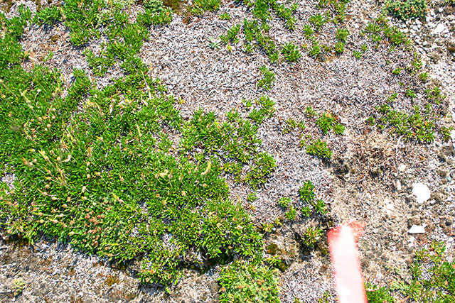
Photo: John Markham
Arctic foxes (Vulpes lagopus) act as ecosystem engineers in areas of the tundra with low-lying vegetation and no trees. They increase nutrients in the soil near their dens through their waste and prey leftovers, which causes vegetation to grow taller. This taller vegetation has more nutrients that decompose faster than vegetation in other areas of the tundra. The taller vegetation also traps more snow in the winter, providing a unique habitat for both plants and animals.
This research seeks to understand the effects of increasing soil nutrients and snow depth around fox dens. Snow fences are constructed and/or fertilizer is added to plots in areas where foxes typically den. Snow depth and vegetation cover in these plots are compared to each other and to control plots with no fences or fertilizer. Results show that some species produce more flowers and larger thinner leaves when both fertilizer and fertilizer combined with snow fencing are added. For plots with fertilizer and fences, there has been an increase in lemming grazing on low-lying shrubs. These plots have also been invaded by sea lyme-grass, which is typically found on fox dens and increases plant productivity. Trail camera imagery has shown that wildlife is attracted to and feed in the fertilized plots, especially those with a buildup of grass.
Understanding how Arctic foxes enhance biodiversity will help predict how vegetation may respond to potential population decline and to changes in soil nutrients brought about by climate change.
Dr. Tim Papakyriakou (University of Manitoba): Assessing land to ocean carbon delivery at the northern extent of the Hudson Bay Lowlands
This project contributes to the understanding of carbon cycling and transport in the continuous permafrost zone of Hudson Bay. Rivers and streams from peat uplands in the interior, where permafrost is common, transform and transport carbon to estuarine and coastal wetlands systems. These areas store carbon in sediments and vegetation; which may provide a source of carbon to the marine system of Hudson Bay.
In July 2024, water samples were collected at nine river and lake stations within Wapusk National Park. These samples will provide a baseline for organic and inorganic properties. Further analysis will focus on understanding carbon and nutrient loads in rivers and streams throughout the park, particularly the Owl and Broad Rivers, and the flow of these components from rivers-to-coast-to-sea.
The seawater transport of carbon is a major carbon loss for the terrestrial peatland system. This project aims to measure that loss to better understand the carbon cycle in the Hudson Bay area.
Tabatha Rahman (Université Laval): Ice-wedge distribution, development, and impacts on landscape evolution in the Barrens of the Hudson Bay Lowlands, Northern Manitoba
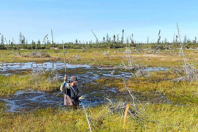
Photo: Tabatha Rahman
The Barrens of Northern Manitoba is home to some of Canada's southernmost continuous permafrost and wedge ice - a type of ground ice that forms during particularly cold winters. The Barrens' wedge ice is predicted to melt with continued climate warming, which will have negative impacts on the crucial Hudson Bay Railway and vital polar bear denning habitat. However, our ability to predict and mitigate risks associated with permafrost thaw is limited because the volume and distribution of the wedge ice are unknown. This research seeks to determine wedge-ice volume, distribution, and impacts on landscape evolution in the Barrens.
Results indicate that 88% of the Barrens' wedge ice is located on peat plateaus, on which the Hudson Bay Railway was built and polar bear build dens. Wedge ice represents 5.58% of the upper 2 m of permafrost in the Barrens' peat plateaus. These ice wedges are located at the top of the permafrost, making them susceptible to permafrost thaw. Permafrost in regions with a thick peat cover (≥ 1m) appears to be resilient to climate warming and fires.
Dr. Robert Rockwell (American Museum of Natural History): The Expansion of Lesser Snow Goose Nesting in Wapusk National Park
Since 1969, the Lesser Snow Geese nesting colony at La Pérouse Bay in Wapusk National Park, has grown from 2500 pairs to more than 75,000 pairs. The area occupied by these geeese has expanded from a 1km wide swath along a small portion the coast to a more than 400 km2 area along the coast and inland to the tree line. As the numbers of geese using La Pérouse Bay for nesting and spring staging have increased, the habitat has become severely degraded by the destructive foraging behavior of the geese and the resulting negative impact on physical processes. As local habitat degrades, many of the geese disperse coastally or inland to less degraded habitat, causing further degradation.
Aerial and ground surveys are conducted to monitor habitat impact and the staging and nesting of snow geese in the park. Overall, 2024 was a warm season with snow cover disappearing early, and there was a correspondingly early peak hatch of lesser snow geese and early flying goslings. Nesting density was down in 2024, when compared to 2010.
Results from this study form the basis of the combined Canada/US plan to manage Lesser Snow Geese. Study data also help with the management of damage related to destructive foraging by Lesser Snow Geese in the park. Results from past years alerted park management to a serious habitat situation at Thompson Point and this ongoing monitoring allows for detection of similar impacts.
Dr. Robert Rockwell (American Museum of Natural History): Ecology and Habitat Impact of Snow Geese at La Pérouse Bay and on the Cape Churchill Peninsula
This long-term research (47 years) focusses on Lesser Snow Geese (LSG) and their interaction with, and impact on, the ecosystems associated with the Hudson Bay Lowlands, including Wapusk National Park. The research includes annual studies of lesser snow and Ross’s geese, common eiders, savannah sparrows and a variety of species of ducks, shorebirds and passerines. It also includes studies on the interactions of snow geese with predators and plant resources in the region. The habitat damage caused by LSG, its impact on other species and recovery once abandoned, along with LSG forage quality and predator monitoring are evaluated in light of climate change.
The recovery exclosure study shows that there is recovery potential inside the exclosures. The greatest recovery is at the sites with the least vegetation damage. Information collected during the banding study showed that goslings appeared more robust and bigger than average, suggesting they hatched early and there was correspondence between plant phenology and the peak in nutrition/abundance of goose forage species in 2024.
Results from this study form the basis of the combined Canada/US plan to manage Lesser Snow Geese. Results are also used by the United States Fish and Wildlife Service and the Canadian Wildlife Service to re-evaluate the management plan for the Mid-continent Population of Lesser Snow Geese. They also help with the management of damage related to destructive foraging by Lesser Snow Geese in the park.
Julie Rogers (The Park School of Baltimore): Long-term monitoring of permafrost-vascular plant-soil moisture and habitat in and around Wapusk National Park
In the ISAMR program (International Student-led Arctic Monitoring and Research), students and teachers, primarily from Churchill and Baltimore, take part in climate change research. This research helps understand changes to permafrost active layer thickness (ALT), measured by the depth to frost line. ALT should increase in arctic regions as the climate warms and permafrost decays. It is related to changes in plant species cover, soil moisture, pH, snowpack and microbiome. There are 14 research sites within Wapusk National Park and 7 sites in Churchill’s Wildlife Management Area, near the park.
For the last 5 years, ISAMR students have traveled with Parks Canada staff to visit the sites in Wapusk to measure ALT, vegetation cover, and analyze soil samples. The data shows a large difference in ALT measurement when comparing bog to fen environments. This has been a trend in the region since 1998.
The data, combined with Parks Canada’s permafrost monitoring at 7 other sites in the park, creates a long-term dataset. This helps improve monitoring efforts to track changes in vegetation and permafrost ALT due to climate change.
Dr. James Roth (University of Manitoba): Investigating Arctic fox food web interactions

Photo: Sean Johnson-Bice
This long-term monitoring project takes place in and around Wapusk National Park. It investigates changes in how species interact in Arctic food webs. Arctic foxes prey on lemmings, geese, and seals. Changes in the numbers of these species can affect how they are hunted by foxes. As southern species, such as red foxes and meadow voles, become more common on the tundra, the hunting patterns and success of Arctic foxes can be affected. Understanding these interactions helps predict effects of future species loss or environmental changes.
In 2024, surveys were conducted in and near Wapusk National Park to estimate the numbers of lemming and voles. Canada goose nest density was estimated, as was clutch size and the start date of each nest. Arctic fox and red fox use of dens in the park was surveyed in the spring to understand den use by the different species and in the summer to measure reproductive success.
Results show that lemming numbers have continued to decrease in this area since the 1930s. This is also happening in many parts of the low Arctic, possibly because of a decrease in snow quality related to climate warming. However, earlier snow melt may allow geese to start nesting sooner, which reduces nest predation and increases hatch success.
Dr. James Roth (University of Manitoba): Examining fox interactions and movements at tundra-taiga transition
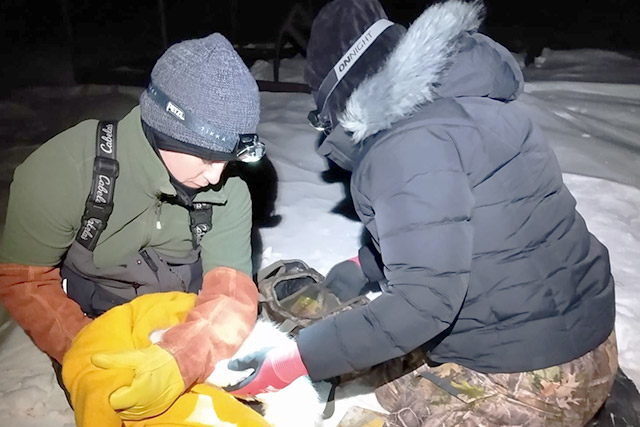
Photo: Chloé Warret Rodrigues
The expansion of red foxes (Vulpes vulpes) into areas that used to be occupied by Arctic foxes (Vulpes lagopus) can threaten the survival of Arctic fox populations. This project uses location information from satellite collars attached to both species of foxes to better understand this threat. The location information shows how foxes use the landscape in and around Wapusk National Park.
In April 2024, 4 foxes were captured in the park: 3 red foxes and 1 Arctic fox. All foxes were found at dens near the Nester One research station. Satellite collars were put on the red foxes; however, the Arctic fox was not collared due to its small size. A total of 7 foxes from 2023 and 2024 remained in the study area during the targeted reproductive period of April 1 to August 31. All other foxes with active collars travelled away from the project area during this time.
Predators such as foxes play an important role in Arctic and sub-Arctic food webs. Changes in the numbers and types of predators and in how they use ecosystems may also impact other species. A warming environment may also increase the range of species into new territories like the Arctic tundra. Understanding the interactions between these two species might help understand why species normally found in the boreal forest may be found in more northern tundra ecosystems and how that might affect ecosystems in the park.
Jesse Shirton (Parks Canada): Sustaining permafrost monitoring to assess state of the park in Wapusk National Park, Manitoba
Wapusk National Park protects the landscape and ecosystems of the Hudson Bay Lowlands, a vast wetland located between the Canadian Shield and southern shores of Hudson Bay and James Bay. The presence of permafrost in this area influences biological and hydrological functions of this terrain. This includes on the elevated peat banks that provide winter forage for caribou and habitat for polar bears. This project uses information collected from permafrost wells, weather stations, and vegetation and soil samples to monitor changes in permafrost thaw across the park.
Permafrost wells collect temperature data throughout the soil profile to depths of up to 10m. This information provides researchers with valuable reference data for estimating the extent of permafrost at a larger special scale.
This project increases the understanding of processes impacted by permafrost thaw. Long-term climate data is also examined to better understand impacts from global climate change on the park ecosystems. The project also supports the development, implementation, sustainability, and review of the park’s Ecological Integrity Monitoring Plan.
Jesse Shirton (Parks Canada): Eyes on the Skies – Arctic Shorebird Monitoring in Wapusk National Park
Shorebirds that breed in the Arctic are currently experiencing population declines. There are significant knowledge gaps about shorebird migration patterns. However, research shows that Wapusk National Park’s shoreline is critical to more than a dozen shorebird species during their migrations.
In 2022, Parks Canada deployed two MOTUS (Motus Wildlife Tracking System) towers in Wapusk National Park and one at York Factory National Historic Site. These towers support the designation of the park’s coastline as a shorebird conservation area. In addition to these MOTUS towers, Dr. Erica Nol from Trent University has one seasonal MOTUS tower deployed at Nester 1 research camp. Since deployment, the towers have detected 7 different species, including the endangered Red Knot.
This project provides Parks Canada with a better understanding of how Arctic-breeding shorebirds are using Wapusk National Park during their spring and fall migrations. Tracking data collected by the MOTUS towers is available on www.motus.org. It includes data for birds in Dr. Nol's project, as well as birds of other national and international MOTUS projects.
Jillian St. George (Government of Manitoba): Management of Sub-arctic Canada and Snow Geese in Wapusk National Park
This project takes place both inside and outside of Wapusk National Park. It consists of an aerial survey to estimate the size of the Southern Hudson Bay Canada goose population as well as the age and sex of the geese. It also includes the banding of flightless interior Canada goose (Branta canadensis maxima) and lesser Snow goose (Anser caerulescens caerulescens) adults and young to estimate harvest and survival rates. These activities are conducted each year by researchers and staff of states and provinces within the Mississippi Flyway, a major north-south bird migration route in North America extending from the southern Mississippi River to the north of Baffin Island. Results from this project provide information for the management of geese populations along this route.
In 2024, 635 adult and 1,297 juvenile Canada geese were banded along the Manitoba Hudson Bay coastline. Of these, 1,909 were interior Canada geese, 22 were giant Canada geese, and 1 was a Cackling goose. In early June an aerial survey took place along the coastlines of Ontario and Wapusk National Park.
Results from the survey show where, and how densely, breeding Canada geese are found in the coastal areas of Wapusk National Park. Results from the banding program show how many geese hatch each year within the park and where they are raised. The banding of lesser Snow geese supports long-term population and habitat monitoring within the park, with the long-term goal of recovering habitats damaged by this overabundant population.
Russell Turner (Parks Canada): Candid Caribou: Documenting Migratory Habitat Use for Caribou in Wapusk National Park
This research uses a network of trail cameras to monitor wildlife in Wapusk. The cameras are placed along the eastern edge of the park from Cape Churchill to Broad River. They are deployed running north to south and equally divided into Fen and Beach Ridge habitat. The goals are to document when and where caribou are throughout the year and to identify which habitat caribou prefer on their summer range.
After three years of image collections, 687,616 images have been captured for data analysis. The images, paired with Indigenous and local knowledge, documented how raised gravel beach ridges are important migration routes for caribou accessing their calving grounds.
In 2020 and 2021, Parks Canada organised the Beyond Borders Caribou Workshop series. The workshops provided a forum for knowledge exchange, creating a space to weave together Western science and Indigenous knowledge systems as equals, co-developing strategies to sustain healthy caribou herds in Northern Manitoba. One outcome of the workshop series was the establishment of this project. Utilizing non-invasive trail cameras is an excellent tool for collecting data and monitoring wildlife populations in remote settings. It also aligns with Parks Canada’s mandate and research priorities to better understand the ecology of Wapusk National Park.
Russell Turner (Parks Canada): Wapusk National Park scat (fecal) monitoring for Caribou
Three different caribou herds are commonly found in Wapusk National Park; the Cape Churchill herd and the Penn Island herd from the Eastern Migratory population and the Qamanirjuaq caribou herd from the barren-ground population. However, how and when these herds use the landscape is unknown. Using scat (fecal) samples, the goal of this research is to collect caribou DNA in different seasons and areas to identify which herd is using what area of the park and how often. DNA from caribou scat identifies individual animals and can help track the movement of herds. The samples will also help support the national database on caribou research as part of the EcoGenomics Canada group: https://www.ecogenomicscanada.ca.
In 2024, 171 samples were collected from 10 different sites in and near the park. Samples have had their DNA extracted and shipped to research partners for genetic analysis. Results are expected in the fall 2025. In late April of 2025, the plan is to collect more DNA samples from caribou calving areas in the park.
Russell Turner (Parks Canada): Wapusk Snow Goose Breeding Survey: Mapping Colonies and Estimating Abundance
For many years, Wapusk National Park has grappled with the adverse impacts of an over-abundant snow goose population. The threat posed by Snow Geese to the park's ecological integrity, mainly through their destructive feeding habits that irreversibly alter the landscape, has become increasingly evident. There is a lack of information about the current distribution and population size of the breeding Snow Goose population within the park. Data from other research suggests that nesting density has decreased as habitat conditions change. As their habitat conditions worsen, the geese disperse to other parts of the park.
In response to these concerns, an aerial survey was conducted in 2024 at the northern portion of the park where the geese are most common. The aim of the survey was to photograph the geese nesting in these areas. Currently, the thousands of photos from the survey are being sorted and referenced to their location on the landscape. Parks Canada staff will then count the nests in the photos to get an updated breeding populating estimate for the park.
Results will be used to understanding the current ecological footprint of these migratory birds and to predict potential changes in their numbers over time. This information will be used to develop a snow goose management plan to address both current and long-term conservation and management efforts in Wapusk National Park.
Monitoring programs enable scientists and managers, through repeated assessment, to look at ecological resources and processes and determine if they are changing over time and whether these changes are related to natural processes or could be due to human impact. Monitoring also allows park managers to determine the effectiveness of management actions.
One of the most important aspects of research and monitoring is communicating the results and information to people outside the science program, to local communities, and to assist in making other researchers aware of the research and monitoring going on in the park.
Annual Report of Research and Monitoring 2015-2016 (PDF, 4.2 MB)
Annual Report of Research and Monitoring 2011-2012 (PDF, 4 MB)
Annual Report of Research and Monitoring 2010-2011
The Wapusk National Park Management Plan highlights Parks Canada’s responsibility for maintaining and monitoring ecological integrity in the Park. Collaborations with universities, government agencies and not-for-profit organizations enhance our collective ability to measure the critical issues that may affect ecological integrity in the Park and surrounding area, and to better understand them.
Churchill Northern Studies Centre (CNSC), Parks Canada staff and researchers met in January 2011 in Winnipeg to share scientific research findings and develop ideas for future research priorities in the greater Churchill region. Following this successful symposium, CNSC worked with Parks Canada to produce the 2011 Annual Report of Research & Monitoring for Wapusk National Park. Please email Email address: manitoba@pc.gc.ca for a copy of the report, which provides summaries of research being conducted in and around the park.
Annual Report of Research and Monitoring 2009-2010 (PDF, 3 MB)
Annual Report of Research and Monitoring 2007-2008 (PDF, 2.43 MB)
The Birds of Wapusk National Park. 2009. Occasional Paper No. 1. (PDF, 3.9 MB)
- Date modified :