
Soren Sorensen Trail
Lower Mount Revelstoke Trails
Mount Revelstoke National Park
The first area to be snow-free in spring, trails on lower Mount Revelstoke can take you to the top of an historic ski jump or on a family-friendly bike adventure. Some trails are open year round for hiking, snowshoeing, mountain biking and fat-biking.
Most requested
Tourism Revelstoke / Bruno Long
Inspiration Woods
- 2.5 km (loop)
- 133 m elevation change
- 1 hr
- Natural trail
- Gently rolling with short, steep sections
Trailhead: 1.9 km up the Meadows in the Sky Parkway
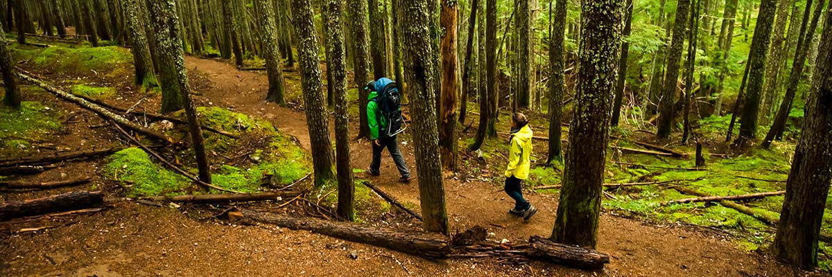
A pleasant walk through the Interior cedar-hemlock rainforest of the Columbia Mountains. The lush carpets of moss and ferns, and light-green and black lichens hanging from the trees, create a mystical and inspiring atmosphere in any weather.
Because of its low elevation, Inspiration Woods is a popular hike both early (April-May) and late (October-November) in the season. In winter, visitors often snowshoe around the trail.
Parks Canada / I. Houghton
Soren Sorensen Bicycles allowed
- a) 2 km (loop)
- 21 m elevation change
- 30 min
- b) 5 km (loop)
- 63 m elevation change
- 1.5 hrs
- Natural trail
- Gently rolling with short, steep sections
Trailhead: Nels Nelsen Historic Area parking lot
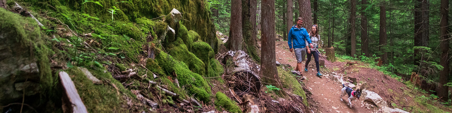
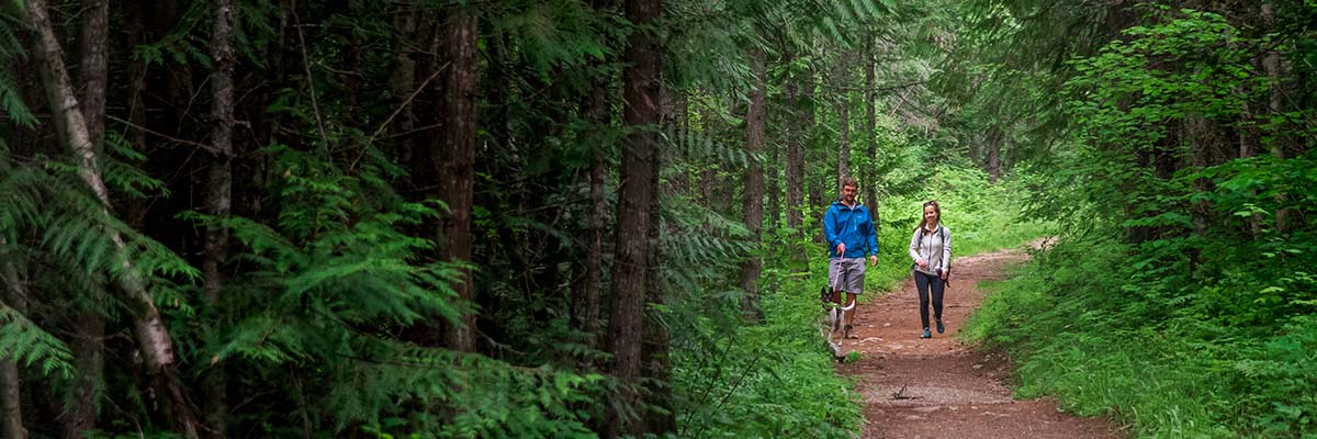
The Soren Sorensen trails are used year-round for hiking, biking, running and snowshoeing through the lush Interior rainforest. Along the trail, get a close-up look at the plants and animals that live in these woods.
This is one of the few places in the park where you might see snakes. Two harmless species, the common garter snake and the western territorial garter snake make their homes along this route. Please try to avoid them as you cycle.
You have two options in hiking this trail: a 2km or 5km loop. You also can connect with the Meadows in the Sky Parkway at the far end of the 5km loop.
Nels' Knickers
- a) 800 m (return)
- 139 m elevation change
- 45 min
- Natural trail
- Steep
- b) 600 m (return)
- 2 m elevation change
- 15 min
- Natural trail with stairs
- Gently rolling
Trailhead: Nels Nelsen Historic Area parking lot
Get a workout hiking up from the Nels Nelsen parking area (a), or follow a gently sloping trail (b) at km 4 of the Meadows in the Sky Parkway to the top of this former ski jump. At the top, lean into a pair of metal pants like those worn by ski jumping champion Nels Nelsen for exhilarating views over the edge.
Picnic tables are available at the upper trailhead. Stop and learn about the only place in Canada where world records in ski-jumping have ever been set.
Parks Canada / Z. Lynch
Broken Bridge
- 2 km (return)
- 40 m elevation change
- 40 min
- Natural trail
- Gently rolling with short, steep sections
Trailhead: 11.5 km up the Meadows in the Sky Parkway
This short forest walk treats you to beautiful valley views and ends at a moss-covered, twisted, wooden bridge. While the bridge is interesting to view and photograph, it is not safe to cross.
Mount Revelstoke Bicycles allowed
- 2.6 km (return)
- 103 m elevation change
- 1 hr
- Paved and natural trail sections
- Steep
Trailhead: Behind Revelstoke Railway Museum
A short hiking and biking route connecting the City of Revelstoke to the park. The trail, and the stories of ski jumping on Mount Revelstoke, begins at the Tournament of Champions Plaza in Revelstoke on Track Street West and continues to the Nels Nelsen Historic Area.
23 Connector Bicycles allowed
- 4.4 km (return)
- 116 m elevation change
- 1.5 hrs
- Natural trail
- Steep
Trailhead: Highway 23N, 1.4 km north of the Trans-Canada Highway
As the name suggests, this trail connects the Columbia Park area of the City of Revelstoke, off Highway 23 North, to the park. Most often used by cyclists, the trail also provides a pleasant walk through the forest, ending near the Welcome Kiosk on the Meadows in the Sky Parkway.
Summit
- 20 km (return)
- 1353 m elevation change
- 6-8 hrs
- Natural trail
- Steep
Trailhead: 1.9 km up the Meadows in the Sky Parkway
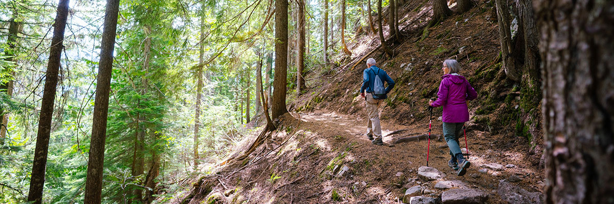
Hike from the base of Mount Revelstoke to the summit! Starting in a cedar-hemlock temperate rainforest, climb through the “snowforest” of spruce and subalpine fir to lush alpine meadows filled with wildflowers.
Along the way, the trail crosses the Meadows in the Sky Parkway six times. At the seventh crossing, the trail follows the original roadway for several hundred metres. Watch for trail signs on the left showing where the roadway becomes a trail again. After this final section through the forest, the trail emerges beside the Balsam Lake cabin. From here you have the choice of hiking another kilometer to the summit of Mount Revelstoke on the Upper Summit trail, walking along the road to the summit or catching a ride on the shuttle bus if it’s operating.
Lindmark
- 15 km (return)
- 982 m elevation change
- 5-7 hrs
- Natural trail
- Steep
Trailhead: Monashee Picnic Area
This quiet trail travels through the woods from Monashee Picnic Area on lower Mount Revelstoke to the summit. The Lindmark Trail traverses the same life zones as the Summit Trail, but has the advantage of not crossing the parkway.
Revelstoke Mayor C.F. Lindmark was an early booster of the scenic values of Mount Revelstoke. Support by local citizens, including the mayor, led to the establishment of Mount Revelstoke National Park in 1914.
Download map and trail information
- Date modified :