
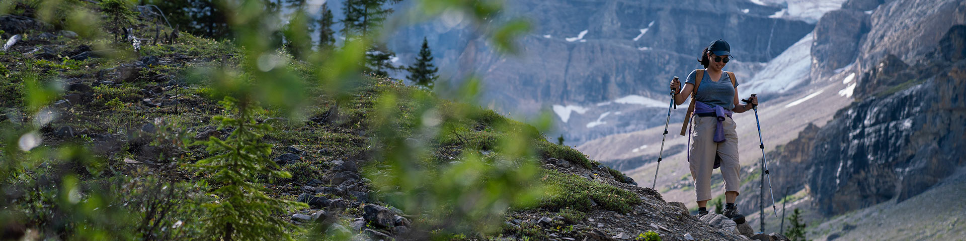
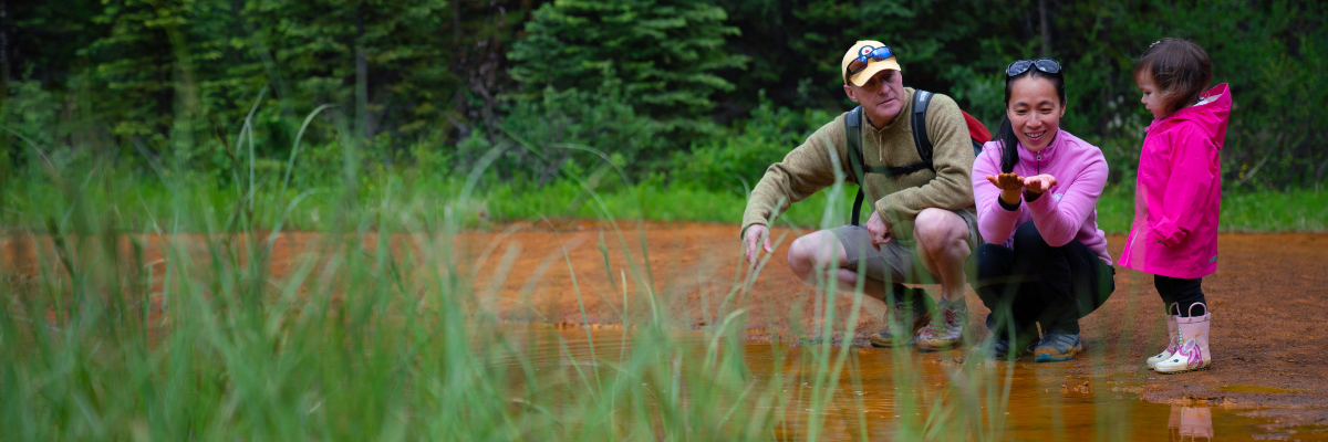
Hikes and walks
Kootenay National Park
Challenge yourself on a day hike through alpine meadows and over rugged mountain ridges or take a break from the drive and enjoy an easy stroll that is suitable for the whole family. Plan your trip using the trail descriptions, maps and safety information below.
For more information and trail recommendations, visit the Kootenay National Park Visitor Centre in Radium Hot Springs or purchase a hiking guide book and topographical map. There is no cell service in Kootenay National Park.
Plan your day and stay safe
Day hikes and short walks in Kootenay National Park
| Trail name | Distance (one way) | Estimated Time (return) | Elevation gain* | Elevation loss* |
|---|---|---|---|---|
 Valleyview Valleyview |
1,3 km | 45 min | 130 m | 10 m |
| Letwilc7úl̓ecw Loop (pronounced Led‐wheel‐oo‐loo) |
1 km loop | 30 min | 25 m | 25 m |
| Redstreak Loop |
1.9 km loop | 45 min | 155 m | 155 m |
| Hot Springs |
2 km | 1.5 h | 195 m | 215 m |
| Redstreak Creek |
2.3 km | 1.5 h | 200 m | 30 m |
| Olive Lake |
0.3 km | 15 min | minimal | minimal |
| Simpson River |
1.6 km | 1 h | 30 m | 25 m |
| Paint Pots |
1 km | 40 min | 35 m | 20 m |
| Vermilion River |
2.9 km | 2 h | 65 m | 110 m |
| Marble Canyon |
0.9 km | 30 min | 65 m | 35 m |
| Fireweed Loop |
0.2 km loop | 15 min | minimal | minimal |
 Sinclair Canyon Sinclair Canyon |
2.8 km | 2 h | 350 m | 260 m |
| Kimpton Creek |
4.6 km | 3 h | 455 m | 100 m |
| Cobb Lake |
2.7 km | 2 h | 155 m | 260 m |
| Dog Lake Loop |
7 km loop | 2.5 h | 195 m | 195 m |
| Stanley Glacier |
4.9 km | 3 h | 405 m | 115 m |
| Ochre Creek |
6.2 km | 4 h | 250 m | 185 m |
 Kindersley Pass Kindersley Pass
|
10 km | 8 h | 1,250 m | 240 m |
| Sinclair Creek
|
6.2 km | 6 h | 1,005 m | 80 m |
| Hawk Creek & Ball Pass |
8.9 km | 7 h | 1,065 m | 150 m |
| Floe Lake |
10.8 km | 7 h or 2 days | 1,120 m | 295 m |
| Numa Creek
|
6.4 km | 4 h or 2 days | 410 m | 275 m |
| Tumbling Creek
|
10.2 km | 6 h or 2 days | 700 m | 245 m |
|
Helmet Creek |
14.2 km | 10 h or 2 days | 795 m | 465 m |
| Rockwall |
54.1 km | 3-5 days | 3,405 m | 3,500 m |
*On most trails you will gain and lose elevation before you reach your destination. Elevation gain represents all the up and elevation loss all the down you will experience on a one-way hike
Thanks to an ongoing collaboration between Parks Canada and Google, you can now explore some Kootenay National Park highlights using Street View for Google Maps.
Trail Descriptions
Valleyview
Valleyview
Distance (one way): 1.3 km
Estimated time (return): 45 minutes
Elevation gain: 130 m | Elevation loss: 10 m
Trailhead: Redstreak Campground entrance, 2.5 km east of Radium Hot Springs; OR parking area 1 km before the campground entrance; OR behind the Kootenay National Park Visitor Centre.
Description: This trail connects the village of Radium Hot Springs with Redstreak Campground. A steep section leads to rewarding views of the Columbia Valley.
Letwilc7úl̓ecw Loop
Letwilc7úl̓ecw Loop
(pronounced Led‐wheel‐oo‐loo)
Letwilc7úl̓ecw means “getting better place” or “healing place” in Secwepemctsín, the language of the Secwépemc People. The name was decided upon by the Shuswap Band community in 2023 and represents the many medicinal and healing plants found in the area.
Distance (one way): 1 km loop
Estimated time (return): 30 minutes
Elevation gain: 25 m | Elevation loss: 25 m
Trailhead: Access from Redstreak Campground. Take the first right after the entrance. Parking lot is on the right.
Description: Walk through a meadow that has been restored by fire. Discover Secwépemc uses of medicinal plants along this interpretive trail.
Redstreak Loop
Redstreak Loop
Distance (one way): 1.9 km loop
Estimated time (return): 45 min
Elevation gain: 155 m | Elevation loss: 155 m
Trailhead: “E” or “F” Loop of Redstreak Campground
Description: Meander through Douglas-fir trees and relax on a bench at the scenic viewpoint.
Hot Springs
Hot Springs
Distance (one way): 2 km
Estimated time (return): 1.5 hours
Elevation gain: 195 m | Elevation loss: 215 m
Trailhead: “H” Loop of Redstreak Campground OR Radium Hot Springs Pools.
Description: An easy walk through a cool, wet forest from the campground to the hot springs. Viewpoints en route.
Redstreak Creek
Redstreak Creek
Distance (one way): 2.3 km
Estimated time (return): 1.5 hours
Elevation gain: 200 m | Elevation loss: 30 m
Trailhead: Small parking area on the south side of Highway 93 South, 6 km east of Radium Hot Springs.
Description: A peaceful, forested path. Ideal in the early season and in the fall when the leaves are changing colour.
Olive Lake
Olive Lake
Distance (one way): 0.3 km
Estimated time (return): 15 minutes
Elevation gain: minimal | Elevation loss: minimal
Trailhead: Olive Lake Day-use Area, 12 km north of Radium Hot Springs.
Description: Explore the boardwalk along the lakeshore. Check the trail report for closures due to bear activity in the spring.
Simpson River
Simpson River
Distance(one way): 1.6 km
Estimated time (return): 1 hour
Elevation gain: 30 m | Elevation loss: 25 m
Trailhead: Simpson River parking lot, 57 km east of Radium Hot Springs.
Description: A walk through a valley marked by fire. Check out the interpretive signs along the first 1.6 km of the trail. Learn about the incredibly forces of nature: lightning, wildfire, regeneration and succession. Continue for another 7.2 km to the park boundary.
Backpacking: This trail leads into Mount Assiniboine Provincial Park in British Columbia.
Paint Pots
Paint Pots
Distance (one way): 1 km
Estimated time (return): 40 minutes
Elevation gain: 35 m | Elevation loss: 20 m
Trailhead: Paint Pots parking lot, 86 km north of Radium Hot Springs.
Description: A gentle walk takes you to three iron-rich mineral springs that stain the surrounding earth.
Vermilion River
Vermilion River
Distance (one way): 2.9 km
Estimated time (return): 2 hours
Elevation gain: 65 m | Elevation loss: 110 m
Trailhead: Marble Canyon Day-use Area, 89 km east of Radium Hot Springs OR Paint Pots Day-use Area, 86 km east of Radium Hot Springs.
Description: Pass through a mix of mature and burnt forest to connect between two popular landmarks: Marble Canyon and Paint Pots.
Marble Canyon
Marble Canyon
Distance (one way): 0.9 km
Estimated time (return): 30 min
Elevation gain: 65 m | Elevation loss: 35 m
Trailhead: Marble Canyon parking lot, 89 km north of Radium Hot Springs.
Description: Hike along the rim of the canyon. Look down from one of the many bridges and enjoy interpretive signs along the way. Relax in the Red Chairs at the end.
Fireweed Loop
Fireweed Loop
Distance (one way): 0.2 km loop
Estimated time (return): 15 minutes
Elevation gain: minimal| Elevation loss: minimal
Trailhead: Continental Divide, 96 km north of Radium Hot Springs.
Description: Walk through a quiet, shaded forest. The Vermilion Pass wildfire swept through this area in 1968. Can you spot any marks left by this fire?
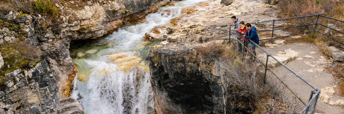
Sinclair Canyon
Sinclair Canyon
Distance (one way): 2.8 km
Estimated time (return): 2 hours
Elevation gain: 350 m | Elevation loss: 260 m
Trailhead: West of Sinclair Canyon OR above the Radium Hot Springs Pools main parking lot.
Description: Hike along the rim of the canyon and into its depths. Make a short detour to the Red Chairs overlooking Radium Hot Springs Pools.
Kimpton Creek
Kimpton Creek
Distance (one way): 4.6 km
Estimated time (return): 3 hours
Elevation gain: 455 m | Elevation loss: 100 m
Trailhead: Kimpton Creek parking lot, 9 km east of Radium Hot Springs. From the parking pullout, walk 100 m south-west along the highway and cross a small footbridge to start the trail.
Description: A cool forested trail on a hot day.
Cobb Lake
Cobb Lake
Distance (one way): 2.7 km
Estimated time (return): 2 hours
Elevation gain: 155 m | Elevation loss: 260 m
Trailhead: Cobb Lake parking lot on the south side of Hwy 93S, 17 km east of Radium Hot Springs.
Description: Descend to Swede Creek, then continue along the banks to a quiet lake encircled by forest.
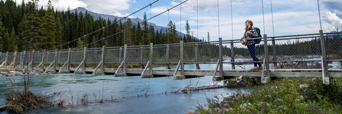
Dog Lake Loop
Dog Lake Loop
Distance (one way): 7 km loop
Estimated time (return): 2.5 hours
Elevation gain: 195 m | Elevation loss: 195 m
Trailhead: Dog Lake Day-use Area, 28 km north of Radium Hot Springs.
Description: A fun family adventure! Cross two bridges over the Kootenay River and meander through old-growth forest. Option to hike to the lake and back (2.6 km one way).
Stanley Glacier
Stanley Glacier
Distance (one way): 4.9 km
Estimated time (return): 3 hours
Elevation gain: 405 m | Elevation loss: 115 m
Trailhead: Stanley Glacier parking lot, 91 km east of Radium Hot Springs.
Description: An extremely popular trail. Hike up to a stunning alpine basin and watch glacier meltwater tumble down massive rock walls. You can also experience this trail on a guided Burgess Shale fossil hike.
Ochre Creek
Ochre Creek
Distance (one way): 6.2 km
Estimated time (return): 4 hours or 2 days
Elevation gain: 250 m | Elevation loss: 185 m
Trailhead: Paint Pots parking lot, 84 km east of Radium Hot Springs.
Description: Connect to Helmet Creek and Tumbling Creek trails through the forest.
Backpacking: This trail leads to the Helmet / Ochre Junction backcountry campground. It is the northernmost access point for the popular Rockwall multiday backpacking route.
Kindersley Pass
Kindersley Pass
Distance (one way): 10 km
Estimated time (return): 8 hours
Elevation gain: 1,250 m | Elevation loss: 240 m
Trailhead: Kindersley Pass parking lot, 11 km east of Radium Hot Springs (south side of Hwy 93S). Cross the highway to access the trailhead.
Description: This trail leads through forested sections and avalanche paths before it reveals panoramic views between Kindersley Pass and the Kindersley-Sinclair Col. Shorter option to return to the highway via the Sinclair Creek Trail (second vehicle required for highway shuttle).
Be advised: Mandatory minimum group size of four because of grizzly bears in the area. Check the Trail Report.
Sinclair Creek
Sinclair Creek
Distance (one way): 6.2 km
Estimated time (return): 6 hours
Elevation gain: 1,005 m | Elevation loss: 80 m
Trailhead: Sinclair Creek parking lot, 12 km east of Radium Hot Springs (north side of Hwy 93S). Recommended parking lot for hikers who are planning to connect the Sinclair Creek and Kindersley Pass trails.
Description: Follow Sinclair Creek and enjoy beautiful alpine meadows along the way. Continue up the valley as the trail opens up to spectacular views around the Kindersley-Sinclair Col. Option to connect to the Kindersley Pass Trail (second vehicle required for highway shuttle).
Be advised: Mandatory minimum group size of four because of grizzly bears in the area. Check the Trail Report.
Hawk Creek and Ball Pass
Hawk Creek and Ball Pass
Distance (one way): 8.9 km
Estimated time (return): 7 hours
Elevation gain: 1,065 m | Elevation loss: 150 m
Trailhead: Floe Lake parking lot, 72 km east of Radium Hot Springs.
Description: A gradual ascent to a rugged pass through regenerating forest, avalanche paths and colourful meadows. You will be rewarded with incredible views. Access to trails in Banff National Park.
Backpacking: This trail leads to backcountry camping in Banff National Park.
Floe Lake
Floe Lake
Distance (one way): 10.8 km
Estimated time (return): 7 hours or 2 days
Elevation gain: 1,120 m | Elevation loss 295 m
Trailhead: Floe Lake parking lot, 72 km east of Radium Hot Springs.
Description: One of the most popular day hikes in the park. Steep trail with sunny exposures and views along the way. A spectacular lakeside destination.
Backpacking: This trail leads to the Floe Lake backcountry campground and is the southernmost access point for the popular Rockwall multiday backpacking route.
Numa Creek
Numa Creek
Distance (one way): 6.4 km
Estimated time (return): 4 hours or 2 days
Elevation gain: 410 m | Elevation loss: 275 m
Trailhead: Numa Falls Day-use Area, 80 km east of Radium Hot Springs.
Description: A shaded creekside trail.
Note: This trail gets heavily impacted by avalanche debris year-round and may be closed. Check the trail report for updates.
Backpacking: This trail leads to the Numa Creek backcountry campround and is a middle access point for the popular Rockwall multiday backpacking route.
Tumbling Creek
Tumbling Creek
Distance (one-way): 10.2 km
Estimated time (return): 6 hours or 2 days
Elevation gain: 700 m | Elevation loss: 245 m
Trailhead: Paint Pots Day-use Area, 84 km east of Radium Hot Springs.
Description: Hike alongside fast, rushing water and stop for a photo at Tumbling Falls.
Backpacking: This trail leads to the Tumbling Creek backcountry campground. It is one of the northernmost access points to the popular Rockwall multiday backpacking route. The initial portion of the trail is along the Ochre Creek.
Helmet Creek
Helmet Creek
Distance (one way): 14.2 km
Estimated time (return): 10 hours or 2 days
Elevation gain: 795 m | Elevation loss: 465 m
Trailhead: Paint Pots Day-use Area, 84 km east of Radium Hot Springs.
Description: Follow the trail through lush vegetation and emerge near the base of Helmet Falls. At 300 m high, this waterfall is worth a visit.
Backpacking: This trail leads via the Helmet/Ochre Junction backcountry campground to the Helmet Falls backcountry campground. It is the northernmost access point to the popular Rockwall multiday backpacking route.
Rockwall Trail
Rockwall Trail
Distance (one way): 54.1 km
Estimated time (return): 3-5 days
Elevation gain: 3,405 m | Elevation loss: 3,500 m
Trailhead: Multiple access points from Hwy 93S.
- Helmet Creek Trail, access via Paint Pots trailhead
- Tumbling Creek Trail, access via Paint Pots trailhead
- Numa Creek Trail, access via Numa Falls trailhead
- Floe Lake Trail, access via Floe Lake trailhead
Note: The higher sections of the trail are snowbound until early to mid-July. Autumn snowfalls may make hiking difficult in late September/October. Numa Creek Trail gets heavily impacted by avalanche debris year-round and may be closed. Check the latest trail report for updates.
Description: This iconic route traverses three alpine passes through sub-alpine meadows and past hanging glaciers. Its defining feature is a massive limestone cliff, towering up to 900 m above the trail below. Pick your route option based on your abilities and campground availability.
Backpacking: This trail takes in a maximum of five backcountry campgrounds.
Related links
- Date modified :