
Waterton townsite map
Waterton Lakes National Park
A map of the Waterton Townsite, showing roads, public parking, visitor centre, washrooms, exhibits, playground, hiking trails, waterfall, picnic areas, courts, theatre, Townsite Campground, post office, Park administration, community centre, RCMP, and any other closed or restricted areas in the vicinity.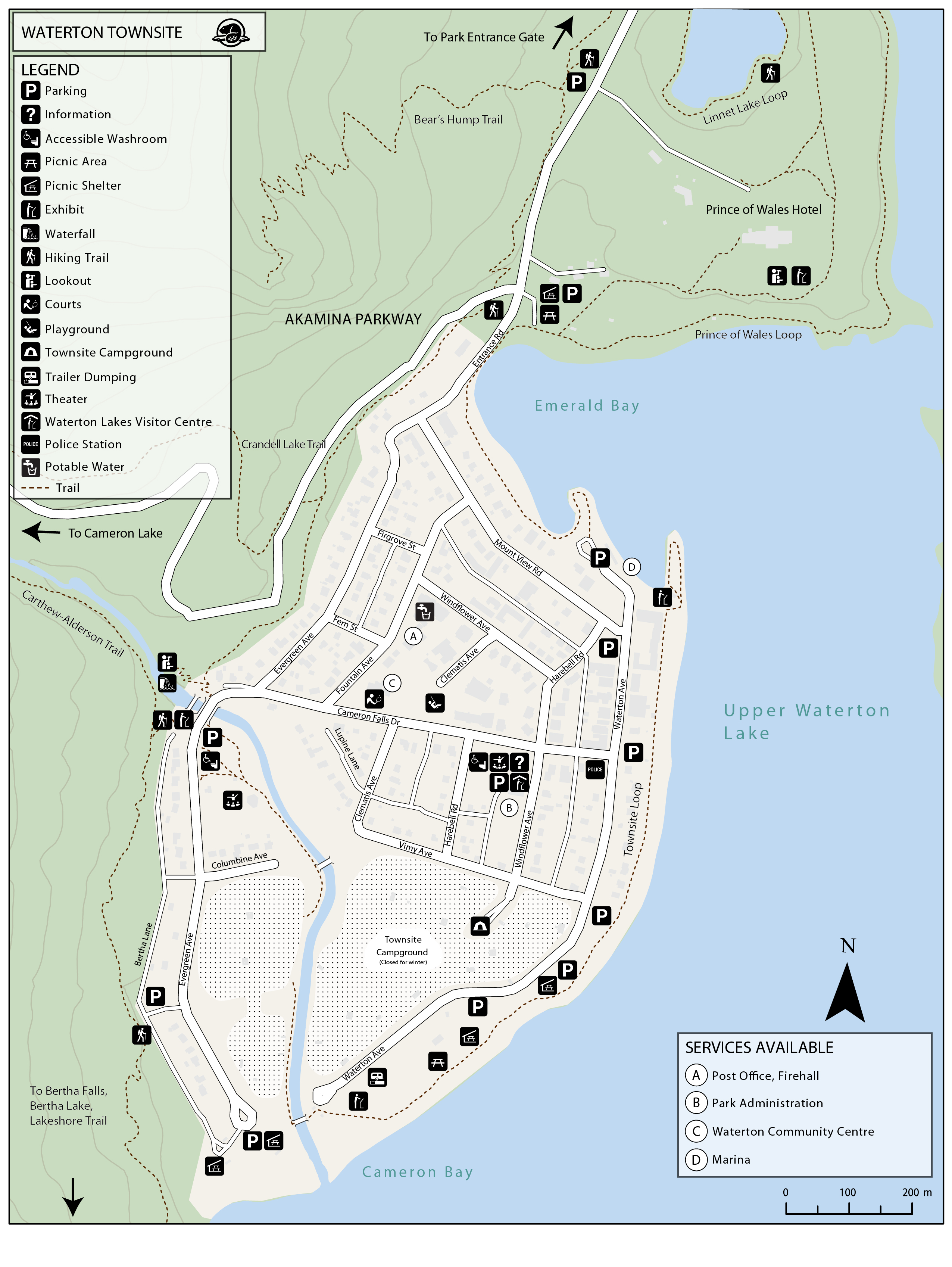
Waterton townsite map - Text description
Related links
- Date modified :