
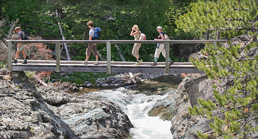
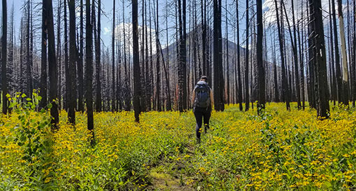
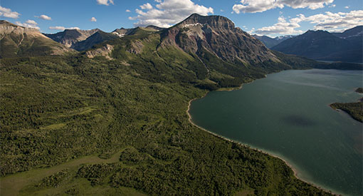
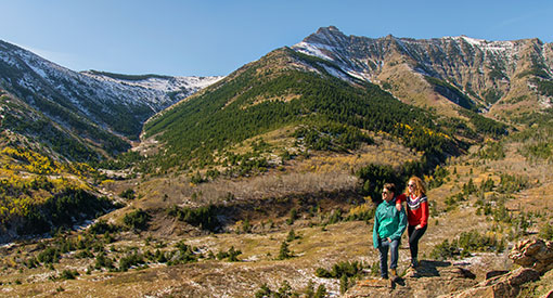
Day hikes
Waterton Lakes National Park
Around town
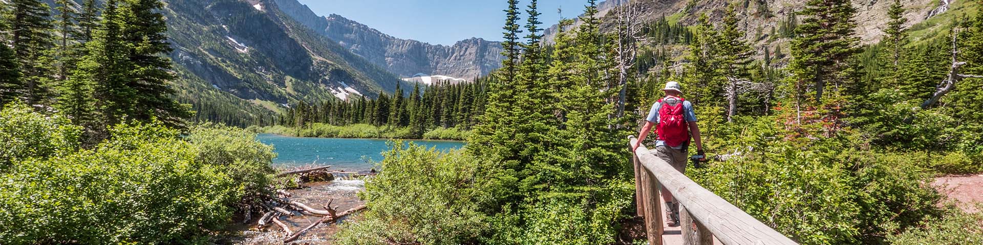
Alderson-Carthew
(access to Alderson Lake, Carthew Lakes, the Summit, Summit Lake)
Length: 19.2 km / 11.9 mi (one way).
Time: 8 hours (one way).
Level of difficulty: Difficult.
Elevation gain: 1,023 m / 3,356 ft.
Trailhead: Next to Cameron Falls.
A steady climb from Cameron Falls in Waterton townsite to Alderson Lake below the towering cliffs of Mount Alderson, then ascend steep switchbacks to alternating shale and shrubs surrounding the Carthew Lakes. A steady climb gives way to steeper trail along the slope leading to the Summit, where you can gaze back at the Carthew Lakes and out to the Waterton Valley and prairie in the distance. Switchbacks lead down to Summit Lake and onwards to the trail’s end, complete with stunning views of Cameron Lake. You can access the Boundary Creek trail at Summit Lake.
Stay at one of our backcountry campgrounds (don't forget to make a reservation).
Bertha
Length: 5.2 km/3.2 mi. to falls (return); 10.4 km/6.4 mi. to lake (return).
Time: 4.5 hours (return).
Level of difficulty: Moderate.
Elevation gain: 460 m / 1509 ft.
Trailhead: Parking lot on Evergreen South, 350 metres south of Cameron Falls.
The Bertha trailhead is in an avalanche path. Check the Bertha-Townsite avalanche advisory (updated daily) before accessing the area.
There are several options on this hike. It starts with a moderate climb from Waterton townsite to a viewpoint overlooking Upper Waterton Lake. From there you can choose to head south along the lake to Bertha Bay, Boundary Bay and into Glacier National Park in the U.S. (Lakeshore Trail). Another option is to follow the creek to Lower Bertha Falls. From there you can continue up steep switchbacks, past brief views of Upper Bertha Falls and on to Bertha Lake. The lake is surrounded by a walking path below magnificent peaks and cliffs.
Stay at one of our backcountry campgrounds (don't forget to make a reservation).
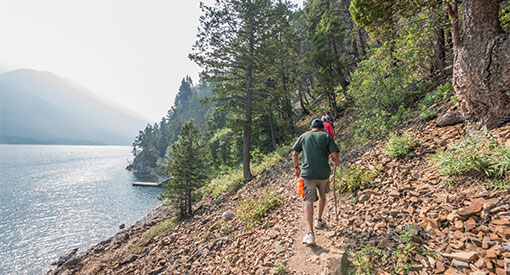
Lakeshore
Length: 13.5 km / 8.4 mi (one way).
Time: 4 hours.
Level of difficulty: Moderate.
Elevation gain: 125 m / 410 ft.
Trailhead: Parking lot on Evergreen south, 350 metres south of Cameron Falls.
The Bertha trailhead is in an avalanche path. Check the Bertha-Townsite avalanche advisory (updated daily) before accessing the area.
Starts at Bertha trailhead in Waterton townsite and climbs moderately to a viewpoint overlooking Upper Waterton Lake. From there you head south along Upper Waterton Lake to Bertha Bay, Boundary Bay and into Glacier National Park in the United States.
Requires a return boat trip from Goat Haunt or return hike. You can access the Boundary Creek trail at Boundary Bay.
Stay at one of our backcountry campgrounds (don't forget to make a reservation).
Travel across the United States-Canada border requires planning ahead and adherence to U.S. Customs and Border Protection (CBP) regulations. Visit Glacier National Park's website for more information about hiking across the Canada-US border and visiting Goat Haunt.
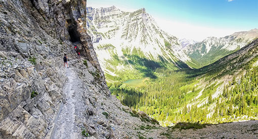
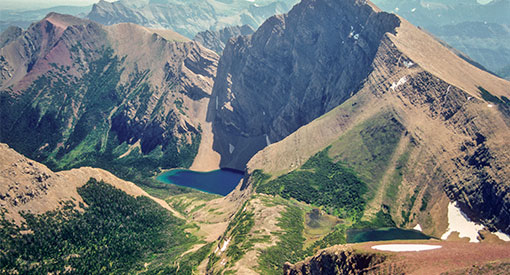
Crypt
Length: 17.2 km / 10.6 mi (return).
Time: 6 hours.
Level of difficulty: Difficult.
Elevation gain: 675 m / 2214 ft.
Trailhead: Fifteen-minute boat ride across Upper Waterton Lake brings you to the trailhead at Crypt Landing. A much longer way to access the trail involves hiking/biking 14 km of the Wishbone trail.
Be prepared for a varied all day hike with spectacular mountain views, several waterfalls, climbs along steep slopes, and a tight tunnel opening onto a narrow ledge above a cliff. A 20-minute side trip off the main trail provides views of Hell Roaring Falls and a steep canyon below. This hike requires a boat shuttle to and from the trailhead. Please contact Waterton Shoreline Cruise Co. for shuttle schedule and availability, particularly during spring and fall.
Akamina Parkway
Akamina Pass
(access to Wall Lake and Forum Lake)
Length: 3 km / 1.9 mi.
Time: 1 hour.
Level of difficulty: Moderate.
Elevation gain: 123 m / 404 ft.
Trailhead: 14 km along the Akamina Parkway, on the right if driving from town.
Akamina Pass is a wide trail with steep sections which leads to the boundary of British Columbia and Akamina-Kishinena Provincial Park. Continuing into the provincial park gives access to Wall and Forum lakes, each surrounded by their own set of sheer rock walls. A short side trip from the Forum Lake trail will lead you to Forum Falls.
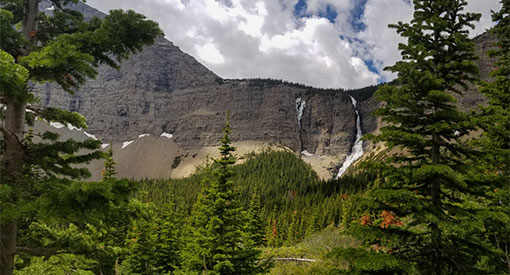
Lineham
Length: 9 km / 5.6 mi (return).
Time: 3 hours.
Level of difficulty: Moderate.
Elevation gain: 350 m / 1148 ft.
Trailhead: 9 km along the Akamina Parkway, on the right if driving from town.
Steady uphill hike to a viewpoint below a stunning 250-metre high waterfall. Excellent views of Mount Lineham and Mount Blakiston, the highest peak in the park.
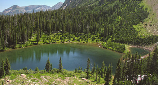
Lower Rowe Lake
(access to Tamarack)
Length: 8 km / 5 mi (return).
Time: 3 hours.
Level of difficulty: Moderate.
Elevation gain: 350 m / 1148 ft.
Trailhead: 10.5 km along the Akamina Parkway, on the right if driving from town.
The trail starts along Rowe Creek as it tumbles over mossy ledges and bright red argillite rocks. Walk through forests and along open slopes to a junction and short path off the main trail to Lower Rowe Lake.
Upper Rowe Lake
(access to Tamarack)
Length: 12.8 km / 8 mi (return).
Time: 5 hours.
Level of difficulty: Moderate.
Elevation gain: 575 m / 1886 ft.
Trailhead: 10.5 km along the Akamina Parkway, on the right if driving from town.
Continue from the junction to the wildflowers and stream at Rowe Meadow and then up steep switchbacks to Upper Rowe Lakes. At Rowe Meadow another set of steep switchbacks leads north onto the ridge above the sparkling chain of Lineham Lakes and beyond, to Lone Lake, the Blakiston Valley, Twin Lakes and a long trek to Snowshoe and Red Rock Canyon.
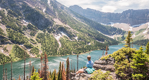
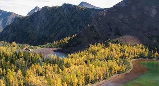
Carthew-Alderson
(access to Summit Lake, the Summit, Carthew Lakes, Alderson Lake)
Length: 20.1km / 12.4 mi (one way).
Time: 8 hours.
Level of difficulty: Difficult.
Elevation gain: 650 m / 2132 ft.
Trailhead: Cameron Lake - on the left when facing the lake.
Starting at Cameron Lake, a series of switchbacks lessen the grade to reach Summit Lake, where the trail levels off for a time to once again switchback to the Summit. Here there are spectacular views of the Carthew Lakes, the Waterton Valley and prairies in the distance. The trail descends along a scree slope to the scree and shrubs along Carthew Lakes, then down steeper terrain to Alderson Lake nestled among the tall cliffs of Mount Alderson. From there it is a steady descent to Cameron Falls in the Townsite. You can access the Boundary Creek trail at Summit Lake.
Stay at one of our backcountry campgrounds (don't forget to make a reservation).
Boundary Creek
Length: 13.1 km / 8.1 mi (one way).
Time: 4 hours (one way).
Level of difficulty: Moderate.
Elevation gain: 600 m / 1,968 ft.
Trailhead: North: Joins the Carthew-Alderson trail at Summit Lake. South: Joins the Lakeshore Trail at Boundary Bay.
Trail goes from Summit Lake (on Carthew-Alderson Trail) to Lakeshore trail, joining at Boundary Bay. Crosses the Canada-USA border.
Stay at one of our backcountry campgrounds (don't forget to make a reservation).
Travel across the United States-Canada border requires planning and adherence to U.S. Customs and Border Protection (CBP) regulations. Visit Glacier National Park's website for more information about hiking across the Canada-US border and visiting Goat Haunt.
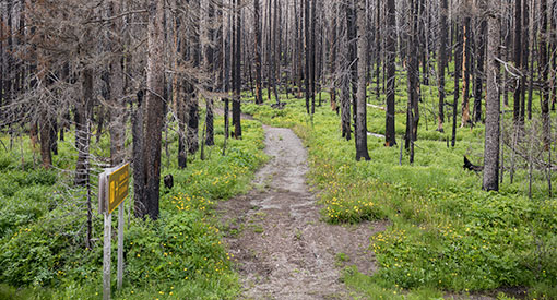
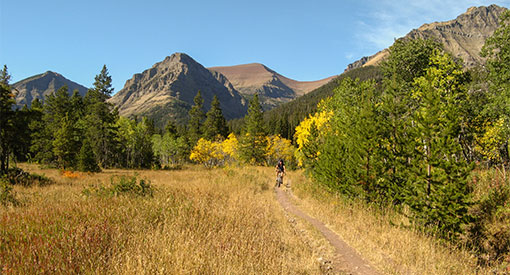
Red Rock Parkway
Snowshoe
(access to Goat Lake, Lost Lake, Twin Lakes, Castle Divide, Avion Ridge, Lone Lake, Sage Pass)
Length: 16.4 km / 10.2 mi (return).
Time: 5 hours.
Level of difficulty: Moderate.
Elevation gain: 150 m / 492 ft.
Trailhead: At Red Rock Canyon upper parking lot, cross the bridge over Red Rock Creek and continue straight.
Formerly a fire road, this trail is suitable for cycling, horseback riding or hiking. Along Snowshoe trail is a junction with the steep path climbing to Goat Lake and one of two access points to bright red Avion Ridge. At Snowshoe backcountry campground there are further hiking options. A short uphill climb will take you to secluded Lost Lake or to Castle Divide at the edge of Castle Wildland Provincial Park (Alberta Parks) and on to Castle Provincial Park (Alberta Parks). This is also the second access point to Avion Ridge. Another trail leading from Snowshoe heads toward Twin Lakes, the Blakiston Valley Trail, Lone Lake and beyond to the Tamarack Trail and Rowe Lakes. Routes to Sage Pass and South Kootenay Pass are found along the way.
Stay at one of our backcountry campgrounds (don't forget to make a reservation).
Blakiston Valley
(access to Blakiston Falls, Lone Lake, Twin Lakes, Tamarack trail, South Kootenay Pass)
Length: 20.2 km / 12.5 mi (return).
Time: 7 hours.
Level of difficulty: Moderate.
Elevation gain: 350 m / 1148 ft.
Trailhead: Red Rock Canyon lower parking lot. Walk past the kitchen shelter, cross the bridge over Red Rock Creek, then left across the bridge over Bauerman Creek and turn right.
Hiking and horseback riding trail along Blakiston Creek to junction. From there head north to Lone Lake, Twin Lakes and Snowshoe trail, south to Tamarack trail and Rowe Lakes or continue on to South Kootenay Pass and access to Akamina-Kishinena Provincial Park in B.C.
Stay at one of our backcountry campgrounds (don't forget to make a reservation).
Eastern areas / Highway 6
Wishbone/Vimy
Length: 26.2 km / 16.3 mi (return).
Time: 8 hours.
Level of difficulty: Difficult.
Elevation gain: Minimal.
Trailhead: Approximately 250 metres along the Chief Mountain Highway. Parking on your left if heading towards the Canada/US border. Trailhead is across the road from the parking area.
A wide trail leads through forests of aspen and birch, crosses streams and traverses some wide stretches of open prairie. The terrain steepens and is more forested just before reaching the junction with the Vimy Trail. Stay right to continue along to Wishbone Landing on the shore of Middle Waterton Lake. The trail to the left climbs steeply to the end of the Vimy trail and crosses montane and subalpine forests of fir and larch. Please note that the final kilometre from the end of the trail to the summit of Vimy Peak requires a scramble and route finding in steep terrain with loose rock and short cliff bands.
Horseshoe
(access to Horseshoe Basin, Oil Basin and Park Line)
Length: 21.3 km / 13 mi (return).
Time: 7 hours.
Level of difficulty: Moderate.
Elevation gain: 350 m / 1148 ft.
Trailhead: Follow the dirt road past the Bison Paddock until you arrive at the parking area. Hike starts at the gate.
Popular hiking and horseback riding area and great early season walk through meadows with abundant wildflowers. Steady ascent through mostly open terrain over the col between Lakeview Ridge and Mount Galway. The trail continues to Oil Basin, near the cut line along the park boundary. Hikers should use caution as the trail becomes indistinct in many places approaching and along the park line.
Related links
- Date modified :