
2025
Columbia Icefield area and the Athabasca Glacier
Jasper National Park
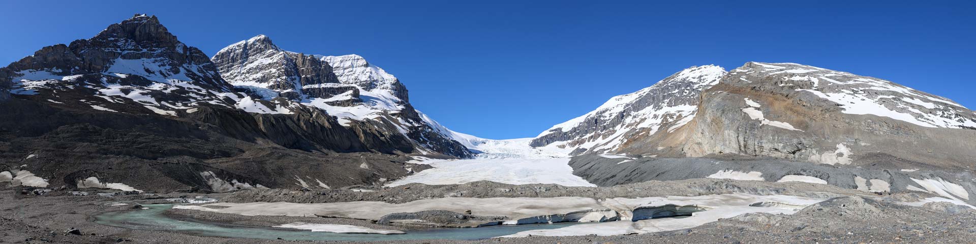
The Columbia Icefield is a surviving remnant of the thick ice mass that once mantled most of Western Canada's mountains. Lying on a wide, elevated plateau, it is the largest icefield in the Canadian Rockies. Nearly three-quarters of the park's highest peaks are located close to the icefield; ideally placed to catch much of the moisture that Pacific winds carry across the British Columbia interior. Spilling from the Columbia Icefield over three giant bedrock steps, the Athabasca glacier flows down the valley and is situated across from the Icefield Centre. Because of a warming climate, the Athabasca Glacier has been receding or melting for the last 125 years. The shrinking glacier has left a moonscape of rocky moraines in its wake. The Athabasca Glacier has experienced significant glacier recession, increased temperatures and a notable lack of snowfall and snowpack in recent years.
A part of the Canadian Rocky Mountain Parks UNESCO World Heritage Site, and one of the world’s most accessible glaciers, millions of visitors have witnessed firsthand evidence of the rapid retreat of this glacier over the past century. This phenomenon, which has been documented by a variety of researchers, is a direct indicator of the adverse effects of climate change on the glacier's health and stability. In 2023, the Athabasca Glacier saw more glacier ice melt than in any of the past 10 years. Parks Canada continues to work towards fostering public understanding, appreciation and enjoyment of the Athabasca Glacier in ways that ensure its ecological integrity for present and future generations.
Caution - The glacier is dangerous! For your safety do not cross the barriers. People have been killed falling into deep, hidden cracks called crevasses in the glacier.
- Date modified :