
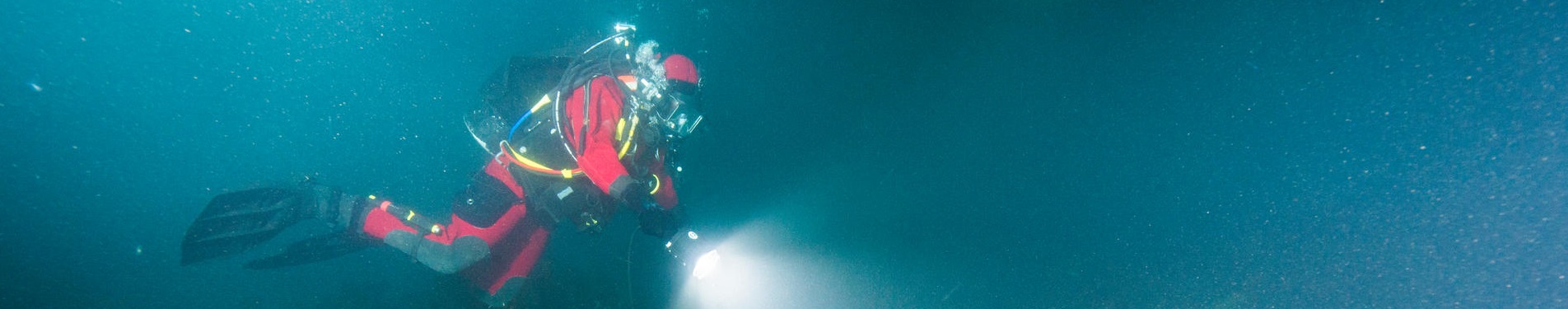
Scuba diving
Banff National Park
Scuba diving in Banff National Park takes place only at Lake Minnewanka or Two Jack Lake.
Lake Minnewanka is 1450 m above sea level, 18 km long with a maximum depth of 100 m. All dives at Lake Minnewanka are cold water, altitude dives. Visibility fluctuates depending on the time of year and the number of divers at the site. Depths vary depending on the time of year, rising up to 5.5 m (18') from spring to fall. Depths listed below were taken in October. There are 16 features located in three main diving areas.
Lake Minnewanka dive sites
Townsite Area
This area is the location of the Minnewanka Landing townsite. The water level increase from the 1912 dam partially submerged the townsite. The 1941 dam flooded the townsite completely.
Caution: A boat is needed to access the Townsite Area. This is a fishing area, with heavy boat traffic. There is a buoy located at site #7 to mark the site and to provide boat mooring. Please use it to avoid anchor damage to the sites.
![]() Dive site #1: House foundation #1
Dive site #1: House foundation #1
Date: 1912 - 1942Location: Townsite area - 200 metres from shore. Townsite's northernmost feature. Follow the clearly identifiable old road.
Description: Concrete, L-shaped foundation with partially excavated basement. Two entrances that lead to the main floor, a third leads down to the basement. Large cement fireplace with a brick hearth has fallen into the basement.
Dive Conditions: Depth is 17.5 m (57'). Very interesting dive - offers divers a lot to observe and explore.
![]() Dive site #2: Fireplace - Oven and cellar
Dive site #2: Fireplace - Oven and cellar
Date: 1912 - 1942
Location: Townsite area - 120 metres SW of Hotel. Hard to find - remote from any other feature.
Description: Oven or fireplace with a rock-filled concrete base covered in rubble that is spread over a 2 m long area. Fifteen metres southeast of this feature lies a 1.5 m deep square hole with a plank crib - possibly a root cellar.
Dive Conditions: Depth is 17.5 m (57'). Recreational interest is limited due to the deterioration of the structure.
![]() Dive site #3:Sidewalk and cellar
Dive site #3:Sidewalk and cellar
Date: 1912 - 1942
Location: Townsite area - approximately halfway between the Hotel and House Foundations #2 and #3. Easy to find by following the old road southwards from the Hotel.
Description: Two level cement sidewalk, 10 m long. Culvert-like pipe lies 5 m away. Two holes nearby - one rectangular with plank crib (possibly a root cellar), the other square with no crib. Remains of a small picket fence are nearby.
Dive Conditions: Depth is 18.3 m (60'). Low recreational interest - remaining structures are small and limited.
![]() Dive site #4: House foundation #2
Dive site #4: House foundation #2
Date: 1912 - 1942
Location: Townsite area - 420 m from shore and 200 m south of Hotel. Follow old road - feature lies at its southern extremity.
Description: Square concrete footing 6.82 m x 6.75 m. Approximately 25 cm thick and 20 cm above bottom. Probably owned by N.K. Luxton.
Dive Conditions: Depth is 18.3 m (60'). Interesting dive, especially if combined with House Foundation #3 and nearby cellar.
![]() Dive site #5: Outhouse Hole - Cellar
Dive site #5: Outhouse Hole - Cellar
Date: 1912 - 1942
Location: Townsite area - over 400 m from shore. Situated close to House Foundation #2 and #3 in a southerly direction.
Description: Cribbed hole approximately 90 cm square and 1 m deep - possibly a root cellar. Probably owned by N.K. Luxton.
Dive Conditions: Depth is 17.5 m (57'). Good complement dive with the nearby house foundations. Limited recreational interest due to the deterioration of the structure.
Cautions: Very fragile resource. Do not lean on or touch. Practice careful buoyancy control in the area of resource.
![]() Dive site #6:House foundation #3
Dive site #6:House foundation #3
Date: 1912 - 1942
Location: Townsite area - 420 m from shore and 200 m south of Hotel. Situated very close to House Foundation #2. Follow the old road.
Description: Square concrete footing 9.20 m x 6.75 m. Approximately 30 cm thick and 10 cm above bottom. Two wood stoves are on site. Probably owned by N.K. Luxton.
Dive Conditions: Depth is 17.5 m (57'). Interesting dive especially if combined with House Foundation #3 and/or nearby Cellar.
![]() Dive site #7: Long wharf
Dive site #7: Long wharf
Date: 1912
Location: Townsite area - over 400 m from shore and 120 m NE of House Foundation #3. Can be found from the old road, or the two adjacent breakwaters.
Description: Rock faced concrete ramp followed by a succession of cement piers with occasional timber supports and rock-filled log cribs. The wharf is ended by an L-shaped crib partially decked. Wharf is 90 m in length.
Dive Conditions: Depth of 24.5 m (80'). Interesting dive. Relatively easy to find because of its length. Length makes it harder to cover the site entirely in one dive.
Cautions: Recommended for experienced divers because of the depth. Anchor dragging to locate these wharves permanently damages these structures.
![]() Dive site #8: North wharf
Dive site #8: North wharf
Date: post 1912
Location: Townsite area - over 400 m from shore and 120 m NE of House Foundation #3. Lies north of the Long Wharf, more or less parallel to it.
Description: Long continuous crib-like log structure. Over 35 m long, turning obliquely southwards in its later section. Height increases from a single log to five superimposed logs. Probably used as both a wharf and a breakwater.
Dive Conditions: Depth of 23 m (75'). Interesting dive especially if combined with the Long Wharf. Visible from the Long Wharf when visibility is fair.
Cautions: Recommended for experienced divers because of the depth.
![]() Dive site #9: South wharf
Dive site #9: South wharf
Date: post 1912
Location: Townsite area - over 400 m from shore and 120 m NE of House Foundation #3. Lies south of the Long Wharf, more or less parallel to it.
Description: Long continuous crib-like log structure. Its height increases from a single log to five superimposed logs. Two parallel rows of logs that are filled with rocks, running for 34 m and then turning north to run for another 4.7 m. Narrower extension, 7.3 m long, comes back towards the southwest. On the south side of this small addition are four slips divided by large horizontal logs supported by large upright posts.
Dive Conditions: Depth 23 m (75'). Interesting dive especially if combined with the Long Wharf, and because of its size and complexity. Easy to locate from Long Wharf.
Cautions: Recommended for experienced divers because of the depth.
![]() Dive site #10: Old wharf
Dive site #10: Old wharf
Date: pre 1912
Location: Townsite area - over 640 m from shore and 220 m SE of the Long Wharf's L-shaped platform. Easternmost feature of the townsite. Hard to find as it is not close to any other feature.
Description: Four rock-filled log cribs in a SW to NE axis. Part of the deck lies to the south. The highest crib rises to a height of four log rows. Feature is in poor condition.
Dive Conditions: Depth of 24.5 m (80'). Interesting dive as the feature predates the partial flooding of the townsite after the second dam was constructed.
Cautions: Recommended for experienced divers because of the depth.
1912 Dam Area
All the features in this area are related to the second dam built by the Calgary Power Company in 1912, and to the dam operators residences built in 1923. This area was submerged in 1941.
Caution: 1912 Dam Area is accessible from the shore. Steep descent on rocks along the shoreline. Heavy boat traffic from nearby wharf and boat ramp.
![]() Dive site #11: 1912 Dam
Dive site #11: 1912 Dam
Date: 1912
Location: 1912 Dam Area - 70 m from the causeway and 120 m from the boat ramp. Orientated north - south across from Devils Canyon.
Description: A three spillway concrete dam over 12 m high topped with a 3 m high earth-filled crib upper structure. Adjacent to the dam is a two-storey concrete building (blockhouse), with two openings on its roof and another at the bottom. Inside the building two other openings allow passage from one level to another.
Dive Conditions: Depth varies from 12.2 m (40') to 27.5 m (90'). Penetration possible inside the blockhouse. Unique diving experience due to the size and complexity of the structure. Visibility diminishes greatly when a large number of divers visit the site. Most visited feature of the Minnewanka submerged townsite.
Cautions: Penetration and deeper areas for well-prepared, well-equipped, experienced divers only.
![]() Dive site #12: House foundation #4
Dive site #12: House foundation #4
Date: 1923
Location: 1912 Dam Area - 80 m from causeway and less than 40 m north of 1912 Dam.
Description: Rectangular concrete footing approximately 30 cm thick with a small sally in one wall. Divided in two parts by a concrete division. A quarter of its surface has been dug out for a basement. Built for Superintendent Smith or dam operators.
Dive Conditions: Depth 13.7 m (45'). Good complement to the 1912 Dam. Good for inexperienced divers, as it is one of the shallower sites. Easy to locate from 1912 Dam, swimming north.
![]() Dive site #13: House foundation #5
Dive site #13: House foundation #5
Date: 1923
Location: 1912 Dam Area - 80 m from causeway and 90 m off the boat ramp.
Description: Large rectangular concrete footing approximately three times the size of House Foundation #4. Built for Superintendent Smith or dam operators.
Dive Conditions: Depth 12.2 m (40'). Limited recreational interest, as it is presently hidden by weeds.
![]() Dive site #14: Well
Dive site #14: Well
Date: 1923
Location: 1912 Dam Area - 125 m from causeway and 40 m NE of house foundations. Easy to find from House Foundation #4 by going to the northeast over the ledge.
Description: One metre square and 4.6 m deep hole with a wooden crib rising above the lake bottom. A few metres from the well is an alignment of five fence posts heading in an easterly direction. Associated with the three nearby house foundations.
Dive Conditions: Depth 16.8 m (55'). Interesting dive offering a dramatic image.
Cautions: Well would be a hazard to divers if they attempted to slip into it. Very fragile resource. Do not lean on or touch the resource. Practice careful buoyancy control in the area of the resource.
![]() Dive site #15: House foundation #6
Dive site #15: House foundation #6
Date: 1923
Location: 1912 Dam Area - 100 m NE of 1912 Dam and 40 m NE of the Well.
Description: Two division house foundation of concrete. One of the divisions seems to be a small square addition to the main foundation which has an overall rectangular shape, with one wall showing three recesses. Built for Superintendent Smith or dam operators.
Dive Conditions: Depth 16.8 m (55')
Bridge Area
This area is the location of the bridge built in 1912 by the government after the 1912 dam flooded Devils Creek. This bridge was submerged in 1941.
![]() Dive site #16: 1912 Bridge
Dive site #16: 1912 Bridge
Date: 1912
Location: Bridge Area - a little more than 100 m along the causeway - off the information plaque on Two Jack road. Feature is orientated east - west.
Description: Bridge remains consisting of two abutments and two piers, all rock-filled log cribs. The deck is gone. The abutments are approximately 4 m wide and 2.5 m long with a dirt ramp with rock retaining side walls leading onto them. Both piers are built in a similar fashion and are 4 m wide and 2.5 m across. The 1912 Lake Minnewanka shoreline is still clearly visible.
Dive Conditions: Depth varies from 15 m (50') to 26 m (85'). Interesting dive due to the size of the structure and as it is an example of early century construction. Accessible from shore - steps along the shoreline. Visibility diminishes quickly as the number of divers increases. Boat traffic is limited. Most visited feature of the Minnewanka submerged townsite.
Cautions: Deeper areas for experienced divers only. To get from one pier to another, divers need to swim over deeper water - good buoyancy control is necessary to avoid going deeper.
Dive map

Dive sites on Lake Minnewanka
Important information:
Rules and regulations
The submerged features of Minnewanka Landing are important cultural resources, rare within a national park. This submerged heritage belongs to each and every Canadian. Anything altered or removed from it diminishes this heritage. Individual visitors may not have a great impact on the site, but hundreds of divers and heavy boat traffic for sightseeing and fishing causes major cumulative and irreversible damage to the sites. Activities such as artifact retrieval, attaching objects to the features, graffiti, anchor dragging and down rigging fishing are all very harmful to these resources.
- Under the Canada National Parks Act, anyone removing, damaging or destroying prehistoric or historic artifacts or structures, is subject to a fine of $2,000.00.
- Please help us to protect this resource by minimizing your impact and reporting any vandalism to the Warden Service at 1-888-WARDENS (toll free)
- An AIS Prevention Self-certification Permit or Parks Canada AIS Prevention Inspection permit is required for all non-motorized watercraft and water-related gear (e.g., canoes, kayaks, stand up paddle boards, fishing gear).
- The Self-certification Permit requires mandatory clean, drain, dry of all non-motorized watercraft and water-related gear, and attestation to these actions. Permits will be available online and at visitor centres and self-serve kiosks at waterbodies in Banff, Yoho and Kootenay national parks, or at Parks Canada watercraft inspection stations in Banff National Park.
- Non-motorized watercraft and water-related gear users that do not meet Self-certification Permit requirements, but still wish to use their equipment within a park should visit a Parks Canada watercraft inspection station. Inspections and issue of a Parks Canada Inspection Permit will occur on a case-by-case basis at the discretion of inspectors.
- Parks Canada Inspection Permit is mandatory for motorized watercraft on Lake Minnewanka in Banff National Park.
- Parks Canada will no longer accept provincial inspection permits for motorized watercraft launching on Lake Minnewanka.
- Dry time requirements - Parks Canada Self-certification and Inspection Permits will require watercraft that has travelled outside of BC, AB, Yukon and Northwest Territories to dry for 30 days and those travelling within BC, AB, Yukon and Northwest Territories to dry for 48 hours.
- Inspection of non-motorized watercraft and water gear will be available at inspection stations in Banff at Lake Minnewanka (motorized and non-motorized watercraft and water-related gear) and Lake Louise overflow parking lot (non-motorized watercraft and water-related gear only).
Safety
- Certification: All divers should be trained and certified by a recognized organization. Trainees must be under the supervision of a certified diving instructor.
- Never dive alone: The buddy system is your protection in the event of unexpected problems.
- Cold water: Low water temperatures in this area can create special hazards. Only experienced divers should attempt deeper dives. Regulator freeze-up can occur, so divers should take appropriate precautions.
- High altitude: High altitudes alter dive times. Dives at Lake Minnewanka are high altitude dives, and most are deeper than 14 m (50'). This shortens dive times dramatically.
- Use the dive flag: Always display a fully visible dive flag when in the water. Restrict all diving to within 30 m (100') of the flag and do not confuse boaters by flying the flag when no activity is underway. Do not attach your dive flag to the structures. Attachment anchors for this purpose are provided at many sites.
- Boat diving: Never leave a boat unattended, especially when it is used for diving. At least one person must be left on board when the boat is anchored or moored.
- Night diving: Only experienced divers should engage in night diving. Each diver should be equipped with an adequate underwater light and a backup light.
Ice diving guidelines and regulations
- Scuba diving, including ice diving, is only allowed at Lake Minnewanka reservoir and Two Jack Lake reservoir.
- Parks Canada does NOT monitor natural ice surfaces for safety or mark potential hazards.
- Commercial diving companies are responsible for ensuring they have the proper business licence to operate and their employees have the proper certification for the activity they are guiding.
- Holes cut in the ice should be no larger than 4 meters in diameter.
- If a chainsaw is used to cut the hole, vegetable oil should be used instead of chain oil to prevent water pollution.
- The cut piece of ice must be pushed aside underwater so it can be used to plug the hole once diving is completed.
- All open holes must be guarded against people falling into the hole and ensure there is adequate warning the opening exists. It is the law.
- When the ice site is vacated and the hole is plugged back up, corners of the hole must be marked with flagging tape and wands for 4 to 10 days. The flagging tape must be removed within 2 weeks.
- Generators are permitted during diving activities only. They should be placed on a waterproof base at least 3 m from the ice hole, surrounded by a snow berm to prevent seepage into the water in the event of a fuel spill.
- The ice site must be kept clean and litter-free.
- All human waste must be disposed of in a washroom or outhouse. A pee bucket may be used if the washroom or outhouse facilities are too far from the site, but all human waste must be removed from the site.
- All diving groups have to be prepared for self-rescue. Parks Canada does not have a dive rescue team. In the case of a rescue, a team will be called from outside the park.
Related links
- Date modified :