
Winter in Banff National Park
Banff National Park
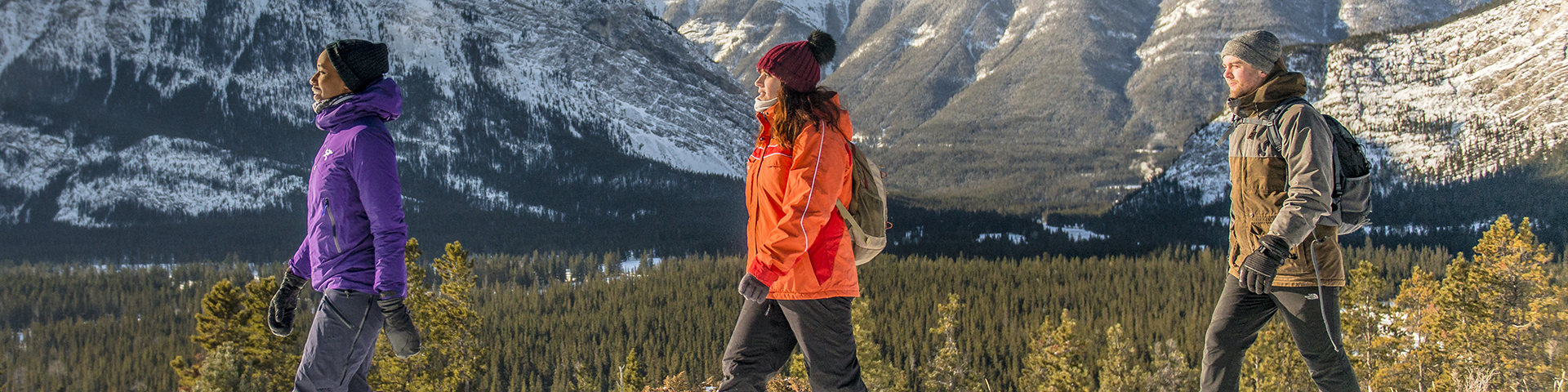
Whether you are here for a family adventure or a relaxing getaway, there is no better way to experience Banff’s pristine mountain landscape than to get out there in the snow. Lace up your boots, wax up your skis, strap on a pair of snowshoes or hop on a fat bike and enjoy one of many winter trails.
CAUTION: Avalanche danger!
Know before you go, don`t take risk! Thousands of avalanches occur throughout Banff National Park every year. Visitors wishing to venture beyond the limits of the trails described in this guide should assume that they are travelling in avalanche terrain and should be prepared with the appropriate knowledge, skills and equipment.

- Visit parksmountainsafety.ca
- Connect with a Parks Canada Visitor Centre and look for the Avalanche Terrain Ratings brochure
- Consult the current Avalanche Forecast.
In case of EMERGENCY, call 911 or the Banff Emergency Dispatch Centre.
Note that cell phones are not always reliable throughout the national park.
Winter Safety
Safety is your responsibility!
There are always hazards associated with outdoor recreational activities. Even short trips from the Town of Banff can have serious consequences. Winter hazards include avalanches, disorientation, thin ice, hypothermia and frostbite.
Ice cleats:
Most trails become snow packed and are at risk for slippery sections. Ice cleats are always recommended for winter walking. Check the trail report before heading out.
Banff Legacy Trail:
A winter warning of the Banff Legacy Trail is in effect. Use of the trail is not recommended as it is not maintained in the winter. Hazards may include snow plow debris, closed gates, icy sections and deep snow.
Wildlife:
Although bears hibernate during winter, they can awaken at any time for short periods. Cougars, wolves and other wildlife remain active throughout the year. If you see wildlife, do not approach; give them lots of space and observe from a distance with binoculars or a telephoto lens. If tracks are observed, do not follow them towards the animal. Be alert, make noise and carry bear spray.
Ice Safety:
Parks Canada does NOT monitor natural ice surfaces for safety or mark potential hazards. Many environmental factors affect the thickness of the ice. If you choose to skate on natural ice, you do so at your own risk. The recommended ice thickness is 15 cm for walking or skating alone and 20 cm for skating parties or games.
Featured Activities:
Winter Trails
Banff area
Trail | Starting point | Distance |
---|---|---|
Banff Avenue TrailRide 100 m until you see a steep path going up through thick forest. Beware of icy conditions. The trail levels-off gradually until it reaches an open meadow; head left on nice rolling single track. This north-facing slope retains snow well and is a reliable fat biking experience. The trail ends at Tunnel Mountain Road. Return the same way or connect with the Tunnel Bench Loop (Coastline) to return to town. |
East end of Banff Avenue at the junction with Banff Legacy Trail. |
Elevation gain 65 m |
Brewster CreekThis trail offers valley views through open and forested areas. Track setting occurs when adequate snow is available. For the more experienced, take the trail to Sundance Lodge. Note that hills can get icy. |
Healy/Brewster parking lot on the Sunshine Village access road. |
Elevation gain 315 m |
Cascade Valley
This wide trail is double trackset with a skate skiing lane to Cascade River bridge and single track set for the remaining route to Stoney Creek on pleasant rolling terrain. Enjoy a fun downhill return trip. For an additional 2 km round trip, ski the trail to Upper Bankhead. |
Lake Minnewanka Day-use Area parking lot. |
Elevation gain 135 m
Elevation gain 250 m |
Castle Junction
A series of interconnected single track set trails that wind through spruce forest. The main trail runs from Castle Junction to Castle Mountain Lookout along the Bow Valley Parkway (Hwy 1A). |
Parking area on the HI Hostel road south of Castle Junction. |
Minimal elevation gain
Minimal elevation gain |
Fenland Trail
This interpretive trail under old growth spruce trees is great for families with young children. For a longer walk from the Banff town site, start at Central Park and follow the Bow River to the Fenland trailhead. Walk east, just over the railway tracks on Mt. Norquay Road (0.9 km one way). |
Fenland Trail parking lot, west of Mt. Norquay Road. Trailhead is a 20 minute/1.5 km walk from downtown Banff. |
No elevation gain |
Goat Creek and Spray River
The track set trail can be skied and the flat, groomed lane can be biked in either direction. Most people choose to start at the Goat Creek above Canmore and ski or bike downhill most of the way to Banff. Vehicle shuttle recommended.
|
Parking area behind the Fairmont Banff Springs
|
Elevation gain 435 m |
Healy Creek
This forested trail is a taste of the backcountry, close to town. Track setting occurs when adequate snow is available. For a shorter one-way trip, arrange for a drop-off at the Healy/Brewster parking lot, and ski or fat bike into the town; a short trail will bring you along Cave Avenue to the Banff Avenue bridge. |
West Trailhead: Healy/Brewster parking lot on the Sunshine Village access road.
|
Elevation gain 95 m |
Ink Pots via Moose Meadows
A quieter alternative to the busier Johnston Canyon Trail, this trail climbs through thick forest to an open meadow with brilliantly coloured mineral springs. |
Johnston Creek trailhead at the Moose Meadows parking lot. |
Elevation gain 340 m |
Johnson Canyon
Travel in the depths of the canyon on wide trails and narrow bridges with railings that lead to the Lower Falls or to the spectacular 30 m high frozen Upper Falls. The trail is usually very icy - ice cleats are strongly recommended. Travel an additional 3.2 km beyond the Upper Falls to reach the Ink Pots. |
Johnston Canyon Day-use Area |
Elevation gain 50 m
Elevation gain 120 m |
Johnson Lake
This trail follows the lakeside shoreline and includes views of Cascade and Rundle mountains. This forest of Douglas fir, spruce and pine trees, is the richest biological zone in Banff National Park - the montane ecoregion. |
Johnson Lake Day-use Area |
Minimal elevation gain |
Lake Minnewanka
Don't let the gentle opening of this iconic ride fool you; the physical demands and the remoteness of this trail require excellent fitness, bike handling skills and preparation. The challenging and at times exposed side hill trail climbs steeply out of Stewart Canyon and heads east on a rollicking single track. Some sections may be very icy - be alert. |
Lake Minnewanka Day-use Area, kiosk at far end of picnic area. |
Elevation gain 45 m |
Marsh Loop
This trail is located in the wide expanse of the Bow Valley and circles around a marsh. It comes alive with birds in the winter and is a great place to see animal tracks. |
Cave and Basin National Historic Site parking lot. |
Minimal elevation gain |
Redearth Creek
The trail climbs gradually through lodgepole pine forests to the Shadow Lake Trail. The last few kilometres back to the highway can be exhilarating; be extra cautious if conditions are icy.
|
Redearth Creek trailhead. |
Elevation gain 335 m |
Spray Connector
This short outing close to town links the Spray River East Trail to Spray River West Trail via a small scenic bridge. If conditions are icy, ice cleats are strongly recommended. |
Park at the Bow Falls Day-use Area, walk past the gate and across the bridge. Follow the Golf Course Road 350 m to the Spray River East trailhead kiosk. Go past the kiosk, head west and take the trail closest to the Spray River. |
Minimal elevation gain |
Spray River East Trail
This trail offers rolling terrain in a picturesque river valley. As the snow falls throughout the year, snowshoers flatten the trail and fat bikers compact the snow, creating a hard-packed trail for both. |
Park at the Bow Falls Day-use Area, walk past the gate and across the bridge. Follow the Golf Course Road 350 m to the Spray River East trailhead kiosk. Go past the kiosk, head west and take the east-most trail. |
Elevation gain 135 m |
Spray River West Trail
This local's favorite is double track set with skate skiing lane, offering rolling terrain in a picturesque river valley. Bring a snack; there is a picnic spot beside the river near the bridge.
|
Spray River West trailhead, past the Fairmont Banff Springs Route 2 |
Elevation gain 105 m |
Stewart Canyon
Explore the Cascade River which feeds Banff National Park's largest lake. This trail can be very icy, especially during the spring. |
Lake Minnewanka Day-use Area, kiosk at the far end of picnic area |
Minimal elevation gain |
Sulphur Mountain
Switchbacks on the slopes of Sulphur Mountain provide a steady uphill hike to a summit renowned for its stunning mountain views. Take a 0.5 km side trip on the boardwalk along the ridge ending at Sanson Peak. You will find more great views, the Sulphur Mountain Cosmic Ray Station National Historic Site and the 1903 weather observatory. If conditions are icy, ice cleats are strongly recommended.
|
Banff Upper Hot Springs parking lot. Route 1 |
Elevation gain 655 m |
Sulphur Mountain Westside
Follow Sundance Trail 2.6 km to the junction, where you will find the Sulphur Mountain Westside Trail branching back to the east. From there, this old weather station access road is a sustained climb for snowshoers or hikers with ice cleats. |
Cave and Basin National Historic Site, start at Sundance Trail west of building. |
Elevation gain 885 m |
Sundance Canyon
Follow the Sundance Trail to this moderately difficult canyon loop. Bikes are not permitted past the bike racks. This trail can be icy - ice cleats are strongly recommended. |
Cave and Basin National Historic Site, start at Sundance Trail west of building |
Elevation gain 155 m |
Sundance Loop
This trail offers views of the Bow Valley while winding through forested areas to the Sundance Canyon picnic area. Sections of the trail are single and double track set. Bikes are not permitted past the bike racks. |
Cave and Basin National Historic Site, trail starts west of building. |
Elevation gain 75 m |
Surprise Corner to Hoodoos Viewpoint
This sunny trail provides open vistas to the Hoodoos Viewpoint. Keep an eye out for wildlife and watch for icy sections. You can make a loop or return to town along Tunnel Mountain Road. |
Surprise Corner, east end of Buffalo Street Route 7 |
Elevation gain 115 m |
Tunnel Bench Loop
Typically ridden clockwise, this popular loop connects The Spine, Coastline, Teddy Bear's Picnic and Don's Bypass to make a winding and varied entry-level singletrack with minimal elevation gain. Take in the spectacular views of iconic Mount Rundle and Cascade Mountain as well as the Fairholme Range. Some sections have significant vertical exposure. For an alternative route, after you enter onto Teddy Bear's Picnic from the service road, watch for the trail junction to Stinky D. This forested trail opens up to wide-open views of the valley, then loops around to Wolf Scat Alley bringing you back to Teddy Bear's Picnic. |
Hoodoos Viewpoint parking area. |
Elevation gain 60 m |
Tunnel Mountain Drive
Closed to vehicles in the winter, this route has splendid views of Cascade Mountain. It also connects with Surprise Corner to Hoodoos Viewpoint Trail. |
The closed gate at the intersection of Tunnel Mountain Drive and St. Julien Road. Route 7 |
Elevation gain 130 m |
Tunnel Mountain Summit
Reach the summit of a mountain in the heart of the Banff townsite. Take in breathtaking views of the town and Bow Valley. This steep trail can be extremely icy. Hiking poles and ice cleats are strongly recommended. |
Lower parking lot on St. Julien Road. Trailhead is a 15 minute/1 km walk from downtown Banff. Route 7 |
Elevation gain 260 m |
Tunnel Mountain Winter Trails
Two seasonally closed campgrounds offer first-time skiers the perfect place to try out a new sport. Get your evening fitness fix with 2.6 km of lit trails in Trailer Court or explore the 5.4 km quiet, forested loops of Village 1. Dogs prohibited on ski trails. |
Tunnel Mountain Trailer Court Campground entrance Route 2 |
No elevation gain |
Tunnel Mountain Winter Trails
Looking for a place to get a feel for fat biking on wide, groomed trails? Want to enjoy a quiet stroll in nature with your dog or try out snowshoeing after a big snowfall? The flat terrain of Trailer Court has something for everyone, and the trails are lit at night. For a slightly more difficult terrain, try the 2.5 km fat bike loop that meanders through coniferous forest. |
Tunnel Mountain Trailer Court Campground entrance Route 7 |
No elevation gain
Minimal elevation gain |
Upper Stoney Loop
This narrow trail climbs, at times steeply, through thick forest to the Stoney Lookout where you can enjoy views of Cascade Mountain and the Bow Valley. From there, continue north and descend on a twisting trail back to the old ski runs above the Cascade Lodge. |
Kiosk at the south end of Mount Norquay ski area parking lot |
Elevation gain 205 m |
Lake Louise area
Trail | Starting point | Distance |
---|---|---|
Baker Creek to Protection Mountain Campground
This trail runs parallel to the parkway. Single trackset. |
Starts across the road from the Baker Creek Chalets. |
No elevation gain |
Bow Lake Meadows
From the lot, snowshoe past the lodge for about 150 metres and then turn north on the old horse trail into the meadows. This trail is difficult to find once it’s snow covered, so expect to find your own route and break trail. |
Park near NumTiJah Lodge. |
Elevation gain 80 m |
Bow River Loop
Single trackset. Mostly flat, following the river. This is a multi-use trail. |
To start, park near the Station Restaurant or just past the campground kiosk, or use the connecting trail from the Post Hotel or the Samson Mall. |
Elevation gain 80 m |
Campground loop - Lake Louise
Double trackset with skating lane. This trail loops around and through the campground on gentle terrain. |
For access, park just past the campground kiosk. |
No elevation gain |
Castle Junction
Single trackset. The trail runs from Castle Mountain Lookout to Castle Junction. At the junction, a series of interconnected single track set trails wind through spruce forest. |
You can park either near the hostel, or at the Rockbound Lake or Castle Lookout trailheads. |
Elevation gain 31 m |
Drummond
If you need a breather, this is the only flat trail in the Pipestone trail system. Single track set. |
Park at pipestone trailhead. |
Elevation loss 24 m |
Fairview
A beautiful trail, the Fairview runs through sections of open clearings and snow-draped woods. It’s also possible to make a 7.5 km loop (160 m total elevation gain) using the Fairview trail, the Moraine Lake Road and the Tramline trail: the recommended direction is counter-clockwise. |
Park at the Fairmont Chateau Lake Louise. |
Elevation gain 60 m |
Fairview lookout
This steep trail ends at a viewpoint overlooking historic Chateau Lake Louise. Start by facing the Lake at the World Heritage Site rock. Look left and follow the trail signs for Fairview Lookout.
|
Park at the Fairmont Chateau Lake Louise. |
Elevation gain 100 m |
Great Divide ("Old 1A")
Double trackset with skating lane. Mostly flat, but trending gently downhill, this trail takes you to the “Great Divide” – the BC / Alberta border at km 7. From here, you can continue into Yoho National Park another 3.5 km (irregular grooming) to the Lake O’Hara parking lot. |
Start at the Great Divide trailhead, near Lake Louise. |
Elevation loss 60 m |
Hector
This trail features good views at both a major fire protection clearing and tranquil Pipestone Pond. Single trackset. |
Park at the Pipestone trailhead. |
Elevation gain 95 m |
"Highline" trail to Paradise Creek
An excellent snowshoeing option. The trailhead is the same as Fairview Lookout, but at the Lookout turnoff, continue for another 40 metres on the main trail then turn left when you see the horse trail sign. |
Park at the Lake Louise public parking lot. |
Elevation gain 60 m |
Laggan's Loop
Head up the Mirror Lake trail approximately 60m on the right. On the sunny side of Lake Louise, gaining elevation along the ‘benches’ of the Little Beehive, trek through the mature subalpine forest and explore the quiet serenity. |
Park at the Fairmont Chateau Lake Louise. |
Elevation gain 50 m |
Lake Louise Loop
Double trackset, this loops features a wide open trail across frozen Lake Louise, followed by a fun “up & down” trip back through the woods – just 100 metres uphill from the lakeshore walking path. Use the Fairview – Lake Louise Connector trail to ski directly from the parking lot onto the lake. Tracksetting ends at the back of the lake, as the trail up the valley crosses large avalanche paths. |
Park at the Fairmont Chateau Lake Louise. |
Elevation gain 15 m |
Lake Louise Lakeshore This trail features classic views and at lake’s end, a 100 m tall frozen waterfall. |
Starting in front of the Chateau Lake Louise. |
No elevation gain |
Louise Creek
This is the best pedestrian option from the village to the lake. From Samson Mall, walk along Lake Louise Drive to the Bow River bridge. Cross and look for the trailhead on the downstream (south) side of the bridge. |
Park at the Samson Mall. |
Elevation 195 m |
Lower Telemark
Park at Great Divide trailhead, ski 700 metres, and turn right at the #8 trail sign. After 4.0 km of twists and turns, exit back onto the Great Divide trail, and turn left to return to your vehicle. Double trackset. |
Park at Great Divide trailhead, near Lake Louise. |
Elevation gain 110 m |
Merlin
Watch for the old pioneer log cabins along this leg of the Pipestone |
Park at the Pipestone trailhead. |
Elevation gain 55 m |
Mirror Lake, via Lake Agnes hiking trail
From the Fairmont Chateau Lake Louise, follow the main Lake Agnes trail as it rises through the forest. Sections of this portion of the trail cross avalanche terrain. |
Park at the Fairmont Chateau Lake Louise. |
Elevation gain 295 m |
Moraine Lake Road
Climbing steadily, this trail includes both gently rolling and hilly stretches. Tracksetting ends at a viewpoint of Consolation Valley and the Ten Peaks. Beyond the viewpoint, the road crosses large avalanche paths. Double trackset with a skating lane. |
Park at the beginning of the Moraine Lake Road. |
Elevation gain 250 m |
Peyto
The trail starts at the upper Deer Lodge parking lot, and connects skiers to the Great Divide and Lower Telemark trails on a gentler grade. |
Park at the Peyto Lake parking lot. |
Elevation gain 45 m |
Peyto Lake Viewpoint
From the parking lot there are two loops. Start by following either the unplowed upper road or take the official trail from the north end of the parking lot. From the viewpoint, a second loop runs through gladed forest. |
Park at the Peyto Lake parking lot. |
Elevation gain 45 m |
Pipestone Loop
Watch for the occasional tight corner and be cautious on the hills. The recommended direction for the outer loop is counter-clockwise. Single trackset. |
Park at the Pipestone trailhead. |
Elevation gain 190 |
Protection Mountain Campground to Castle Mountain Lookout
This new single track set trail links the two existing cross country ski trails on the Bow Valley Parkway. Travel this unique path to discover a new perspective on the original auto-route through Banff National Park. |
Park at Protection Mountain Campground. |
Elevation gain 15 m |
Taylor Lake This challenging trail ends in a scenic hanging valley below Mount Bell. Start at the parking lot 18 km east of Lake Louise or 8 km west of Castle Junction on the Trans-Canada Highway. |
Park at the Taylor Lake trailhead. |
Elevation gain 585 m |
Townsite - Lake Louise
This short trail provides access to the northwest end of Village Road, near all the village hotels. |
Park at the Lake Louise public parking lot. |
No elevation gain |
Tramline
This trail runs from valley bottom to Lake Louise at a steady 3% rise, following the old grade of the tramline that once connected the train station and the Chateau Lake Louise. |
Park at the Fairmont Chateau Lake Louise. |
Elevation gain 195 m |
Upper Telemark
This trail has several steep and technically demanding hills. If you find them too imposing, they can be avoided by taking the “Hillside” bypass. Start in front of the Chateau Lake Louise as if going to Lake Agnes, then turn right onto trail #5. Once up and behind the Chateau, ski steeply down to the Great Divide and Lower Telemark trails. |
Park at the Fairmont Chateau Lake Louise. |
Elevation loss 65 m |
Trail etiquette:
-
Dogs are not permitted on certain trails, read trail descriptions before you go. If you are bringing your dog along always keep them on leash and physical under control.
The track set portion of the trail is for classic skiing only! The flat, groomed lane is for other users.
Fat bike and hike only on hard-packed trails to prevent ruts. If your tires or feet sink deeper than 2.5 cm (1 inch) conditions are too soft.
When climbing, please yield the right of way to descending skiers and fat bikers.
When taking a break, step to the side, leaving room for others to pass.
Leave no trace. Pack out everything you pack in.
Featured locations:
Plan ahead
Ask for advice at a Parks Canada Visitor Centre for help with trip planning. Visitor Centres offer maps, brochures, permits, backcountry reservations, up-to-date park information, weather, trail, avalanche and road reports, interpretive exhibits and events. Banff Lake Louise Tourism has an office in the Banff Visitor Centre and in the Lake Louise Visitor Centre.
Trip planning references:
- Pre-arrival checklist
- BanffNow
- Trail condition report
- Important Bulletins
- Seasonal closures and restrictions
- Weather forecast
- Road conditions - Alberta 511
- Road conditions - Drive BC
- Parking in Banff
Winter brochures
- Date modified :